
![[The European Part of the Russian Empire.] Европейская Часть Россійской Имперіи.](/map/small/66704.jpg)
Detailed and very rare Russian-language map of the European part of Russia, published in Saint Petersburg in 1836. Rarity The map is very scarce. We have been unable to find any other examples in sales databases, libraries and archives, nor in...
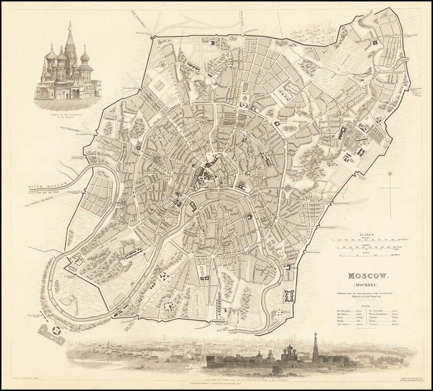
Highly detailed town plan of Moscow, showing streets, buildings, rivers, parks, public squares, a race course, churches, barracks, bridges, and a host of other details. Large vignette of the Church of the Assumption in the Kremlin and a view of the...
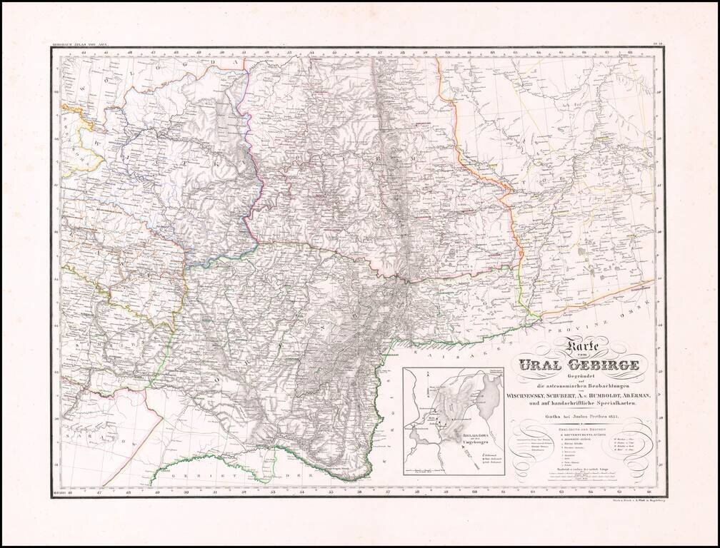
Rare and highly detailed map of the Ural region, with a large inset of the Bjelaja Gora area. The map shows post roads, government roads, district roads, mountains, rivers, lakes, towns, boundaries and a host of other details. There are very few maps...
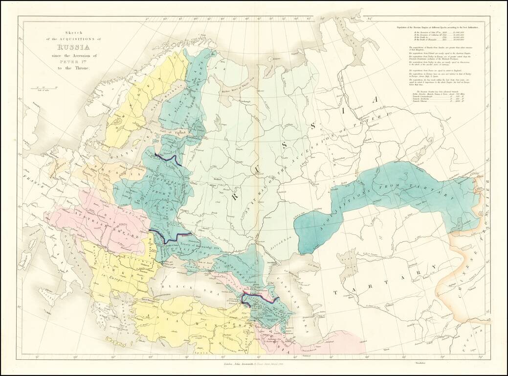
Interesting historical map of Russia, examining the history of Russia from the Reign of Peter the Great in 1689 to the Death of Alexander in 1825.
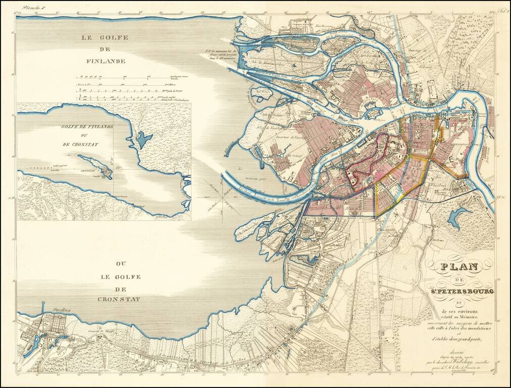
Rare Plan of St. Petersburg Proposing An Early Solution to St. Petersburg's Perennial Flooding Issues Von Wiebeking's plan for St. Petersburg was one of several competing plans proposed for the purpose of addressing the chonic flooding issues in St....
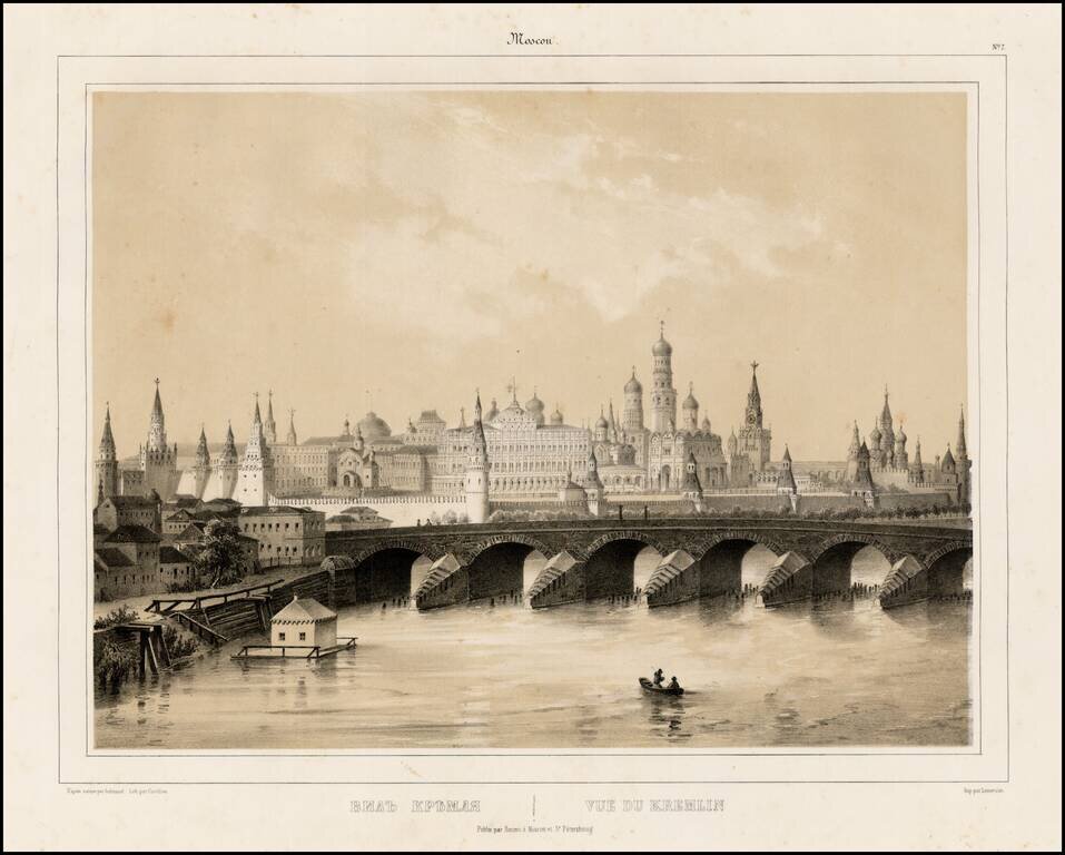
Fine lithographic view of the Kremlin, from a series of views of Moscow and Petersburg, published by Daziaro in Moscow and St. Petersburg.
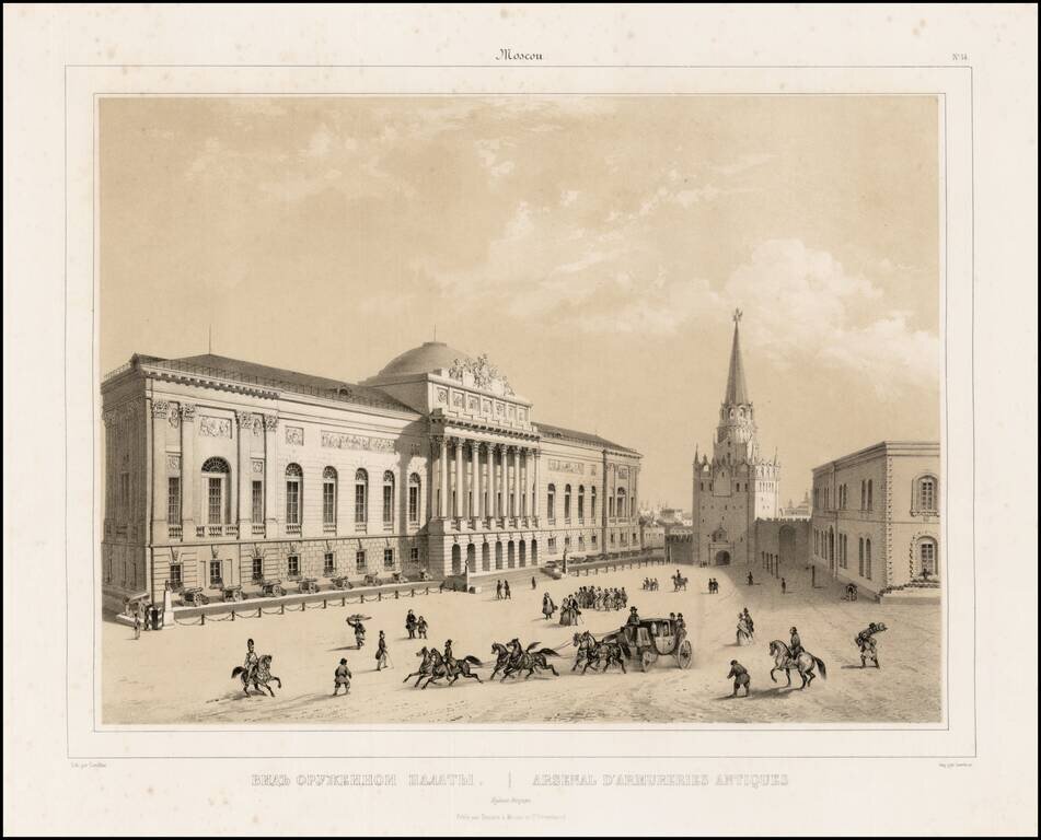
Fine lithographic view of the Kremlin Arsenal Moscow, from a series of views of Moscow and Petersburg, published by Daziaro in Moscow and St. Petersburg. The Kremlin Arsenal was previously used as an armory, which was built within the grounds of the...
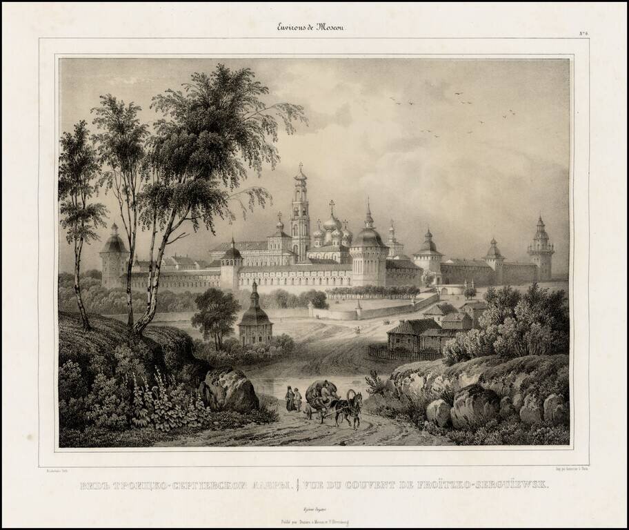
Fine lithographic view of the Convent of Froitzko-Serguiewsk, from a series of views of Moscow and Petersburg, published by Daziaro in Moscow and St. Petersburg.
![[European Russia] Гидрографическая Карта Европейской Россіи. Составлена Департаментом Проэентовъ И Смѣтъ Главнаго Управления Путей Сообщения и Публичныхъ Зданій | Hydrographical Chart of European Russia Compiled by the Project and Estimate Department of](/map/small/61005.jpg)
An Empire Connected by Rivers. Large-format Russian-language map of European Russia, focusing on the ever-expanding project to connect all of European Russia through its navigable rivers and canals. From the 18th to the 20th centuries, the primary...
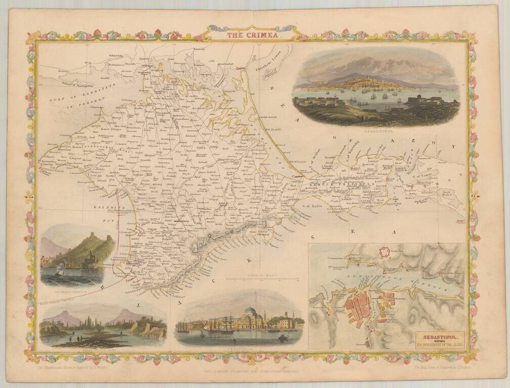
Nice full color example of Rapkin' map of The Crimea, in the style of the maps of John Tallis Vignettes includes Sebastopol (2), Balaklava Harbor, Bank of the Alma River and Eupatoria.
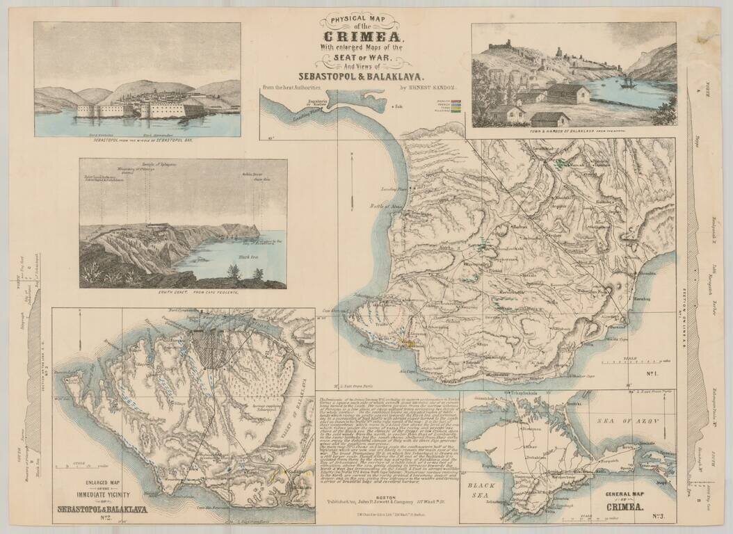
Rare separately issued map of showing the status of the War in the Crimea, published by John P. Jewett & Co. in Boston and Lithographed by S.W. Chandler & Bro. in Boston. The map includes inset maps entitled "General Map of Crimea" and...
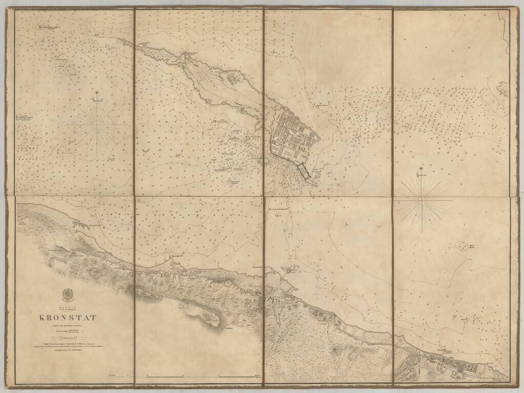
Scarce chart of the Island of Kronstat, the primary defensive position for the Russian Navy in defense of Russia's Czarist Capital of St. Petersburg. Published on the eve of the Crimean war in anticipation of the conflict with Russia, the Allied Navy...
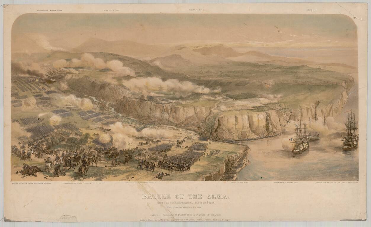
Fine view of the battle of Alma, lithographed by Andrew Maclure from contemporary drawings. The Battle of Alma (September 20, 1854) is generally considered the first battle of the Crimean War. An Anglo-French force under Jacques Leroy de Saint Arnaud...
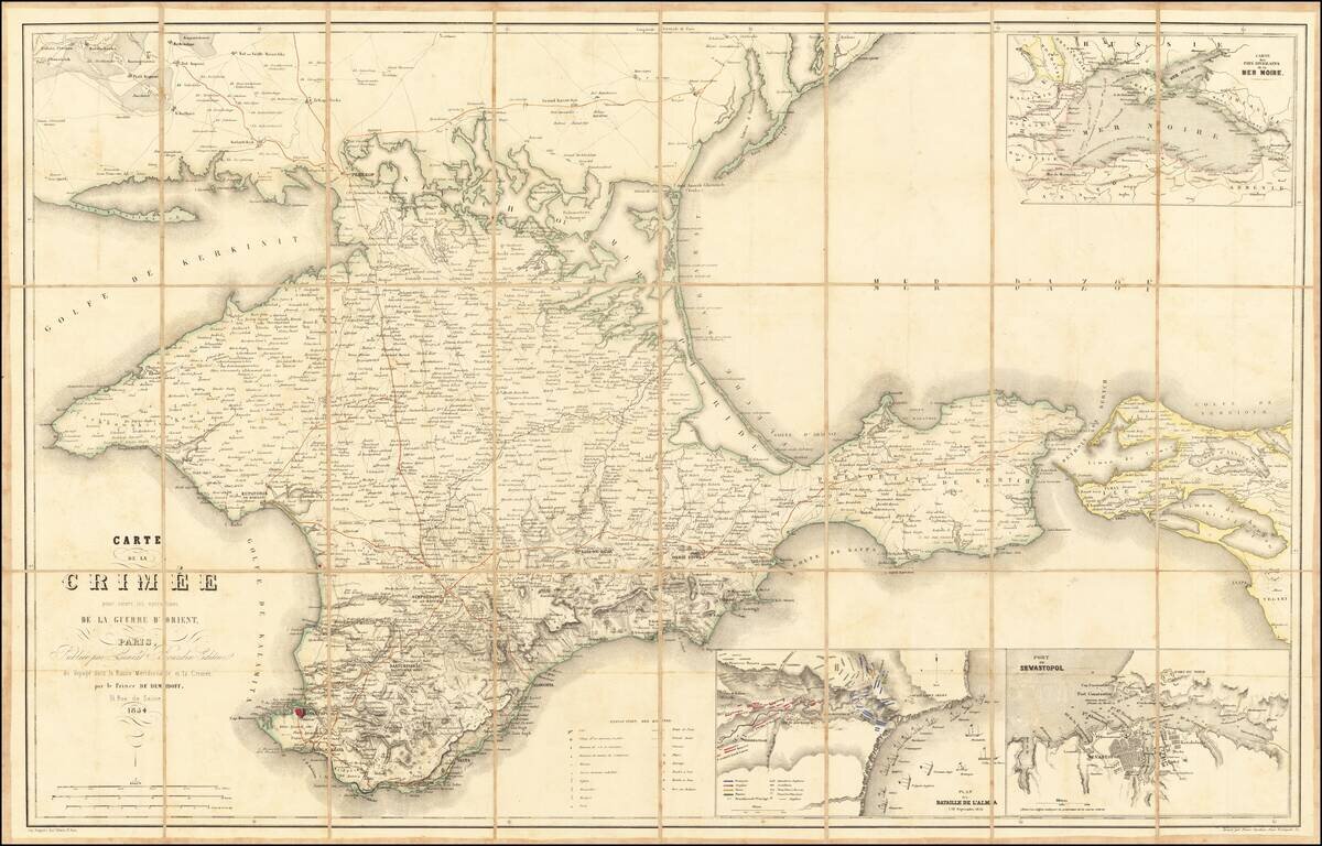
Large map showing the Crimea region, published to follow the Crimean war, published by Ernest Bourdin in Voyagé dans la Russie Méridionale et la Crimée, par le Prince de Deminoff. The map includes Post Roads, Great Roads, Railroads, etc. Includes...
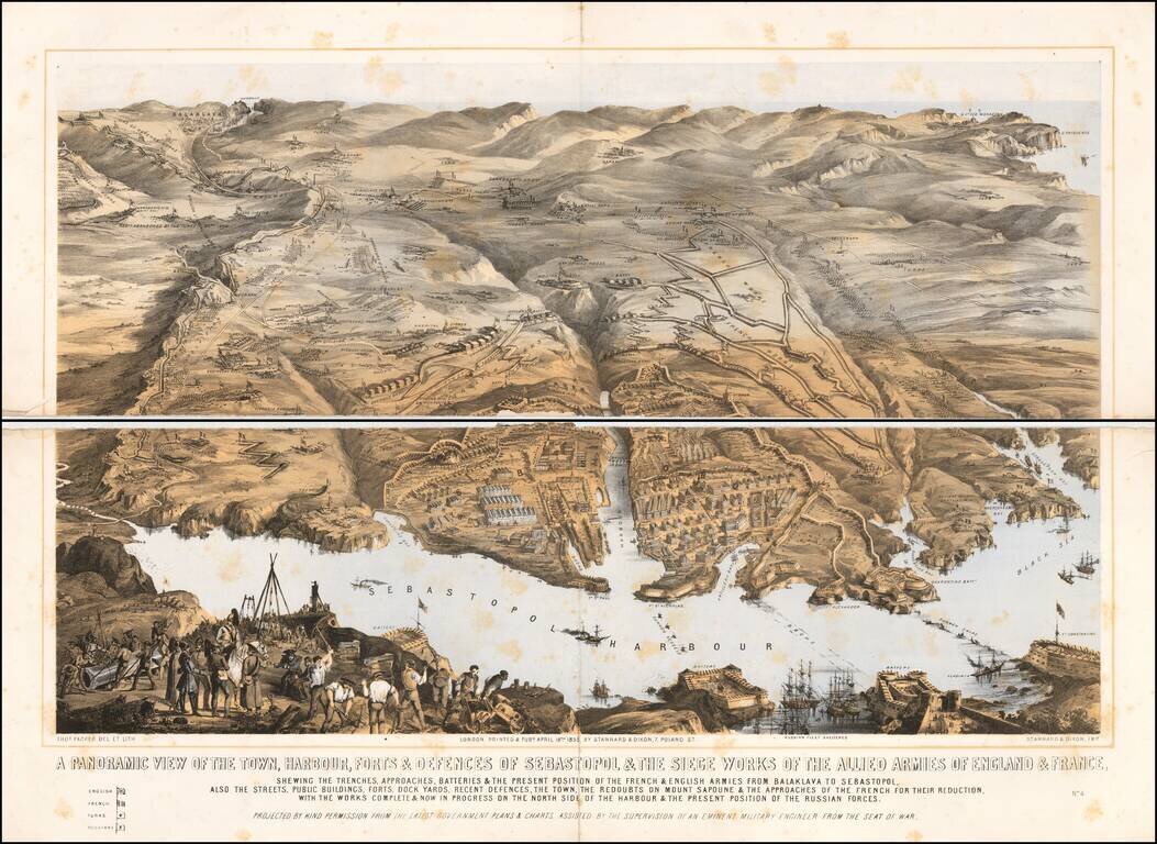
A large panoramic plan of the town, harbour, forts and defenses of Sevastopol in Ukraine. Chromolithographed and designed by Thomas Packer, and published by Stannard and Dixon, 7, Poland Street in London. Full Title: A panoramic view of the town,...
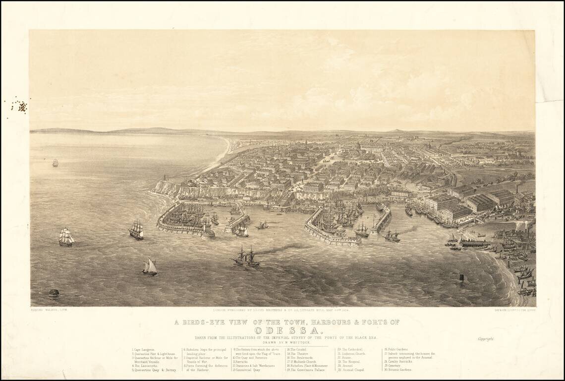
Fine early view of Odessa, published by Lloyd Brothers & Co. in New York and Lithographed by Edmund Walker for Day & Son, Lithographers to the Queen. The view include a key locating 30 points of interest, and is based upon a drawing by...