
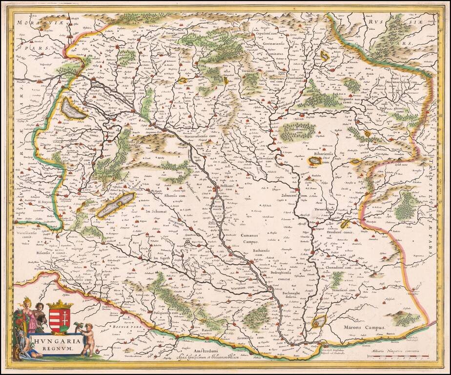
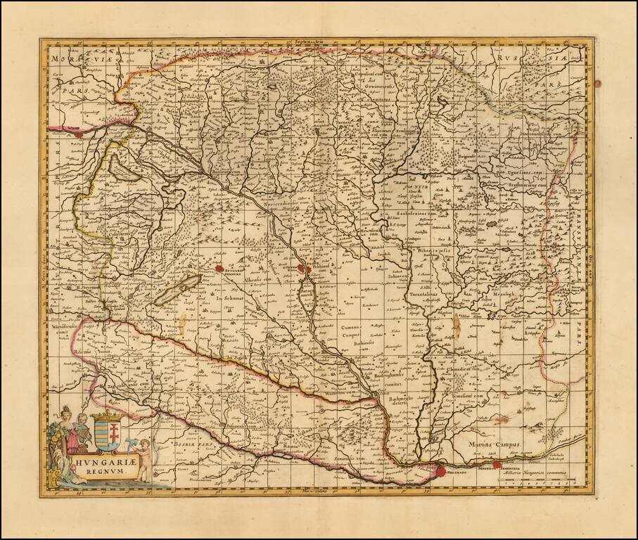
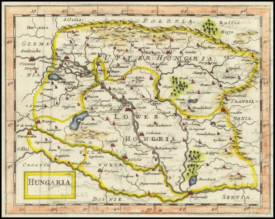
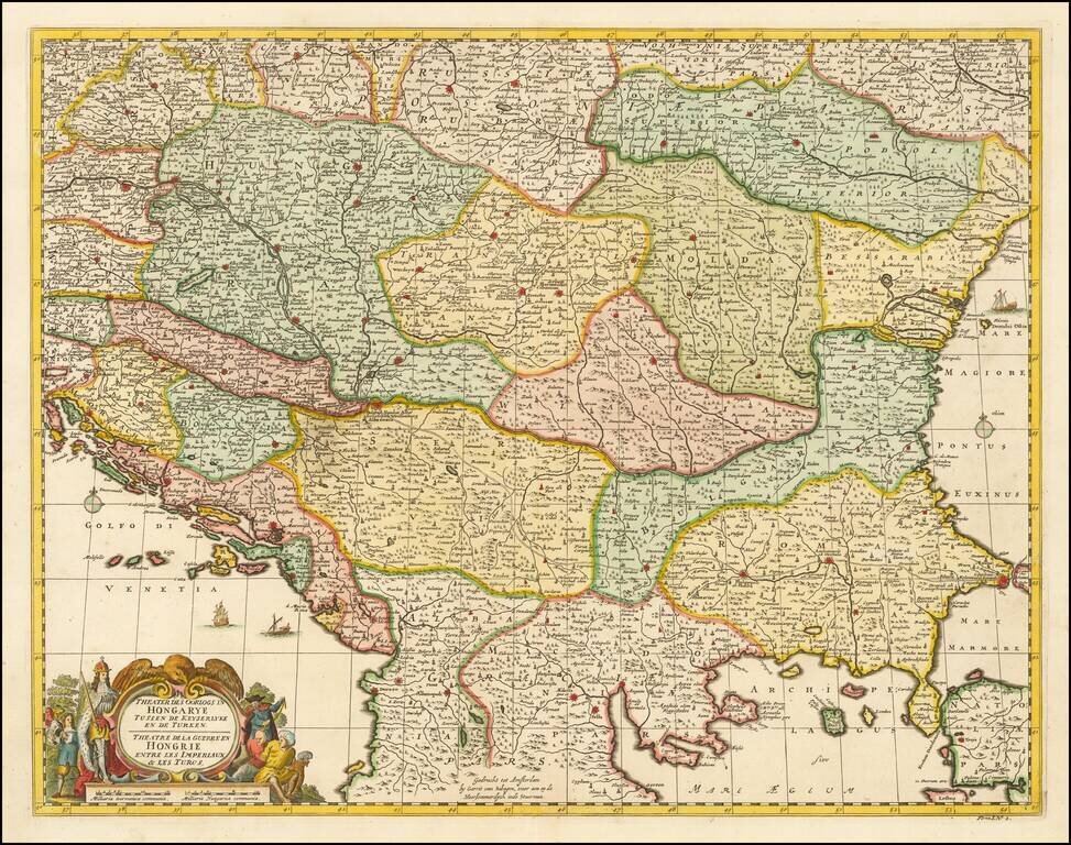
Striking example of Blaeu's map of the Kingdom of Hungary. Includes decorative cartouche, coat of arms, etc.
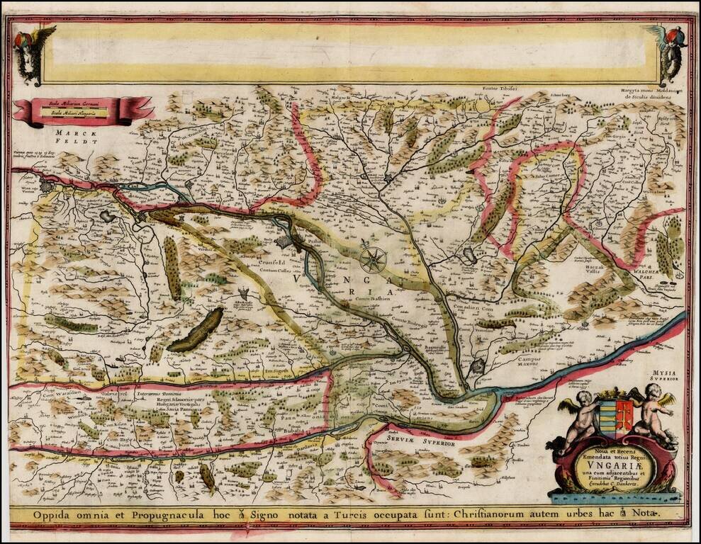
Extremely rare proof state of Danckert's map of Hungary, pre-dating the addition of 2 views in the upper blank box and the only edition to bear the name Cornelis Danckerts. The proof state is known in only a few examples, one of which is in the...
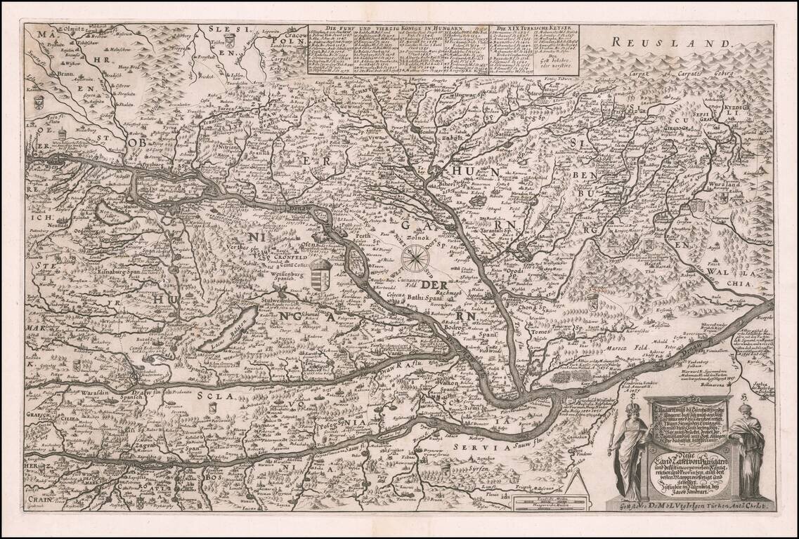
Rare map of Hungary by Jacob von Sandrart, published in Nuremberg. The map includes fine details, many coats of arms, towns, rivers, bridges, lakes, mountains and other details, including historical annotations with dates reflecting the battles fought...

Rare map of Hungary, published by Sir Jonas Moore in London. The map appeared in Moore's A New Geography. Many of the plates in the work were engraved by Herman Moll, who had moved to London in 1678 and had not yet begun publishing under his own...
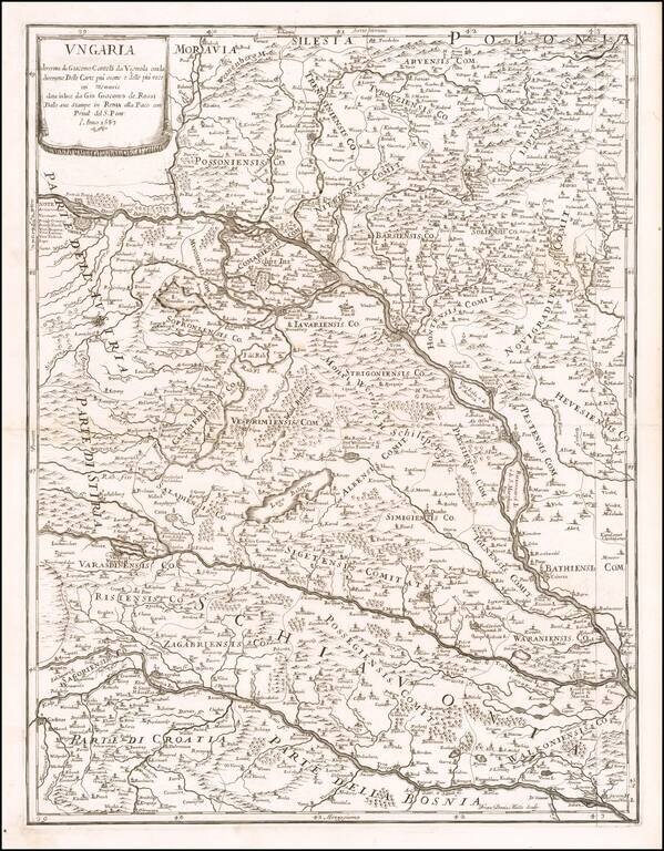
Scarce map of Hungary, Slovenia and part of Croatia and Bosnia, first published by Rossi in 1683. The map extends from the Saw River and Tributaries to the area to the north of the Danube.
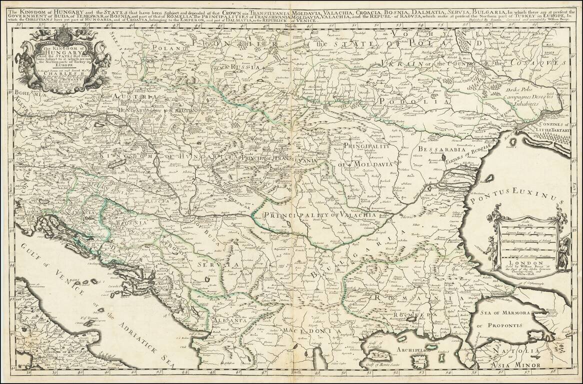
First State, from 1683, the Year of the Siege of Vienna. Rare, large engraved map of southeastern Europe, published by William Berry in London in 1683. The map was published at a pivotal point in the history of the region; in 1683, the Ottoman Empire...
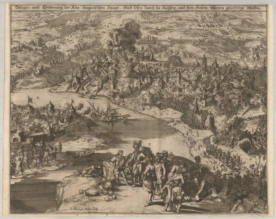
J.C. Haffner's View of the 1686 Siege of Budapest. Finely engraved view of the 1686 Siege of Budapest, engraved by Johann Christoph Haffner in Augsburg in 1687. The view depicts the battle between the Ottoman Turks and the Holy League for control...
![[Eger, Hungary] Pianta e Bloccatura dell'Inespugnabile Cittá e Fortezza d'Agria overo Erla o Eger nell'Ungaria Superiore bloccata il P.o Luglio 1687 e Resa All'Armi Cesaree Sotto Il Comando Del Marchese D'Oria Li 2 Decembre 1687 Dalla Quale Uscirono Li T](/map/small/59070.jpg)
Rare separately published map showing the Siege of Eger, published in Rome in 1688. The Siege of Lorraine was undertaken by a Holy League force, led by Charles of Lorraine. The key at the lower left of the map shows the positions, encampments,...
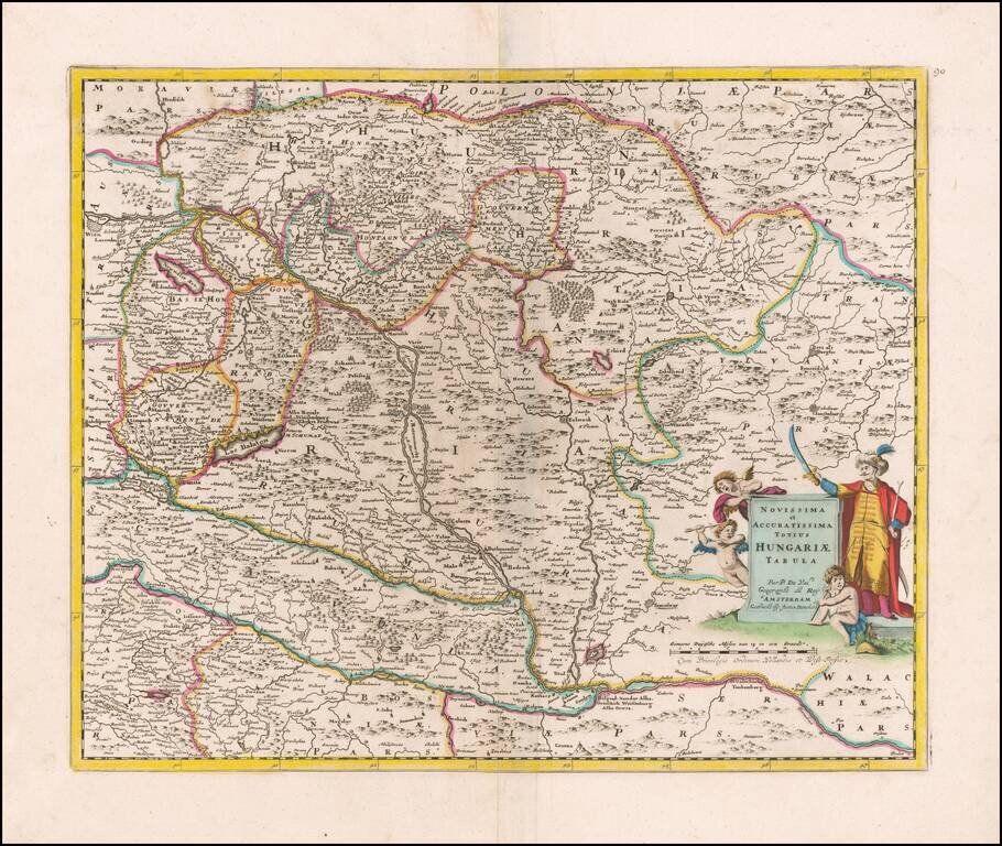
Detailed late 17th Century map of Hungary. Includes decorative cartouche, coat of arms, etc. Originally engraved by Jan Jansson, the copperplate was later acquired by Valk & Schenk. The Valk & Schenk edition is by far the more scarce edition...
Rare separately published Justus Danckerts map of Hungary, based upon an early map by Pierre Du Val. Du Val original published his map during the Great Turkish War (1683-1699), illustrating the Hapsburg controlled region at a time when the Ottoman...
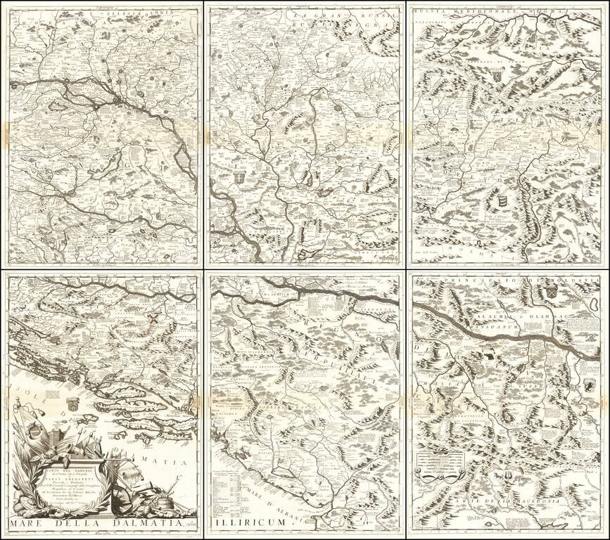
Monumental Six Sheet Map of the Danube Region Nice example of Vincenzo Maria Coronell's magnificent 6-sheet map of the course of the Danube River from Vienna to Nikopolje, published in Venice. The map is a remarkable compendium of information...
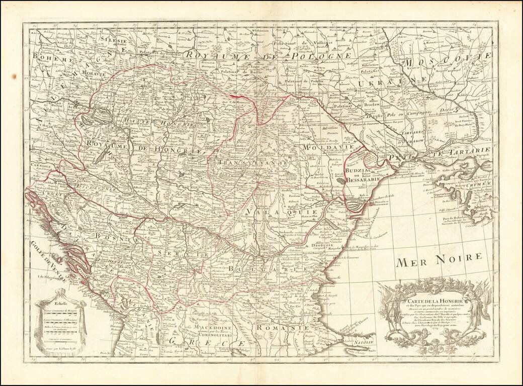
Detailed map of Southern Europe published by Guillaume De L'Isle. Shows Hungary, along with part of Dalmatia, Serbia, Macedonia, Romania, Constantinople, the Black Sea, Crimea, the Ukraine, Poland, Hungary, Transylvania, Moravia, Moldovia, the...
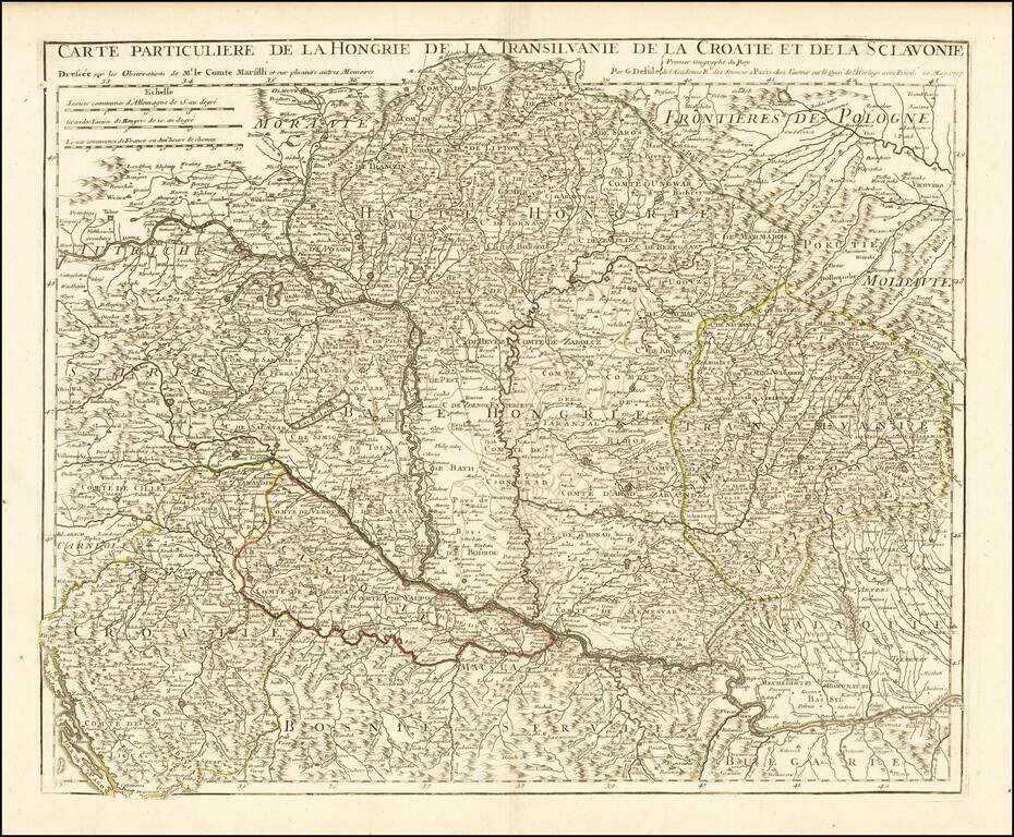
Scarce regional map of the region north of the Danube, published by Guillaume De L'Isle in Paris. Includes all or part of Hungary, Romania, Transylvania, Slovenia, Croatia, Bulgaria, Bosnia, Serbia, and Poland.
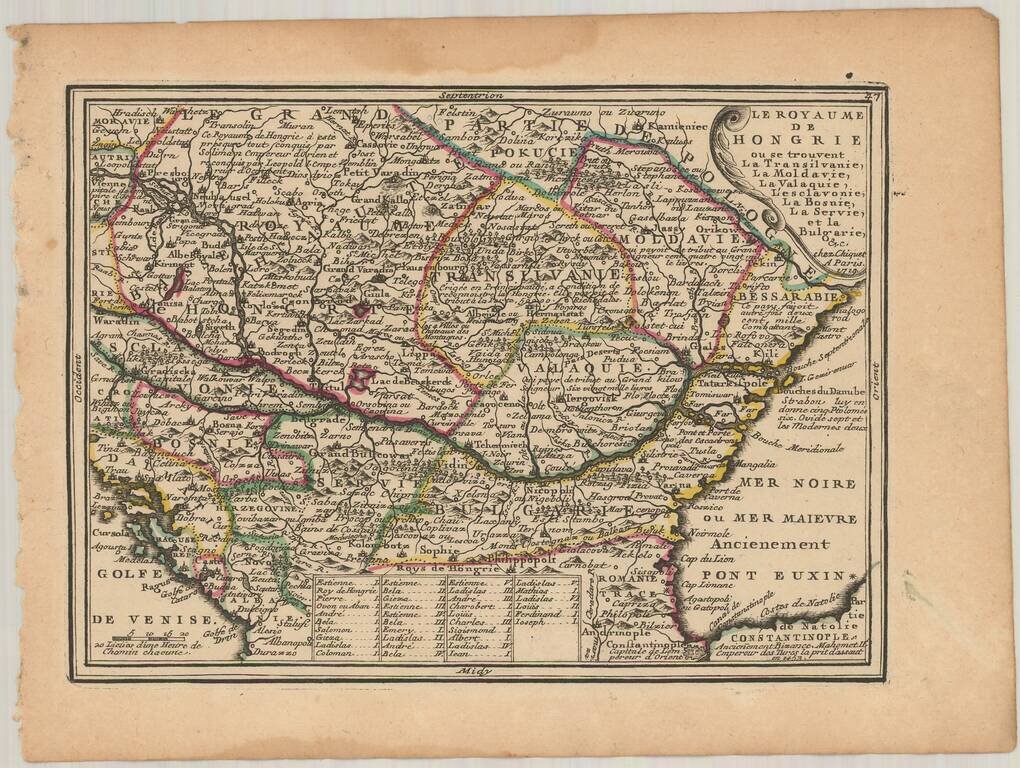
Nice example of Chiquet's map of Hungary and the Balkans, from his Le Nouveau et Curieux…
Gerrit van Schagen's hand-colored engraved map of the Balkans, showing Hungary, Romania, Bulgaria, Serbia, etc. Attractive cartouche in the lower left.