Map size in jpg-format: 4.26795MiB
Click to open in high resolution (open in new tab).
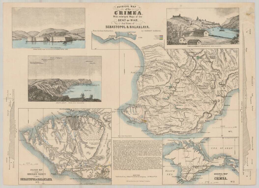
Rare separately issued map of showing the status of the War in the Crimea, published by John P. Jewett & Co. in Boston and Lithographed by S.W. Chandler & Bro. in Boston.
The map includes inset maps entitled "General Map of Crimea" and "Enlarged Map of the Immediate Vicinity of Sebastopol & Balaklava," the latter showing troop locations in blue (French), red (English), Green (Russian) and yellow (Turks), as does the primary map.
The map also includes views of Sebastopol and Balaklava, along with a prospective view of the South Coast from Cape Feolente.
The map was prepared by Ernest Sandoz and endorsed "By Professors Guyot & Agassize of Cambridge."
Ernest Sandoz was a surveyor and civil engineer from Princeton, who was the nephew of the noted geographer Arnold Henri Guyot, who served as Guyot's assistant for a number of years.
OCLC lists a single copy of the map at Cornell University. The 1857 Catalog of the New York State Library also lists a copy.
If you are a student, write to us in telegram: @antiquemaps and indicate what material you need and for what work you need a map in high detail. We are ready to provide material on special terms. For students only!
![[Signed Political Satire Artwork] Vietnam ... Vietnam ... Vietnam ...](/map/small/68726.jpg)

