
![[Soviet Union] Our Country -- From Wooden Plough To Sputnick](/map/small/47092.jpg)
Fascinating Soviet map and promotional brochure, prepared for the USSR Section of the Brussels Universal and International Exhibition, 1858. The map shows the Russians at the North Pole and prosperously exploiting their bountiful natural resources....
![ЛЕНИНГРАД СПУТНИК ТУРИСТА [Leningrad Tourist Companion]](/map/small/54850.jpg)
Attractive color-printed Soviet tourist map of Leningrad (present-day St. Petersburg) published by the Soviet Navy. The map features parks and landmarks, the latter of which are shown pictorially. The map is in Russian.
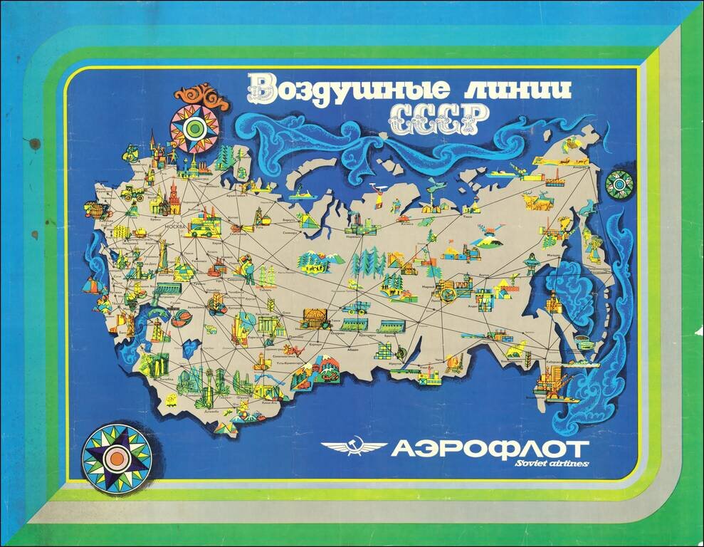
Attractive modernist travel poster issued by Aeroflot, the official national airline of the Soviet Union. The map highlights exclusively domestic routes within the Soviet Union. Interestingly, though not particularly unusual for the time, the routes...
![[Moscow. Motorist's companion. Schematic plan of the main streets and highways of the capital] Москва Схематический План Основных улиц и Магистралей Столицы](/map/small/70244.jpg)
Vintage map of Moscow focusing on automobile infrastructure at the end of the 1960s. The map shows some of the development of the city's automobile infrastructure: 105 gas stations, 32 official parking spots, a dozen of car repairs, and a small number...
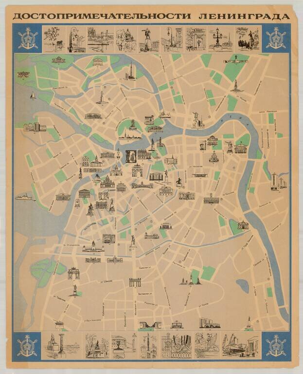
Fine Soviet-era pictorial tourist map of Leningrad (St. Petersburg), published in the former Soviet Union. The map illustrates over 90 points of interest, with 16 inset views at the top and bottom of the map. Extensive descriptive text and additional...
![Курская битва (Battle of Kursk) [Russian Educational Wall Map -- 1943]](/map/small/46011.jpg)
Fascinating Russian Educational Wall Map, illustrating and describing the Battle of Kursk in the Summer of 1943, with a vignette from the Battle. This map was likely used for teaching purposes, to Russian High School aged students, in the 1970s. The...
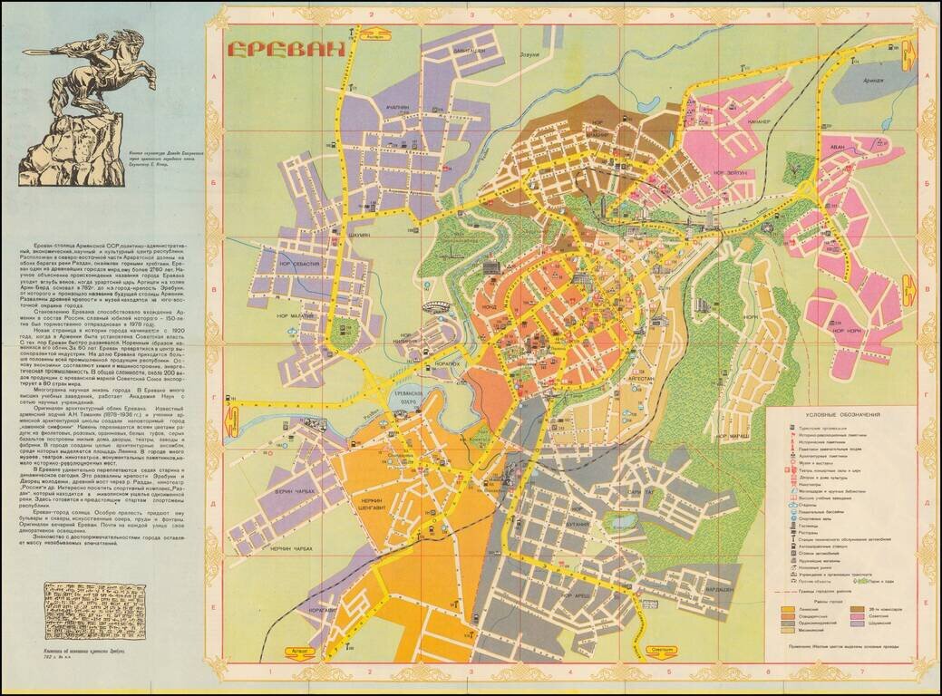
Beautiful color-printed Soviet-era map of Yerevan, then-capital of the Armenian SSR. This is a somewhat typical Soviet era tourist map, highlighting the major parks, and neighborhoods of Yerevan. It includes a panel on the history of the city, and on...
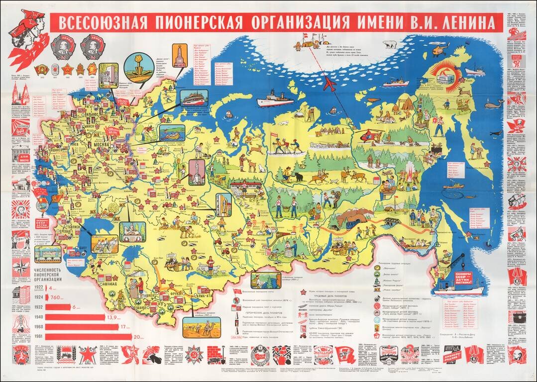
A Propaganda Map for Soviet Children -- The Soviet Boys and Girls Scouts Educational/Propaganda map of the Soviet Union (including Baltic & Southern republics) showing the State border, key cities, pioneer museums and large construction projects...
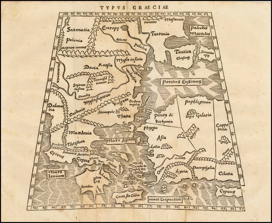
Rare early modern map Greece, Turkey, the Black Sea and Cyprus, from Solinus' Polyhistor, rerum toto orbe memorabilium thesaurus locupletissimus. Huic ob argumenti similitudinem Pomponii Melae de situ orbis libros tres adiunximus. This fine early map...
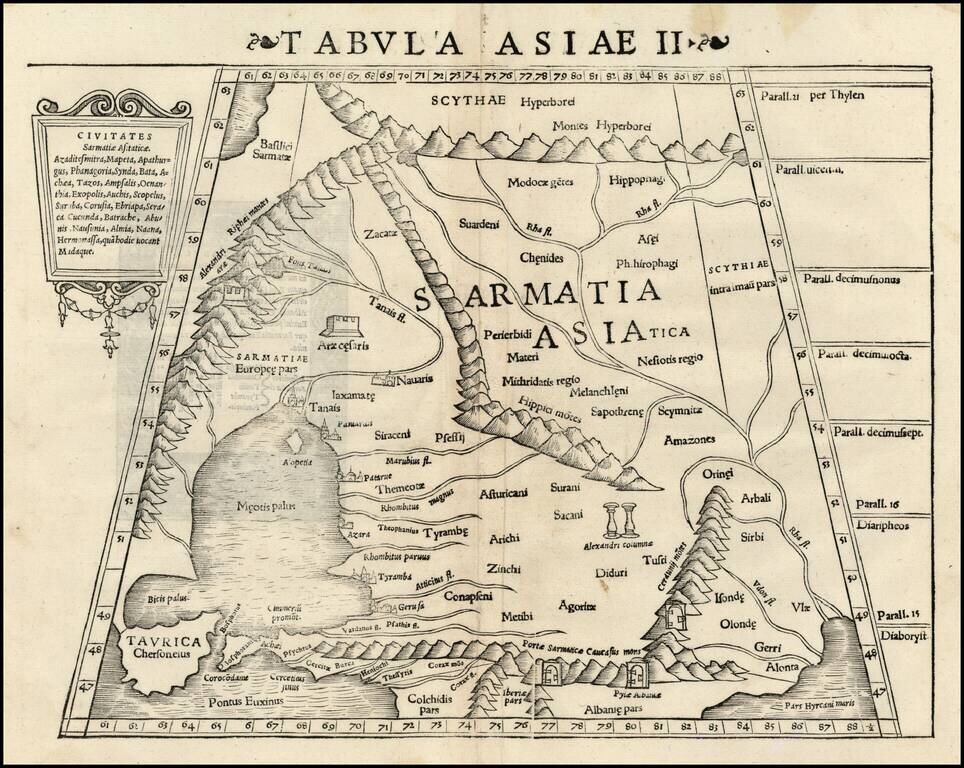
Rare first edition of Munster's Ptolemaic map of part of the Ukraine and the region between the Black Sea and Caspian Sea extending south to include all of Armenia Maior and part of Armenia Minoris. Shows Noahs Arc in the Caspian Sea, believed to have...
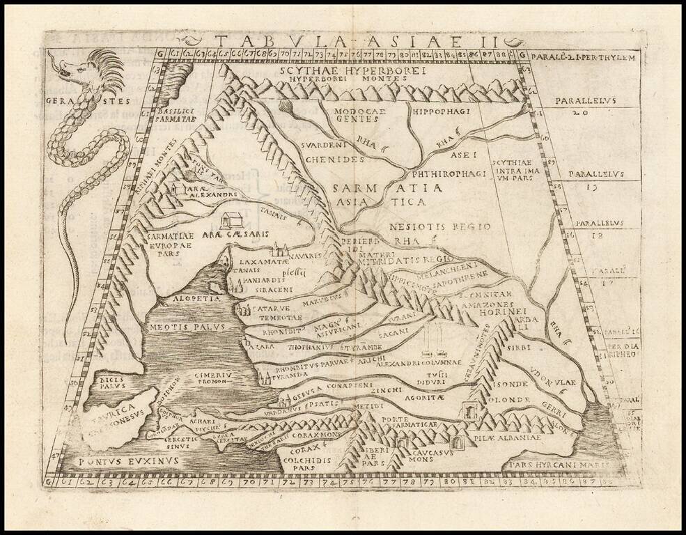
Fine example of Gastaldi's map of Ukraine, Russia, Georgia, Armenia and neighboring regions, based upon the work of Claudius Ptolemy. Giacomo Gastaldi's Atlas of 1548 has been called the most comprehensive atlas produced between Martin...
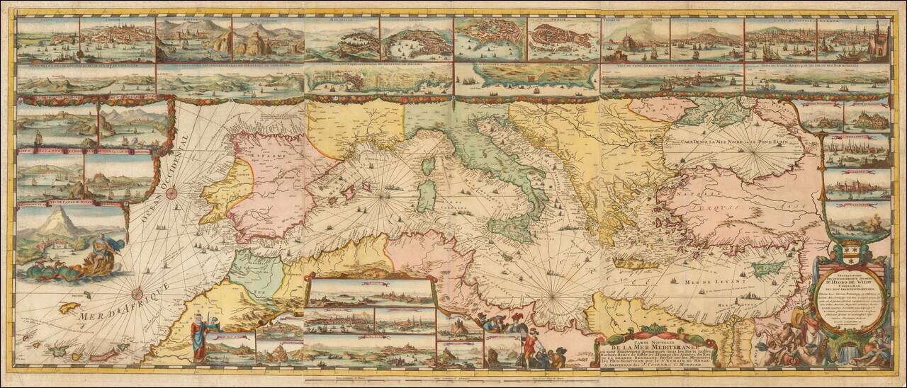
The Most Lavishly Illustrated Map of the Mediterranean of the 17th Century Covens & Mortier edition of Romeyn De Hooghe map of the Mediterranean, embellished with 38 inset maps and views of the major ports and harbors of the Mediterranean. Fine...
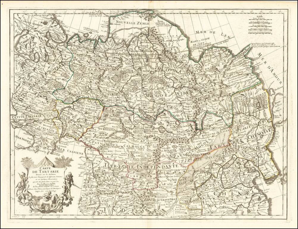
Nice example of this detailed map of Tartary, consisting of the Eastern part of Russia, Central Asia, China and Korea, first published by Nicholas De L'Isle in 1706. The map extends from the Peninsula of Korea in the east to the Caspian and Black...
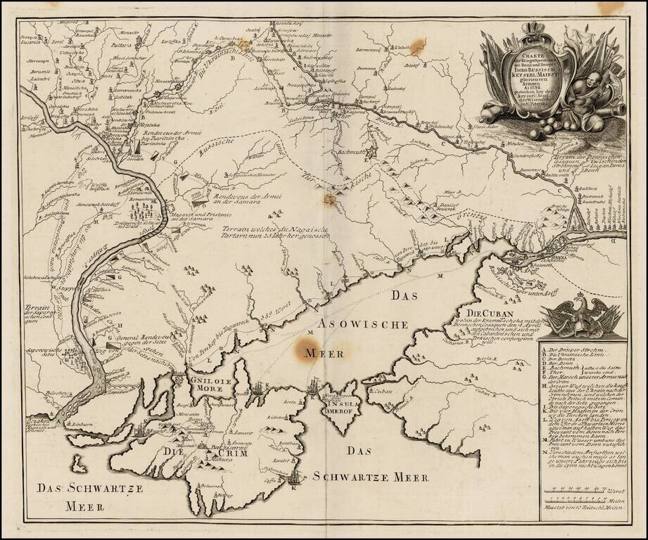
Very rare separately published map of the southern part of Ukraine, published by the Royal Academy in St. Petersburg. The map provides a detailed account of the battles between the Russian and Turkish Armies. The map was later copied in Augsburg by...
![[Ochakov] Plan veritable de la fameuse Forteresse d'Oczakow Prise d'assaut sur les Turcs par l'Armee Russie Sous le Commandement de S. Exc. Mr. le Marechal Comte de Munich le 2 Juillet 1737 et deffendue vaillammant par Mr. le Major General de Stoffel, con](/map/small/62883op.jpg)
Exceptional Original Color Finely colored example of Antoine du Chaffat's exceedingly rare map of the Siege of Ochakov, published in Augsburg. The plan includes a detailed treatment of the fortifications and 7 item key in French and German locating...
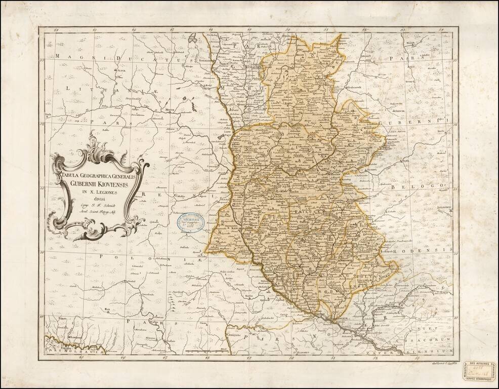
One of the Earliest Maps of the Kiev Guberniya Rare separately published map of the Kiev region, published in St. Petersburg. The map depicts the Kiev Guberniya in fine detail, perhaps more so than any prior map. The map is issued at the end of the...