
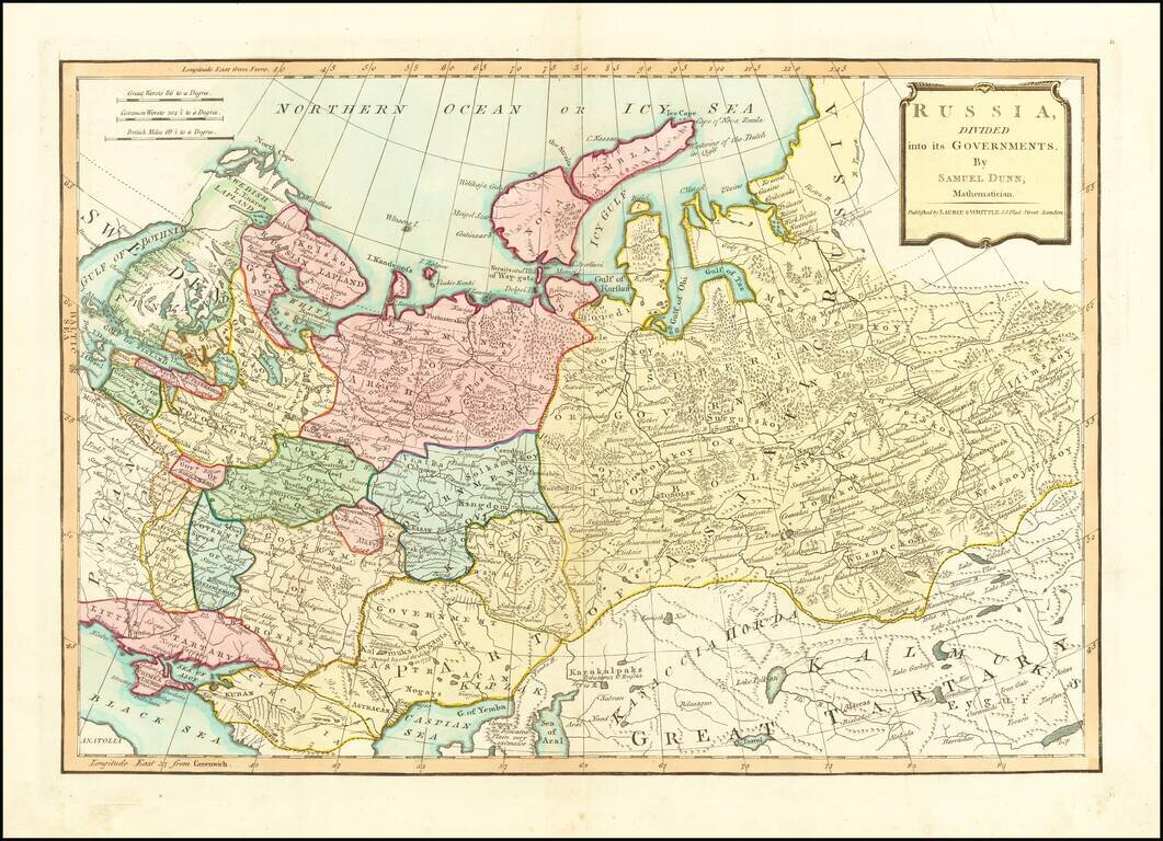
Finely colored map of Russia and its political divisions. Includes towns, mountains, rivers, lakes, islands, etc. From Dunn's New Atlas or Mundane System of Geography.
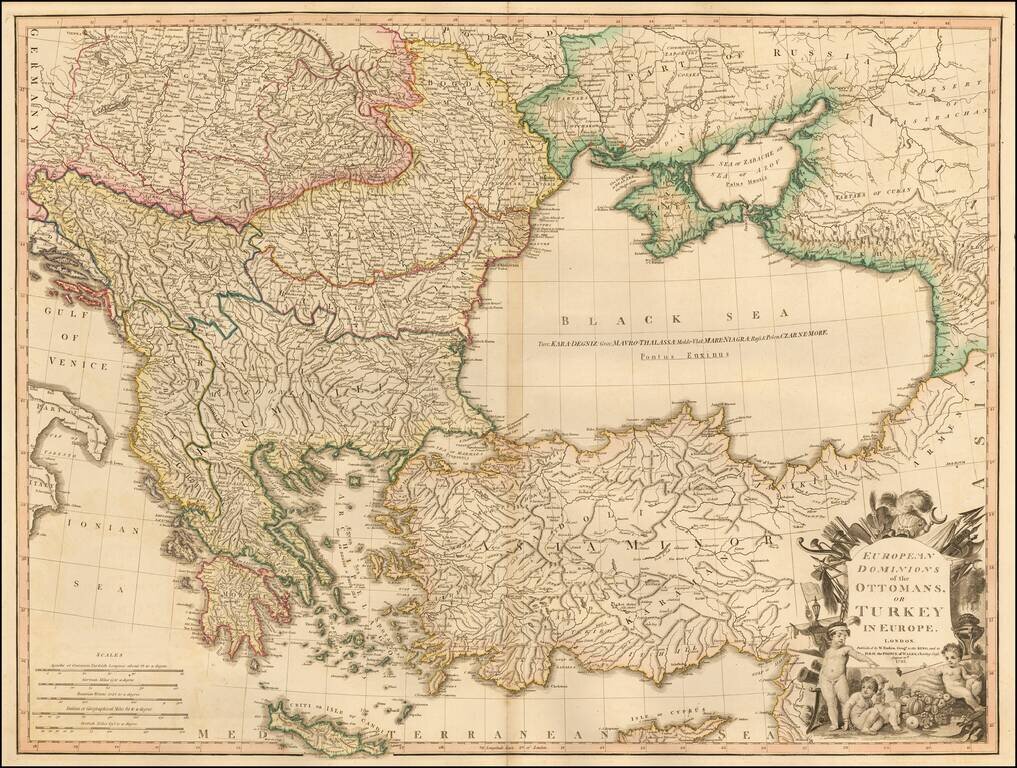
Large detailed Faden map of the region bounded by Greece and the Ionian Sea, the Ukraine, the Gulf of Venice, Asia Minor and the northern coast of Cyprus. Extremely detailed. The map shows the Ottoman Empire, circa 1720 and includes an ornate...
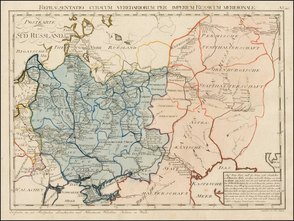
Rare postal map of Ukraine and Southern Russia, which appeared in Von Reilly and Kuhn's Atlas Universae rei veredariae bilinguis ... Allgemeiner Postatlas von der ganzen Welt . . . , published in Vienna in 1799. Von Reilly & Kuhn's atlas is the...
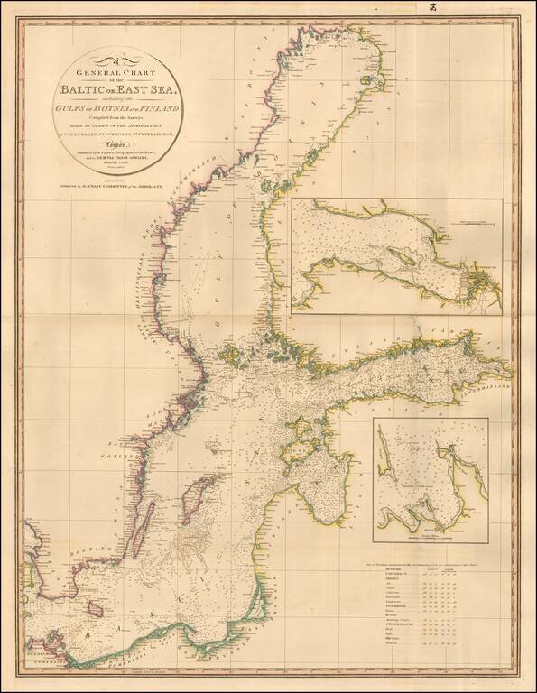
Highly detailed chart of the Baltic and contiguous coasts, from Faden's general atlas. Includes detailed insets of the areas around Revel and St. Petersburg. One of the most detailed general charts of the Baltic to appear in an English Commercial...
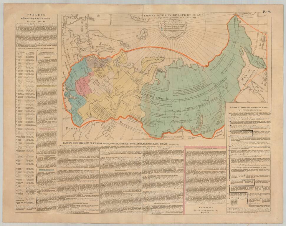
Rare Florentine map of Russia with original color showing the growth of the empire under the major rulers. Includes numerous notations and explanations. Panels of text describe the history and geography of the region. Side includes text panels. This...
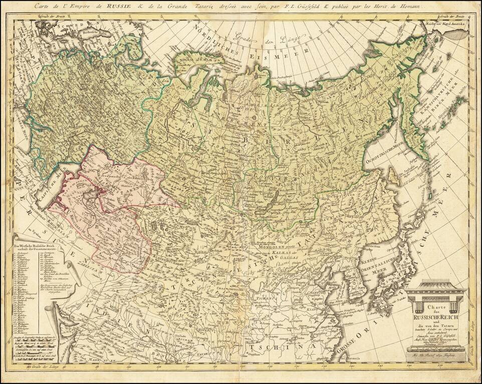
Rare late edition of this detailed map of the whole of Russia and parts of China and Central Asia. Interesting and highly detailed. This is the first time we have seen this state of the map.
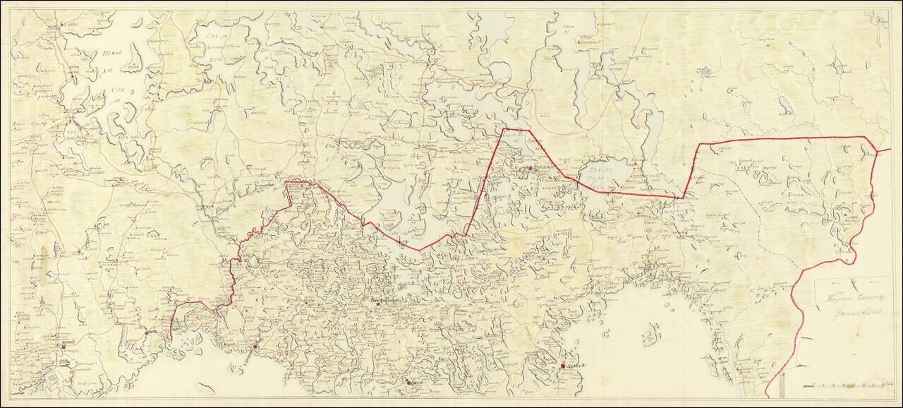
Imperial Russian Manuscript Map of the Russia-Finland Border, circa 1810. Pavlovsk Palace Library Provenance. Large Imperial Russian manuscript map of the Russia-Finland border as it existed between 1743 and 1812. The Russian side of the border...
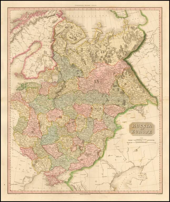
Highly detailed map of European Russia. Highly detailed regional map, one of the best regional maps of the area to appear in an English Atlas during the period. Pinkerton's now rare elephant folio atlas is one of the best engraved works of the period....
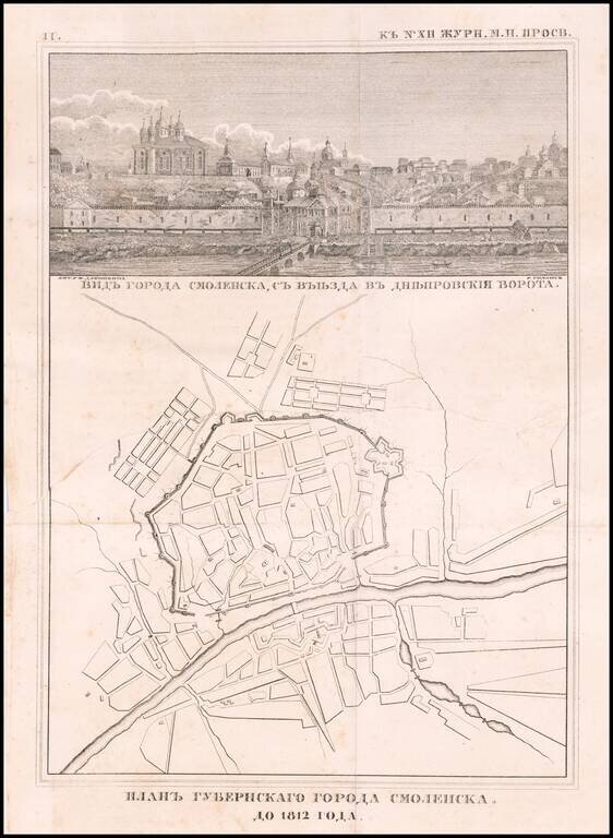
Rare engraved map of Smolensk on the Russian border with Belarus, published in 1812. Above the map is a view of the city titled "Видъ города смоленска, съ въезда въ днепровския ворота." (View of the City...
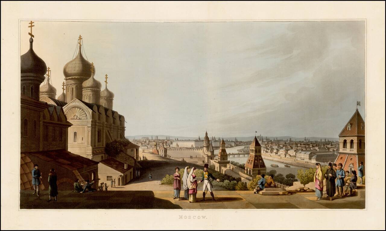
Fine colored acquatint view of Moscow, published by Robert Bowyer in London in 1816, from An Illustrated Record of Important Events in the Annals of Europe, During the Years 1812, 1813, 1814 & 1815, Comprising a series of Views of Paris, Moscow,...
![[Plan of the City of Pskov with its suburban settlements] Планъ Города Пскова...](/map/small/67397.jpg)
Scarce Russian Military Topograhers map of the city of Pskov, issued in 1821. The map includes a 25-item list of the streets of the city (at the right edge), a 17-item list of city gates (upper-left), and an extensive key at the bottom listing seven...
![Europe No. 17 Partie De La Russie [Orenbourg & Petitehorde]](/map/small/19822.jpg)
Regional map of part of Russia. Shows towns, roads, rivers, mountains, and a host of other details. From Vandermaelen's remarkable 6 volume atlas, which if combined as globe gores forms an immense globe.
![Russian Empire [with] Chart of the Communication Between The Archipelago And Black Sea](/map/small/64013.jpg)
Unusual pair of maps of Russia and the water route from the Black Sea and the Mediterranean, published in Edinburgh by Thomson. Striking regional map, showing all of Russia, the Arctic Ocean, Northeast Passage, and Chinese Tartary, along with Japan,...
![[Black Sea Map in Russian] Карта Чернаго Моря Составленная и Гравированная въ Гидрографическомъ Депо 1829 Годa. [Map of the Black Sea Compiled and Engraved in the Hydrographic Depot 1829.](/map/small/61778.jpg)
Rare Russian-language chart of the Black Sea, issued by the Hydrographic Depot in St. Petersburg in 1829. The map was published in 1829, in which year the Russians took control of the most of the eastern edge of the Black Sea and the mouth of the...
![[Hydrographic Map of European Russia] ГИДРОГРАФИЧЕСКАЯ КАРТА ЕВРОПЕЙСКОЙ РОССИИ](/map/small/54482.jpg)
A Vision of Linking the White Sea, Baltic Sea, Capsian Sea, and the Black Sea. Impressive engraved folding hydrographic map laying out Imperial Russia's extensive canal network, published by the State Transport University...
Full color example of the first edition of David Burr's map of the Russian Empire, which appeared in his Universal Atlas, first issued in 1836. Burr's Atlas was perhaps the most elegant American commercially published atlas of its time, utilizing...