
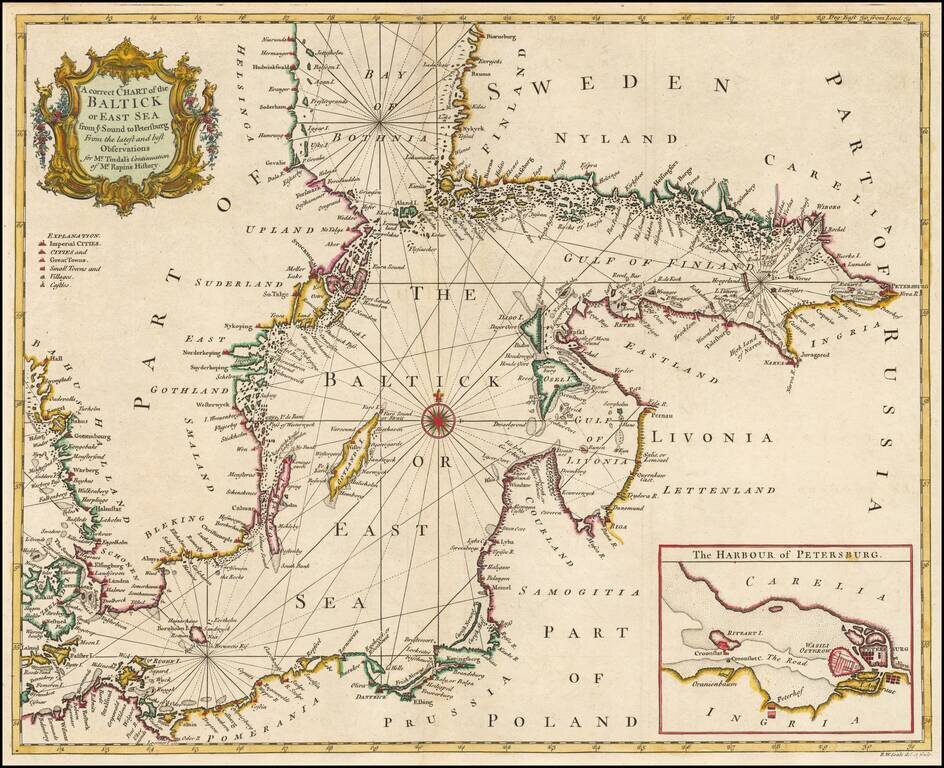
Detailed coastal chart of the Baltic Sea, Bay of Bothnia, Gulf of Finland and contiguous coastlines, with a large inst map o the Harbour at St. Petersburg. Includes a compass rose and rhumblines, with a decorative title cartouche.
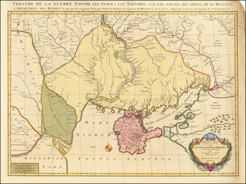
Fine old color example of this rare map depicting the theater of the Russo-Turkish War in the Ukraine in 1737. The map provides excellent detail of the fortifications including the Ukrainian line - a system of defenses from the Dnipro to the Donetz...
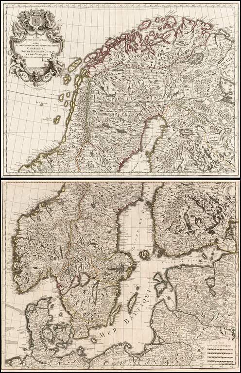
Large format 2-sheet map of the region from Scandinavia to the Baltic and part of Poland, originally issued by De L'Isle in 1708.
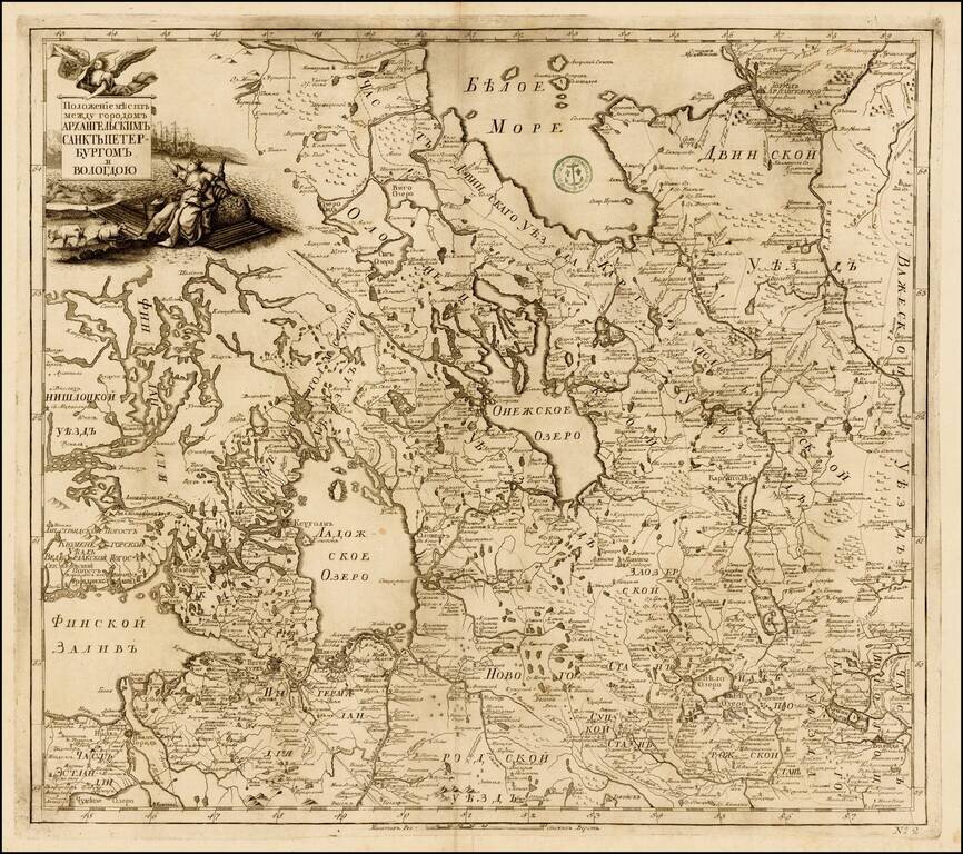
Fine example of the rare map of the region of Petroburgum, from the Russian Academy of Science's Russischer Atlas : Welcher in einer General-Charte und neunzehen Special-Charten das gesamte Russische Reich . . . , first pubished in St. Petersburg in...
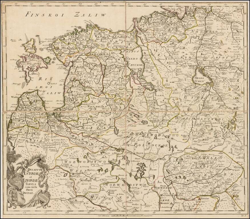
Rare separately issued map of Estonia, Latvia, Lithuania and contiguous parts of Russia and Belarus, published by the Akademiia nauk SSR (Russian Academy of Science) in St. Petersburg. The map extends south to Wilna and Minsk, showing remarkable...
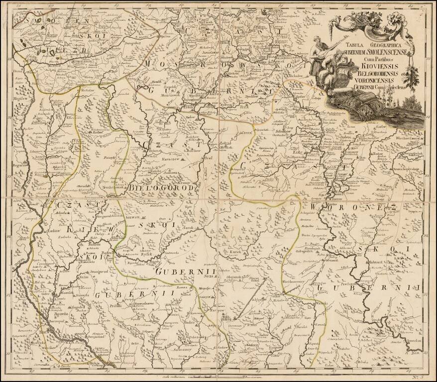
Fine separately issued example of JN De L'Isle's map extending from Moscow to the Ukraine, from the Atlas Russicus (Atlas Rossiiskoi). The first atlas of Russia, published by the Academy of Sciences in St. Petersburg, expanding on the cartographic...
![[The Course of the Neva River from Lake Lagoda to St. Petersburg] Теченїе Невы рѣки изъ-ладожского озера къ Ст: Петербургу.](/map/small/59696.jpg)
Russian-Language Map of the Neva River, Running Between Lake Lagoda and St. Petersburg. Engraved map of the Neva River from the 1745 Atlas Russicus. The cartouche includes allegorical figures and the coats of arms of St. Petersburg and the Russian...
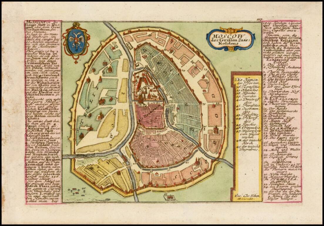
Finely detailed plan of Moscow, with extensive keys on either side of the map, identifying important places. Includes title cartouche and coat of arms.
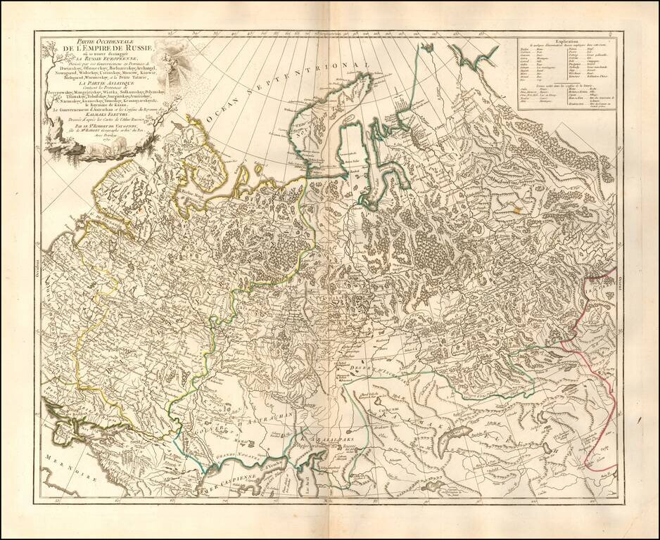
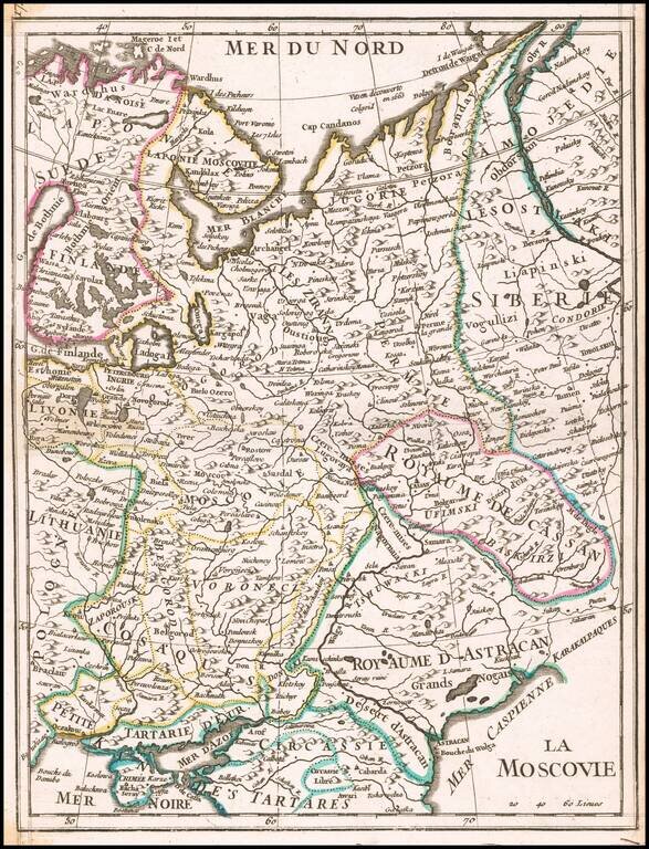
Highly detailed map of the Western Part of Russia, extending South to the Caspian and East to Irkurkoy and Ilimskoy.
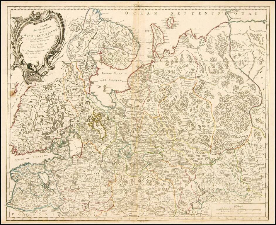
Highly detailed map of the Northwestern part of Russia, from the Gulf of Finland and Poland, to the western part of Asian Russia. Decorative cartouche.
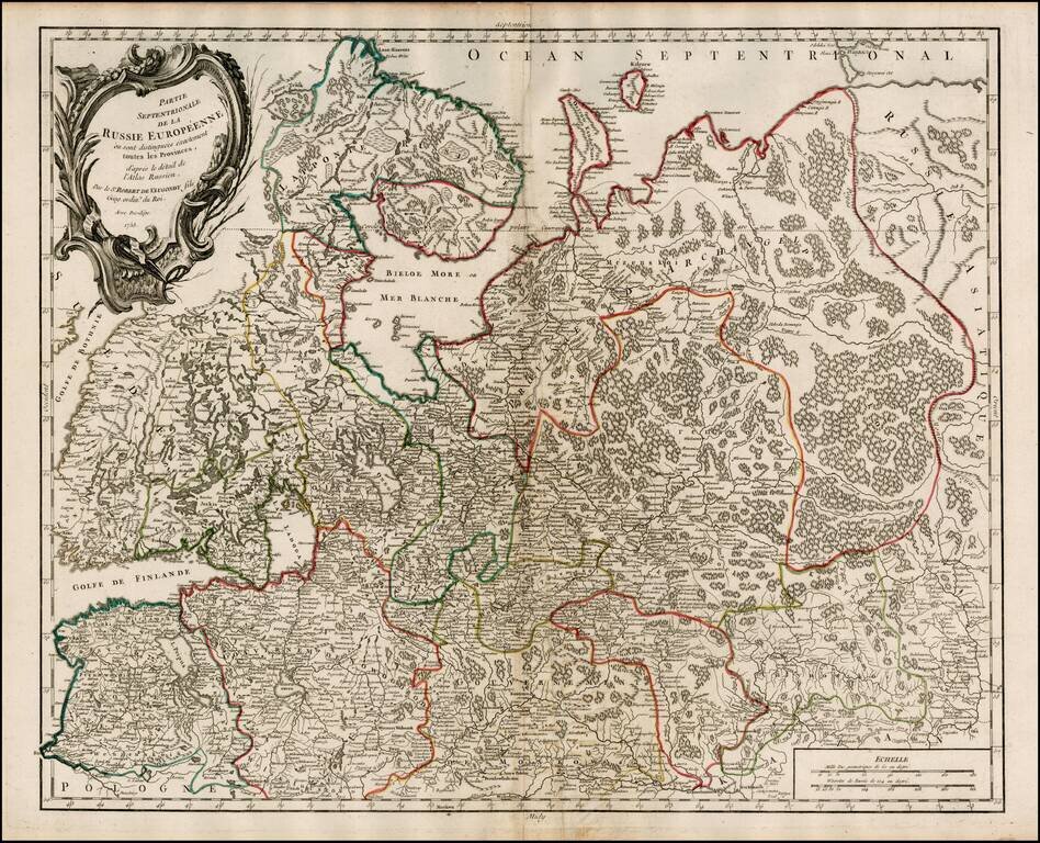
Highly detailed map of the Northwestern part of Russia, from the Gulf of Finland and Poland, to the western part of Asian Russia. Decorative cartouche.
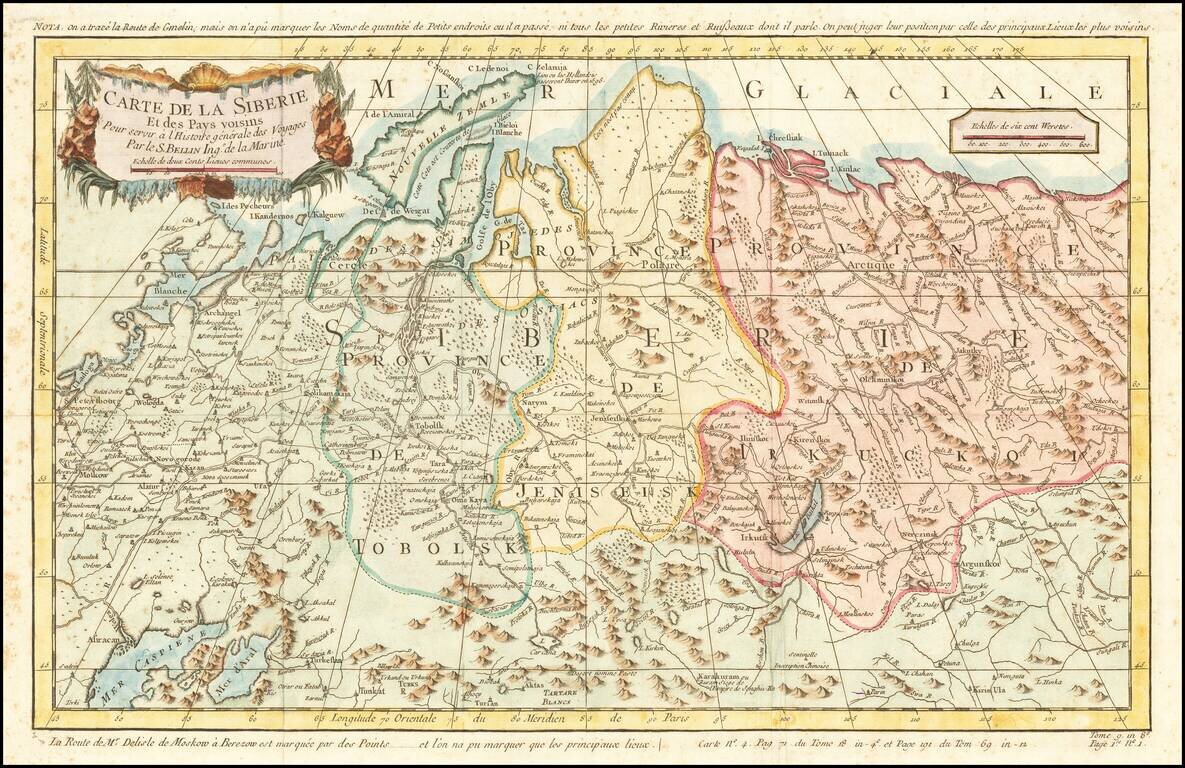
Detailed map of Siberia, extending from the White Sea and the Caspian Sea in the west to Irkuckoi Province, Jakutky on the Lena River and regions just to the east. Centered on the Jenisi River. Nicolas Bellin was the official map maker to the King of...

Detailed map of Nova Zembla and part of the Northeast passage. Includes a decorative title cartouche. One of the maps produced by Nicholas Bellin for L'Histoire Generale des Voyages.
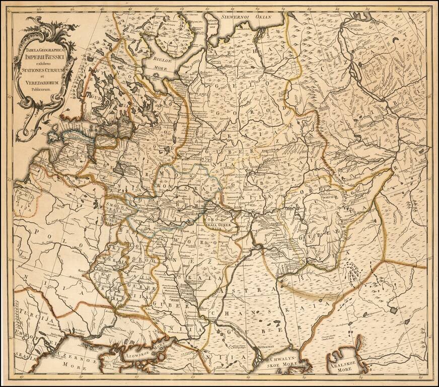
A Russian Published Map of the Russian Empire Important map of the Russian Empire, published in St. Petersburg by Johannes Treskot Treskot & Schmidt's survey of Russia was the next major survey following the work of Joseph Nicolas De L'Isle....
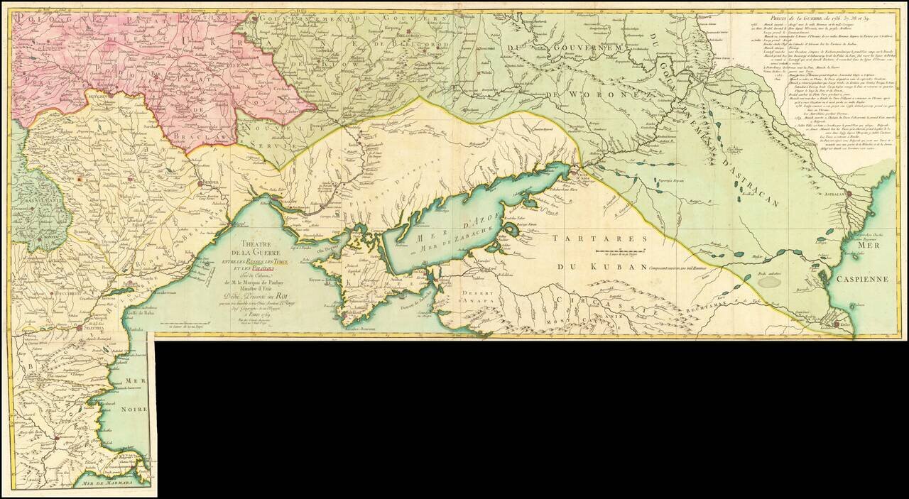
Fine old color example of this rare map illustrating the Theater of Russo-Turkish War (1768-1774). The map emphasizes the territories located on the north and west coasts of the Sea of Azov and the Black Sea and Crimea, namely Bulgaria, Romania,...