Map size in jpg-format: 61.4249MiB
Click to open in high resolution (open in new tab).
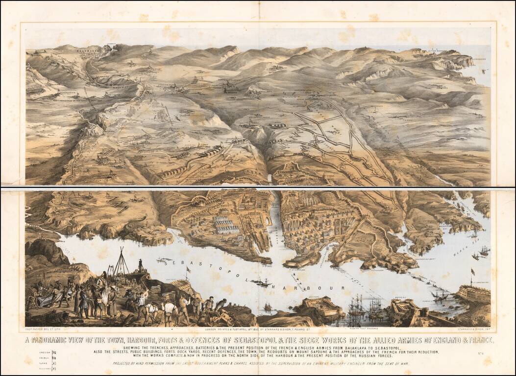
A large panoramic plan of the town, harbour, forts and defenses of Sevastopol in Ukraine. Chromolithographed and designed by Thomas Packer, and published by Stannard and Dixon, 7, Poland Street in London.
Full Title:
A panoramic view of the town, harbour, forts & defences of Sebastopol & the siege works of the allied armies of England & France : shewing the trenches, approaches, batteries & the present position of the French & English armies from Balaklava to Sebastopol : also the streets, public buildings, forts, dock yards, recent defences, the town, the redoubts on Mount Sapoune & the approaches of the French for their reduction. With the works Complete & Now in Progress on the North Side of the Harbour & The Present Position of the Russian Forces.
If you are a student, write to us in telegram: @antiquemaps and indicate what material you need and for what work you need a map in high detail. We are ready to provide material on special terms. For students only!
![[Signed Political Satire Artwork] Vietnam ... Vietnam ... Vietnam ...](/map/small/68726.jpg)

