
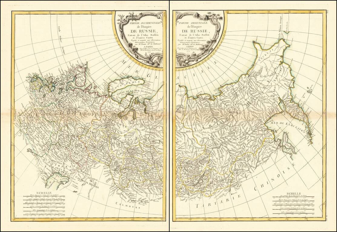
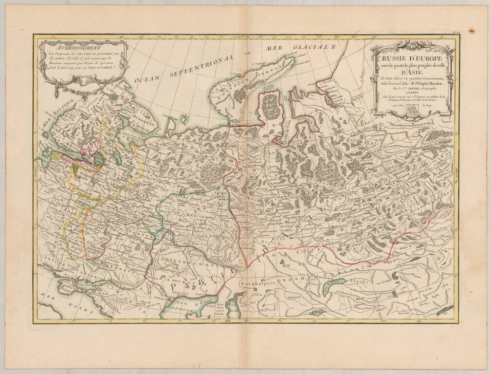
Striking pair of maps, showing Russia from the Pacific Ocean to its Western European Boundaries.
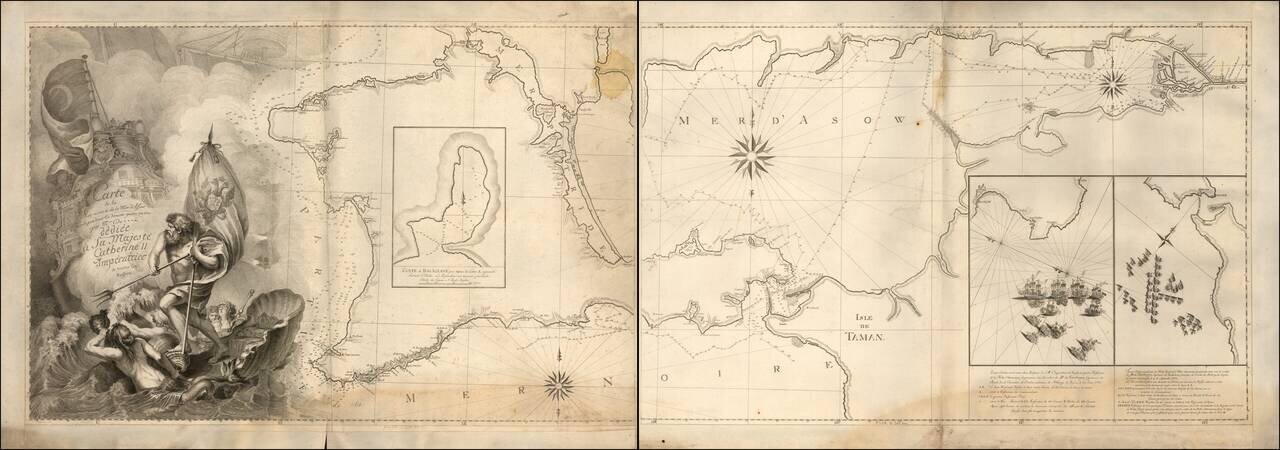
Imposing French Sea Chart of the Crimea Commemorating the Decisive Russian Victory over the Ottoman Empire. Two-sheet, separately issued engraved sea chart of Crimea, featuring insets of two naval battles during the Russo-Turkish War (1768-1774)....
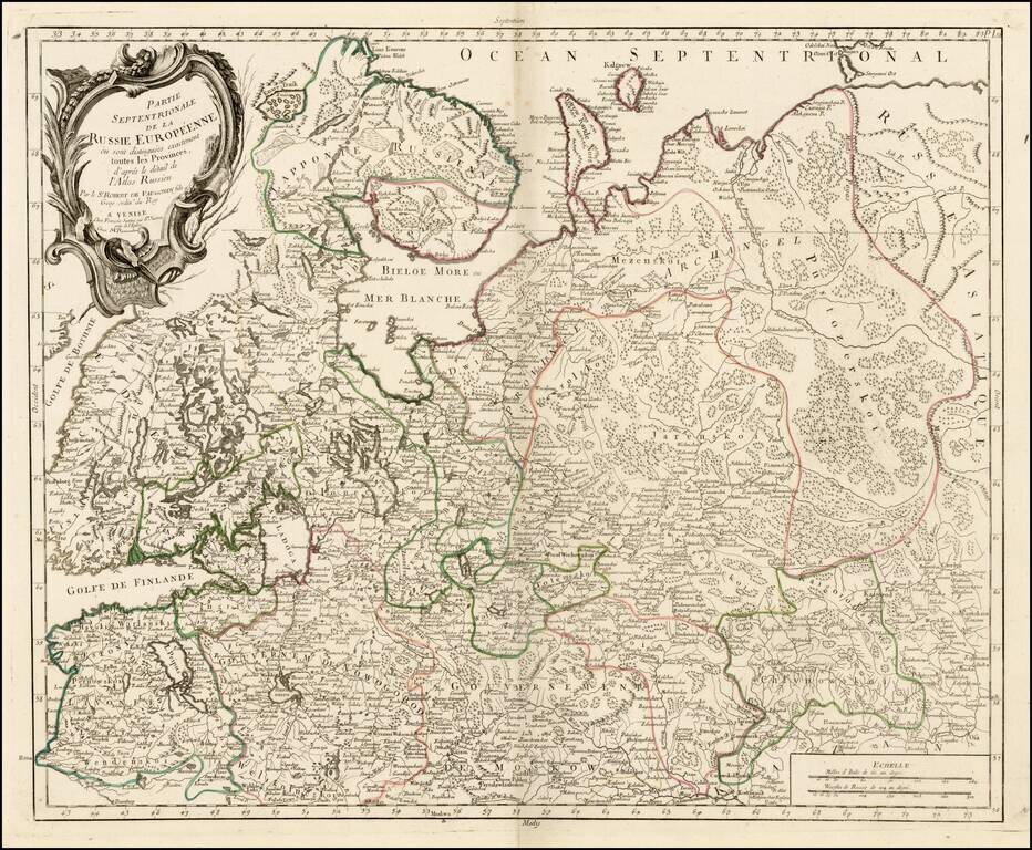
Highly detailed map of the Northwestern part of Russia, from the Gulf of Finland and Poland, to the western part of Asian Russia. Decorative cartouche.
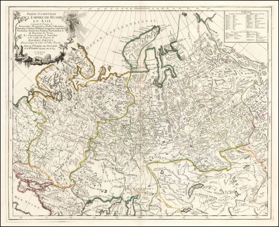
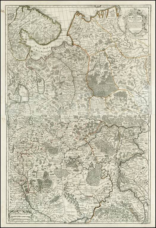
Highly detailed map of the Western Part of Russia, extending South to the Caspian and East to Irkurkoy and Ilimskoy. The map is drawn from the Atlas of Russia compiled under the direction of Joseph Nicolas De L'Isle in St. Petersburg.
![Генеральной Планъ Калужскаго Уѣзда. [General Plan of the Kaluga Department.]](/map/small/58518.jpg)
The General Map of the Kaluga Department from the Межевая экспедиция Mapping of Russia. Detailed engraved cadastral map of the Kaluga region in western Russia. The map is characteristic of the modern surveying that began in Russia...
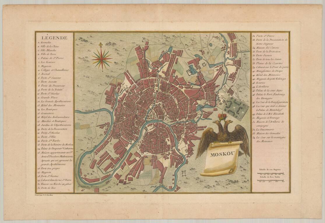
Finely engraved map of Moscow, published in Tardieu's Histoire physique, morale civile et politique de la Russie Ancienne.
Detailed map of Russia, extending from Scandinavia and Baltics to nearly the Pacific. Shows forests, rivers, towns, mtns, lakes, etc. 2 decorative cartouches. The map is based upon the rescently completely Atlas of Russia, for which the famous French...
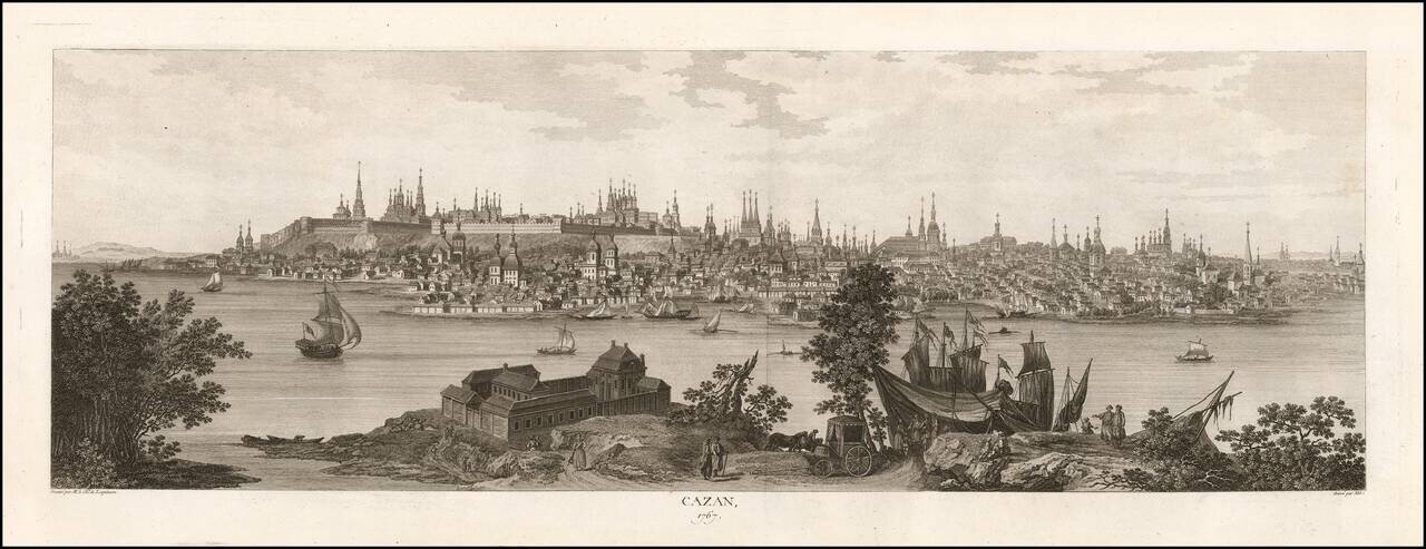
Rare 18th-century View of Kazan. Large engraved view of Kazan from across the Volga River, showing the elevated citadel and the many church spires. The view was published in Historique physique, morale, civile et politique de la Russie Ancienne....
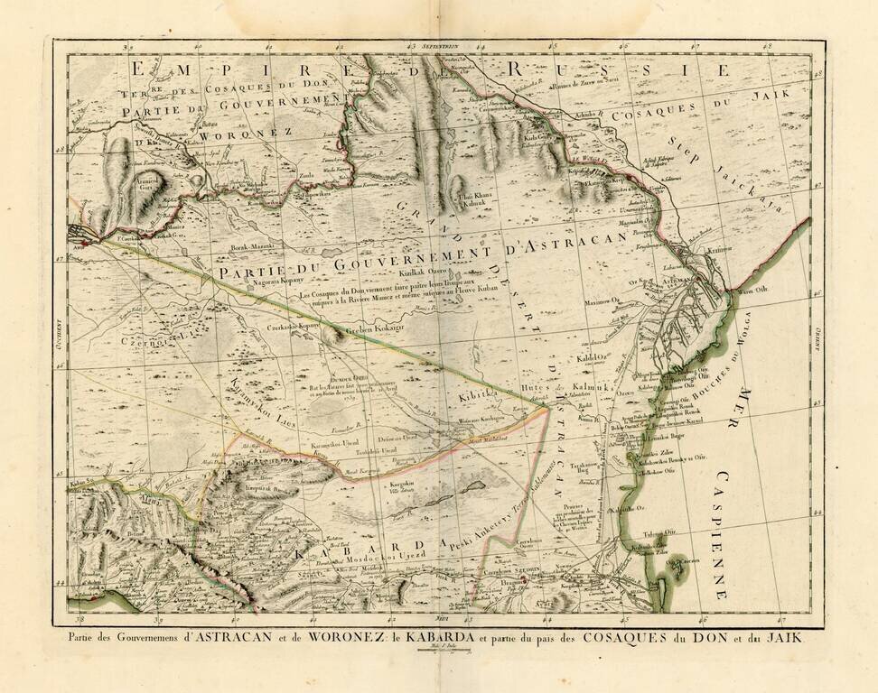
Detailed map of the region north of the Black Sea and West of the Caspian Sea. One of the most detailed maps of the region to appear in a commercial atlas.
Detailed map of Russia and Ukraine, based upon an earlier map by Guillaume De L'Isle.
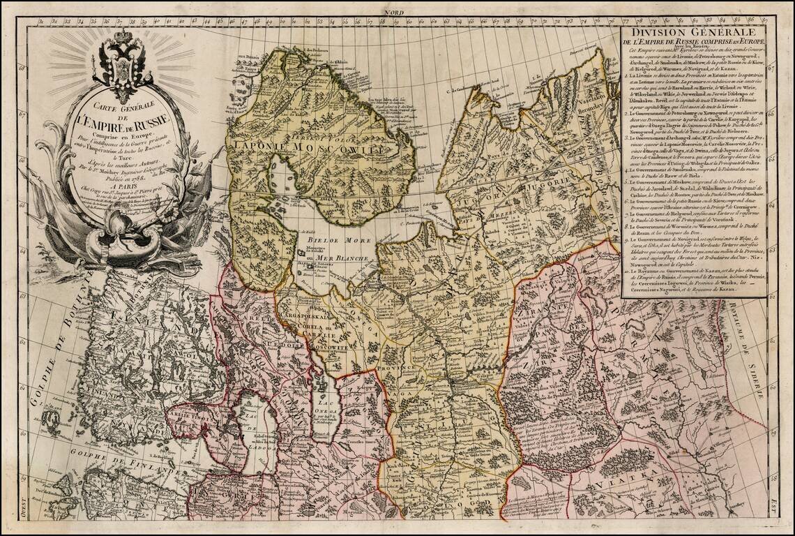
Rare upper sheet of this 2 sheet map of Russia, published in Paris. Extensive key in the upper right corner and elegantly engraved title cartouche.
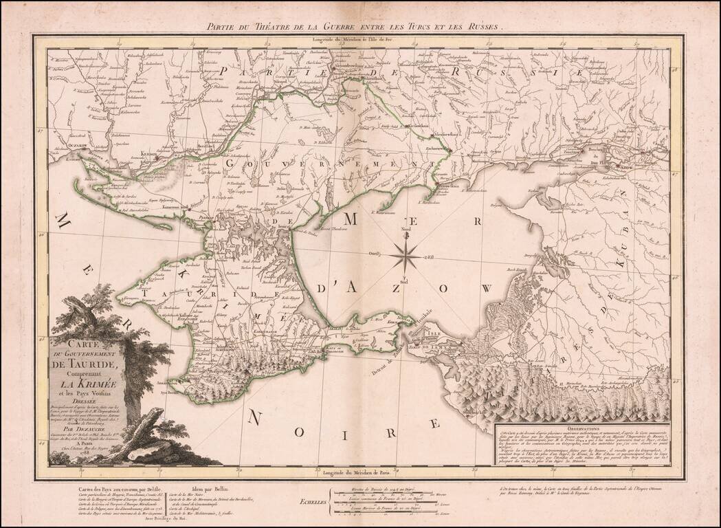
Dezauche's map illustrates the theater of the Russo-Turkish War that began in 1787, one year before the publication of the map. At the end of the previous Russo-Turkish War, Russia had annexed the Crimean Khanate, but the Ottomans sought to regain the...
![[Plan of Moscow] Plan stolichnago goroda Moskvy](/map/small/37809.jpg)
A very rare first edition of Ivan Marchenkov's decorative large-format map of Moscow, the most important printed plan of the city issued during the second half of the 18th Century. Ivan Marchenkov's masterly plan is the finest map of Moscow to appear...
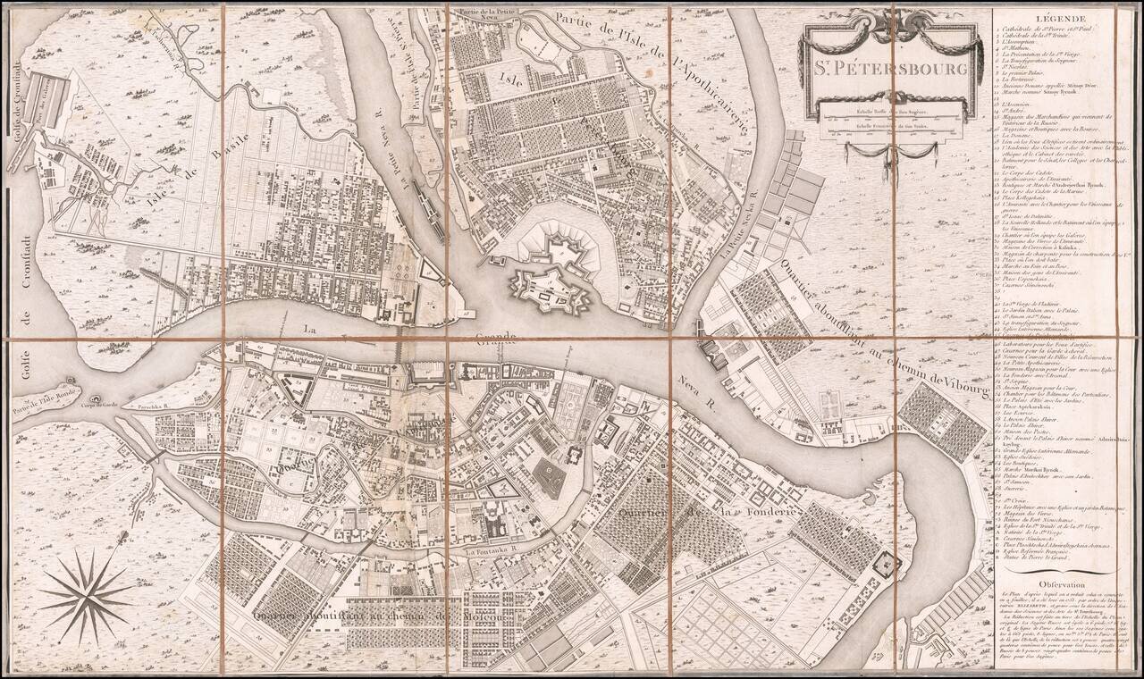
Scarce separately published example of Tardieu's scarce plan of the City of St. Petersburg. Tardieu's plan is based upon a larger plan, first prepared in 1753 for the Russian Academy of Sciences & Arts. The key at the right lists 79 places of...
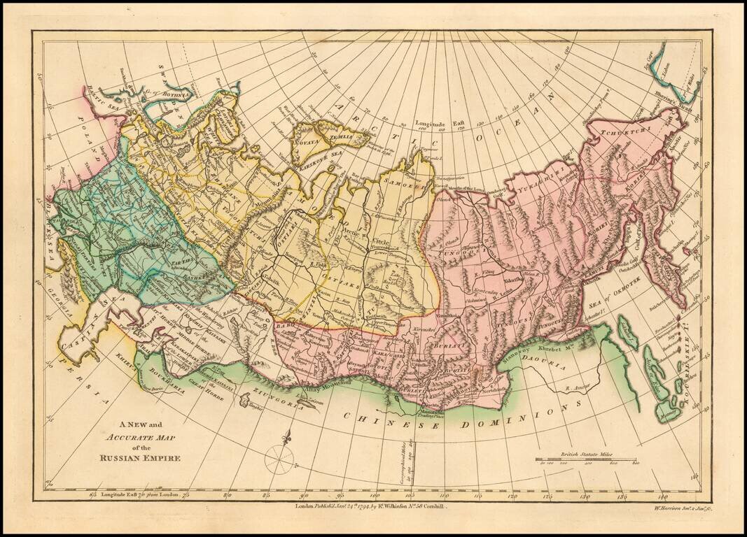
Interesting map of the Russian Empire, extending from the Baltic and the Caspian Seas in the West to the Bering Straits, Kamtchatka and the Sea of Okhotsk in the East. Shows towns, rivers, mountains, lakes, etc. Striking original wash colors. Robert...
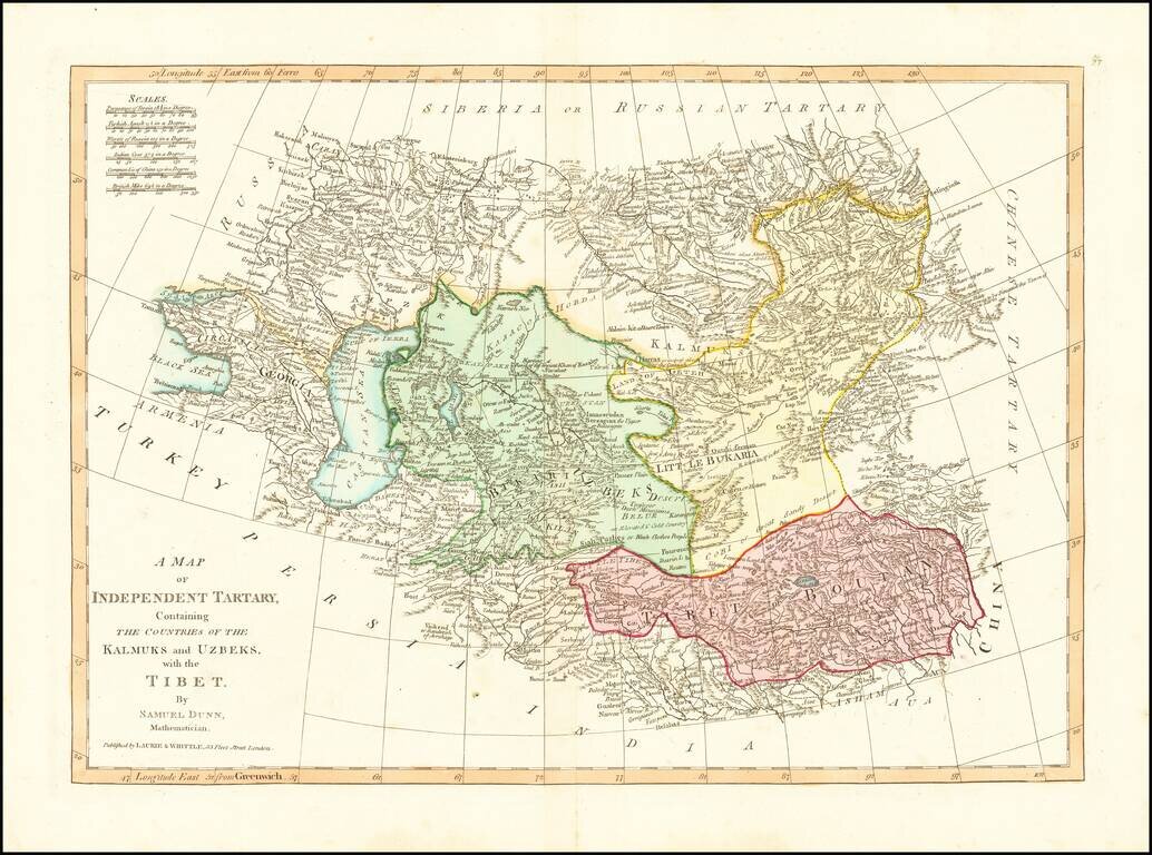
Detailed regional map, extending from European Russia and the Caspian Sea to Chinese Tartary. Nice detail in Tibet, Bukaria, and the Mountainous regions of western China. From Dunn's New Atlas or Mundane System of Geography.