logo

1850. The Crimea

  • The Crimea

Map size in jpg-format: 2.9164MiB

Download "The Crimea", in high resolution.

The Crimea information:

Year of creation: 
Resolution size (pixels): 
 4418x3366 px
Disk Size: 
 2.9164MiB
Number of pages: 
 1
Place: 
 London
Author: 

Print information. Print size (Width x height in inches):
Printing at 72 dpi 
  61.36 х 46.75
Printing at 150 dpi 
 29.45 х 22.44
Printing at 300 dpi 
 14.73 х 11.22

An example of detailing the file of this map of in a printable high-resolution:

Click to open in high resolution (open in new tab).
Attention! this is just the central piece (central area 960x960 px) of the map file!
This is an example, so that you can see and study the level of detail of a given map. The entire Map will be fully available after payment!

The Crimea

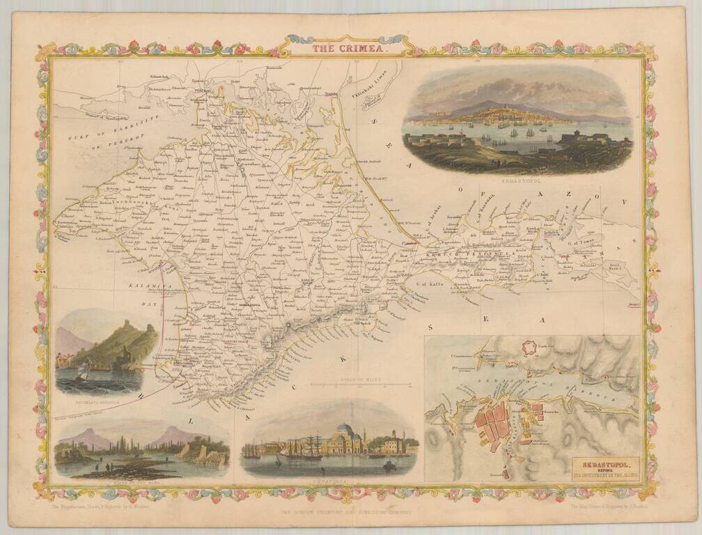
Nice full color example of Rapkin' map of The Crimea, in the style of the maps of John Tallis

Vignettes includes Sebastopol (2), Balaklava Harbor, Bank of the Alma River and Eupatoria.


Special conditions for students!

If you are a student, write to us in telegram: @antiquemaps and indicate what material you need and for what work you need a map in high detail. We are ready to provide material on special terms. For students only!

Item information:

Year of creation:
Size:
4418x3366 px
Disk:
2.9164MiB
Number of pages:
1
Place:
London
Author:
John Rapkin.
$14.99

Related item