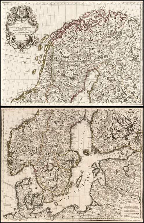
Large format 2-sheet map of the region from Scandinavia to the Baltic and part of Poland, originally issued by De L'Isle in 1708.
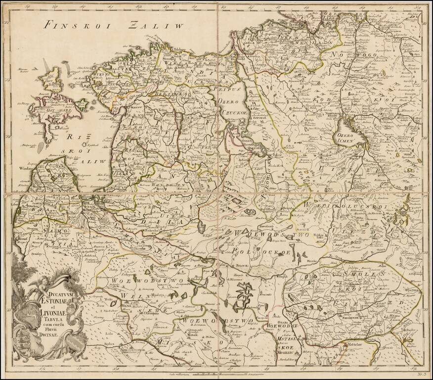
Rare separately issued map of Estonia, Latvia, Lithuania and contiguous parts of Russia and Belarus, published by the Akademiia nauk SSR (Russian Academy of Science) in St. Petersburg. The map extends south to Wilna and Minsk, showing remarkable...
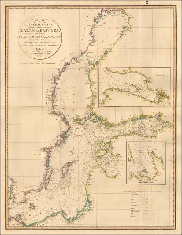
Highly detailed chart of the Baltic and contiguous coasts, from Faden's general atlas. Includes detailed insets of the areas around Revel and St. Petersburg. One of the most detailed general charts of the Baltic to appear in an English Commercial...
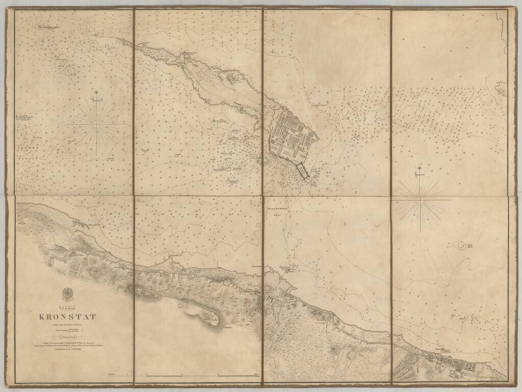
Scarce chart of the Island of Kronstat, the primary defensive position for the Russian Navy in defense of Russia's Czarist Capital of St. Petersburg. Published on the eve of the Crimean war in anticipation of the conflict with Russia, the Allied Navy...
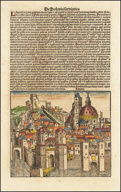
Nice full color of this fanciful view of a Lithuanian or Polish City, from the German edition of his Liber Chronicum. The...
![[Riga] Ryge](/map/small/67761.jpg)
Rare early view of Riga. Rare early town view of Riga, with the founder bishop Albert from Buxhoeveden and coat of arms of Riga. The image appeared in Croneken der Sachsen published by Schöffer in Mainz. On the verso is an image of Albrecht, coat...
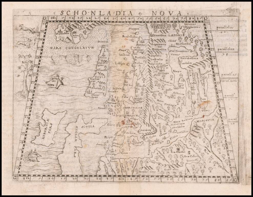
Important early modern map of Scandinavia, Iceland, and the Baltic, published in Venice by Giacomo Gastaldi. Gastaldi's modern map of Scandinavia and environs "built upon previous publications, in particular, the representation was based on the map of...
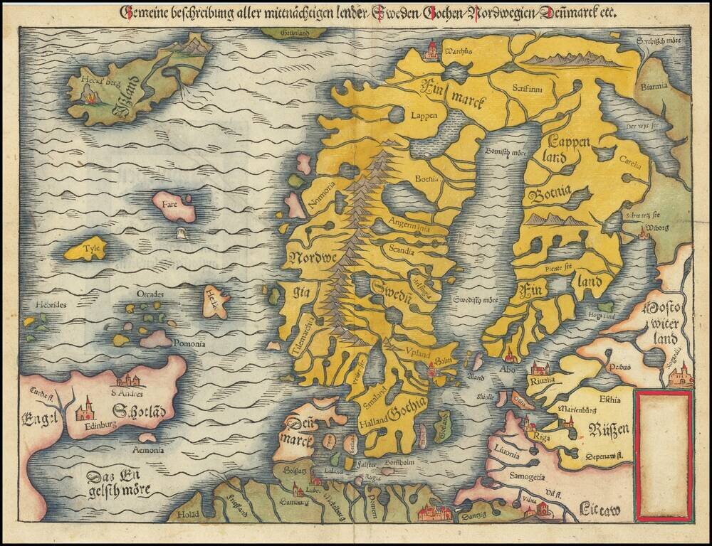
Second edition of Munster's map of Scandinavia, first issued in 1545 to replace the very rare first edition of the map, which appeared in only the first three editions of Munster's Geographia. Munster's first map relied upon the cartography of Jacob...
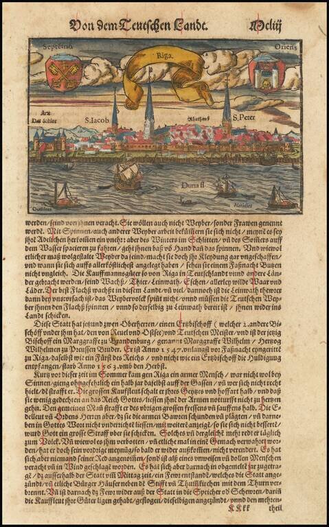
Nice example of Munster's birdseye view of Riga from the river, with decorative title banner and two coats of arms in the sky. View is from the Duna, with several major place names given. Munster's Geographia was a cartographic landmark, including...
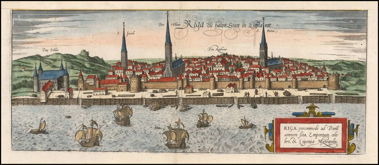
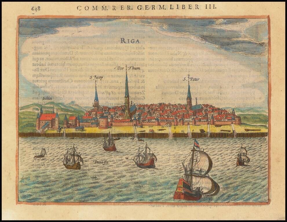
A fine early view of Riga, first published by Braun and Hogenberg in 1581. This is one of the earliest obtainable views of the city and was heavily based on Munster's slightly earlier map of the city. This map appeared in Braun and Hogenberg's...
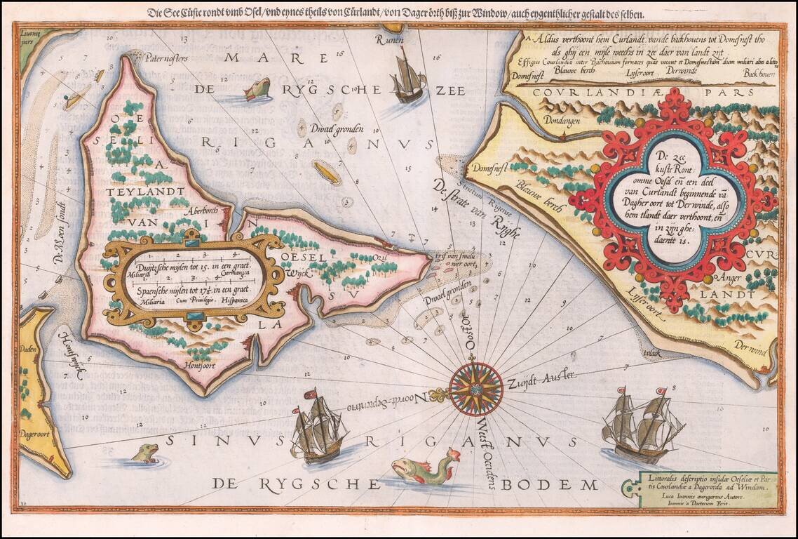
Antique map of Saaremaa and the Estonian Coastline. Striking example of the antique sea chart of the Gulf of Riga, along the Latvia-Estonia border. Includes sea monsters, sailing ships, a compass rose, and decorative cartouches, soundings, and...
Fine early example of Waghenaer's map a portion of the Gulf of Finland showing Wyburch (Vyborg), Telsborch, Narua, Niewkerck, Reisenburg, and the region just west of St. Petersburg, from Lucas Waghenaer's Spiegel der Zeevaerdt. Includes sea monsters,...
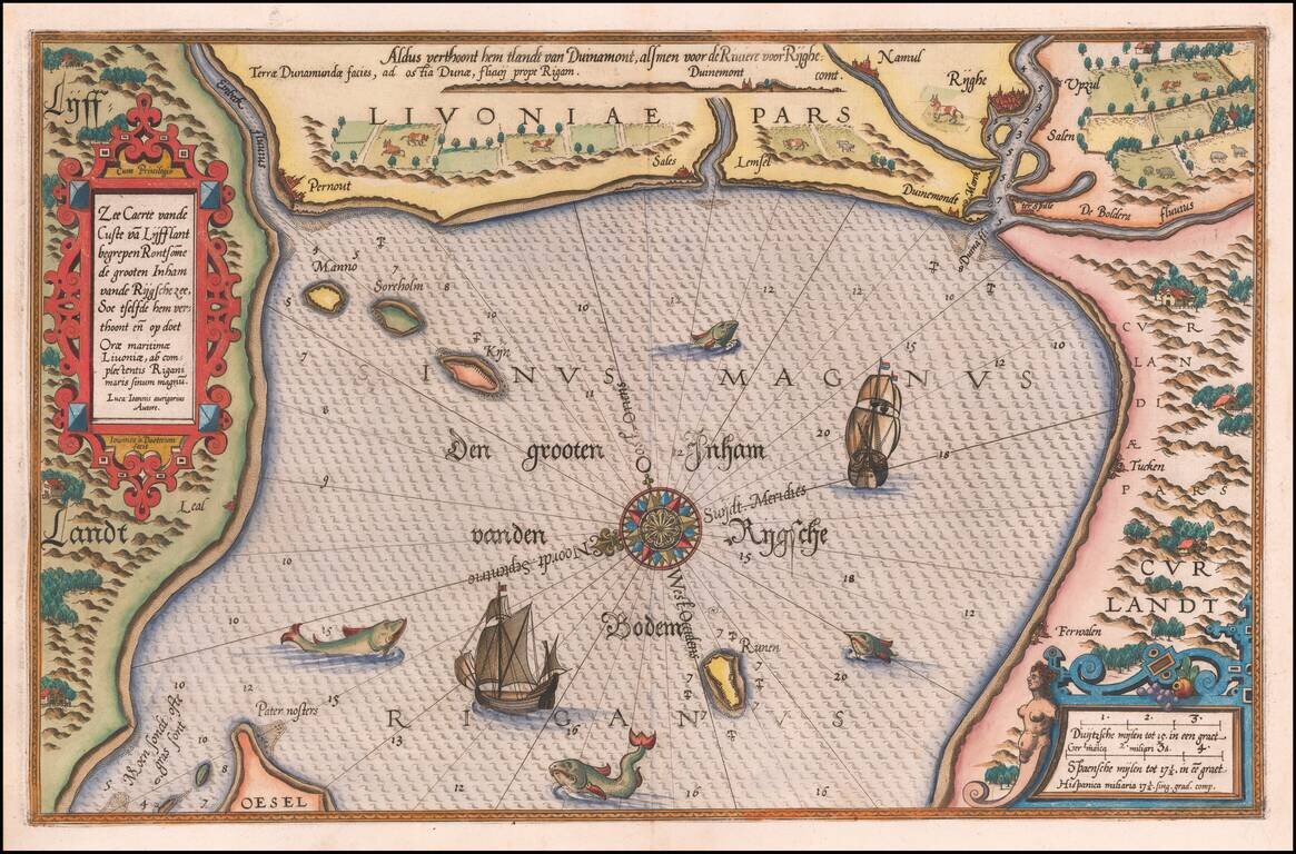
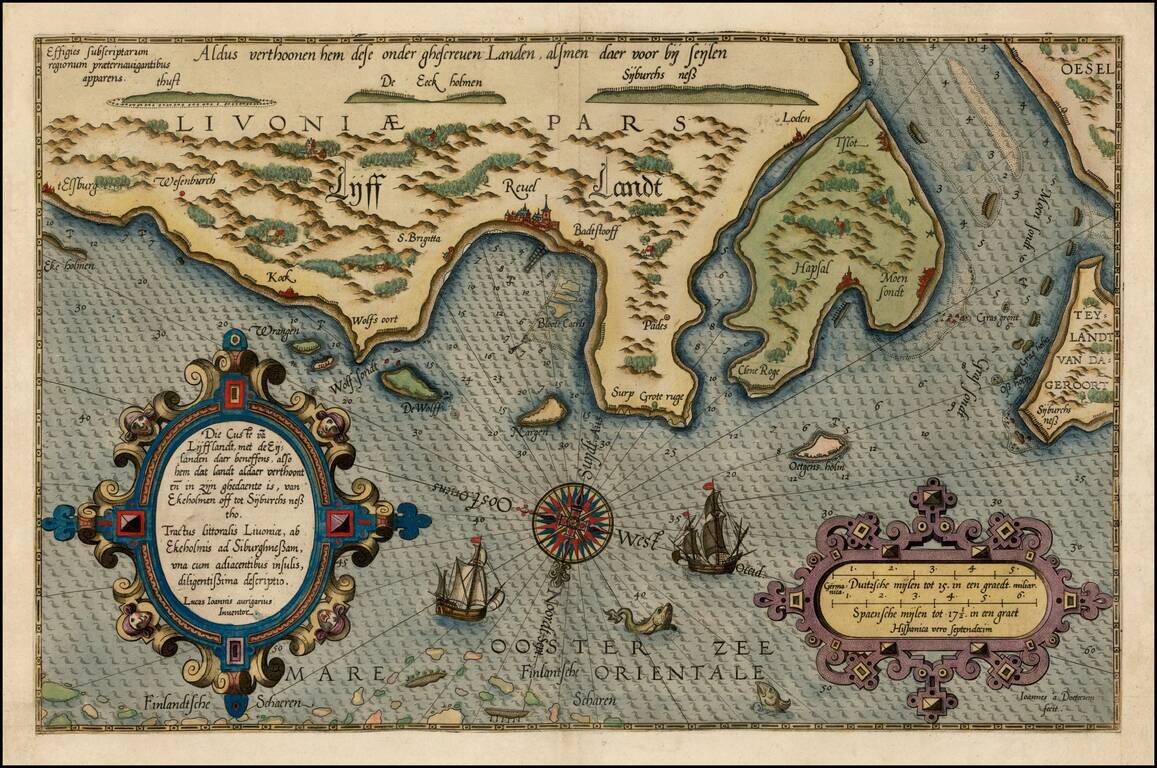
Striking example of Wagenhaer's map of the coast of Latvia, including the area around Riga and part of Curland. Includes sea monsters, sailing ships, compass rose, decorative cartouche, anchorages and soundings. Wagenhaer was a Dutch pilot who...
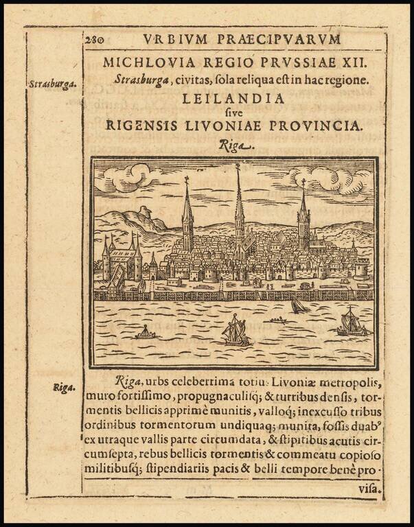
Rare early view of Riga, published in Parvum Theatrum Urbium sive Urbium Praecipuarum totius orbis Brevis & Methodica Descriptio by Adrianus Romanus, first printed in Frankfurt in 1595.
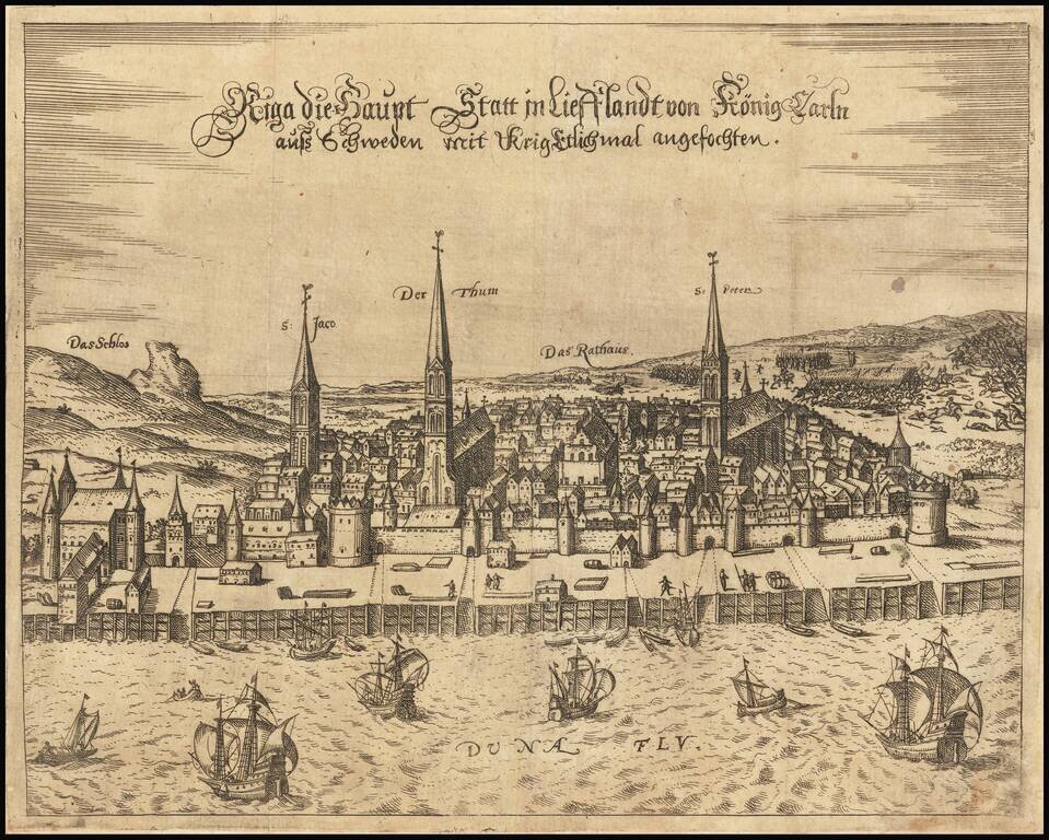
Extremely rare early view of Riga, published in Frankfurt by Georg Keller. The town is shown looking east across the Daugava River, with the three main churches and the Town Hall prominently named and shown. The town is shown shortly after it came...