
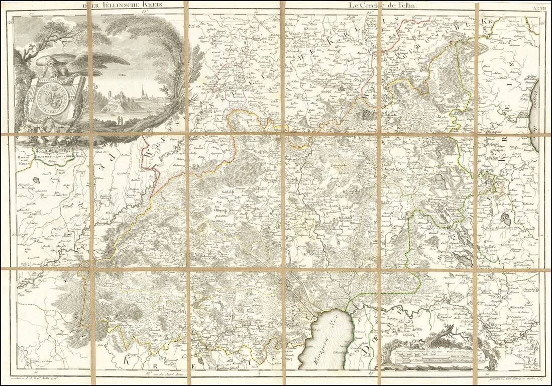
Rare engraved map of central Estonia north of Lake Võrtsjärv covering parts of present-day Järva, Viljandi, Tartu, and Jõgeva Counties. The map features an attractively-engraved coat of arms of Viljandi Kreis, a province in Livoniain the 18th and...
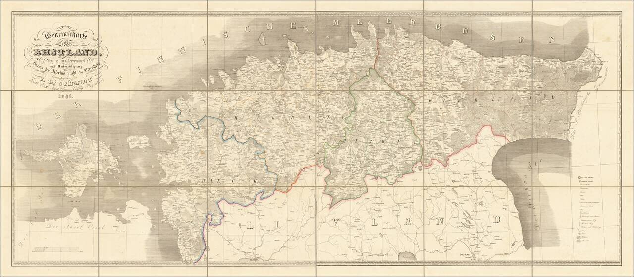
Interesting and scarce map of old Estonia (the old Duchy of Estonia, or Ehstland in German), stretching from the St. Petersburg Government in the east to Hiiumaa Island in the west. To the south of the map is "Livland", which is today part of modern...
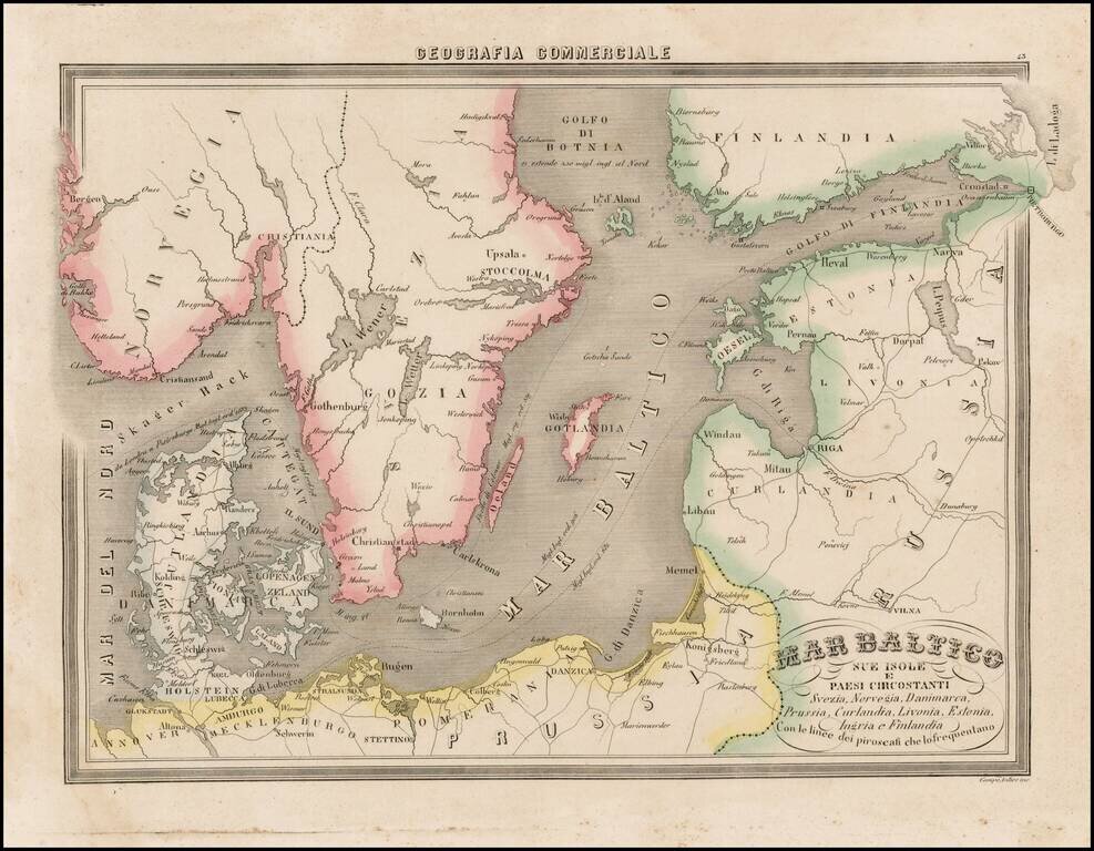
Fascinating map of the Baltic region and Scandinavia, focusing on the topographcal features, from Marmocchi's scarce Geografia Commerciale. A very unique map. The second time we have seen this map on the market.
![Rīgas Plāns Izdevusi 1937. gadā Rīgas pilsētas nekustamu īpašumu valde. [Riga Plan issued in 1937 by the Riga City Real Estate Board]](/map/small/63953.jpg)
Impressive four-sheet Latvian-language wall map of Riga, issued just before the Second World War, in 1937, by the Riga City Real Estate Board. The lower-left corner has a map of Riga in 1400, including fortress walls, castles, churches, etc. In the...
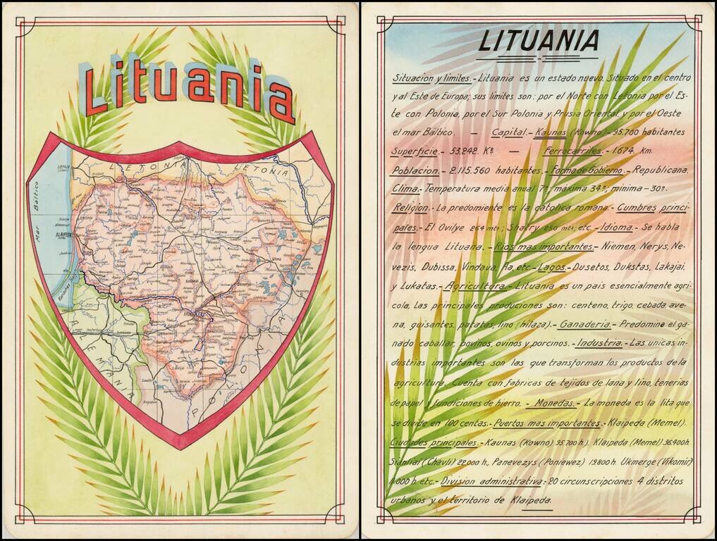
Award winning pair of manuscript cards, prepared by Antonio Raggio for the 11th Congreso de la Union Postal Universal (World Postal Congress) Exposition Filatelica Internacional, held in Buenos Aires, Argentina, in 1939. The map shows a finely...