
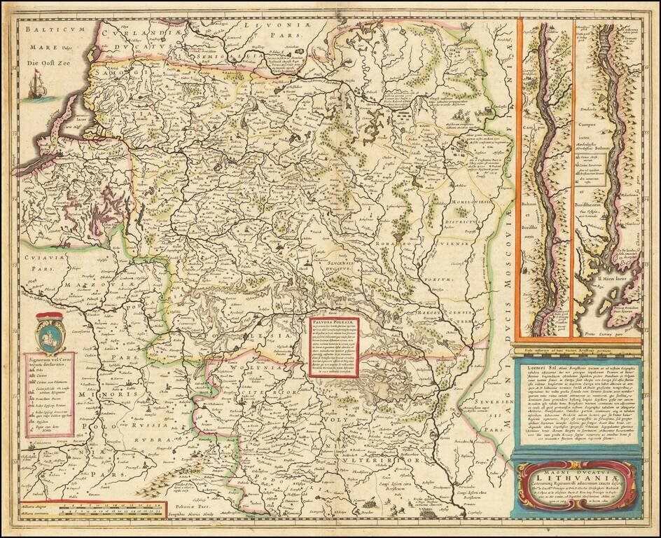
Nice old color example of this important map of Lithuania at its grandest scale (incuding Poland, Ukraine and part of Russia), including a large inset of the Dniepr River, based upon Hessel Gerritsz's four sheet map of the same title. Hessel Gerritsz...
![Oost Zee door Arnold Colom . . . [Heightened with Gold!]](/map/small/26286.jpg)
Fine example of this rare sea chart of the Baltic Sea (Oost Zee), by Arnold Colom, from Colom's Zee Atlas Ofte Water-Wereldt. Colom's detailed sea chart of the Baltic Sea from Rügen and Denmark extending towards eastern Finland and Livland, is one of...
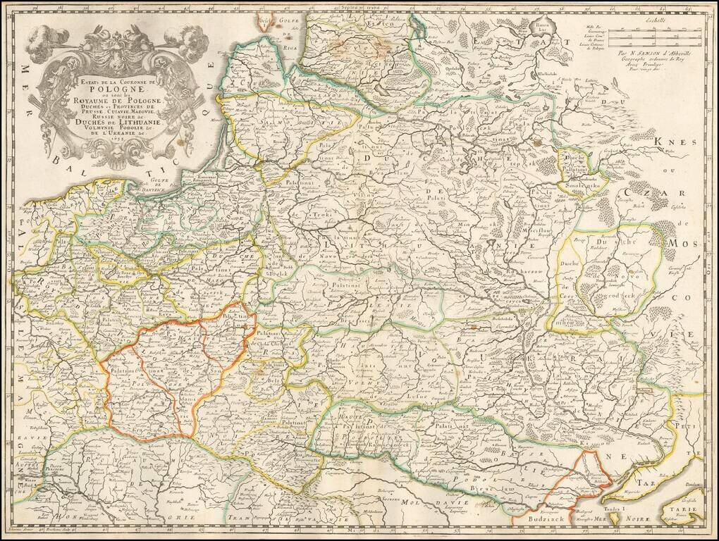
First state of Nicolas Sanson's 1655 double-page engraved map of Poland, Ukraine, and the Baltic states, including modern-day Lithuania and Estonia. Sanson revised the map a number of times during its 50-year publication history.
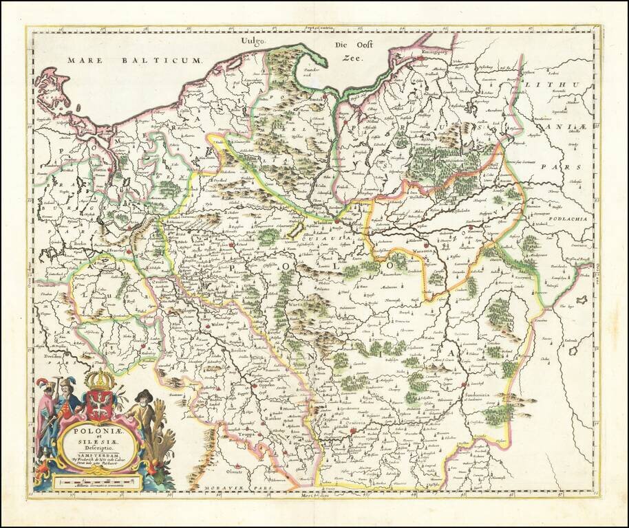
Fine example of De Wit's rare map of Poland and Silesia, extending north to the Baltic Sea. This is the second state, with "fo. 16" at the top right corner. This the second example of the map we have offered in more than 20 years.
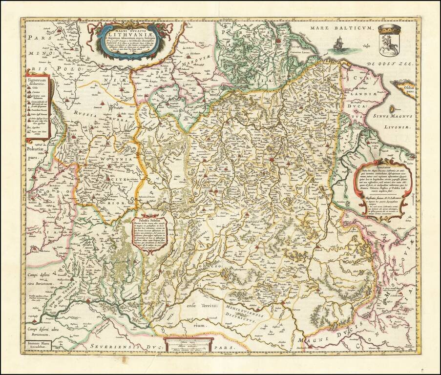
Nice example of Blaeu's rare map of Poland, Lithuania, etc., which first appeared in the 1662 edition of Blaeu's Atlas Maior. This is Blaeu's second map based upon Radizwill's early map, originally engraved by Hessel Gerritsz. The Radziwill map is one...
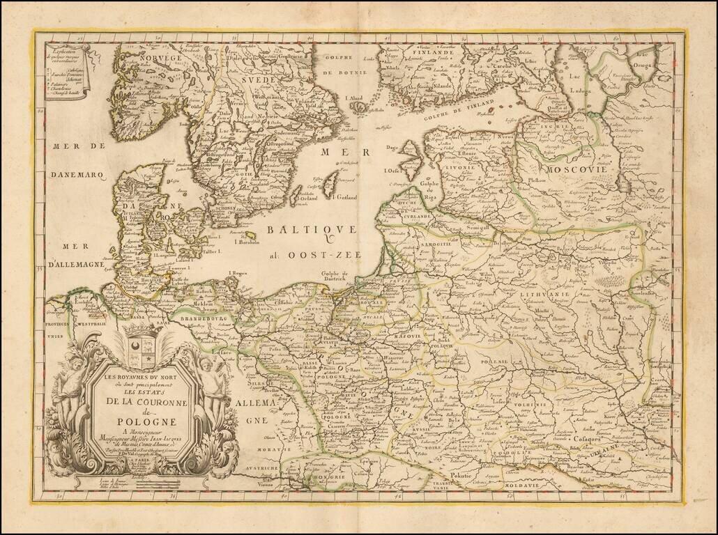
Rare map of Poland and the neighboring regions, published in Paris by Du Val. The map extends to include the Ukraine and western Russia. With decorative tittle cartouche lower left with a dedication to Jean-Jacques de Mesmes, comte d'Avaux (1640 - 9...
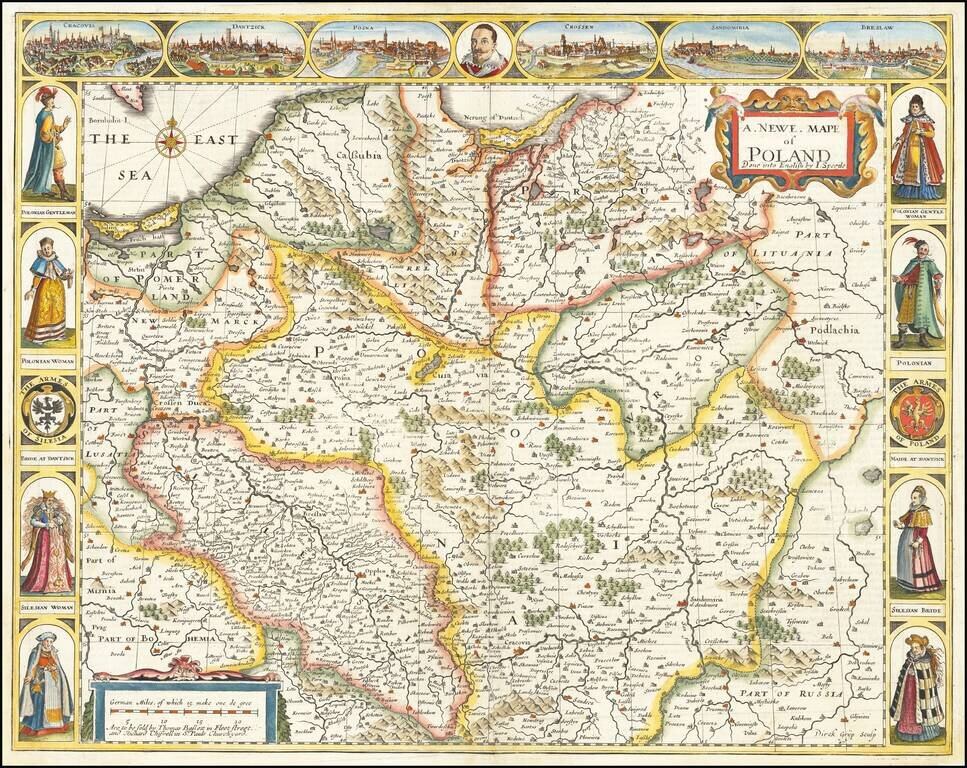
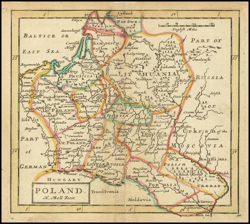
The First Map of Poland Published in England Decorative example of John Speed's highly sought after map of Poland, the first map of Poland to appear in an English Atlas. The map includes birdseye views of Cracow, Dantzick, Posna, Crossen, Sandomiria...
![Moscovia Parte Orientale . . . [with] Parte Occidentale . . .](/map/small/37824.jpg)
Nice example of Coronelli's two sheet map of Russia, extending from the Baltic and the Black Sea in the west to Gran Tartaria in the east. Coronelli's map of Russia is one of the most detailed and elaborate maps of the 17th Century, providing...
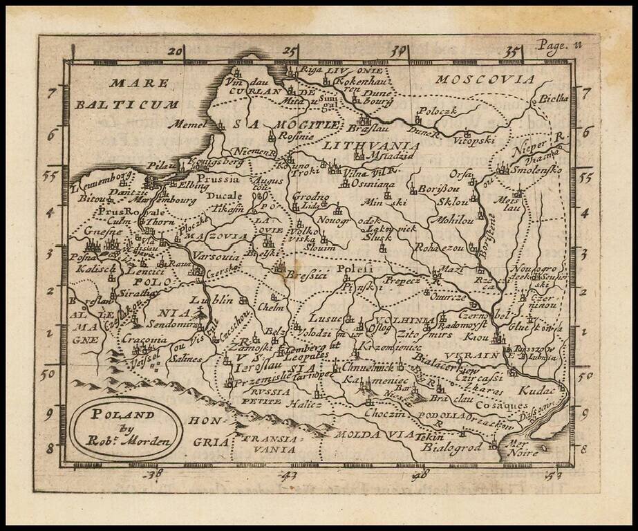
Rare early English map of Poland. Maximum Poland, extending from the Baltic to the Ukraine and beyond the Dniepr River.
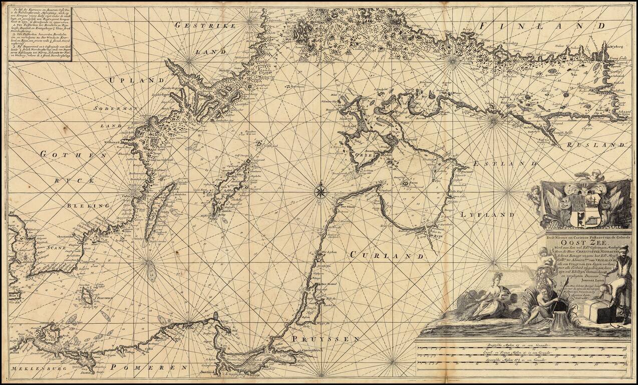
Extremely rare over-sized sea chart of the Baltic, published by Johannes Loots. Loots chart of the Baltic Sea extends from Copenhagen and Rostock in the west, to Wyborg, Narva and Ryga in the east, showing the region in exceptional detail, including...
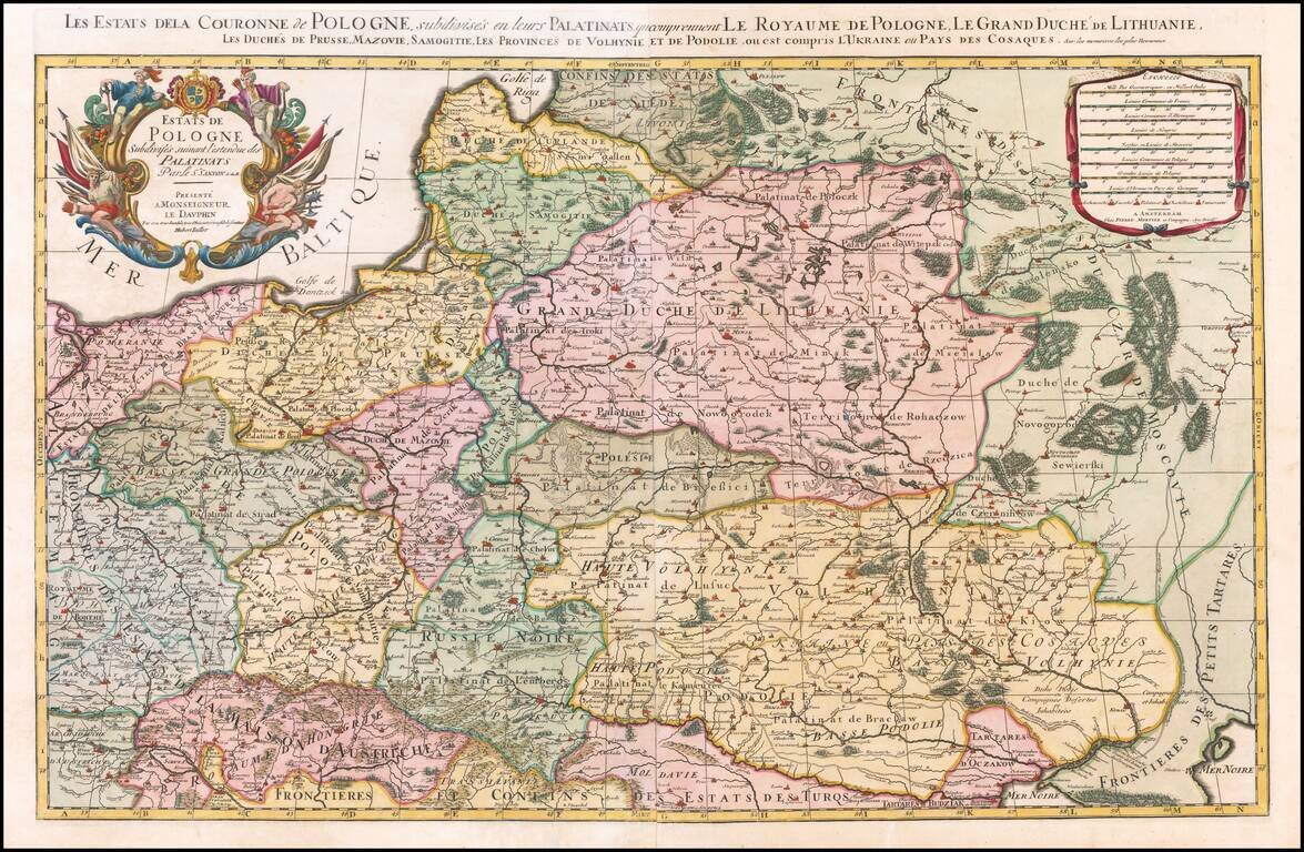
Nice example of the Pierre Mortier edition of this large format map of Poland, Lithuania, the Ukraine and part of Russia, first published by Hubert Jaillot in Paris, in 1679. One of the largest atlas maps of the late 17th Century to focus on Poland,...
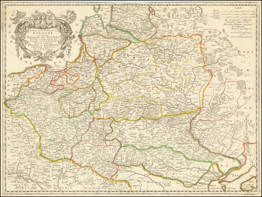
Rare late edition of Sanson's second map of the Polish Empire, Lithuania, Ukraine, etc. Sanson created this scarce map of modern day Poland, Lithuania, Belarus and Ukraine, etc. in 1655 and revised several times over the next 50 years. The date 1679...
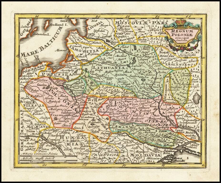
Decorative map of Poland and Lithuania in their grandest configurations, published by Weigel. The map extends from the Baltic to the Black Sea, capturing the details and reach of these then powerful countries at the beginning of the 18th Century. The...
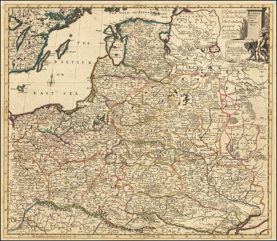
Detailed map of the Polish Empire, published by John Senex. This is the second edition of the map, which was first published by Morden & Browne in 1710. The remnants of the earlier printing , which have been burnished out of the cartouche, are...
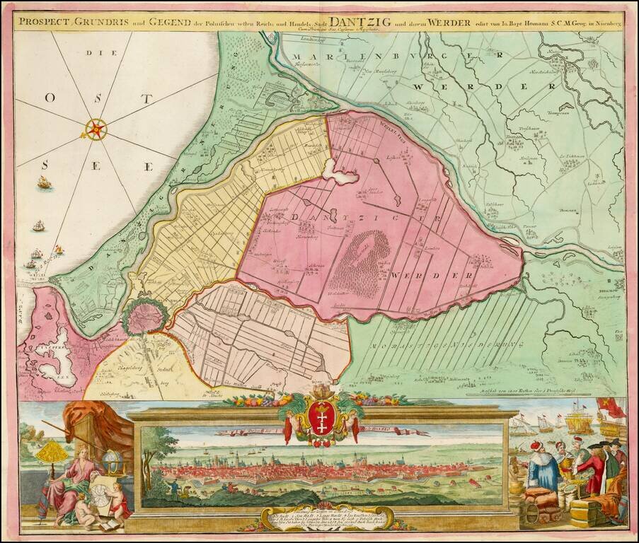
Striking example of Homann's map of Dantzig (Gdansk) and neighboring regions and striking birdseye view, major port to the Baltic Ocean, which for centuries was an important trading center for the Polish, Prussian, German and Baltic regions whose...