Map size in jpg-format: 9.10769MiB
Click to open in high resolution (open in new tab).

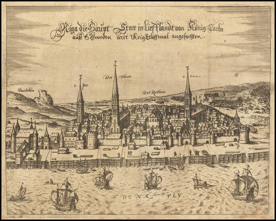
Extremely rare early view of Riga, published in Frankfurt by Georg Keller.
The town is shown looking east across the Daugava River, with the three main churches and the Town Hall prominently named and shown.
The town is shown shortly after it came under the influence of the Polish-Lithuanian Commonwealth, under the Treaty of Drohiczyn.
If you are a student, write to us in telegram: @antiquemaps and indicate what material you need and for what work you need a map in high detail. We are ready to provide material on special terms. For students only!


