
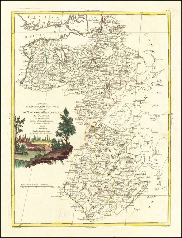
Antique engraved map of the Duchies of Livonia and Estonia, and the Governments of Novgorod, Belgorod, and Kiev. The map was published by Antonio Zatta in Venice in 1782.
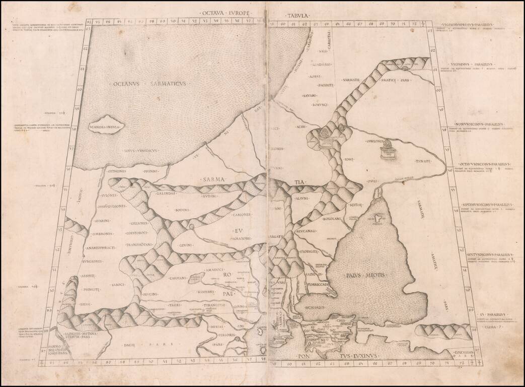
The Earliest Obtainable Map of the Poland, the Baltic, Russia & Ukraine Region Important early map of Northeastern Europe, from the Baltic to the Sea of Azoff and the Danube, which first appeared in the 1478 Rome edition of Ptolemy's Geography,...
![Octava Europae Tabula [Russia, Ukraine, Poland, Baltic]](/map/small/42081.jpg)
Sylvanus' map of Poland, the Baltic, Russia and Ukraine, extending south to the Black Sea and west to the Vistula. Sylvanus's map is one of the earliest obtainable maps of the region and the first printed in two colors. The map appeared in Sylvanus'...
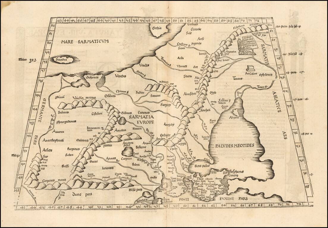
![Octava Europe Tabula [Baltic, Scandinavia, Poland & Eastern Europe]](/map/small/54759.jpg)
Nice old color example of Waldseemuller's map of Eastern Europe, extending from the Black Sea to Scandinavia and the Baltic Regions, centered on Russia and the Ukraine. The map includes a number of written notes in a contemporary hand. The map is...
A Rare Early Fries Edition Detailed map of the region between the Baltic and Caspian Seas, from the 1525 edition of Fries Geographia. Lorenz (Laurent) Fries was born in Alsace in about 1490. He studied medicine, apparently spending time at the...
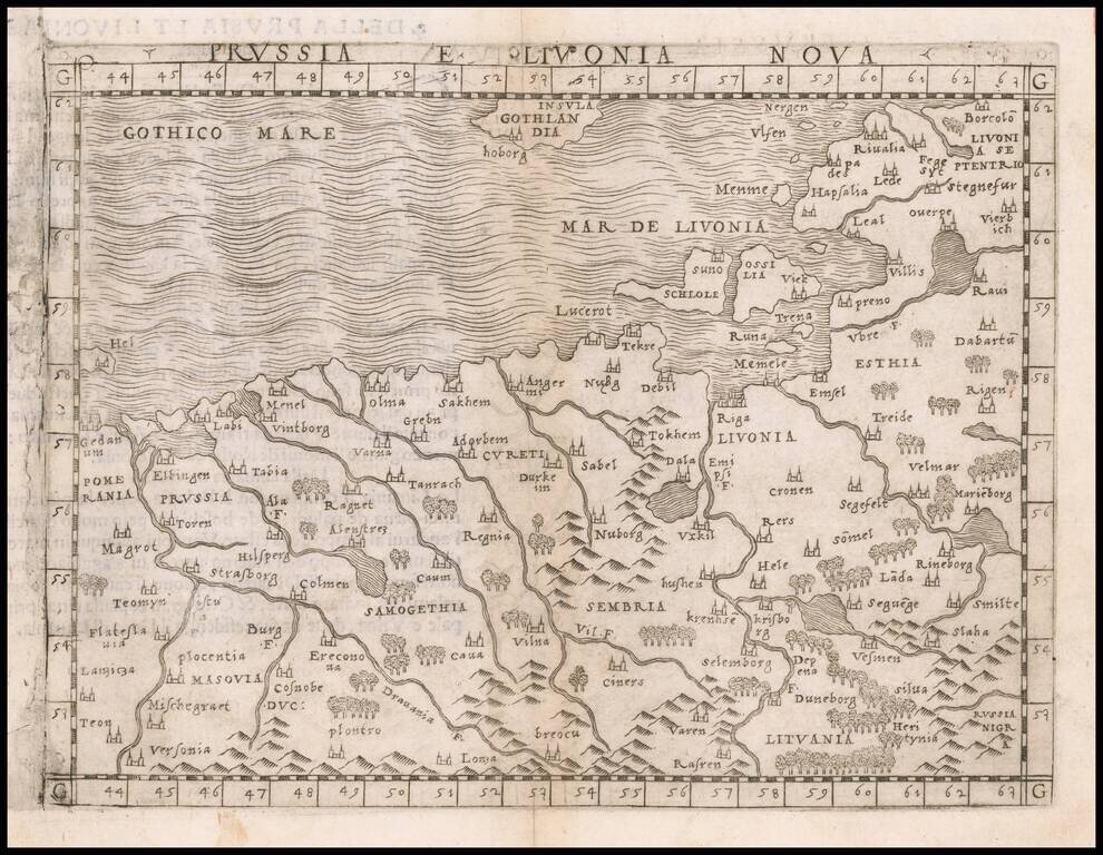
One of the Earliest Obtainable Modern Maps of the Baltic Region Nice example of Gastaldi's map of the region bounded by the Vistula River and Prussia in the west, Livonia in the east, and Lithuania in the southeast. The map is centered on Riga and...
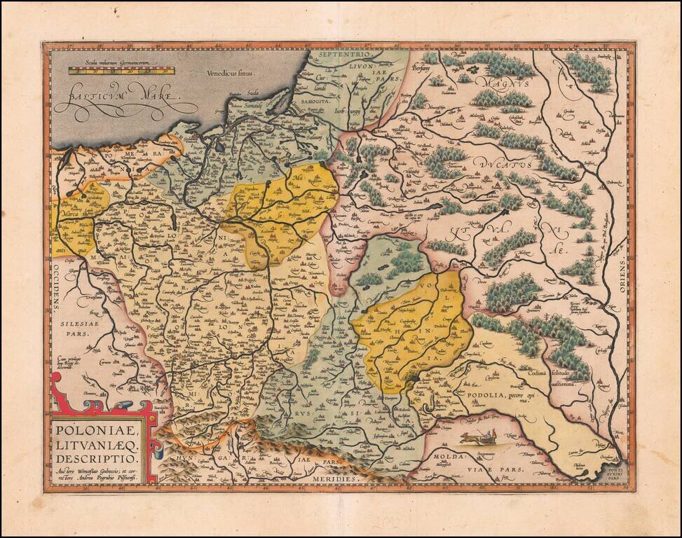
Nice example of Ortelius' second map of Poland and Lithuania which first appeared in the 1595 Latin edition of Ortelius' Theatrum. The map extends from the Dniepr River in the east to the Oder in the west and includes all of Poland, as well as...
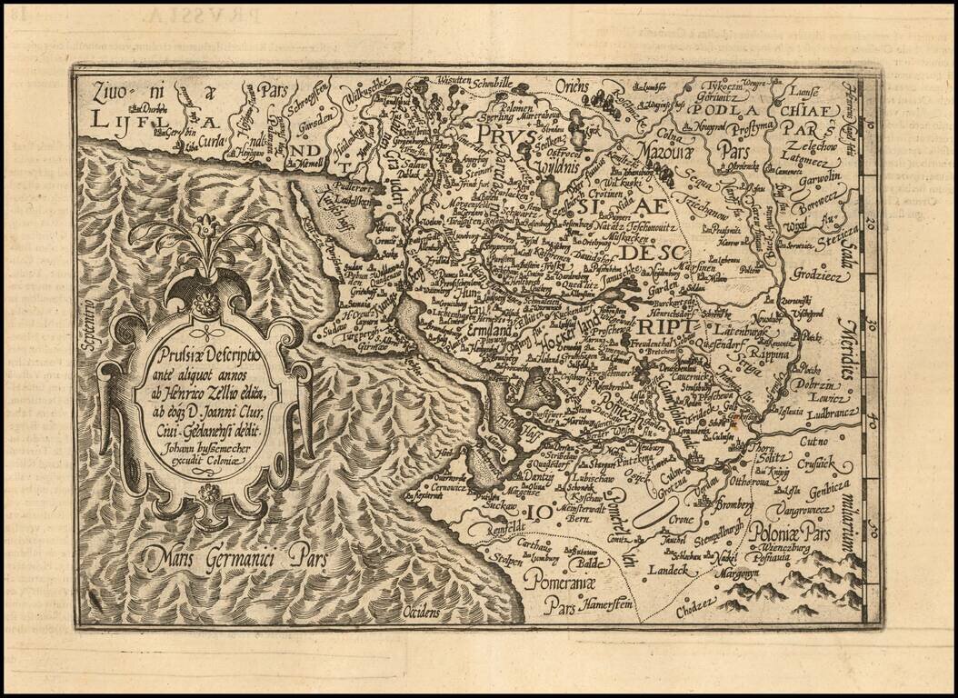
An Early Map of Prussia Detailed map of the region centered on the southern Baltic Coast, reaching inland to the Bug River. Includes a detailed early coverage of the areas around Dantzig, Konnigsberg and the Lithuanian coastline. East is oriented...
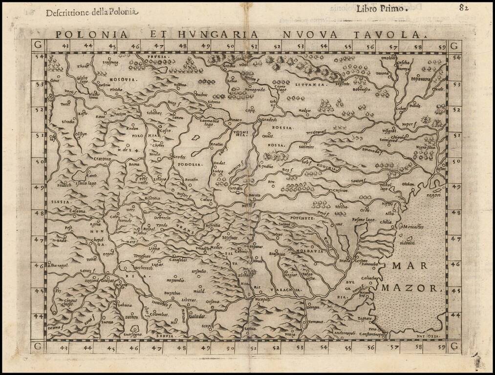
Striking dark impression of Ruscelli's map of Poland, Hungary, Slovakia, the Czech Republic and parts of the region bounded by the Black Sea in the east and the Danube in the south. Ruscelli's Atlas is an expanded edition of Gastaldi's Atlas of 1548,...
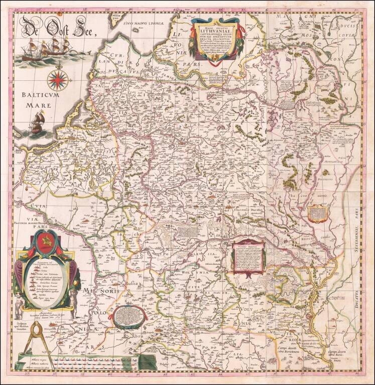
The Most Important Map of Lithuania and Poland from the first part of the 17th century Fine example of this important wall map of Lithuania and parts of Poland, Russia, Ukraine, Latvia, etc. extending to Cracow, Kiev, Warsaw, Riga, Konigsberg,...
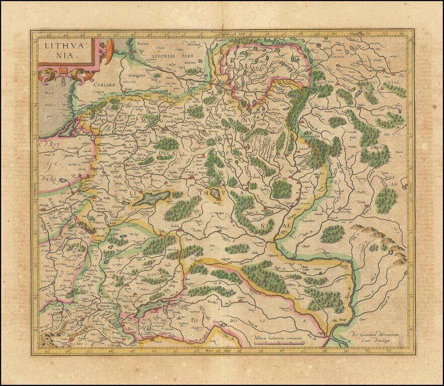
Nice old color map of Lithuania, with parts of Poland, Prussia, Ukraine and Belarus, published by Gerard Mercator. This is one of the maps which includes Gerhard Marcator's name as the map maker. Extends from the Baltic, including part of Prussia, to...
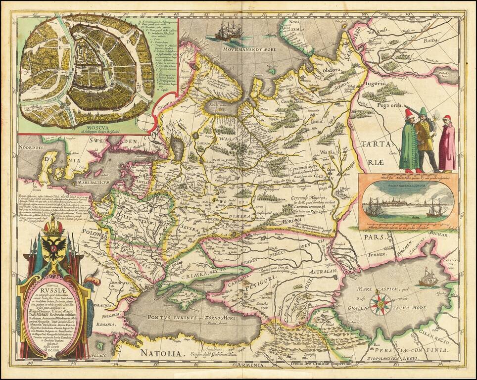
Decorative hand-colored example of Hessel Gerritsz's map of Russia, with the large inset of Moscow and plan of Archangelsckagoroda. Hessel Gerritsz's map of Russia, first issued 1613, was published by Blaeu after he acquired the plate following...
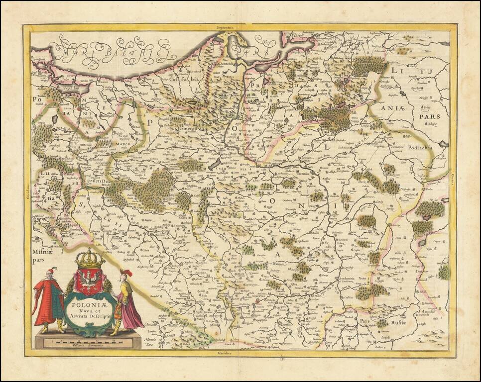
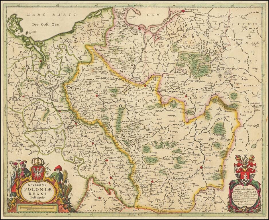
Striking example of Jansson's map of Poland and parts of Lithuania, Pomerania and Prussia. A scarce map of Poland extending from Stettin and Crossen to Cracow, to Lublin and Warsaw and north to the Baltic. Several imposing figures support the...
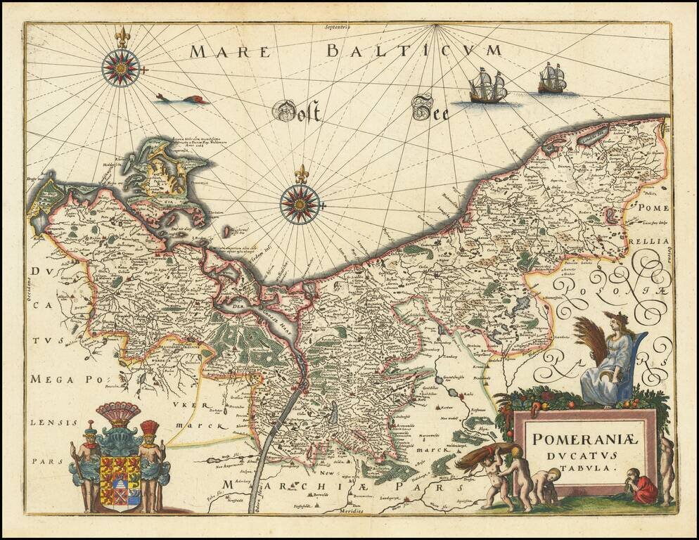
Decorative map of Pomerania and the Baltic Sea, from Merian's Neuwe Archontologica Cosmica . . .. Includes a decorative coat of arms and title cartouche. Based on earlier maps by Blaeu.
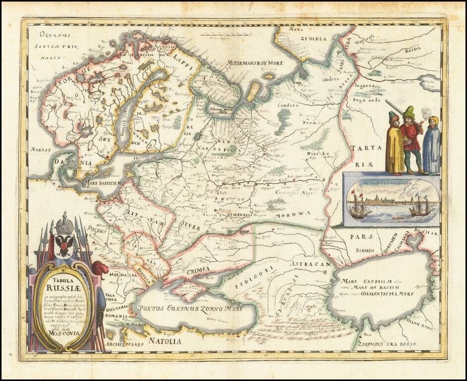
Nice example of the Merian edition Hessel Gerritsz's map of Russia, with view of Archangelsckagoroda. The map was compiled from manuscript maps and work brought back by Isaac Massa. Includes a decorative birdseye view. Richly decorated a large title...
Striking map of Poland and the Baltic states, with two decorative cartouches. Extends east to Lithuania, North To Koningsperg, East to Rugia and South to Dresden, Olmutz, Radibor and Carcovia. Shows Danzig, Wladislaw and Warzovia.