
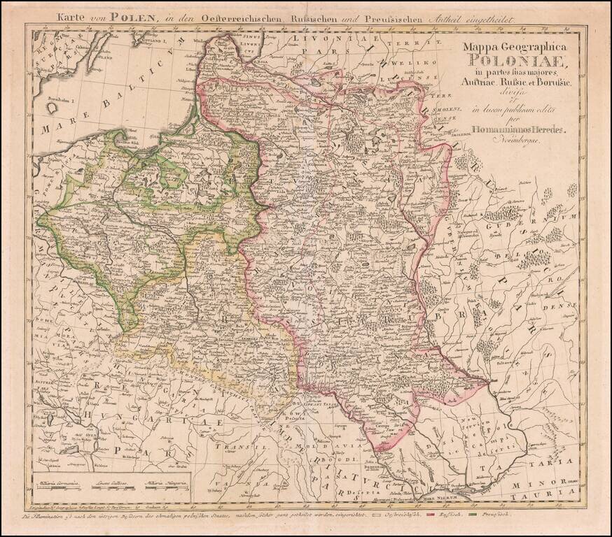
Rare map of Poland, published by the Homann Heirs is Nuremberg. This is the rare final state Tobias Mayer map of Poland. Additional title in upper margin: "Karte von Polen, in den Oesterreichischen, Russischen und Preussischen Antheil Eingetheilet"....
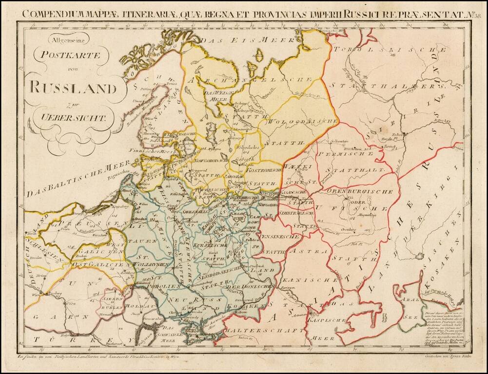
Rare postal map of the Russian Empire, which appeared in Von Reilly and Kuhn's Atlas Universae rei veredariae bilinguis ... Allgemeiner Postatlas von der ganzen Welt . . . , published in Vienna in 1799. Von Reilly & Kuhn's atlas is the first...
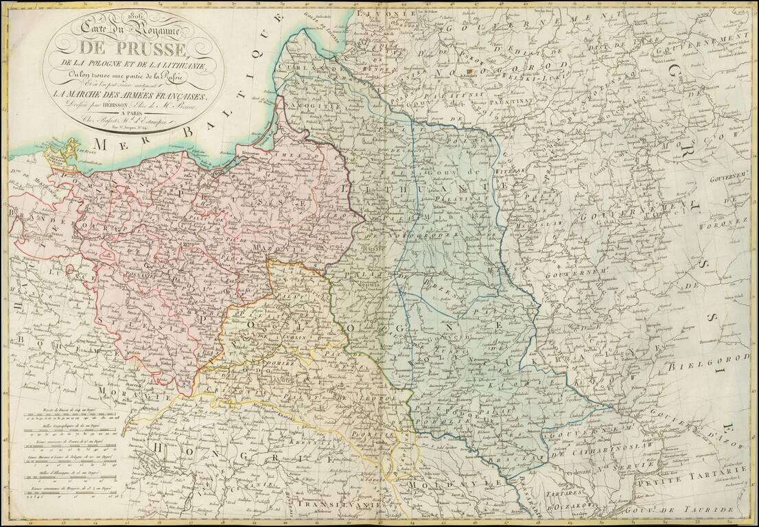
A Rare Map of Poland at the Time of the Creation of the Duchy of Warsaw. Detailed map of Poland and environs, showing the regions which were the subject of the marches of Napoleon's French Army and its allies, which resulted in the creation of the...
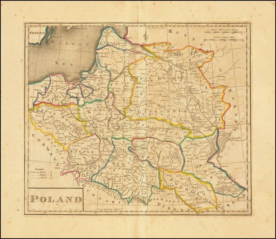
Second edition of the first map of Poland published in the United States. Published by Matthew Carey in 1814. Title revised and shortened from the first edition, although the content is unchanged.
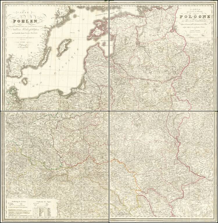
Highly detailed map of Poland, Lithuania, Latvia and Estonia, along with neighboring regions, published in Vienna by Tranquillo Mollo. The map includes significant detail, including postal roads, post stations, etc.
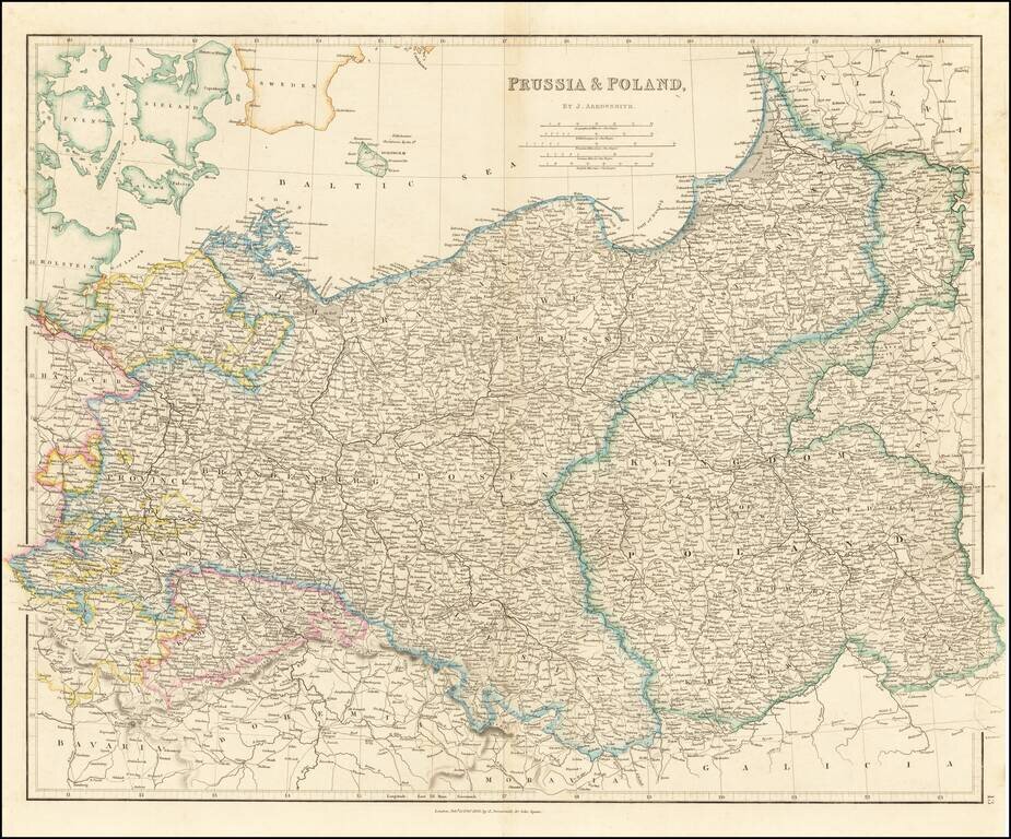
Striking map of the Kingdom of Poland, Prussia and the Baltic Region, published by John Arrowsmith. Highly detailed, showing towns, roads, rivers and other details, by John Arrowsmith, London's leading mapmaker of the period.
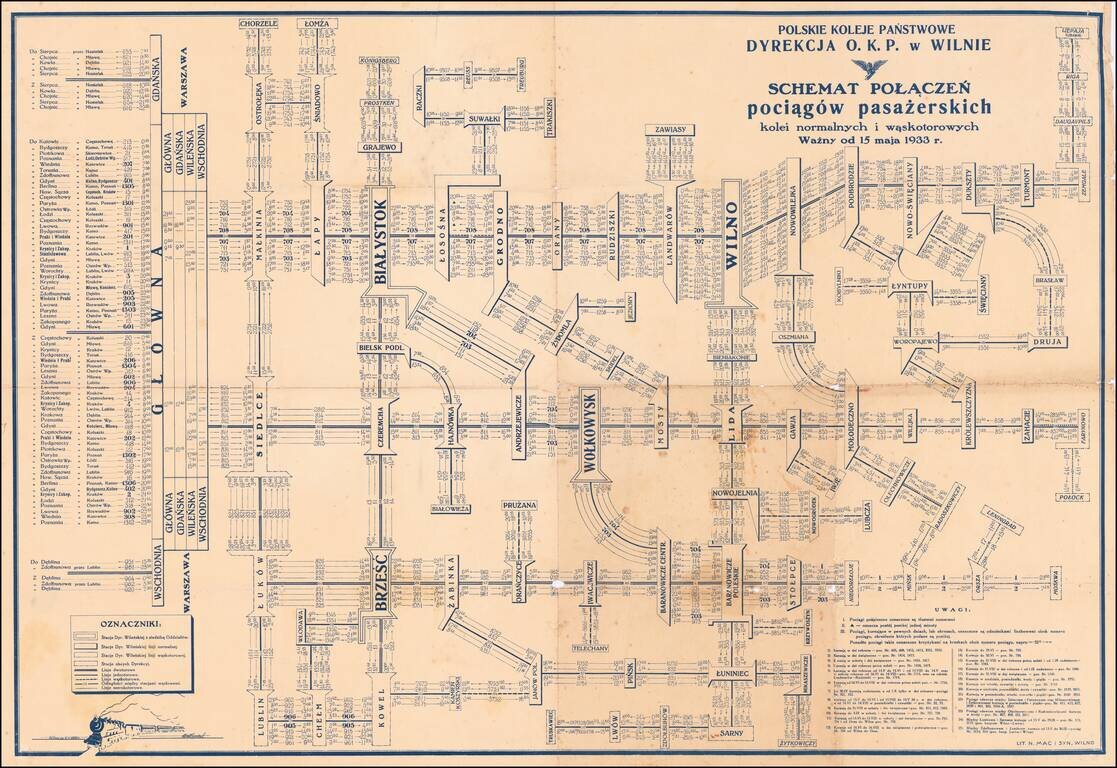
Detailed schematic map of the passenger train routes on normal and narrow gauge rail lines, centered on Vilnius and Bialystok. The title translates as: Polish State Railways Directorate P.K.P. Vilnius village - Diagram Connection of passenger trains...
![Europae Tabula VIII [Russia, Ukraine, Baltic, Scandinavia]](/map/small/44610.jpg)
Nice example of Gastaldi's map of the region bounded by the Baltic in the North and the Black Sea in the south, based upon Ptolemy. Giacomo Gastaldi is considered as the foremost Italian cartographer of the 16th century along with Paolo Forlani. From...
![[Russia, Sweden, Finland, Estonia Latvia and Lithuania].](/map/small/36638.jpg)
A fine wide margined example of the northern sheet of the first edition of Gastaldi's 2-sheet map covering Russia, Sweden, Finland, Lithuania, Latvia and Estonia, published in Venice in 1562. The present offering is the northern sheet only (of 2) of...
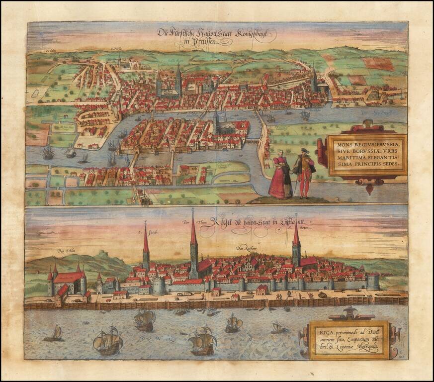
Fine early views of Kalingrad and Riga, first published by Braun & Hogenberg in 1581. The view is one of the earliest obtainable views of Kalingrad and Riga.
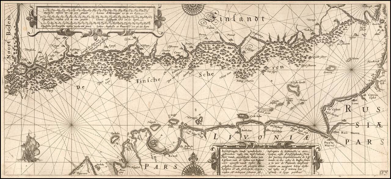
One of the Earliest Detailed Sea Charts of the Baltic Coastline Finely engraved sea chart Gulf of Finland, extending from St. Petersburg in the east to Estonia and the entire coast of Southern Finland. The chart appeared in Blaeu's Her Licht der...
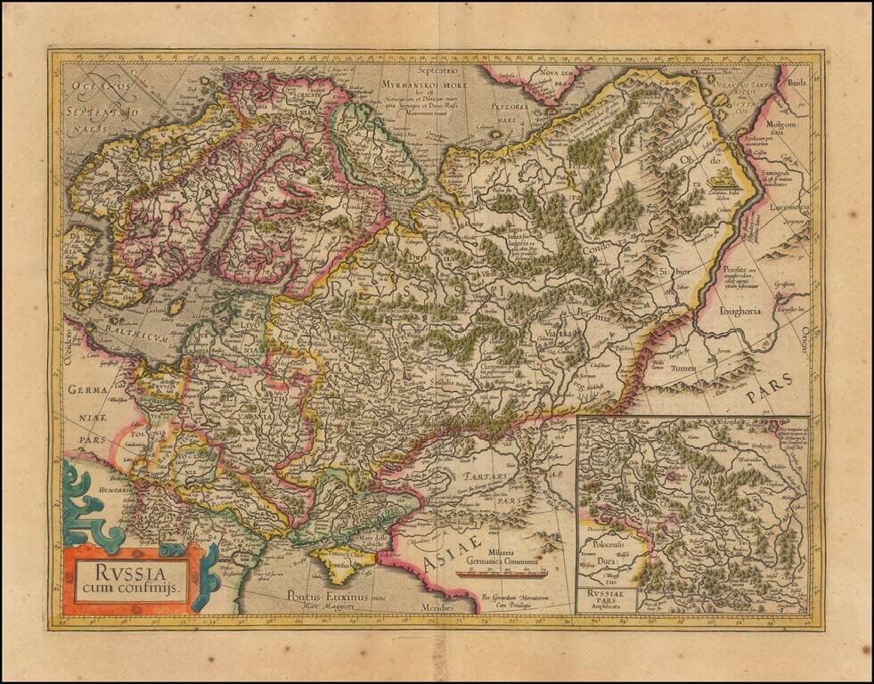
Nice outline color example of Mercator's first map of Russia. The map shows the region from Scandinavia to the Black Sea and the Oby River. Large inset of Russia Pars Amphisicata (Moscovia). Numerous Eastern European regions are shown, including:...
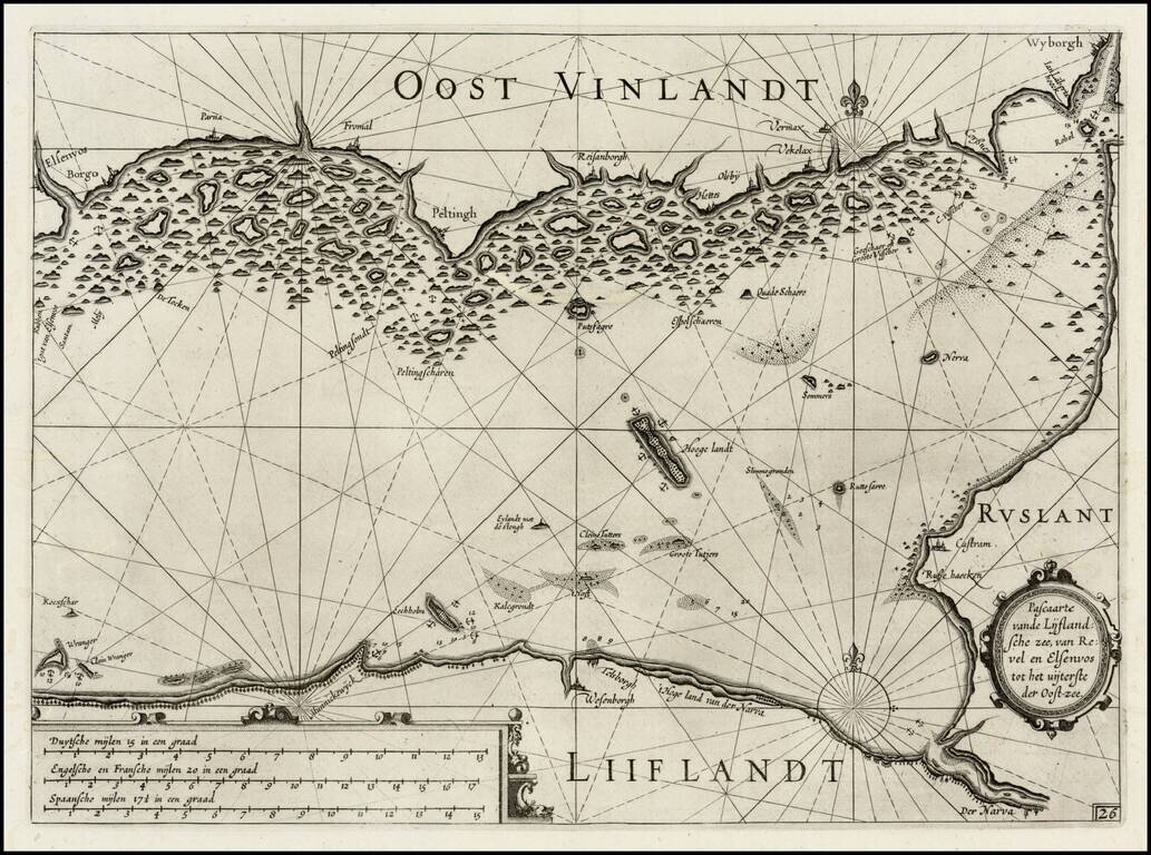
First edition of Blaeu's chart the Narva Bay and the area around St. Petersberg in Russia, from Blaeu's Zeespiegel, Inhoudende Een Karte Onderwijsinghe in de Konst de Zeevaert, en Eene beschrijvinghe der Seekusten van de Oostersche, Noordsche, en...
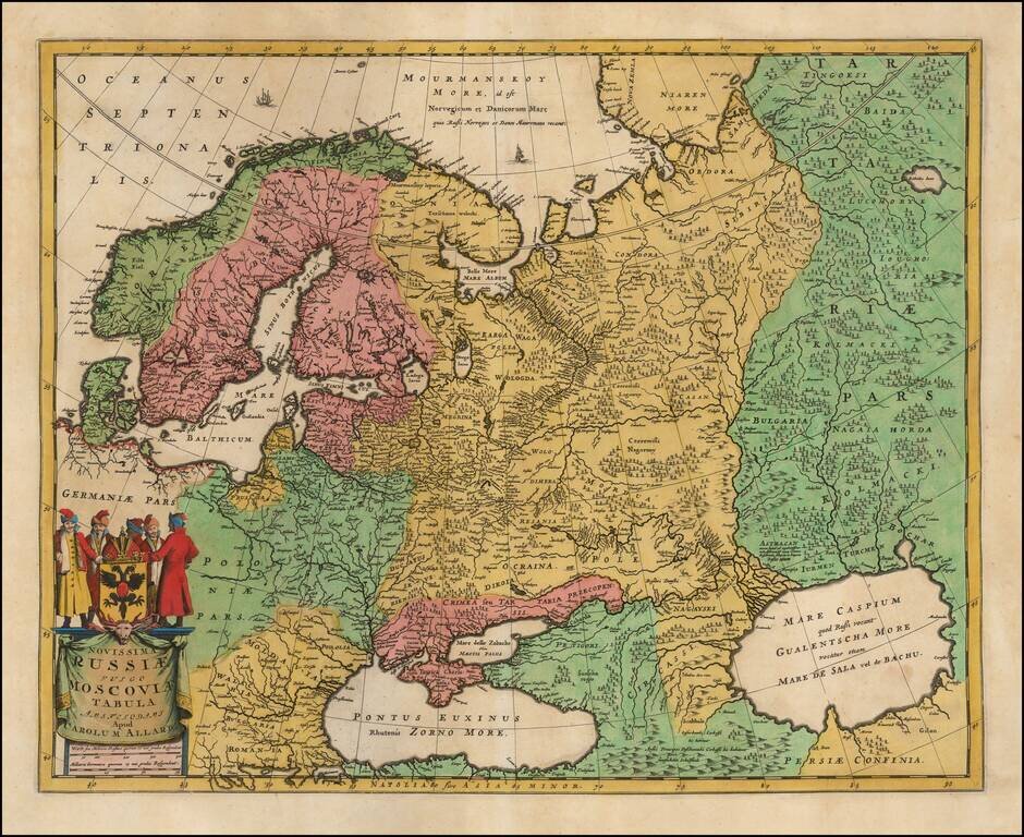
Nice example of Carol Allard's map of Russia and much of Northern Europe. Embellished with a decorative cartouche and coat of arms, plus sailing ships and sea monsters. Based on the cartography of Isaac Massa. The map is an updated version of Hugo...
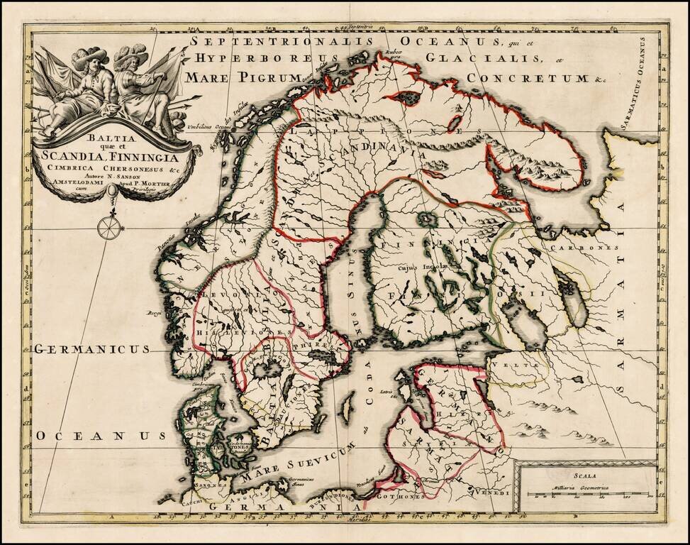
Scarce map of Scandinavia, the Baltic Region and contiguous parts of Finland and Russia. The map appeared in Mortier's Atlas Antiquus, based upon the work of Nicolas Sanson.
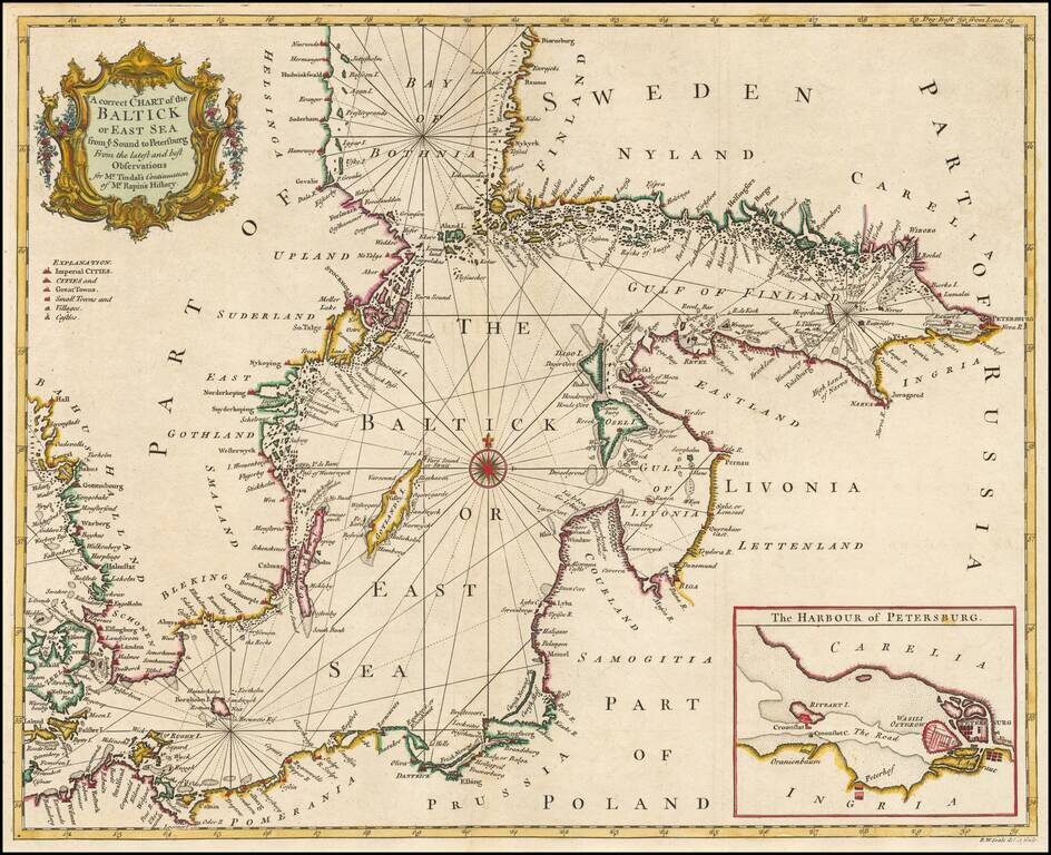
Detailed coastal chart of the Baltic Sea, Bay of Bothnia, Gulf of Finland and contiguous coastlines, with a large inst map o the Harbour at St. Petersburg. Includes a compass rose and rhumblines, with a decorative title cartouche.