Map size in jpg-format: 4.4147MiB
Click to open in high resolution (open in new tab).
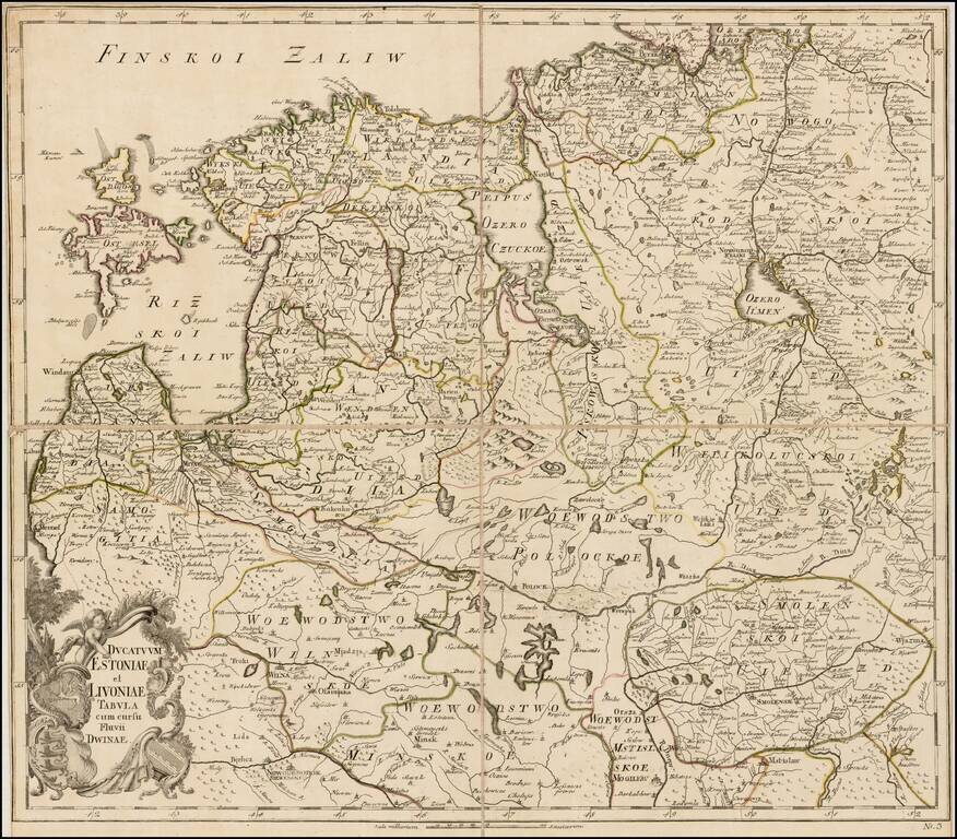
Rare separately issued map of Estonia, Latvia, Lithuania and contiguous parts of Russia and Belarus, published by the Akademiia nauk SSR (Russian Academy of Science) in St. Petersburg.
The map extends south to Wilna and Minsk, showing remarkable details.
As noted by Rumsey:
The first atlas of Russia, published by the Academy of Sciences in St. Petersburg, expanding on the cartographic work done previously by Ivan K. Kirilov. Postnikov: "It brings together all the geographical discoveries of the early 18th century to give a fuller picture of the entire Empire than shown in the so-called Kirilov atlas. The maps were mostly based on instrumental surveys, geographical descriptions and maps compiled by the Petrine geologists and their successors."
The present example is unusual, in that it was intended as a separately issued map and was apparently never bound into an atlas.
If you are a student, write to us in telegram: @antiquemaps and indicate what material you need and for what work you need a map in high detail. We are ready to provide material on special terms. For students only!
![[Signed Political Satire Artwork] Vietnam ... Vietnam ... Vietnam ...](/map/small/68726.jpg)

