
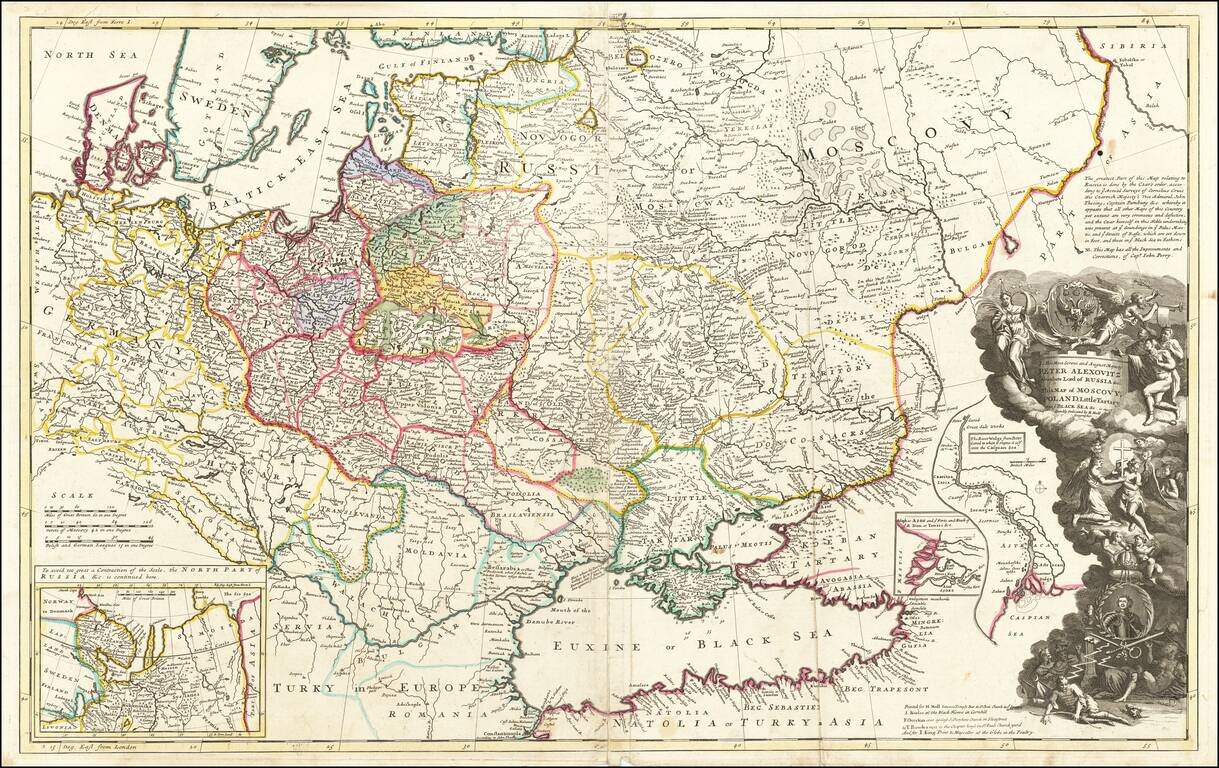
Striking large format map of Russia, Ukraine, Poland, Finland and the Baltic Countries and extending south to the Black Sea and the Balkans, with an ornate dedication cartouche to Peter the Great, including a portrait of the Czar near the bottom of the...
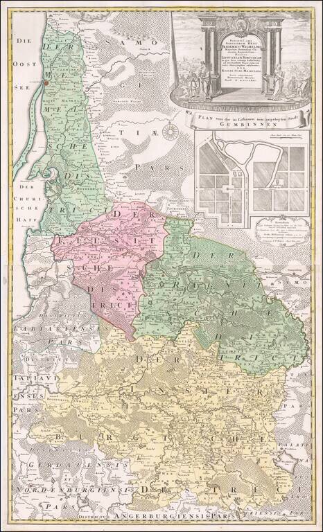
Fine large map of the Baltic and Poland, published by the Homann Heirs. The map illustrates what was then 'Lithuania Minor', the most easterly province of the Kingdom of Prussia, given the name because of the large number of Lithuanian speakers. The...
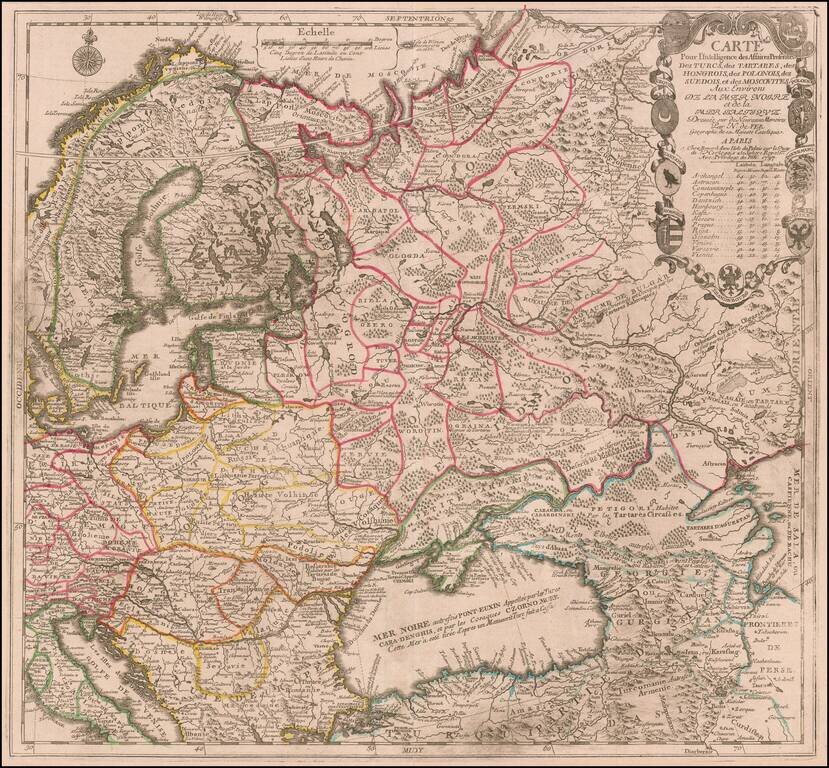
Scarce map of the region centered on the Black Sea and Russia, published by Nicolas De Fer in Paris. The map extends from Scandinavia and the Baltic in the west to the mouth of the Volga in the Caspian Sea. Elaborate cartouche includes 9 coats of...
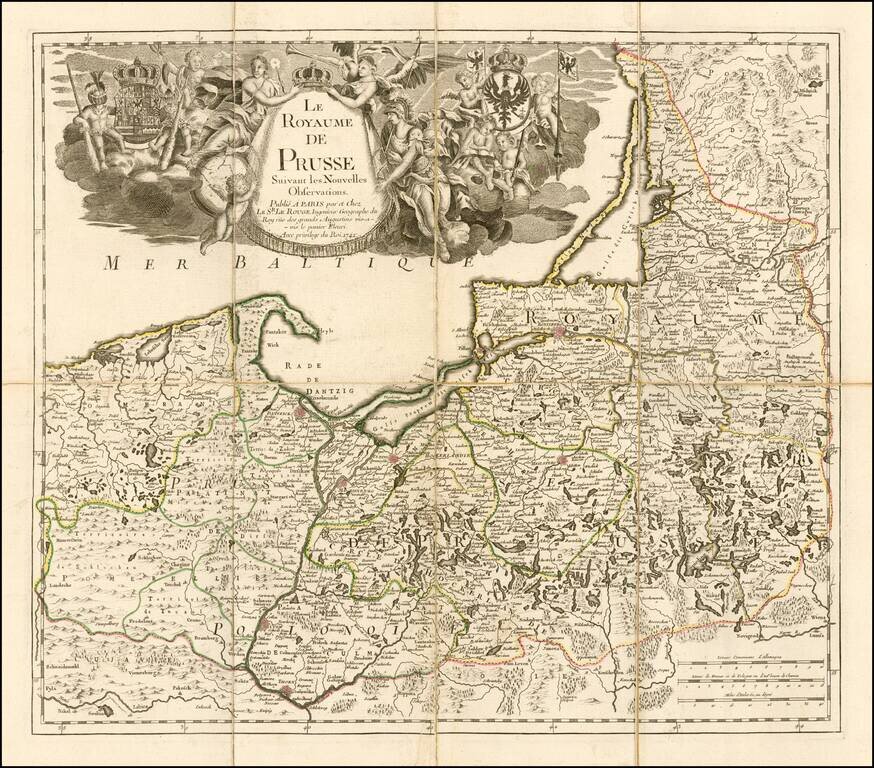
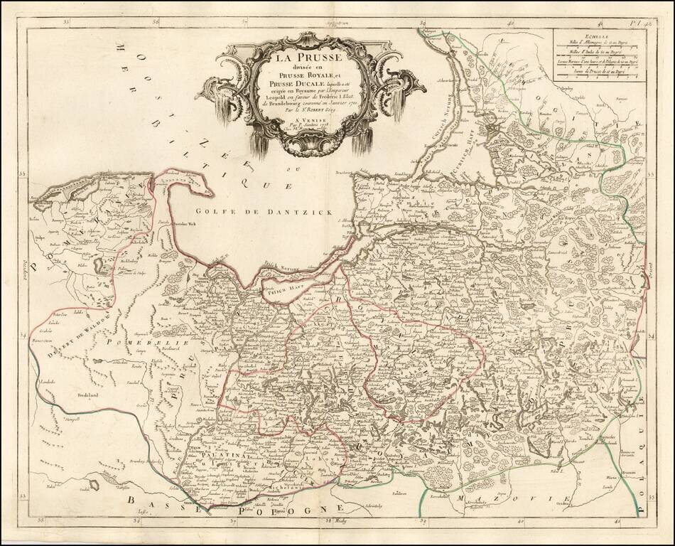
Fine separately issued example of Le Rouge's map of the Kingdom of Prussia, incorporating Poland and the Baltic countries. The map was published two years into the reign of Frederick II (1712-1786) as 'king in Prussia." Includes a fine elegant...
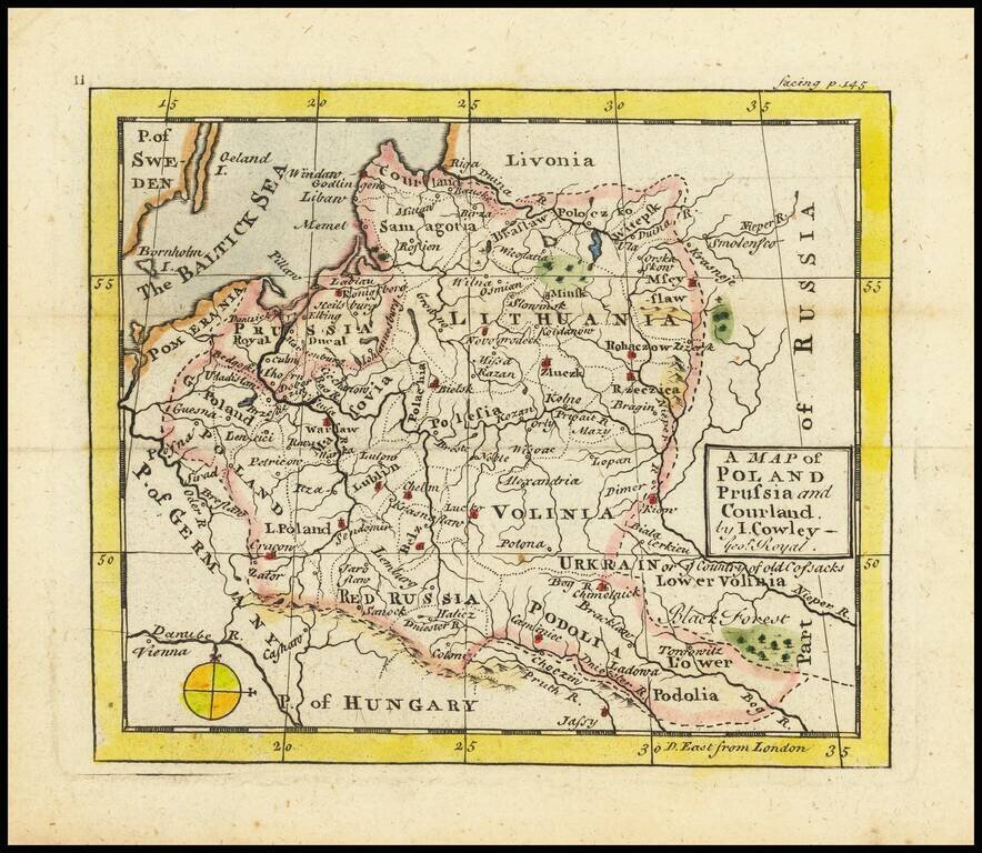
Antique engraved map of the area covering modern-day Poland, the Baltics, and Belarus, by John L. Cowley from “A New and easy introduction to the study of geography”. The map includes Lithuania as the dominating polity in the region. Along with...
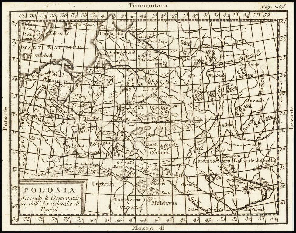
A map of Poland and the Baltic States, extending from Pomerania into Russia as far as Moscovia. Forests, rivers, mountains, settlements, and more are all shown. The four principal winds of the Mediterranean are shown at the edges of the map as a...
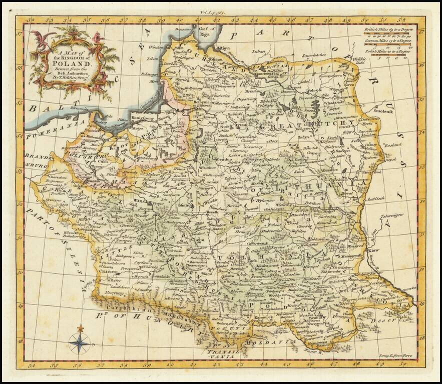
Scarce English map of the Kingdom of Poland (and Lithuania) on the eve of its initial dismemberment. The map appeared in Busching's A new system of geography: in which is given, a general account of the situation and limits... of the several kingdoms...
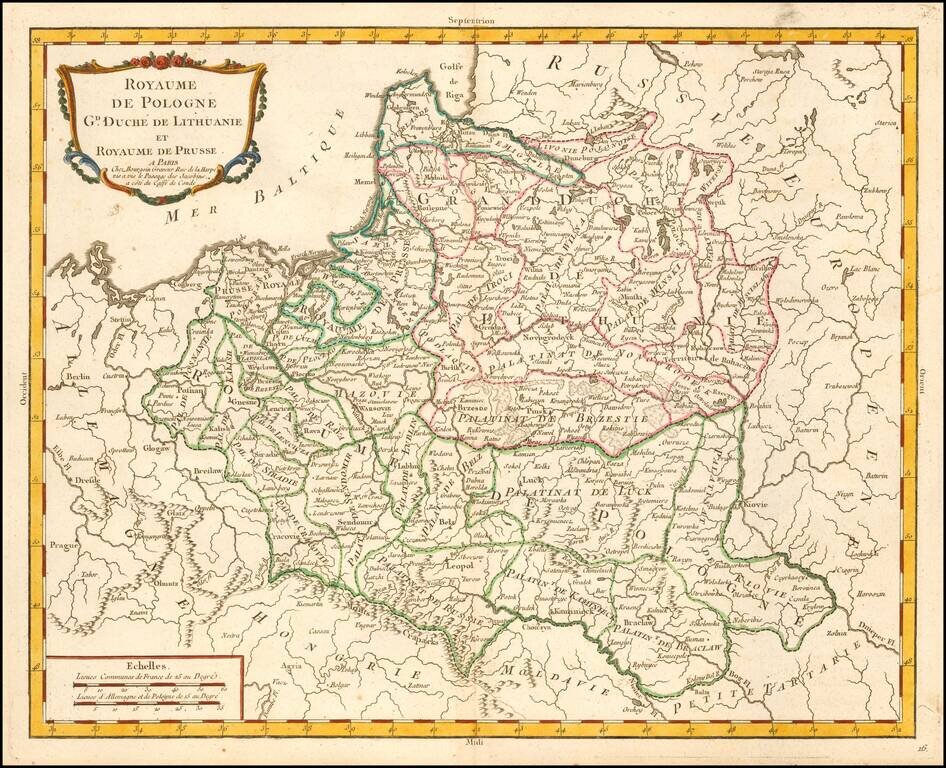
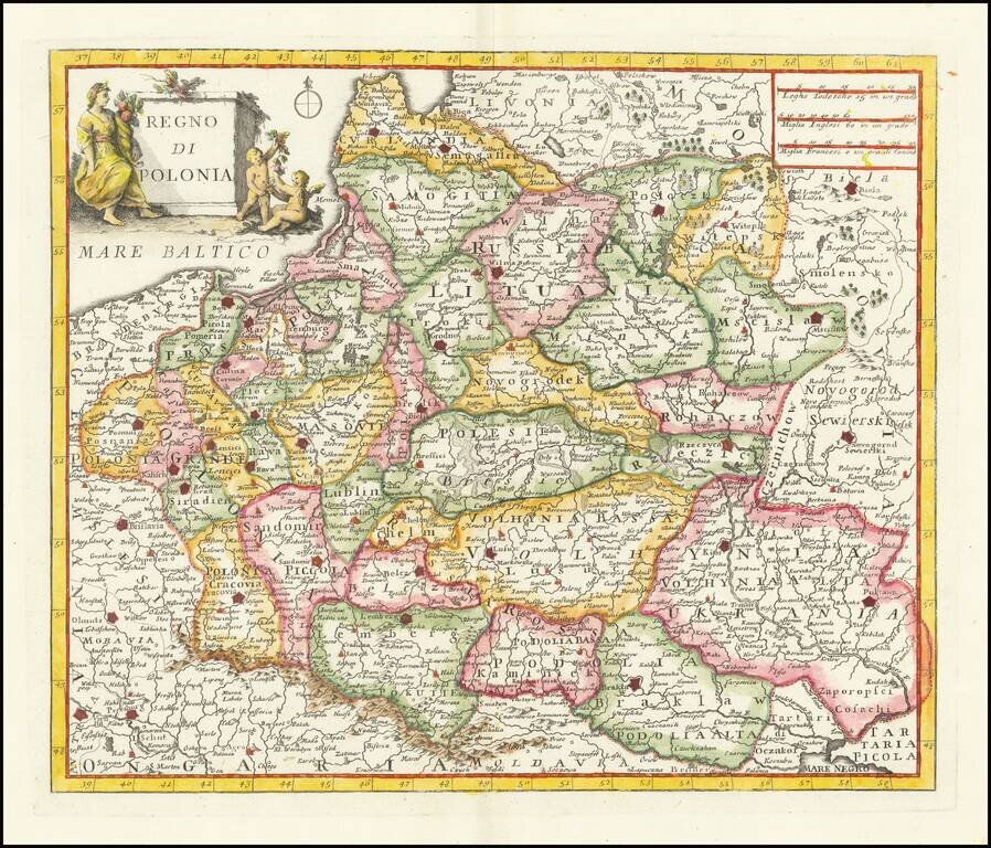
Scarce map of the Kingdom of Poland and Duchy of Lithuania, published by Pierre Bourgoin in Paris. The map is subdivided into Palatinates and includes topographical details, towns, rivers, lakes, etc. According to Niewodniczanski, this map first...
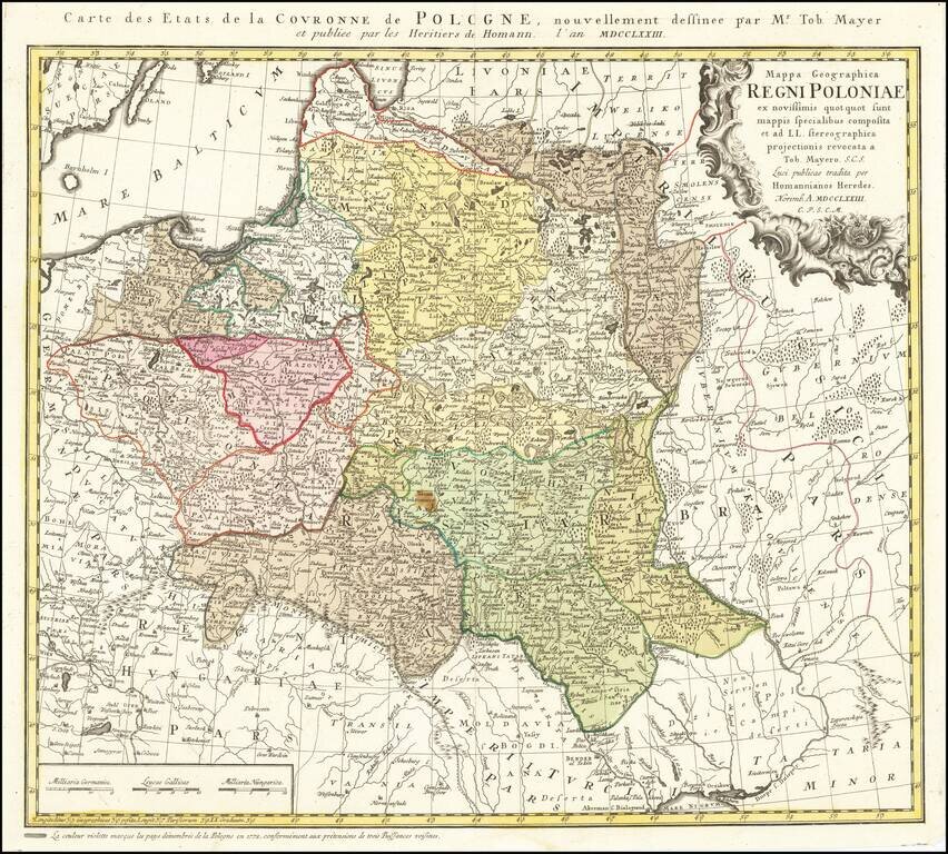
Detailed map of Poland, by Tobias Mayer, dated 1773 in the title cartouche. Poland extends from Glogau and Breslau in the west, to Braclaviensis in the south along the Dniestr River, east to the Dniepr River and Mscislaw and north to include parts of...
![Tabula Regni Borussiae Borussiam Orientalem exhibens MDCCLXXV [and] Borussiae Occidentalis Tabula . . . 1780](/map/small/58775.jpg)
Scarce map of Poland, Lithuania, Kalingrad, Pomerania, etc. The maps were created by Gussefeld, one of his earliest maps, and published by Homann Heirs.
Fine and highly detailed map of Belarus, Latvia, with the Dnieper River. The map includes the towns of Smolensk, Orsa, Minsk, etc. Santini gives credit to Homann Heirs in the cartouche.
Fine and highly detailed map of parts of Poland, Kaliningrad, Lithuania, etc. Shows the Kingdom granted to Frederick I of Prussia, after Prussia was elevated by Leopold to the status of a Kingdom in 1700. Frederick made himself the King of Prussia on...
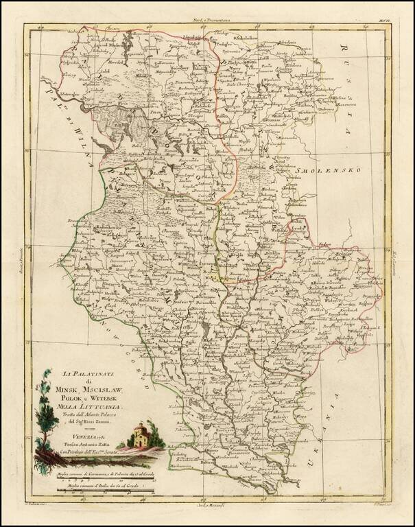
Decorative regional map of several Palatinates in modern day Belarus, centered on the Upper Dniepr River and Upper Dwina River. Issued as part of Zatta's Atlante Novissimo.
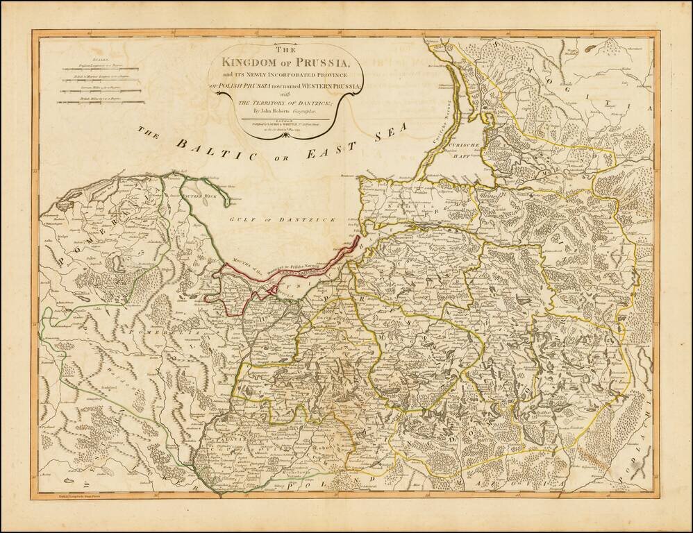
Strking full color example of this fine map of Prussia and Polish Prussia, following the Polish Dismemberment. Includes a significant section of modern Lithuania.
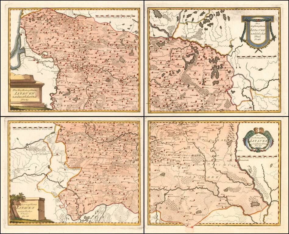
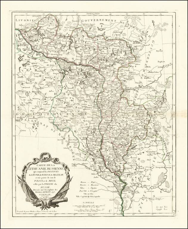
Scarce 4-sheet regional map of Lithuania, published by Von Reilly, The map shows region bounded by the Dnieper, Dwina and Wilia Rivers and including Mohilow, Polock, and Braslaw. Shows rivers, roads, towns, castles, forests, lakes and a host of other...