
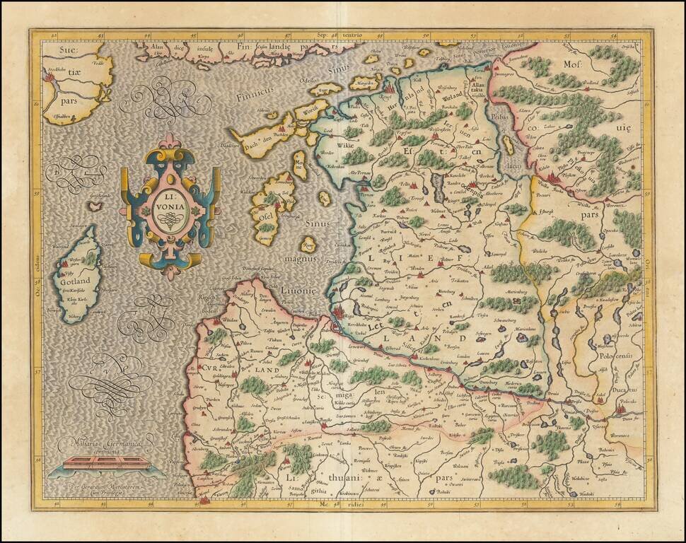
Finely colored example of Mercator's detailed map of the northern Baltic region. Decorative cartouche.
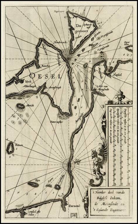
Rare map of the Island of Oesel (Saaremaa) and contiguous coastline of the Gulf of Riga, from the first edition of Blaeu's rare Zeespiegel, Inhoudende Een Karte Onderwijsinghe in de Konst de Zeevaert, en Eene beschrijvinghe der Seekusten van de...
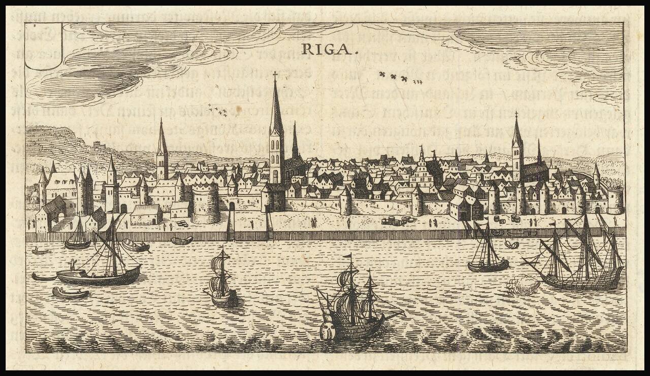
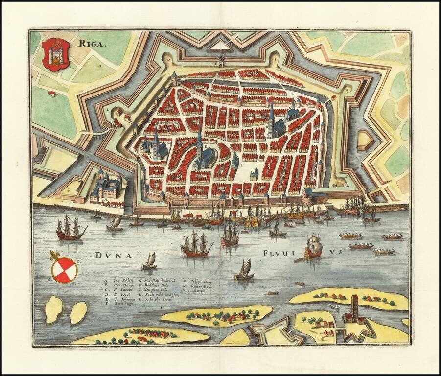
Fine early view of Riga, from an unknown source. We suspect the work is by Jodocus Hondius or Petrus Bertius, but we have been unable to find a definitive source.
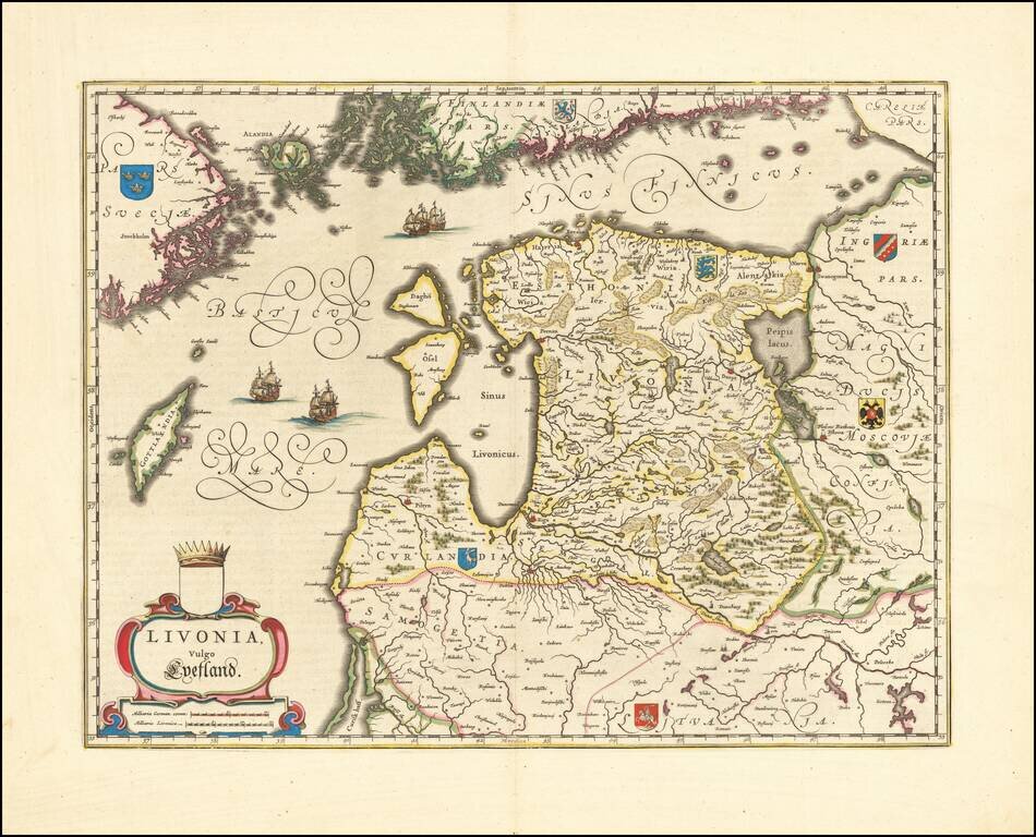
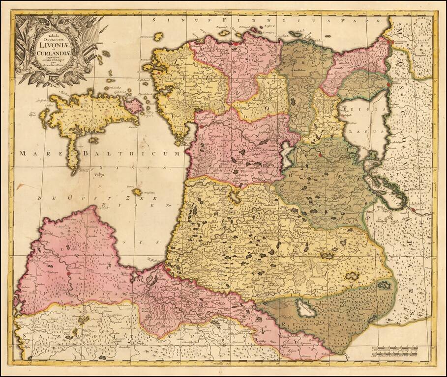
Striking full color example of Jansson's new map of the Balkans and the Sinus Finnicus. Decorative map of Estonia and Latvia. Including the southern tip of Finland and the south eastern tip of Sweden, including Stockholm. Includes a decorative...
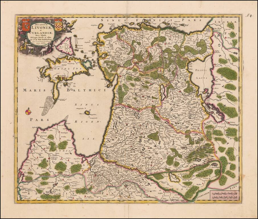
Nice example of this decorative map of the Baltic, Lithuania, Estonia, Latvia, Gottalandia, and parts of Sweden (including Stockholm) and Finland (including Helsinki). The map includes a decorative cartouche, the coats of arms for Sweden, Finland,...
Striking view of the town and harbor of Riga, including a coat of arms. Matthaus Merian (1593-1650) was a Swiss engraver and one of the most prolific engraver's of town views in the 17th Century. Merian learned the art of copperplate engraving in...
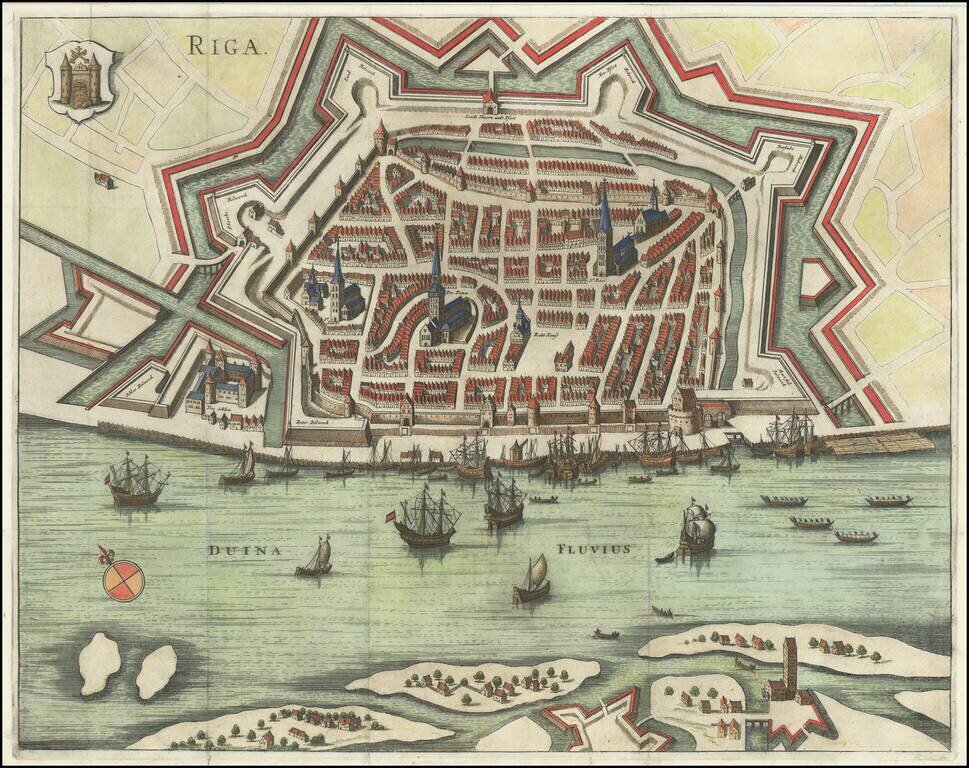
Gorgeous early plan of Riga, including coat of arms and sailing ships in the harbor. The map shows the town plan and the Duina River, with several places identified by name. Jansson's plan appeared in two different publications, Jansson's rare 6...
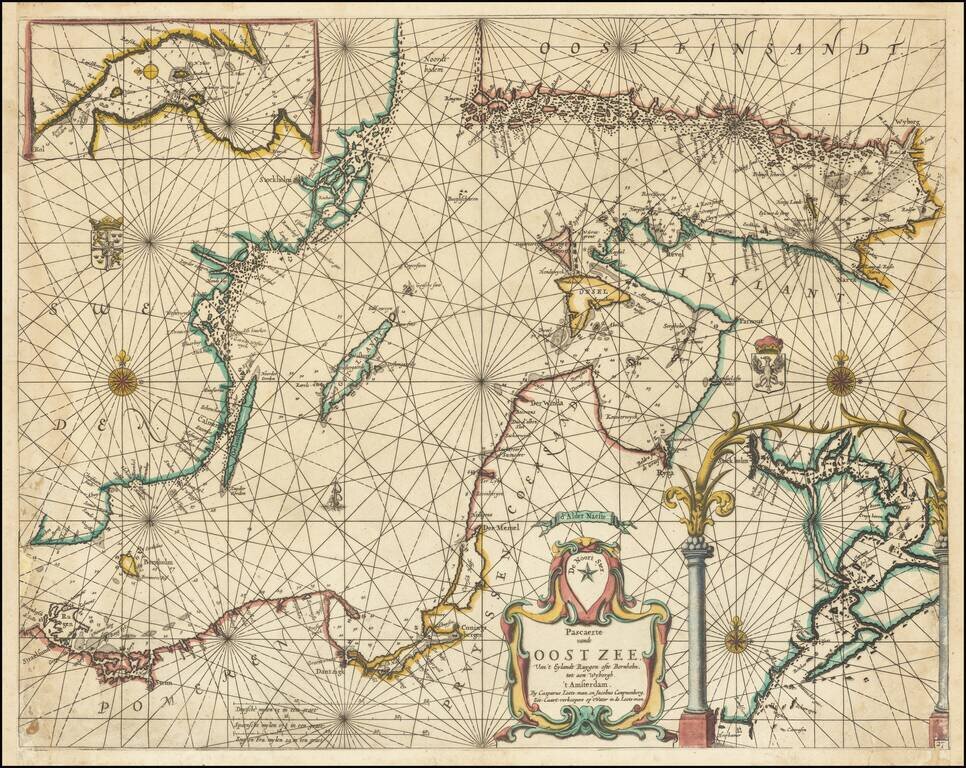
Exceptionally rare chart of the Baltic Sea and adjoining coastlines published by Caspar Lootsman (here "Casparus Loots-man") in Amsterdam. The chart shows the Baltic Sea from Trelleborg to Rugen at the west and the easternmost section of the Gulf of...
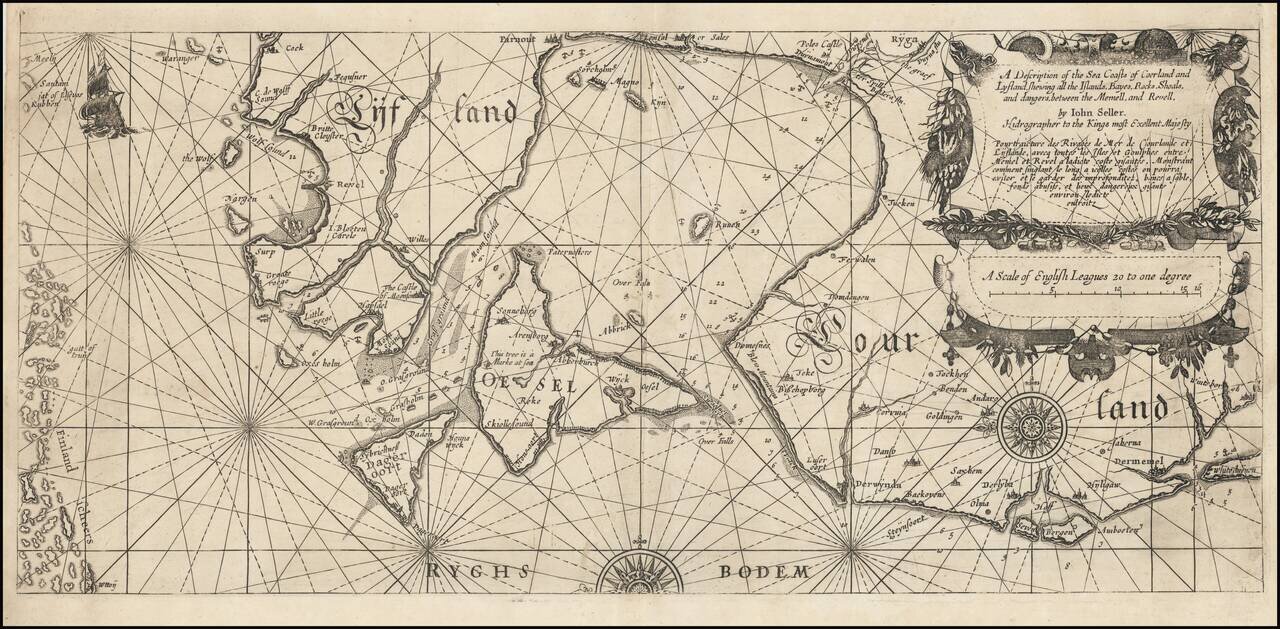
An Extremely Rare English Chart of the Baltic Coasts of Estonia, Latvia, and Lithuania. A wonderful rarity from the early days of English sea chart publication, being one of the maps that John Seller produced using copper plates bought from the Dutch...
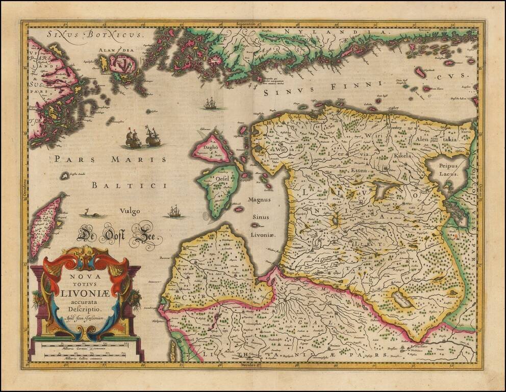
Fine old color map of the Baltic region, covering Estonia and the northern part of Latvia, published in Amsterdam. Includes 2 coats of arms in the cartouche.
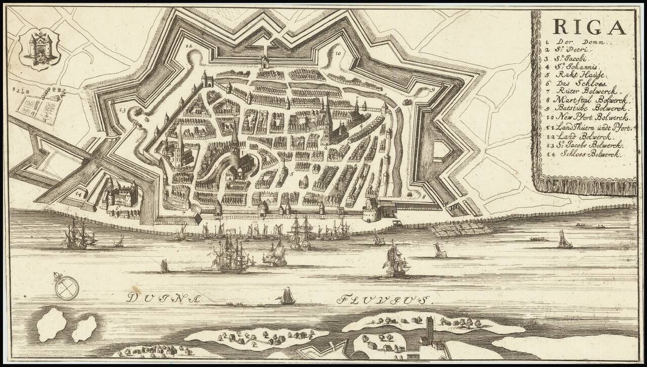
Detailed plan of Riga, with a key locating 14 points of interest. The map is in the style of several other 17th Century maps of Riga, but we were not able to determine a maker.
Scarce Gerard Valk map of the northern Baltic coast, in old color. A rare Valk imprint, printed on double thick paper, with wide margins and old color.
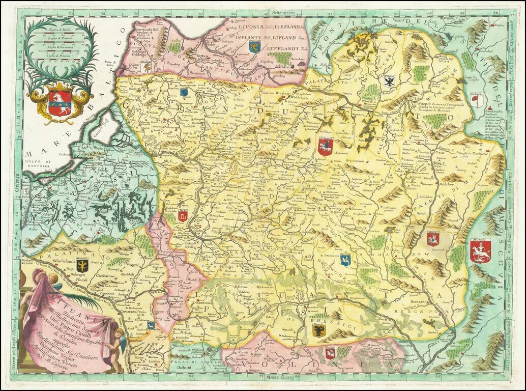
Full color example of Coronelli's scarce and very attractive detailed map of Lithuania. The map covers Lithuania and parts of Poland and the Baltic and includes numerous coats of arms in the body of the map and two large decorative cartouches.

Striking 17th century view of the City of Riga and environs, showing the Siege of 1656. Siege of Riga The Siege of Riga by the Russian Army under Czar Alexei Mikhailovich was a major battle of the Russo-Swedish War. In 1652, the Swedes had started...
![[Narva] Entsatz der Stadt Narva und der Moscowitzer grosse Niederlage den 20, 21, des Novembermonats 1700 Zum Ersten Theile Leben K. Karl XII auf der 221:under folgen der Seite](/map/small/28095.jpg)
Rare separately issued battle plan of the Siege of Narva, engraved by Fritzsch, based upon original drawings by Zacharias Wolf, a Swedish Engineer and Officer who was present at the battle and would go on to have a distinguished career as a military...
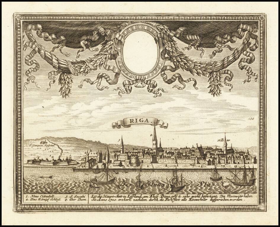
Finely engraved view of Riga, published in Augsburg. Includes key at the bottom locating points of interest.