
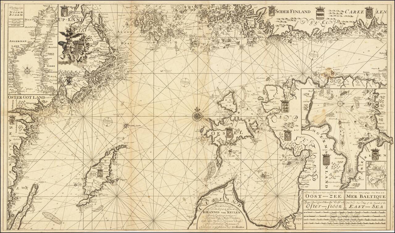
Scarce Dutch sea chart of the Baltic Sea, published by the Van Keulen firm, the leading Dutch sea chart publishers of the 18th century. The map covers much of the Baltic Sea, the Swedish coast around Stockholm, the Gulf of Riga and West Estonian...
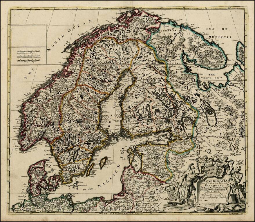
Fine map of Scandinavia and the Baltic, published in Amsterdam by Valk. Shows Norway, Sweden, Finland, Estonia and Latvia. It depicts a significantly contracted Swedish Empire having suffered defeats against both Norway and Russia over the previous...
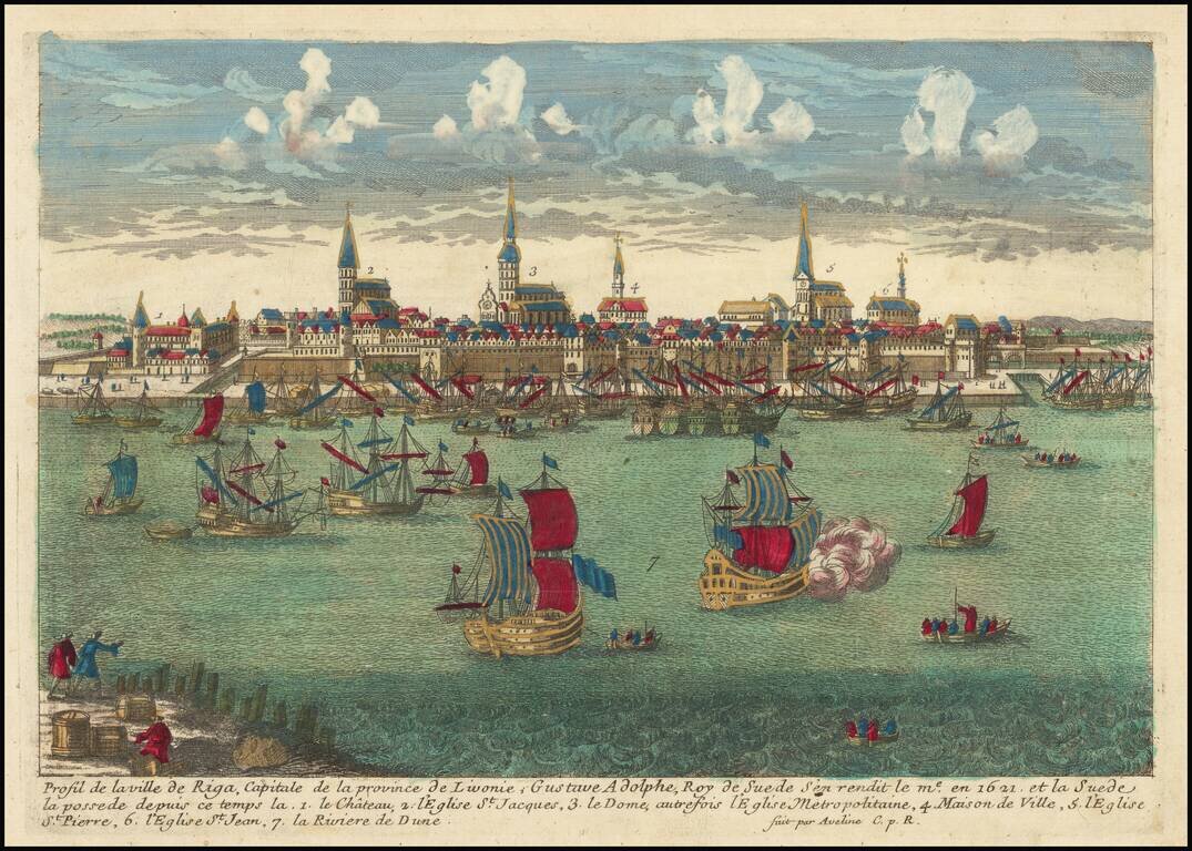
This is an attractive antique view of Riga from across the Duna, showing the skyline of the city with many ships stationed in the river. Seven features of interest are marked, including St. Peter's Cathedral, Riga Castle, and Riga Cathedral. The...
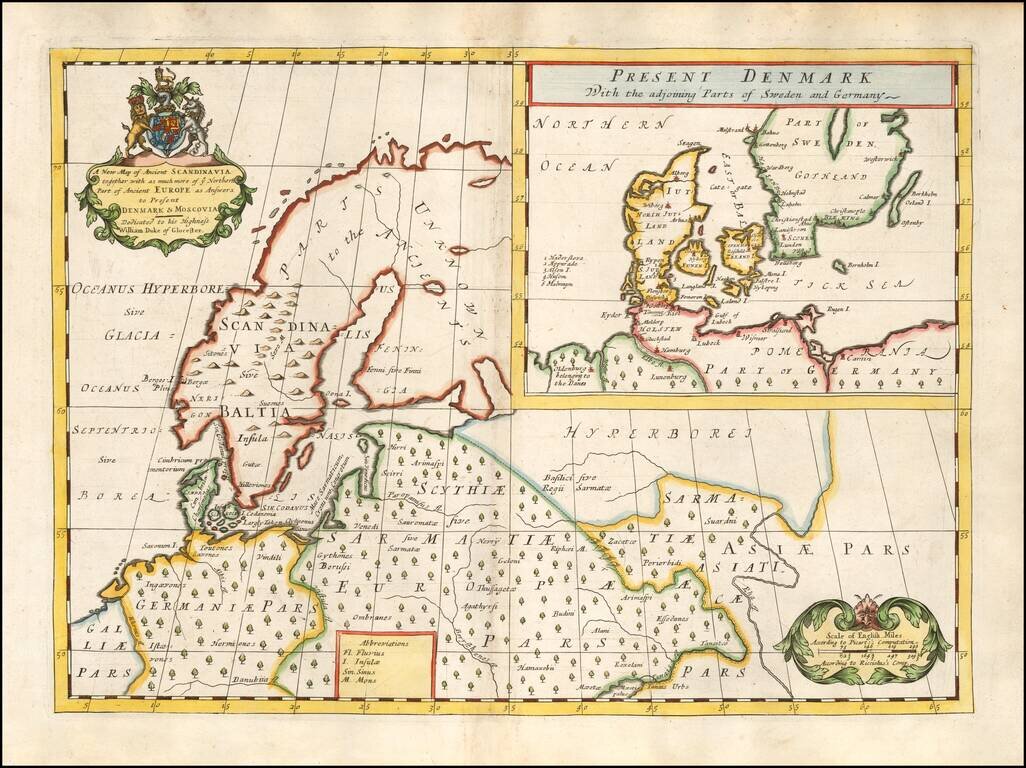
Decorative map of Scandinavia and Northern Europe, with an inset of Denmark and part of Norway and Sweden. Two decorative cartouches. Wells map is 1 of a set of 22 maps dedicated to William, Duke of Glouchester, who at the time of publication of the...
![Carte De La Partie Meridionale du Royaume de Suede avec une Table des Provinces et des Villes Principales [including Baltic Sea, Estonia, Latvia and Lithuania]](/map/small/41643.jpg)
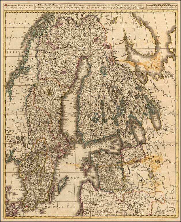
Detailed map of the Southern part of Scandinavia, the Baltic Sea and contiguous parts of Estonia, Latvia and Lithuania. From Chatelain's monumental Atlas Historique.
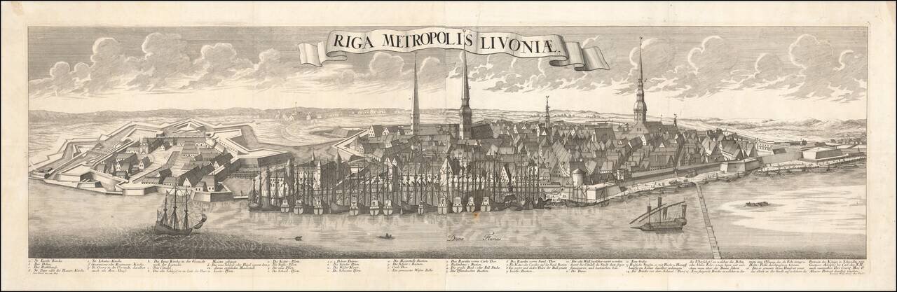
An Important Early View of Riga Striking example of this spectacular panoramic view of Riga, based upon the work of Friedrich Bernhard Werner (1690-1776). This is the first of several of Werner's views of Riga, which would be issued with revisions...
![[Daugavgriva] Die Haupt Vestung Dunamunder Schanz Welche die Saxen Anno 1700. Augustusburg nandten, aber Ao. 1701. auff Discretion wider auffgeben miessen.](/map/small/60087.jpg)
This is a small and well-engraved map of the fortress of Daugavgriva, located at the mouth of the Daugava River, just downstream from Riga. The map shows the fortress alongside an attractive title cartouche. An inset shows the region, including Riga,...
Nice example of John Senex's map of Scandinavia and the Baltic Sea, from his New General Atlas. Fine dark impression of this scarce map, including a decorative cartouche, 3 coats of arms and a dedication to the Duke of Shando.
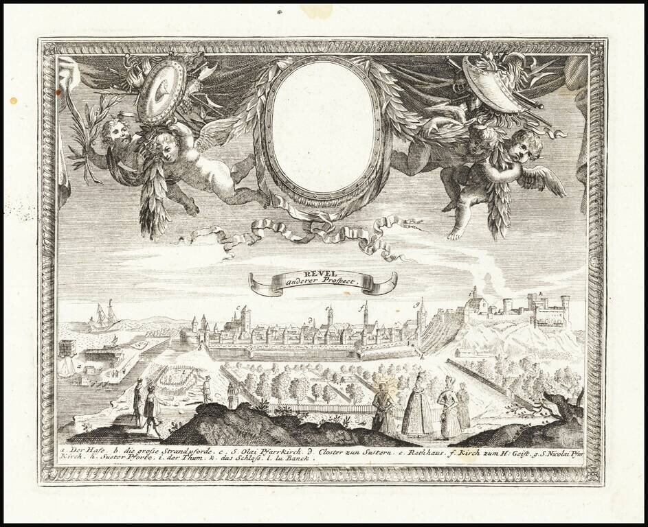
Fine decorative view of Talinn, published by Gabriel Bodenehr in Augsburg.
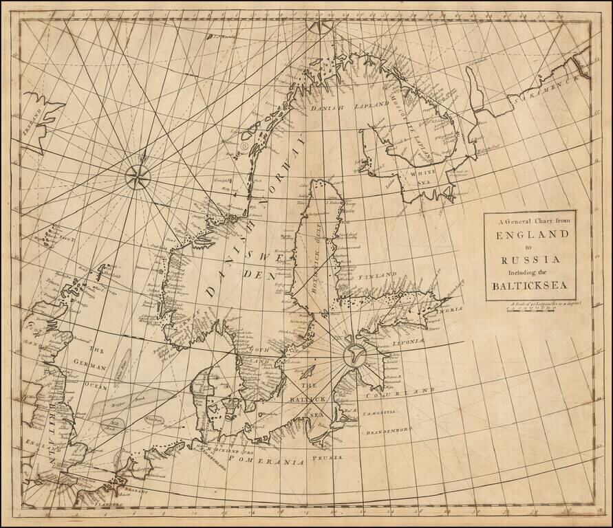
Rare Chart of Northern Europe from an Influential Atlas Scarce engraved sea chart comprising Scandinavia, the Baltic Sea, and the North Sea (here "German Ocean"). Interestingly, Norway is separate from Danish Norway, and there is a separation drawn...
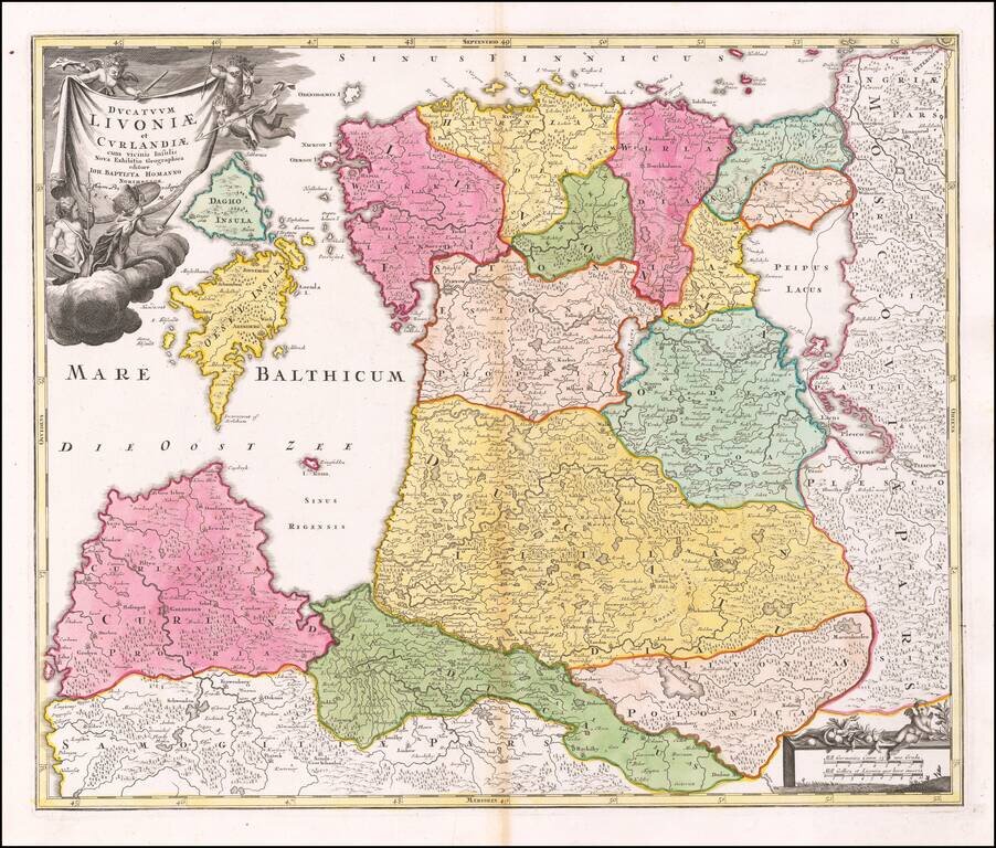
Early Map of Estonia and Latvia Nice example Homann's map of the northern Baltic region, published in Nuremberg. The cartouche shows Homann's "Cum Privilegio, S.C.M, placing the date of the map in or shortly after 1730 Fine dark impression.
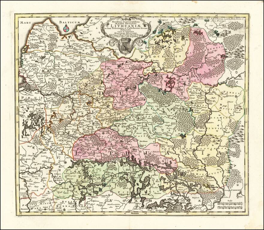
Second State of Seutter's map of Lithuania, extending from the Baltic (Riga) to Palatinat Polesia Bressicenis in the south. A highly detailed map of Lithuania, showing towns, castles, Palatinates, rivers, lakes, forests, etc. There are 3 states of...
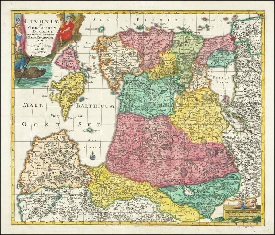
Finely engraved map of the Baltic region, published by Lotter. The map includes a striking allegorical vignette engraved by Abraham Drentwet.
![[Riga & Environs]. Der Rigische Kreis / Le Cercle de Riga](/map/small/69148.jpg)
Rare 18th Century map of the area around Riga, published in Berlin by Carl Jack. The map was published for the Atlas von Liefland, oder von den beyden Gouvernementern u. Herzogthümern Lief- und Ehstland, und der Provinz Oesel - entworfen nach...
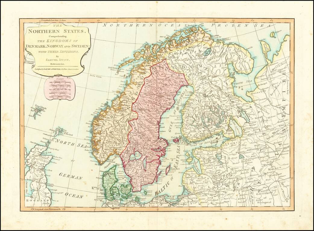
Detailed regional map of Scandinavia and the Baltic Sea, colored by Political divisions. Includes towns, mountains, rivers, lakes, islands, etc. From Dunn's New Atlas or Mundane System of Geography.
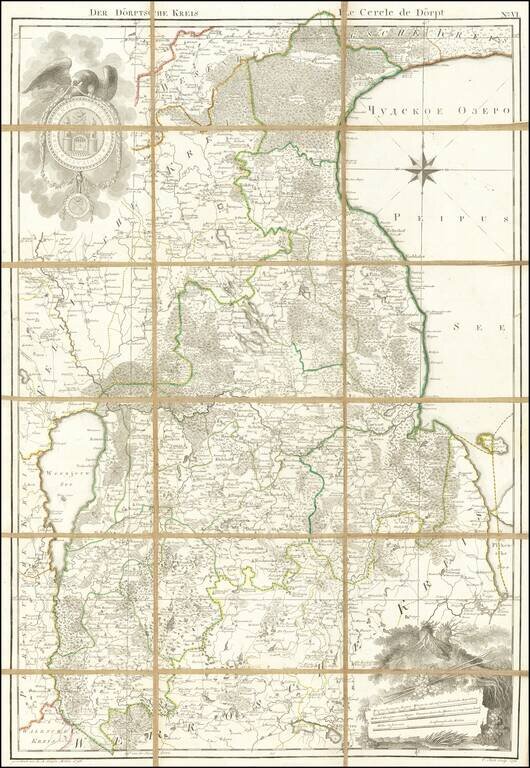
Rare engraved map of eastern Estonia between Lakes Võrtsjärv and Peipus, with the town of Doerpt (now Tartu) at the center. The map features an attractively-engraved coat of arms of the city of Doerpt at the upper-left. This map was included in...