logo

1814. Poland

  • Poland

Map size in jpg-format: 30.7319MiB

Download "Poland", in high resolution.

Poland information:

Year of creation: 
Resolution size (pixels): 
 10733x9300 px
Disk Size: 
 30.7319MiB
Number of pages: 
 1
Place: 
 Philadelphia
Author: 

Print information. Print size (Width x height in inches):
Printing at 72 dpi 
  149.07 х 129.17
Printing at 150 dpi 
 71.55 х 62
Printing at 300 dpi 
 35.78 х 31

An example of detailing the file of this map of in a printable high-resolution:

Click to open in high resolution (open in new tab).
Attention! this is just the central piece (central area 960x960 px) of the map file!
This is an example, so that you can see and study the level of detail of a given map. The entire Map will be fully available after payment!

Poland

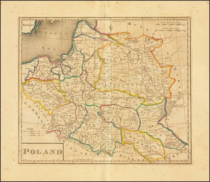
Second edition of the first map of Poland published in the United States. Published by Matthew Carey in 1814.

Title revised and shortened from the first edition, although the content is unchanged.


Special conditions for students!

If you are a student, write to us in telegram: @antiquemaps and indicate what material you need and for what work you need a map in high detail. We are ready to provide material on special terms. For students only!

Item information:

Year of creation:
Size:
10733x9300 px
Disk:
30.7319MiB
Number of pages:
1
Place:
Philadelphia
Author:
Mathew Carey.
$14.99

Related item