Map size in jpg-format: 4.6461MiB
Click to open in high resolution (open in new tab).
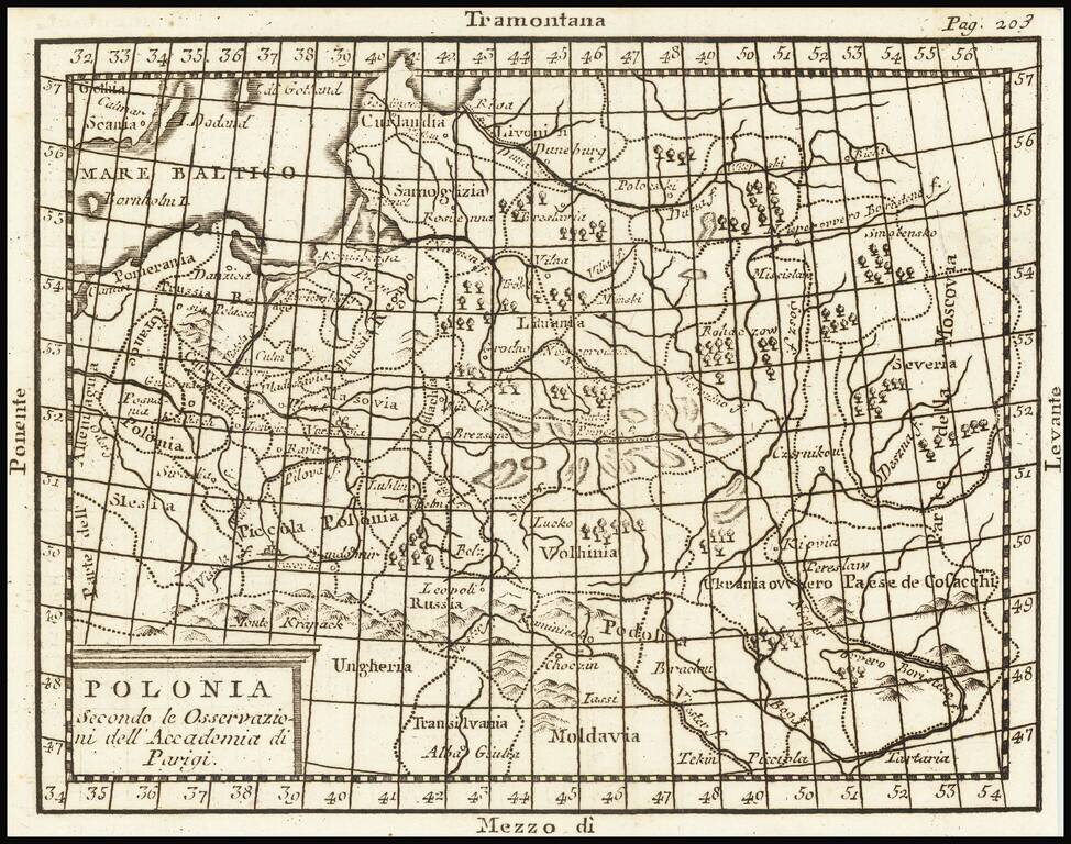
A map of Poland and the Baltic States, extending from Pomerania into Russia as far as Moscovia. Forests, rivers, mountains, settlements, and more are all shown. The four principal winds of the Mediterranean are shown at the edges of the map as a stand-in for the cardinal directions.
The many regions of Poland are all named, including Volhynia, Grand and Little Poland, Masovia, and Livonia. Cities shown include Danzig, Riga, Vilnius. Sweden is shown, labeled Gothia. This refers to the historical interpretation of the southernmost part of Sweden as the land of the Goths, more popularly known as the Geats, the most famous of which was mythical Beowulf.
Numerous geopolitical boundaries are shown on this map. The complex interplays between the different populaces and their geographical relations would define the geopolitics of the next century and a half, over which Poland was divided during the Partitions.
If you are a student, write to us in telegram: @antiquemaps and indicate what material you need and for what work you need a map in high detail. We are ready to provide material on special terms. For students only!


![[Hand Drawn Prussian Military Encampment at Opole, Poland] Special Grund-Riss Des Kaeyserl Feldl Lagers bey Oppeln in Ober Schlesien](/map/small/59726.jpg)