Map size in jpg-format: 3.50652MiB
Click to open in high resolution (open in new tab).
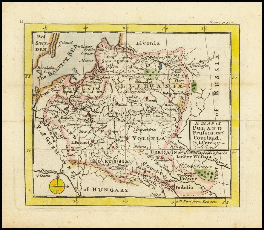
Antique engraved map of the area covering modern-day Poland, the Baltics, and Belarus, by John L. Cowley from “A New and easy introduction to the study of geography”.
The map includes Lithuania as the dominating polity in the region. Along with Volinia, Ukrain or Lower Volinia, Red Russia, Podolia, Samagoria, etc.
If you are a student, write to us in telegram: @antiquemaps and indicate what material you need and for what work you need a map in high detail. We are ready to provide material on special terms. For students only!


![[Hand Drawn Prussian Military Encampment at Opole, Poland] Special Grund-Riss Des Kaeyserl Feldl Lagers bey Oppeln in Ober Schlesien](/map/small/59726.jpg)