Map size in jpg-format: 15.7673MiB
Click to open in high resolution (open in new tab).
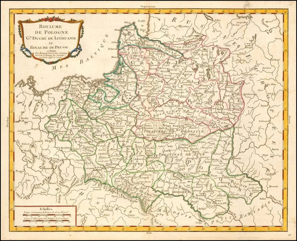
Scarce map of the Kingdom of Poland and Duchy of Lithuania, published by Pierre Bourgoin in Paris.
The map is subdivided into Palatinates and includes topographical details, towns, rivers, lakes, etc.
According to Niewodniczanski, this map first appeared in the 1765 edition of the Atlas Elementaire de la Geographie, including the address Chez Bourgoin Gaveur Rue de la Harpe vis a vis le Passage des Jacobins, a cote du Caffe de Conde, and was later re-issued in 1784 in the same atlas, with a different address for Bourgoin and without the number 16 in the bottom right corner.
If you are a student, write to us in telegram: @antiquemaps and indicate what material you need and for what work you need a map in high detail. We are ready to provide material on special terms. For students only!


![[Hand Drawn Prussian Military Encampment at Opole, Poland] Special Grund-Riss Des Kaeyserl Feldl Lagers bey Oppeln in Ober Schlesien](/map/small/59726.jpg)