Map size in jpg-format: 1.41828MiB
Click to open in high resolution (open in new tab).
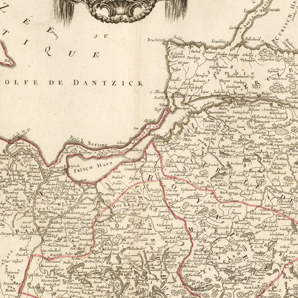
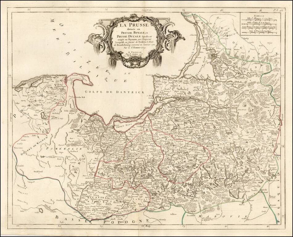
Fine and highly detailed map of parts of Poland, Kaliningrad, Lithuania, etc.
Shows the Kingdom granted to Frederick I of Prussia, after Prussia was elevated by Leopold to the status of a Kingdom in 1700. Frederick made himself the King of Prussia on January 18, 1701.
Paolo Santini (1729-1793) was an Venetian engraver known especially for his religious prints and fine cartographic engravings. He published in Venice and may have a been a member of the clergy. In his maps, he largely adopted and adapted the work of his French counterparts, especially the brothers de Vaugondy.
If you are a student, write to us in telegram: @antiquemaps and indicate what material you need and for what work you need a map in high detail. We are ready to provide material on special terms. For students only!


![[Hand Drawn Prussian Military Encampment at Opole, Poland] Special Grund-Riss Des Kaeyserl Feldl Lagers bey Oppeln in Ober Schlesien](/map/small/59726.jpg)