
![[Stop The Fake News!] Halte au Menteurs! Les Colo Bacilles Sement La Haine!](/map/small/59951.jpg)
Halt The Liars! Stop The Fake News! Rare separately published political broadside, decrying the channeling of Stalinist Russia's lies, fake news and disinformation campaigns via the French Communist Party, after World War II. As described in greater...
![[August 1961: The Berlin Crisis and Foreshadowing Construction of the Berlin Wall]](/map/small/59512.jpg)
The Berlin Wall in Popular Media Fine large format news map issued in August 1961 by Newsweek, illustrating the Berlin Crisis and foreshadowing the construction of the Berlin Wall. The larger map illustrates the division between the Russian and...
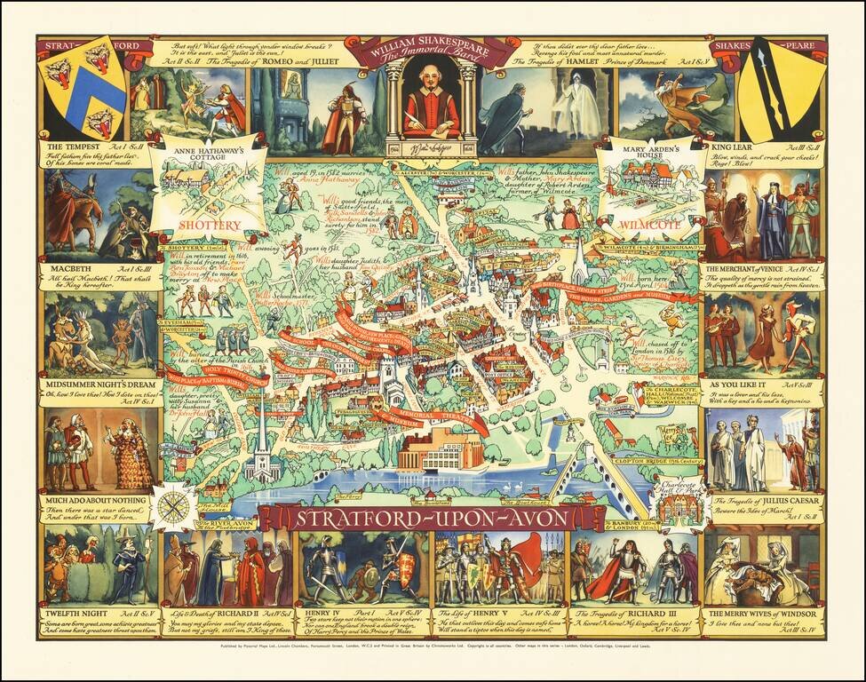
Rare pictorial map of Stratford-upon-Avon, the ancestral home of William Shakespeare. In the center, a map of the town is shown, naming streets, famous buildings, churches, parks, Inns, etc. The homes of famous locals are noted, with some William...
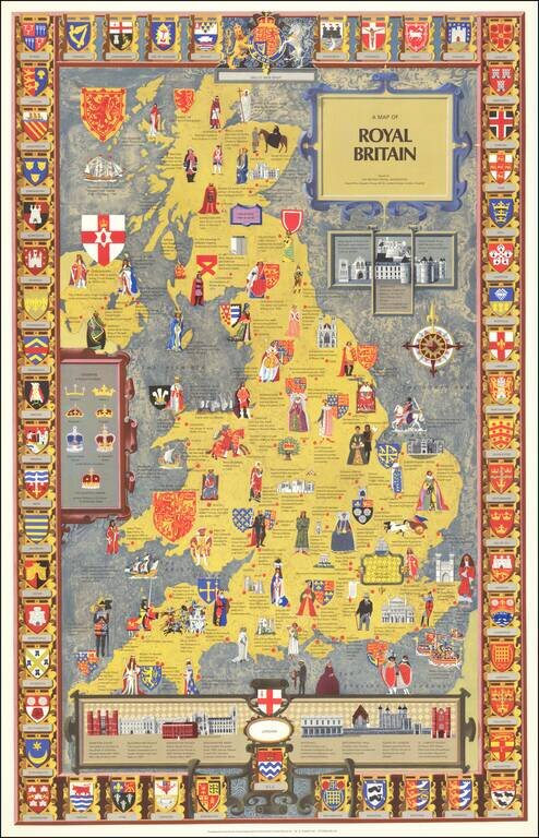
Striking pictorial map of England, Wales & Scotland, published by the British Travel Association. The map is embellished with images illustrating the royal lineage and events of British history. Surrounded with the crests of different regions...
![A Chart of the Aintree Race Course [Liverpool, England]](/map/small/70234.jpg)
Rare pictorial map of the famed Aintree Race Course, home to the Grand National, drawn by pictorial artist George Annand, The two mile course boasts 30 fences, individually numbered, the race consists of two laps. Ditches and water features provide...
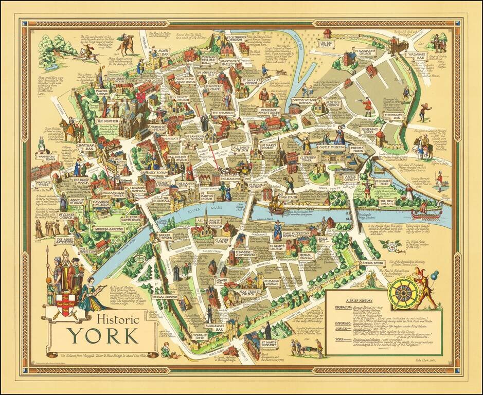
Finely executed pictorial map of the City of York, published in York by by Ben Johnson & Co. The map is the work of York's own commercial illustrator Estra Clark. The map shows buildings, landmarks, sites of significant events, the city wall,...
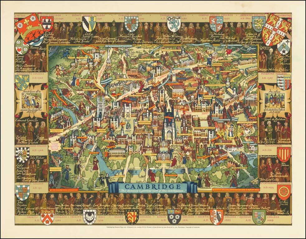
An attractive pictorial map of the idyllic and historical university town of Cambridge. The twenty-one constituent colleges of the university are all listed and shown around the map, save for Selwyn, Newnham, and Girton. The city is portrayed in...
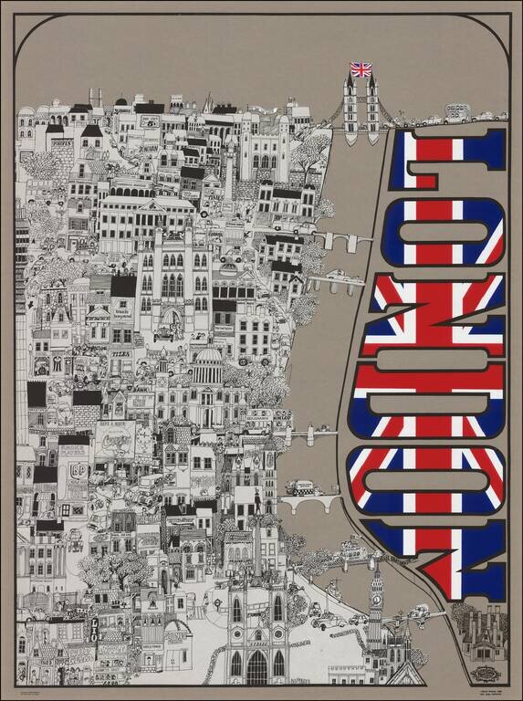
An Iconic Rock 'n Roll Post Map of London Lively illustrated View of London by California artist David Schiller. David Schiller was one of the kings of rock art, producing album covers and posters for many 1960's bands and venues: The Beatles, The...
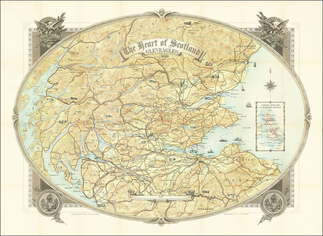
Promoting Gleneagles Hotel & Golf Courses Fine large map of southern Scotland, published to promote Gleneagles Hotel and the London Midland and Scottish Railway, whose emblem appears on the cover, with an inset map of the route of the LMS at the...
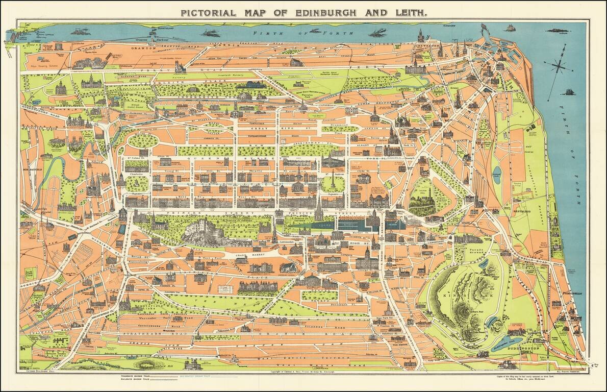
Vintage pictorial map of Edinburgh, Scotland, with the landmarks and major building, illustrated pictorially. The map was issued for tourists by George A. Reid, an Edinburgh-based publisher. On the verso are the stories of Mary Queen of Scots, Sir...
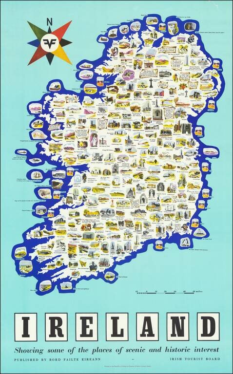
Vintage pictorial poster map of Ireland, issued by the Irish Tourist Board (Bord Failte Eireann) circa 1958. The map features dozens of captioned illustrations covering Ireland's many landmarks and points of interest. The map poster was printed by...
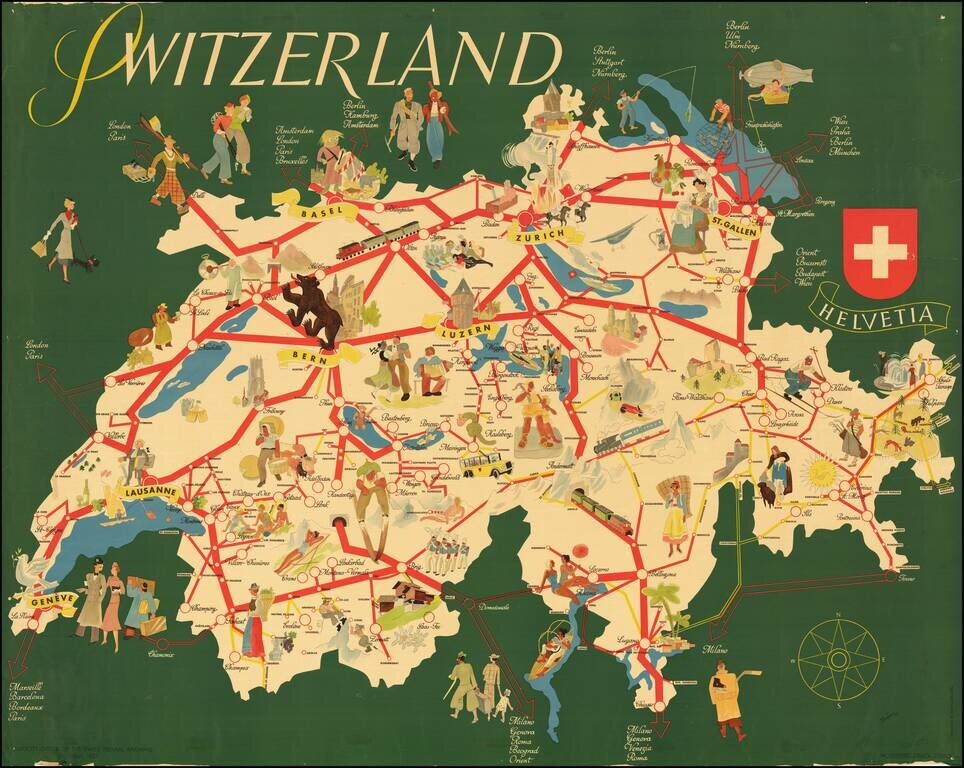
Rare separately published tourist map of Switzerland, published in Berne. The map focuses on the major rail lines, cities and tourist attractions within the country, with lively pictorial vignettes throughout.
![[Rhone River]](/map/small/70229.jpg)
Rare Lucien Boucher Pictorial map of the Rhone River region of South France. The map extends from Lyon and Lake Geneva in the north the the French Mediterranean, including caricatures of famous sites in St. Maries de la Mer, Nimes, Arles, Avignon,...

Great vintage pictorial of Cap D'Antibes in southern France published by Bonfant & Rampleberg, in Nice, in 1949. The map is by Vic (Victor?) Raymon and features the quintessential glamorous style of mid-century southern France. The point of the...
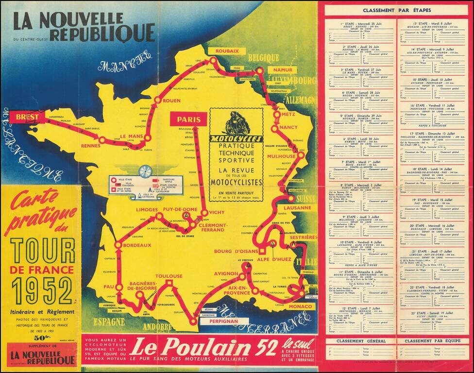
A great antique map made for the 1953 Tour de France, showing the many cities and towns the race would pass through. The route starts in Strasbourg and then passes through Liege, Lille, Caen, Nantes, Bordeaux, Marseille, and Lyon before arriving in...
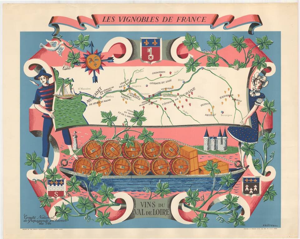
Fine promotional map of the wine regions of the Loire Valley, drawn by Remy Heteau in 1954. The map shows the major wine producing regions with cluster of grapes, using red for red wines, and yellow for white wines. The map is surrounded by a compass...