
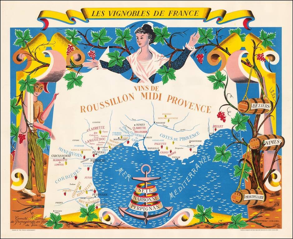
Fine promotional map of the wine regions of Roussillon and Provence, drawn by Remy Heteau in 1954. The map shows the major wine producing regions with cluster of grapes, using red for red wines, and yellow for white wines. The map is surrounded by a...
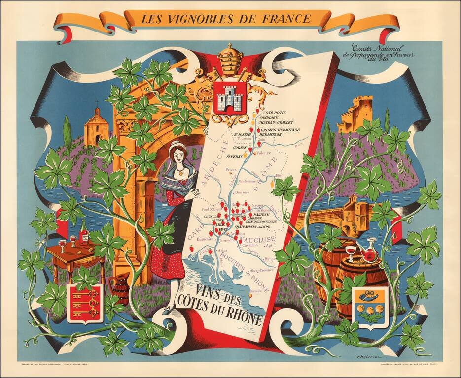
Fine promotional map of the wine regions of the Cote du Rhone, drawn by Remy Heteau in 1954. The map shows the major wine producing regions with cluster of grapes, using red for red wines, and yellow for white wines. The map is surrounded by a compass...
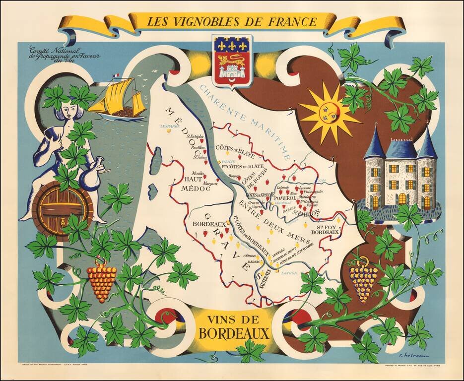
Fine promotional map of the wine regions of Bordeaux, drawn by Remy Heteau in 1954. The map shows the major wine producing regions with cluster of grapes, using red for red wines, and yellow for white wines. The map is surrounded by a compass rose,...
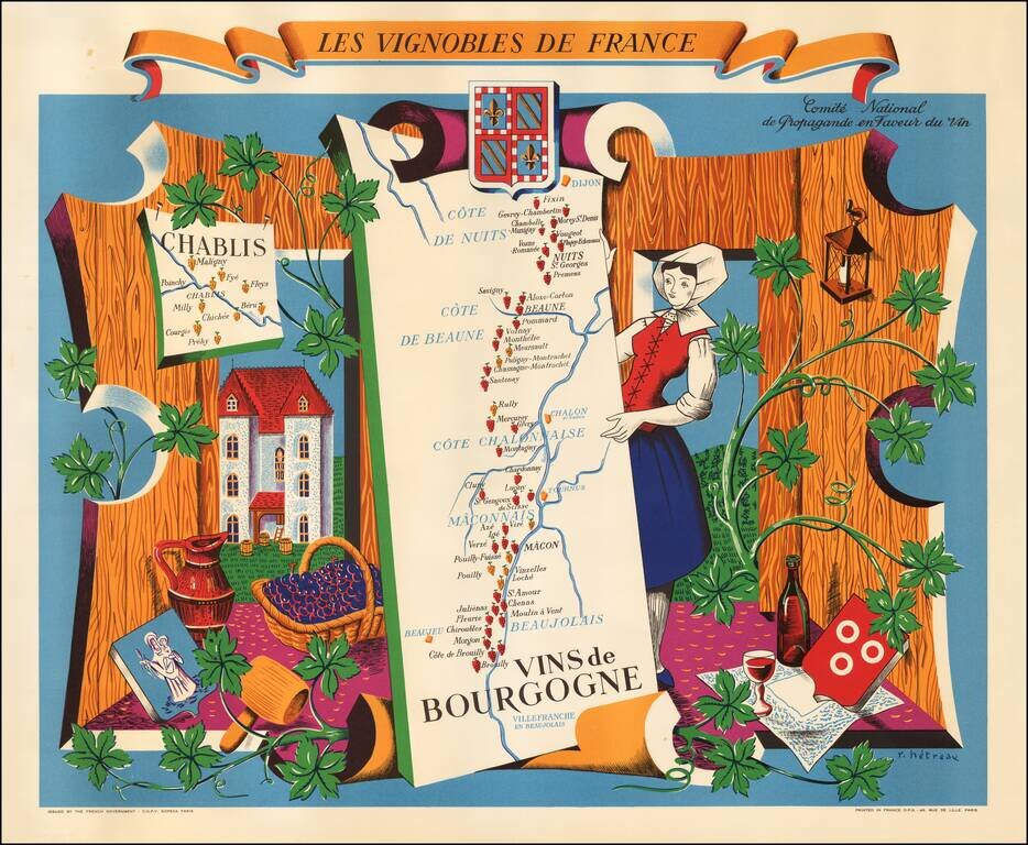
Fine promotional map of the Burgundy wine region, drawn by Remy Heteau in 1954. The map is one of a series of 11 maps titled Les Vignobles de France; the others in the series are of Région Est, Région Normandie, Champagne, Roussillon, Val de Loire,...
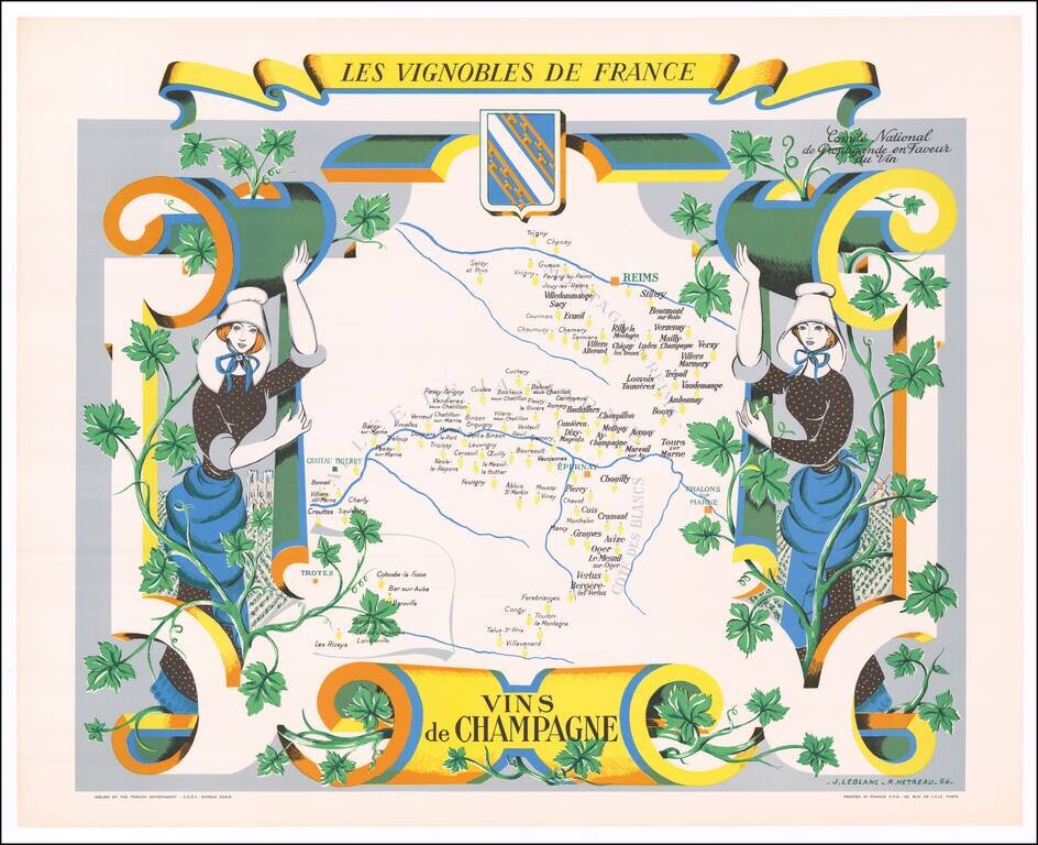
Fine promotional map of the Champagne Region, drawn by Remy Heteau in 1954. The map shows the major wine producing regions with cluster of grapes, using red for red wines, and yellow for white wines. The map is surrounded by a compass rose, grapes on...
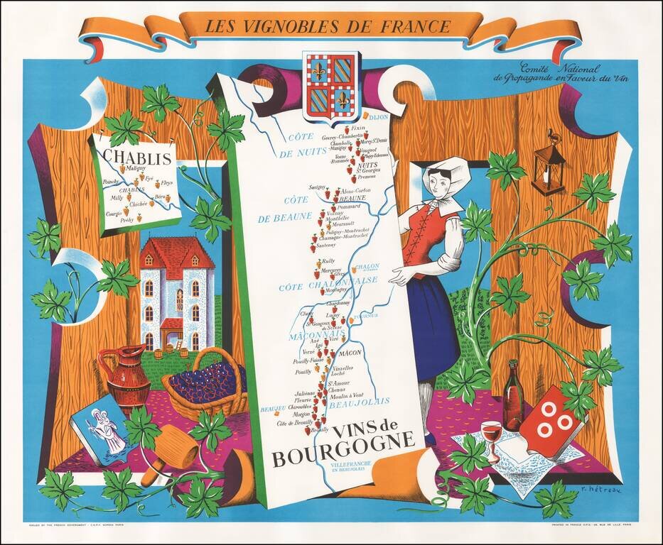
Fine example of this decorative map promoting the Wines of the Burgundy Region of France, published by the Comite National des Vins de France. The center of the map includes a map of the Burgundy Region, from Dijon to Lyon, tracking the Saone River...
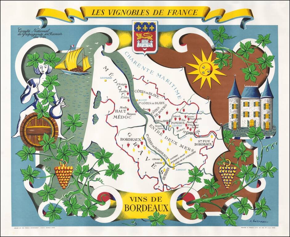
Fine example of this decorative map promoting the Wines of the Bordeaux Region of France, published by the Comite National des Vins de France. The center of the map includes a map of the Bordeaux Region, following the Gironde River from...
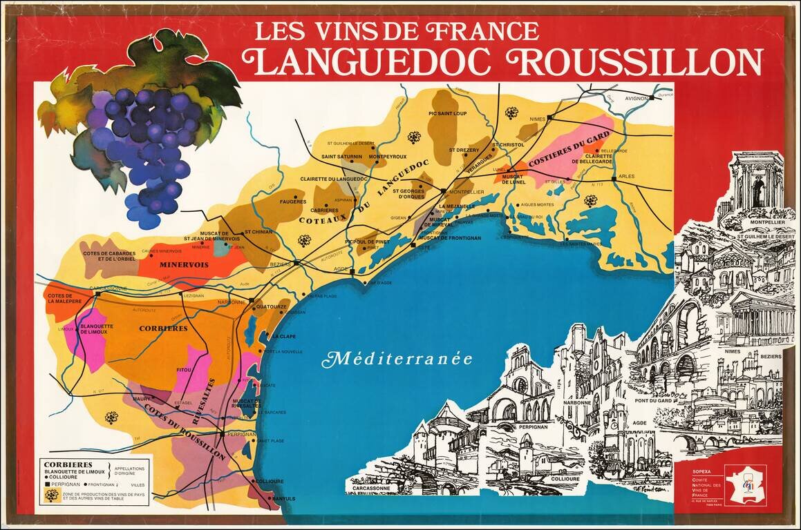
Fine large poster map promoting wine from the Languedoc and Roussillon regions. The poster was issued by Sopexa - International Communication Agency Food, Drink, Lifestyle, for the Comite National Des Vins de France. At the bottom right is an...
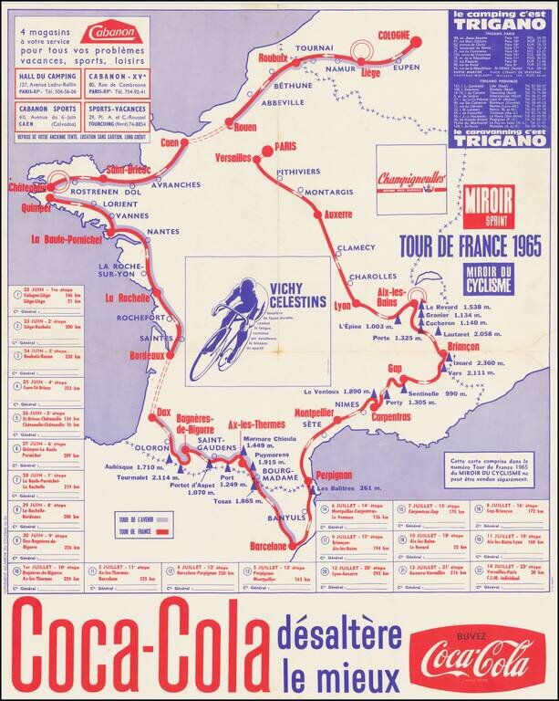
Coca Cola Sponsors The Tour de France A map showing the route of the 1965 Tour de France, sponsored by Coca Cola. The 1965 Tour de France was the 52nd edition of the Tour, June 22 - July 14, 1965, with 22 stages covering a distance of 4,188 km (2,602...
![[Cultural Revolution Maps - Map of France / A Sketch Map of Events of May 1968] [Fagu di tu - Faguo ren min ge ming dou zheng yi tu]](/map/small/65576.jpg)
Chinese Reporting on the May 1968 Uprising in France Two Chinese cultural Revolution Maps printed on a single sheet (back to back), published following hte May Uprising in France in 1968. The map illustrates France as dominated by the worker's...
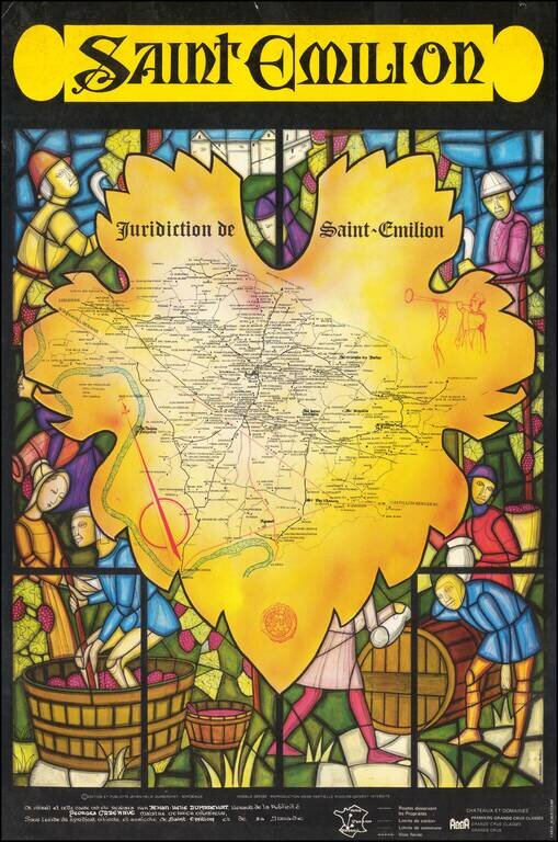
Striking wine map of the Saint-Emilion region, surrounded by a medieval stained glass image of wine making. The map was issued as a promotional map for Viticulture and Agricultural Syndicate of Saint-Emilion.
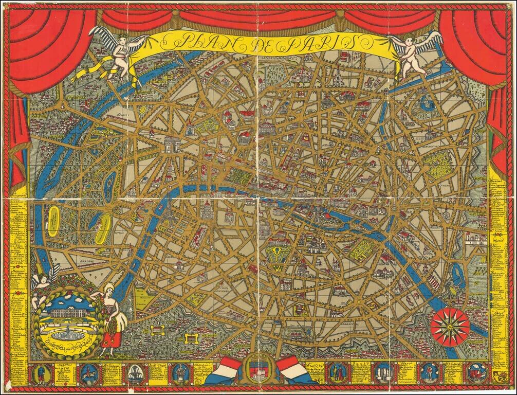
Finely illustrated pictorial map of Paris, drawn by Ilonka Karasz and published by the Washington Square Book Shop, 27 West 8th Avenue, New York City. Rumsey (8091) notes: Karasz's design and the vivid color printing used for this map of Paris are...
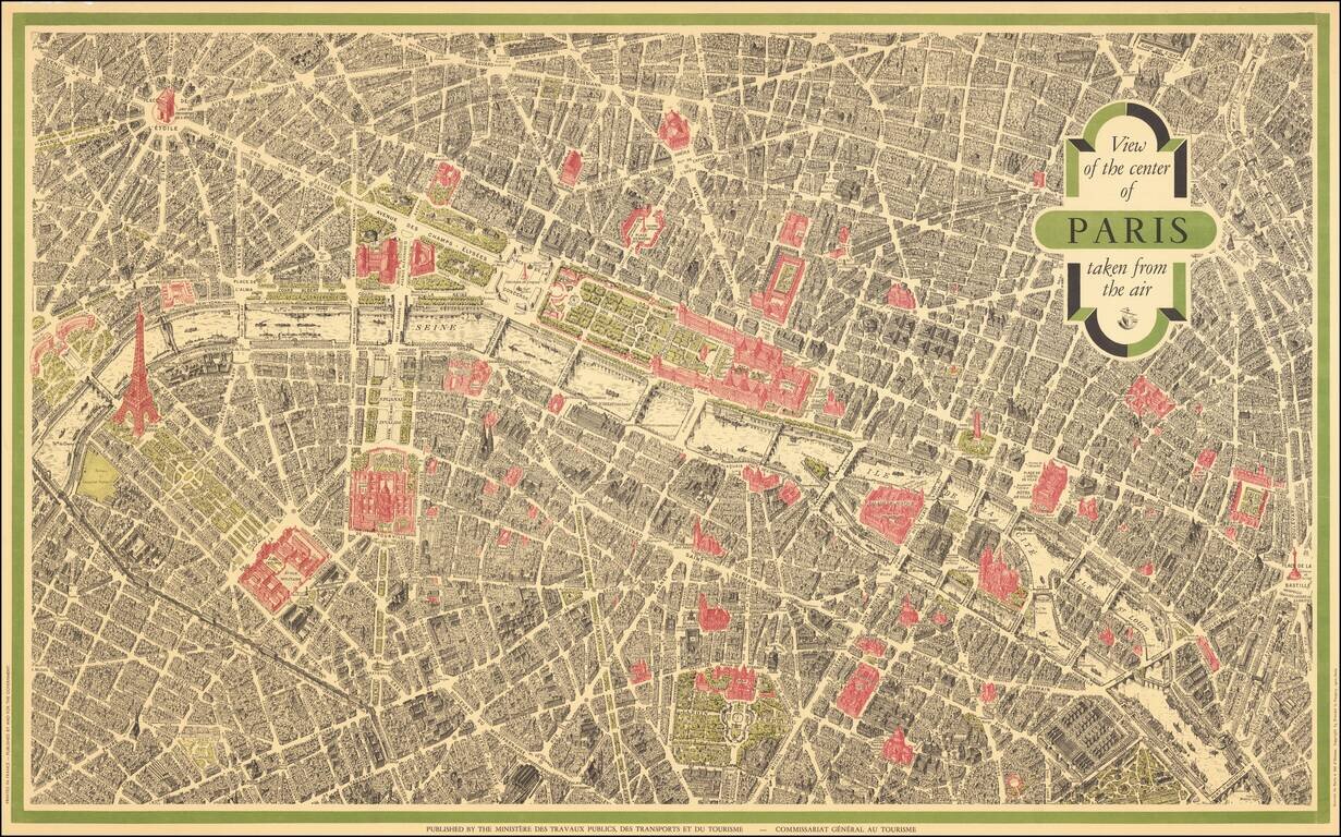
Vintage pictorial bird's eye view of Paris, based on the view Peltier and issued by Blondel La Rougery for a host of hotels and Parisian retail companies throughout the 20th century. This view is the most famous bird's eye view of Paris, second only...
![(Second World War - Nazi Germany) L'Allemagne Paradis du Tourisme. [Germany The Paradise of Tourism.]](/map/small/63210.jpg)
Striking propaganda and travel map of Germany, published by the Reichsbahnzentrale fur den Deutschen Reiseverkehr and the German Railways Information Bureau. Text, map, and graphics on the verso. Includes decorative border alternating crests and "La...
![(Second World War - Allied Bombing of Germany) Offensive Aerienne des Allies contre l'Allemagne Jusqu'au 1 Fevrier 1941 [Allied Air Offensive against Germany Up To January 1st 1941]](/map/small/67411.jpg)
Broadside showing the location of bombing runs of the Allied bombers in Germany up to January 1, 1941. Inset map shows the heavy concentration of bombs in the Ruhr Valley, with a key locating the different types of facilities being bombed:...
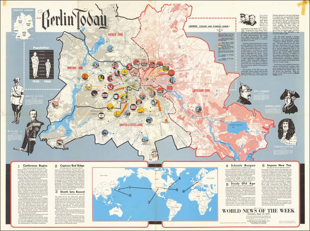
This is a detailed map of Greater Berlin, divided into its four occupied zones. Made at a time when the Cold War was at one of its many peaks, some recent conflicts had led to renewed public interest in the city, which had been the subject of its...