
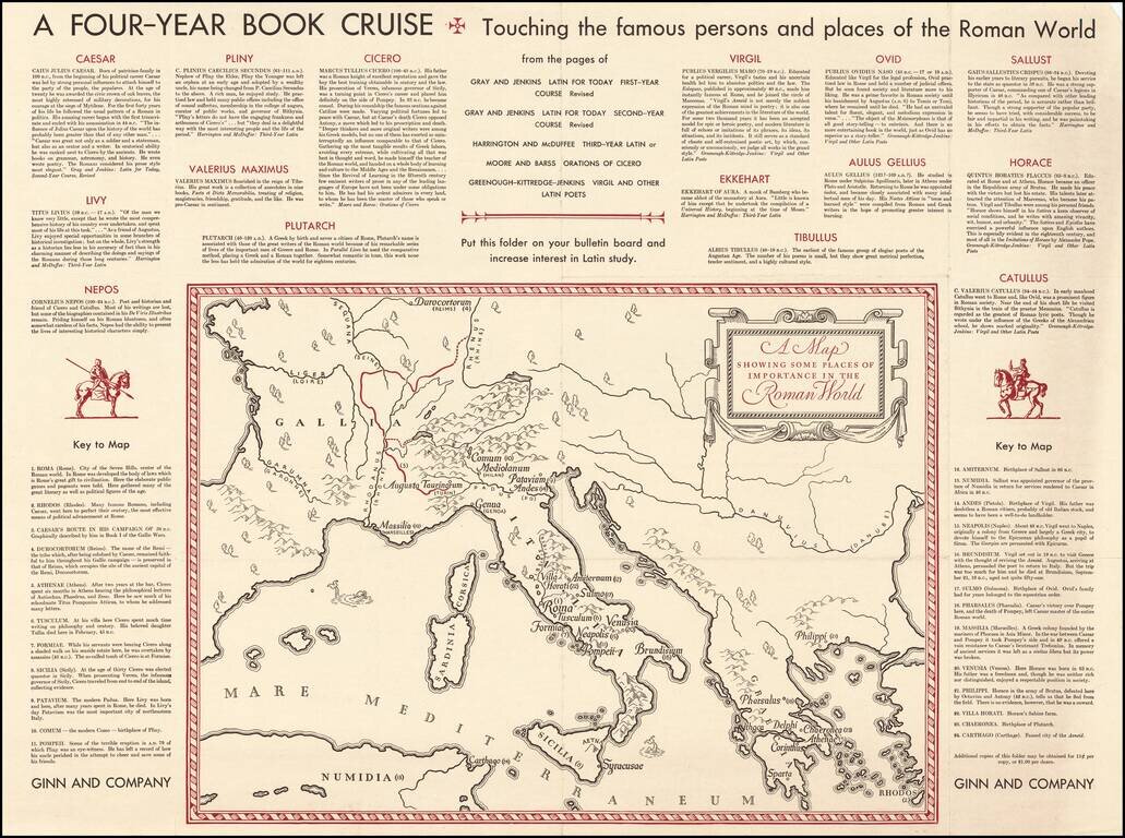
Fascinating "map of the Roman World", illustrating a Ginn & Company promotional advertising brochure promoting its Latin and other educational text books.
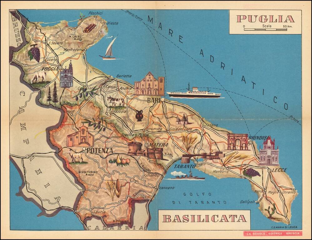
Decorative pictorial map of Basilicata in Southern Italy, published in Brescia. Shows the major towns, agricultural and farming products and shipping lines.
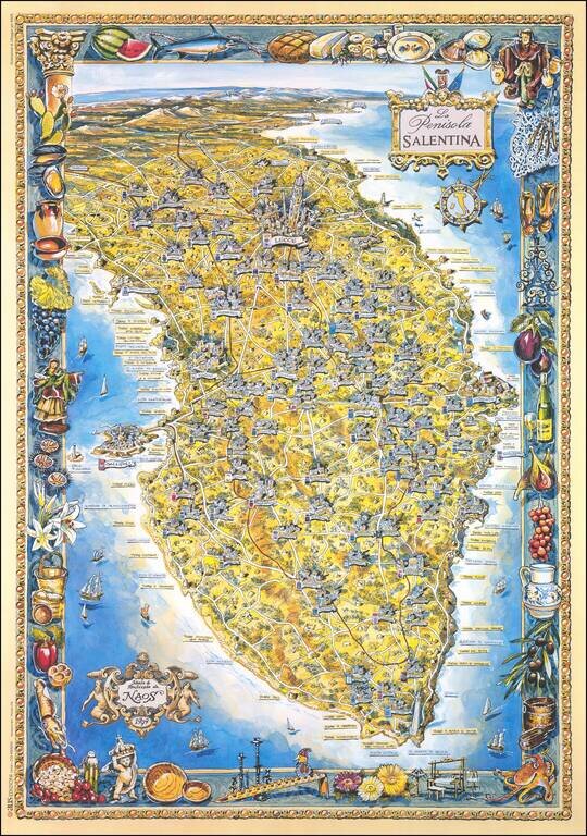
Brilliantly colorful pictorial map of the Salento Peninsula in Apulia, Italy. The map features a border depicting the products of the region. The towns are rendered pictorially, with particular attention shown to Gallipoli and Lecce. The map was made...
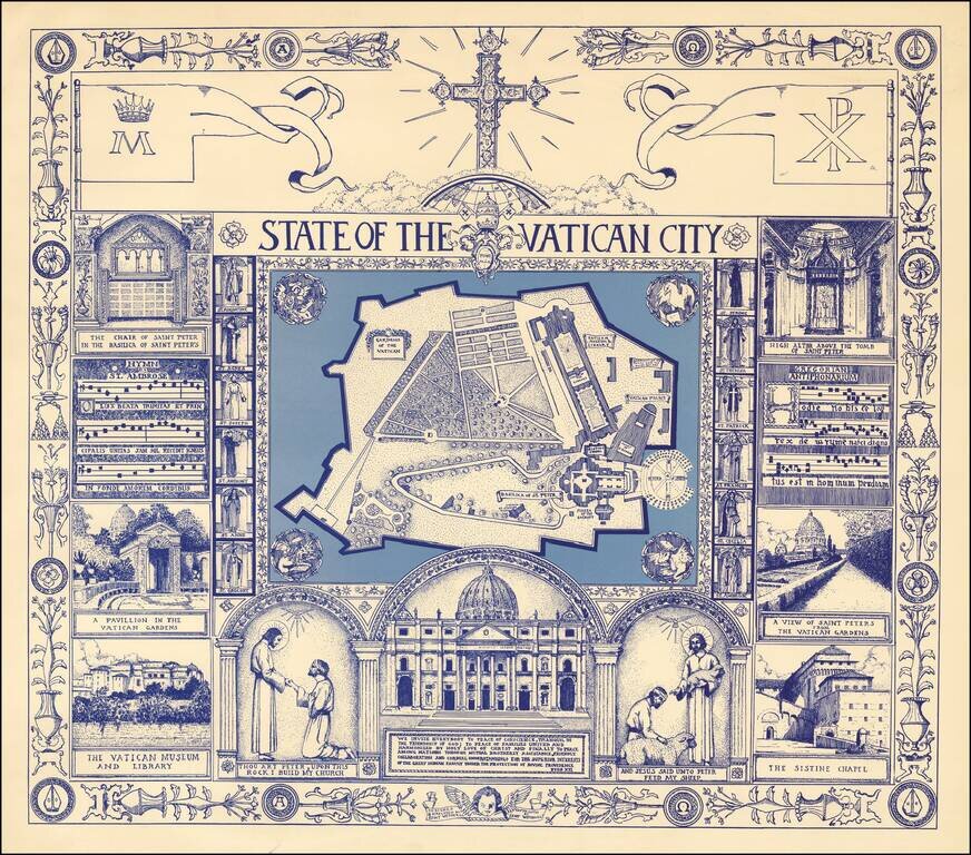
Fine large format pictorial view of the Vatican, surrounded by religious themed vignettes. We were not able to locate information on the artist, other than credits for other illustrations done in the mid-1970s.
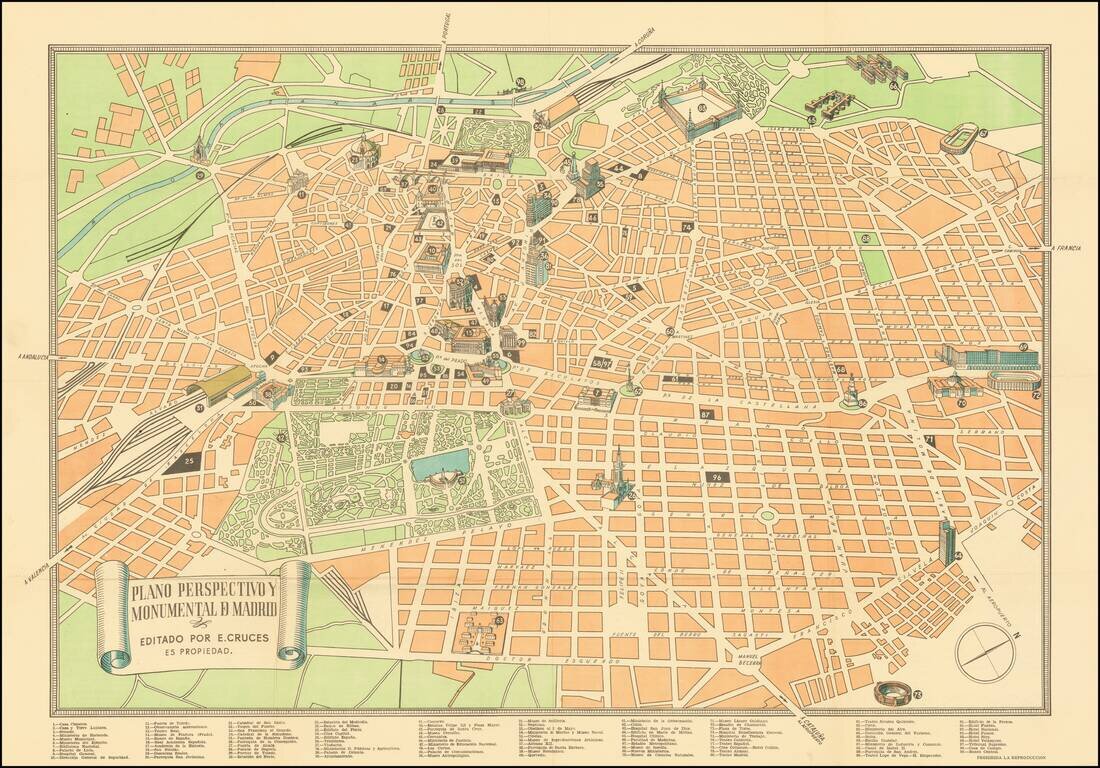
Scarce Tourist plan of Madrid, published in Madrid. Includes a key locating 99 places of interest. Major monuments are illustrated with small building vignettes. Rarity The map is apparently quite rare. OCLC locates 2 examples (Utrecht University...
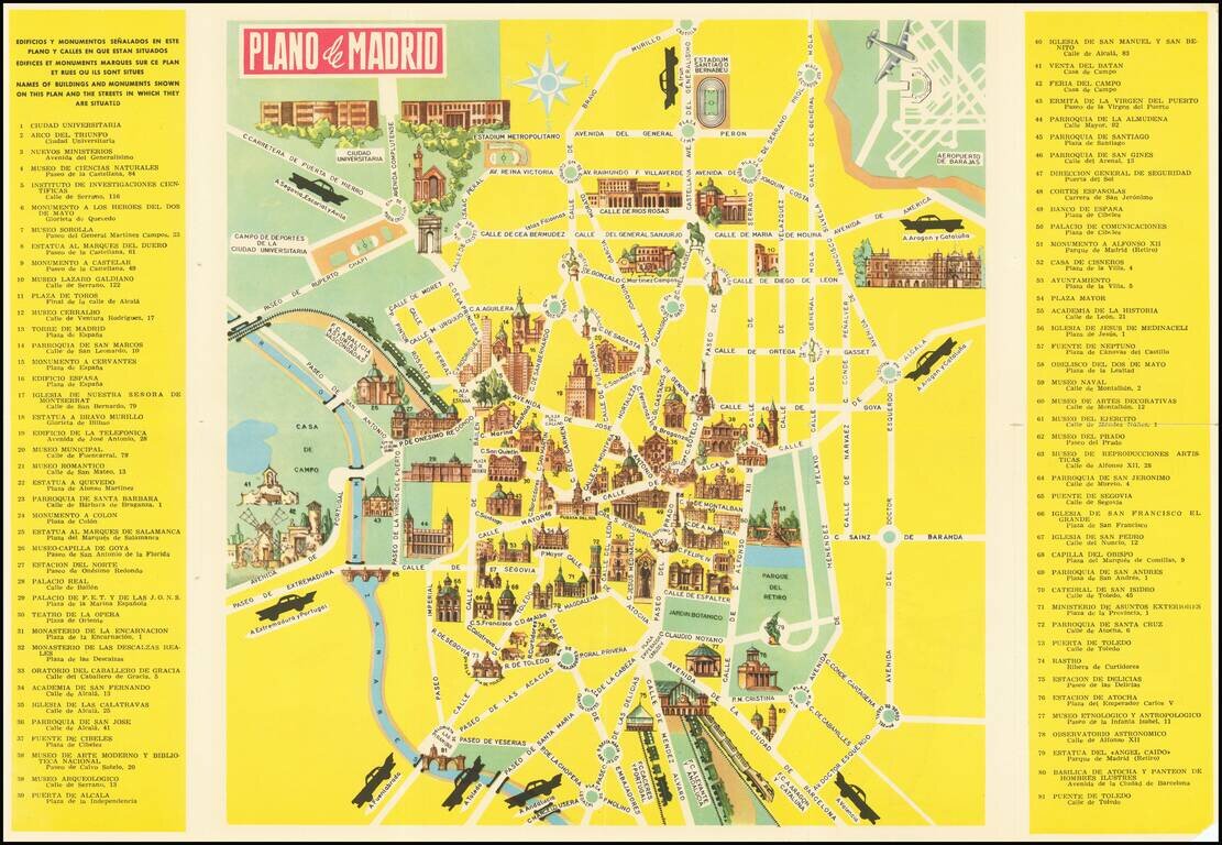
Pictorial Tourist map of Madrid, published for tourists. Features vignettes of Madrid's major monuments and points of interest. Includes advertising for the Hotel Carleton on the verso.
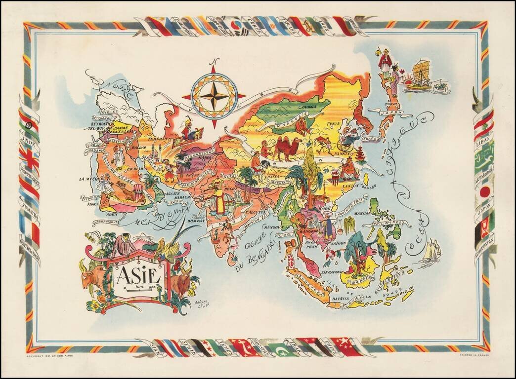
Decorative map of Asia, published by Jacques Lizou. Lizou published a number of maps in this style in 1951, including maps of the French provinces, etc.
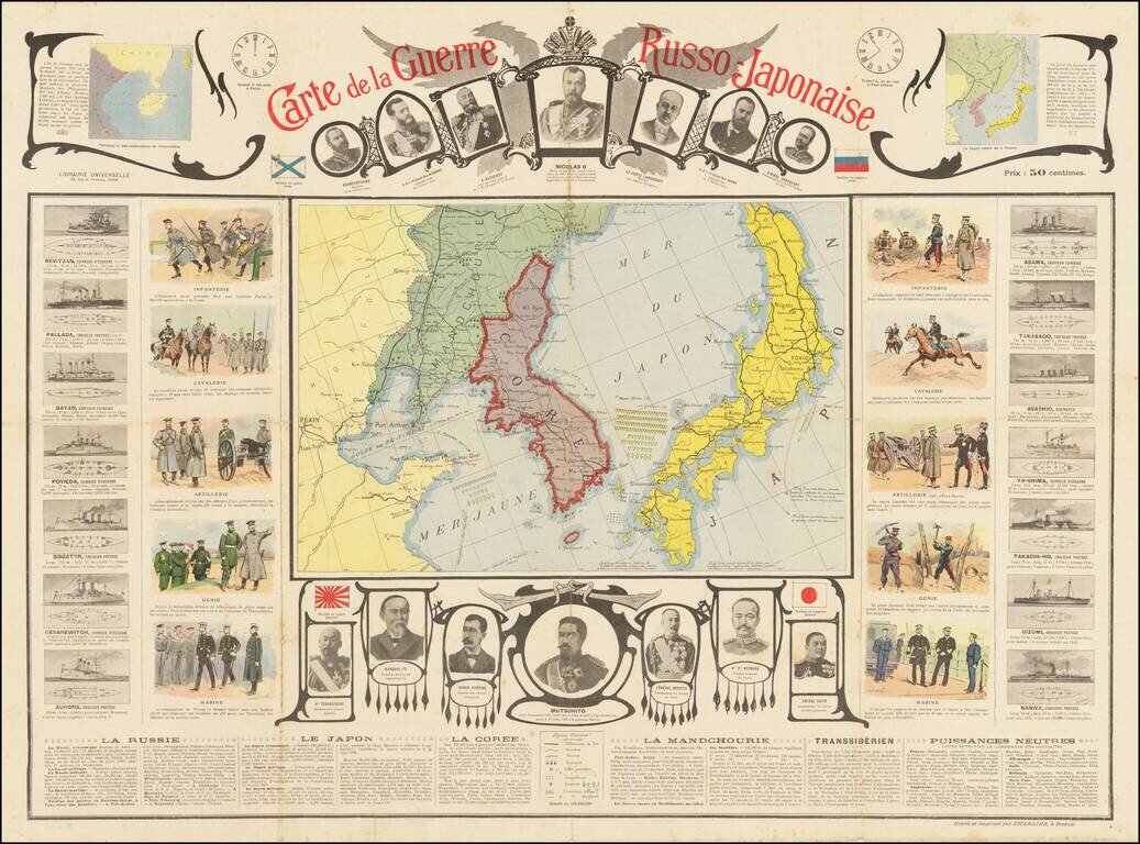
Detailed pictorial map of the Pic, published in Paris. The map is surrounded by vast amounts of pictorial and textual information, including: The time difference between Port Arthur and Paris (about 8 hours) Portraits of Russian leaders across the...
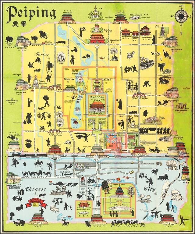
Early State of Kirk Sewall's Scarce Map of Peiping (Beijing). Pictorial map of central Beijing, published in Beijing by the Peiyang Press. Sewall's map is richly embellished with illustrations of landmark buildings and black silhouettes of workers,...
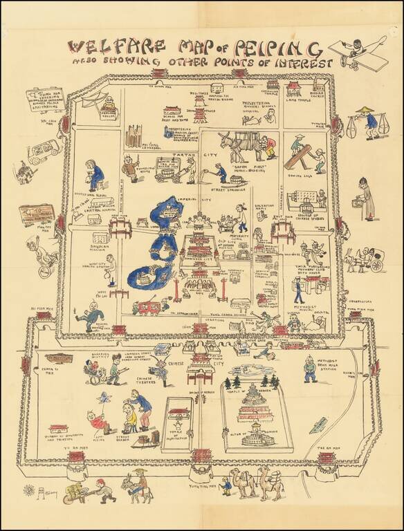
A Beijing Pictorial Rarity – The Welfare Map Whimsically-designed and colored example of an extremely rare pictorial map of China, made by an American missionary woman born in Tianjin. The map takes the viewer on a cartoonish tour of Beijing, or...
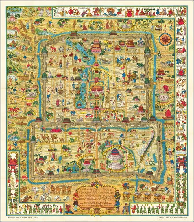
Scarce Variant Edition -- Different German Flag Finely executed pictorial map of Beijing, published by Frank Dorn and the Peiyang Press. Ltd. of Tientsin and Peiping, in 1936. The present example is a variant edition, with the flag of Germany being a...
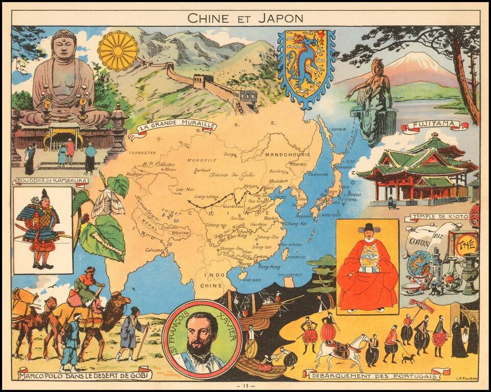
Decorative pictorial map of China, Japan and Korea, published by Children's book artist JP Pinchon.
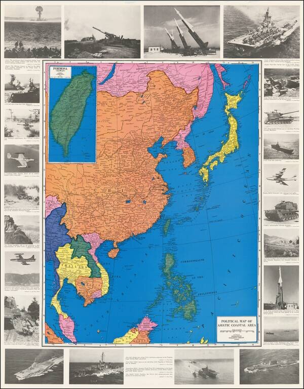
Projecting Power in the Nuclear Age Colorful Map of Southeast Asia, the Philippine Islands and China, ringed by images of American military assets. At the top left is an image of a mushroom cloud from the first atomic artillery shell. Other...
![[Hong Kong Published Fishing Map!] Bountiful fish harvest maritime map 漁獲豐收海圖](/map/small/55323.jpg)
Hong Kong Map Advertising New Skills to Fisherman Interesting fishing map extending from Hainan Islands in the southwest to Xiamen in the northeast, centered on the Hong Kong - Macau area. The map shows the fishing grounds in the area, highlighting...
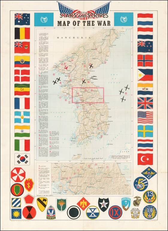
Decorative map of Korea, intended for distribution to soldiers stationed in Korea in the 1950s. Shaded relief with key military features locations marked and described. Includes a decorative border of flags of allies and insignia of military units.
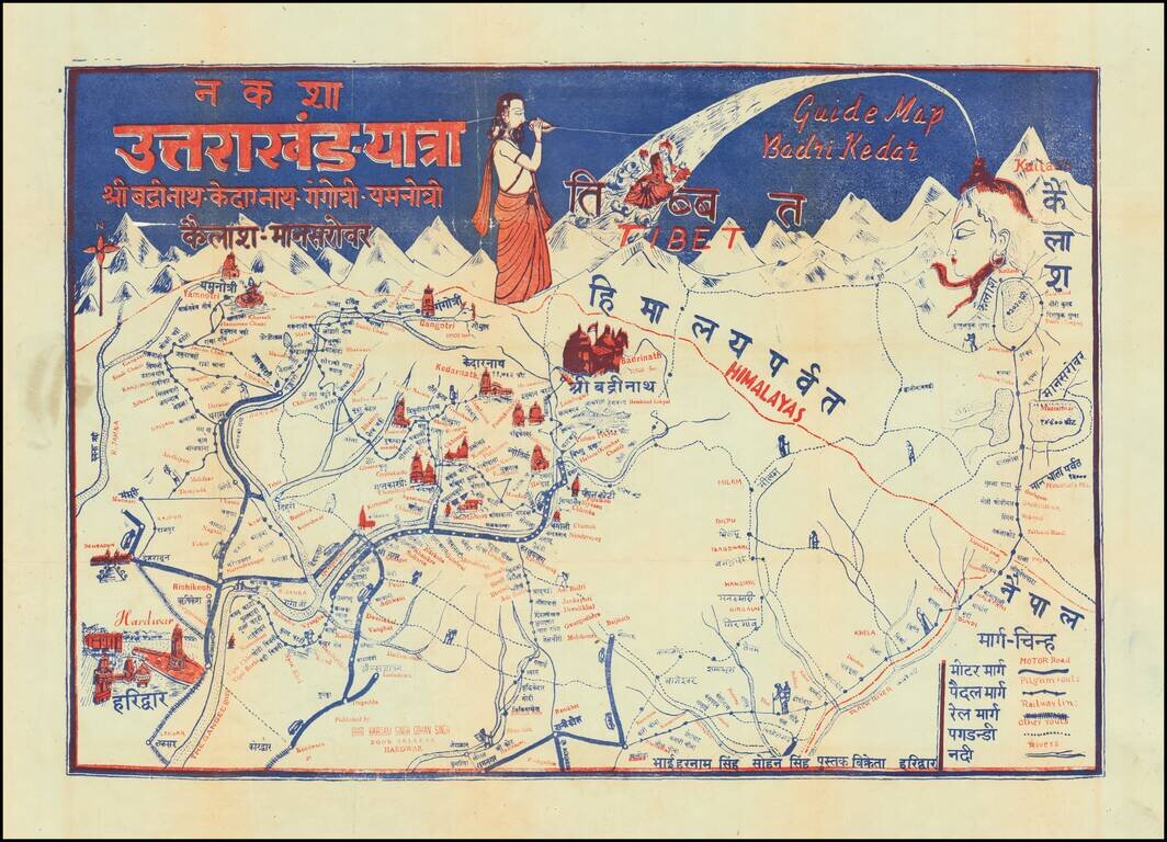
Pictorial Pilgrimage Guide Map for Uttarakhand, India Showing Important Holy Sites for Multiple Religions This interesting pictorial guide map shows pilgrimage routes for all the temples on the Chota Char Dam pilgrimage circuit, Badrinath, Kedarnath,...