
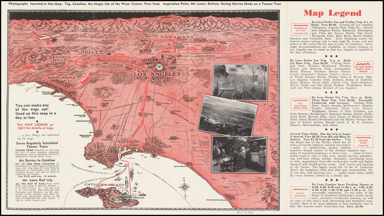
A pictorial map of Los Angeles from circa 1930 with photographs of Avalon, Mt. Lowe, and more. The map itself shows the area from Long Beach to the San Fernando Valley, and eastwards as far as Mt. Lowe and Monrovia. The image is drawn from a birdseye...
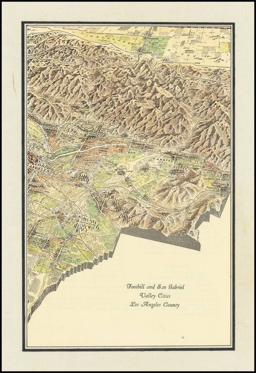
Interesting promotional map of the Eastern portion of Los Angeles County, likely published at about the time of the1932 Olympics. The map is centered on Pasadena and the the San Gabriel Valley, stretching north to Lancaster and south to Artesia and...
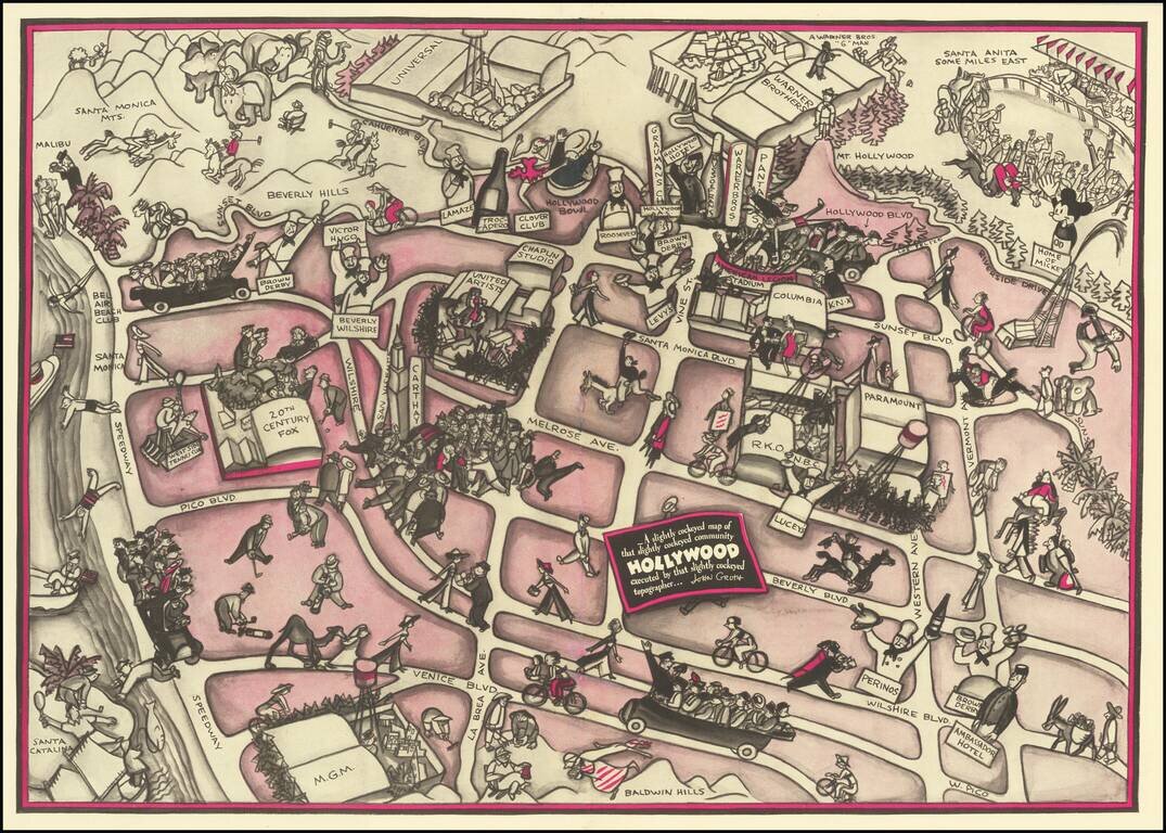
Hollywood in the 1930s Pictorial map of Hollywood section of Los Angeles, also incorporating surrounding areas. Shows streets, locations of film producers and directors, studios, and other points of interest with cartoon illustrations. Landmarks...
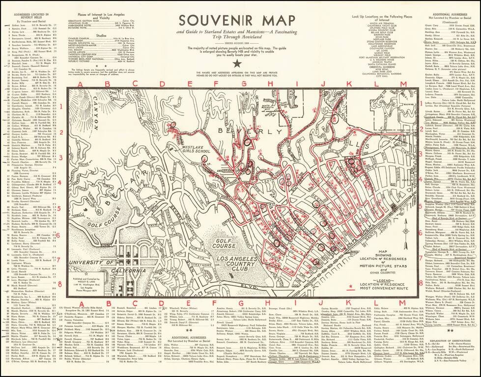
1938 Hollywood Stars Souvenir Map Scarce early map of Beverly Hills and Westwood, showing the locations of prominent movie star homes, published in the August 1938. Stars named include Fred Astaire, James Cagney, Charles Chaplin, Marlene Dietrich,...
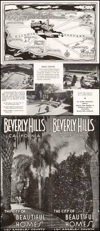
Pictorial map of the Los Angeles Basin, centered on Wilshire Boulevard and Downtown Los Angeles, drawn by C.A. Stanley. Places illustrated include the Malibu Beach Colony, Flim Studios, Municipal Airport, etc.
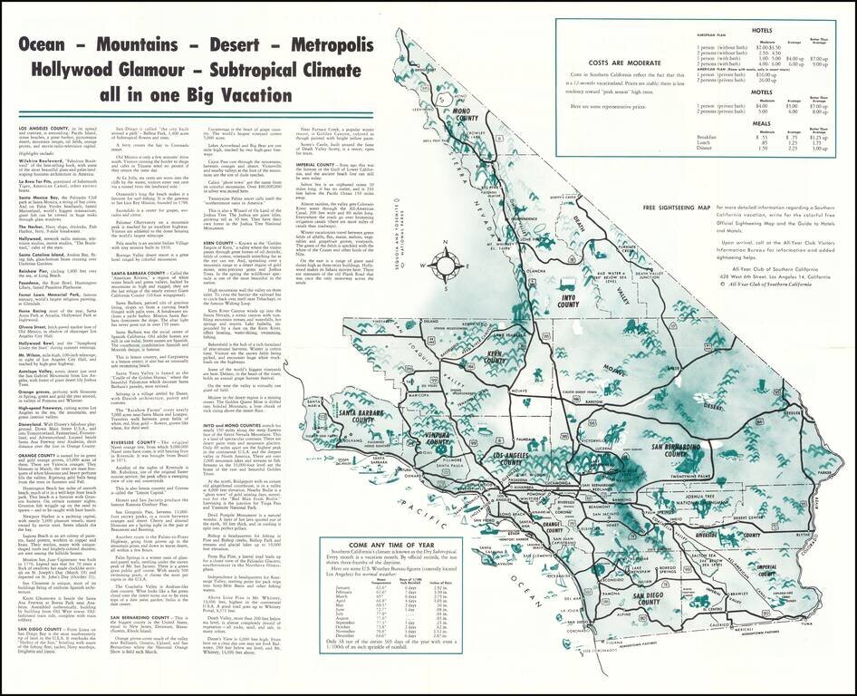
Vintage pictorial map of Southern California, issued by The All-Year Club of Southern California to promote tourism to the region in the middle of the 20th century. The main map includes an overview of Southern California (stretching up to Mono...
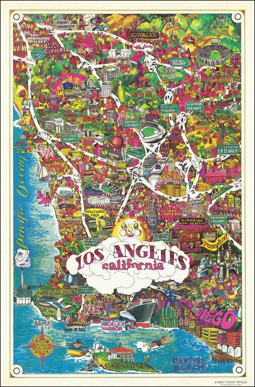
Bright and whimsical pictorial map of Los Angeles, published by Funny Funny World in 1976. The map emphasizes the famous tourist attractions of Southern California, including: Disneyland Queen Mary Marineland Ports of Call Knotts Berry Farm and...
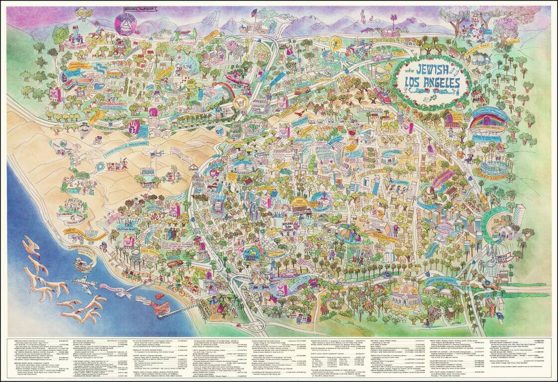
Rare promotional pictorial map of "Jewish Los Angeles," providing a whimsical look at Great Los Angeles and its various Jewish businesses, schools, temples and other public and private institutions. The map includes a directory of businesses and...
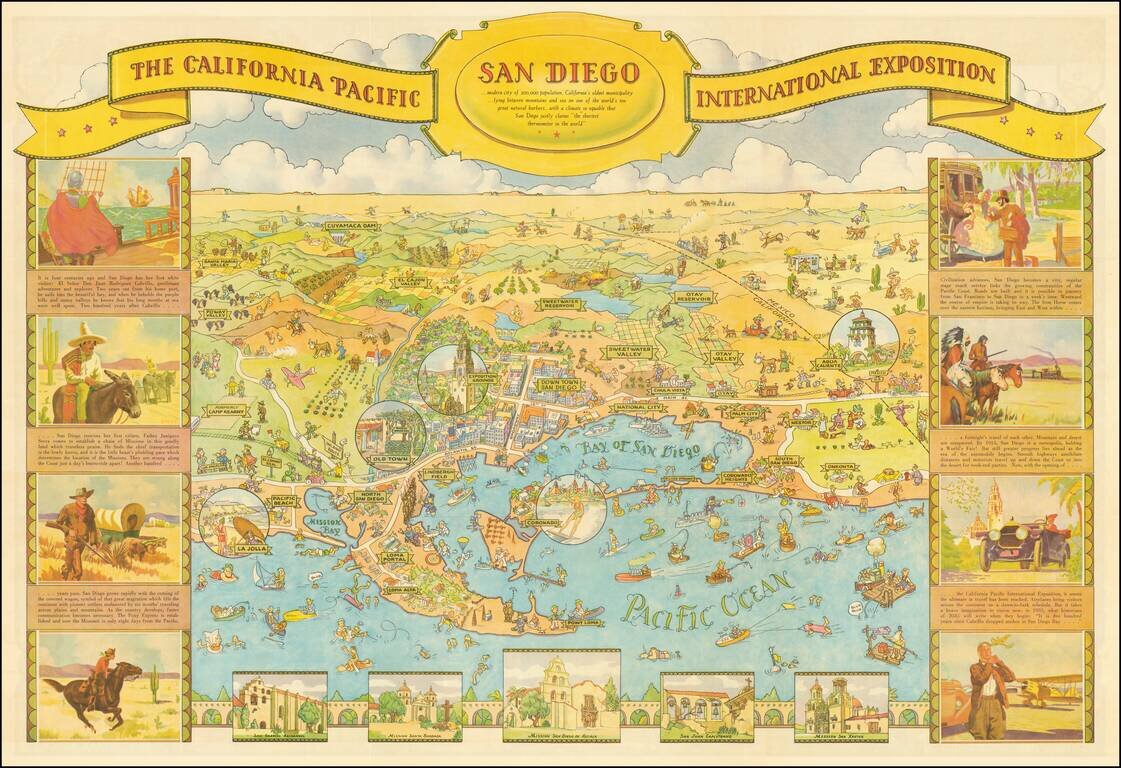
This is one of the great California caricature maps, showing San Diego on one side and Balboa Park on the verso. This edition was prepared by Shell Oil Company for the 1935 California Pacific International Exposition. The map was drawn by Don...
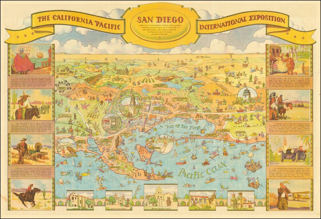
Decorative illustrated map of San Diego on one side and Balboa Park on the verso, prepared by Shell Oil Company for the 1935 California Pacific International Exposition. One of the great California caricature maps. The map was drawn by Don Bloodgood,...
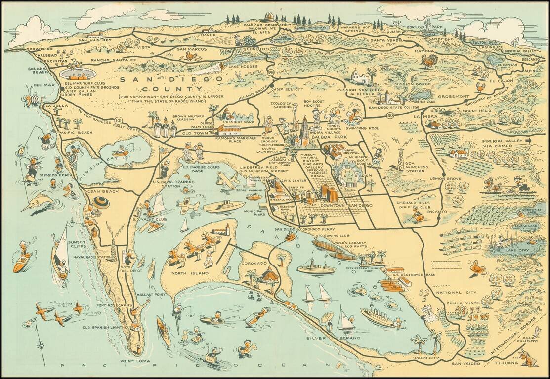
Whimsical map of San Diego County, showing a host of activities throughout, with a larger city street map. Among the more timely inclusions in the map are the Baseball field next to the County Administrative offices and Balboa Stadium, next to San...
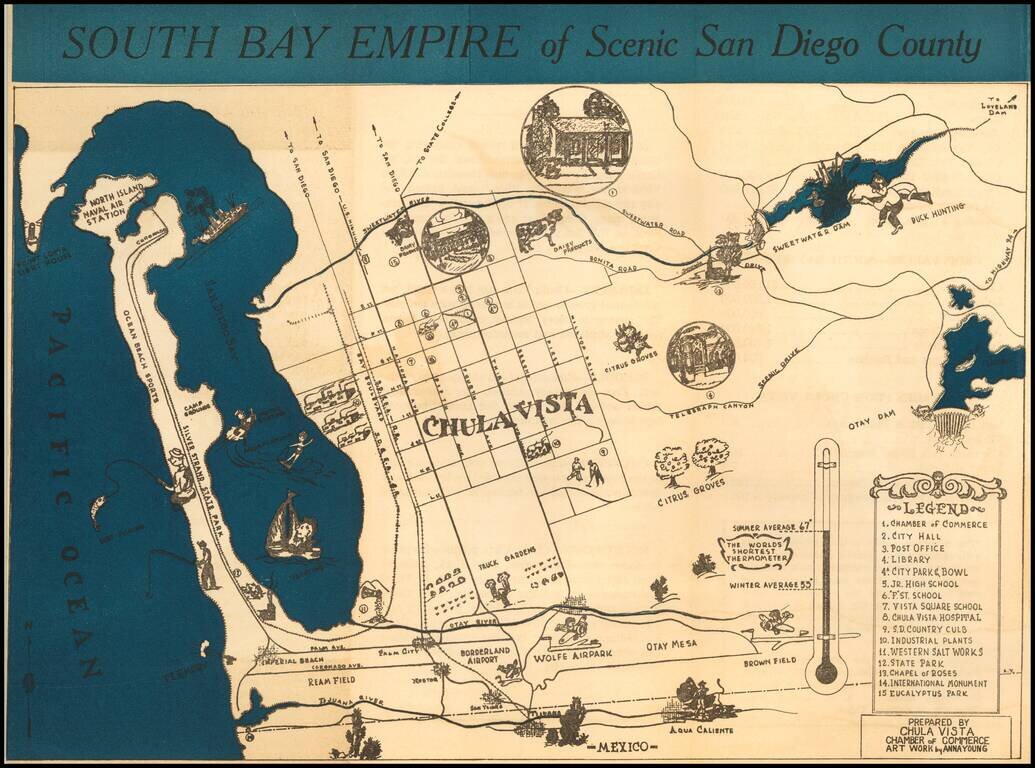
Rare promotional brochure map of San Diego's South Bay, drawn by Anna Young for the Chula Vista Chamber of Commerce. The map extends north to Point Loma and and the Sweetwater Dam area, centered on Chula Vista. Rarity The map is apparently very...
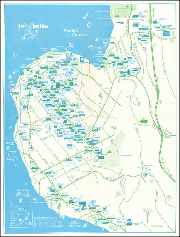
Rare separately issued map of La Jolla, California, published by the La Priscilla Publications of San Diego (Pacific Beach). The map locates dozens of businesses, with a legend noting Churches Golf Courses (including Torrey Pines) Schools...
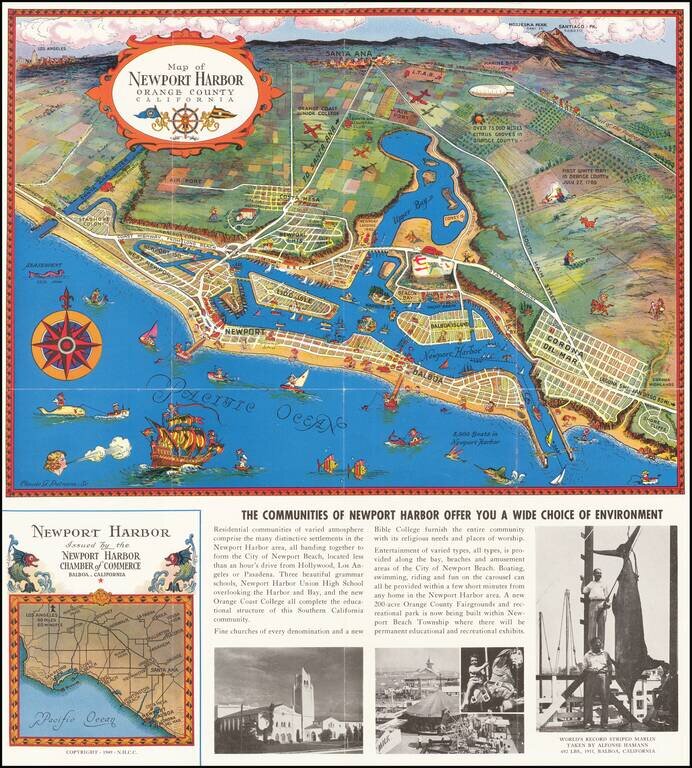
Decorative vintage pictorial promotional map of Newport Harbor and Newport Beach, California, issued by the Newport Harbor Chamber of Commerce. This is the second of Claude Putnam's maps of Newport Harbor, with a prior edition issued in 1939.
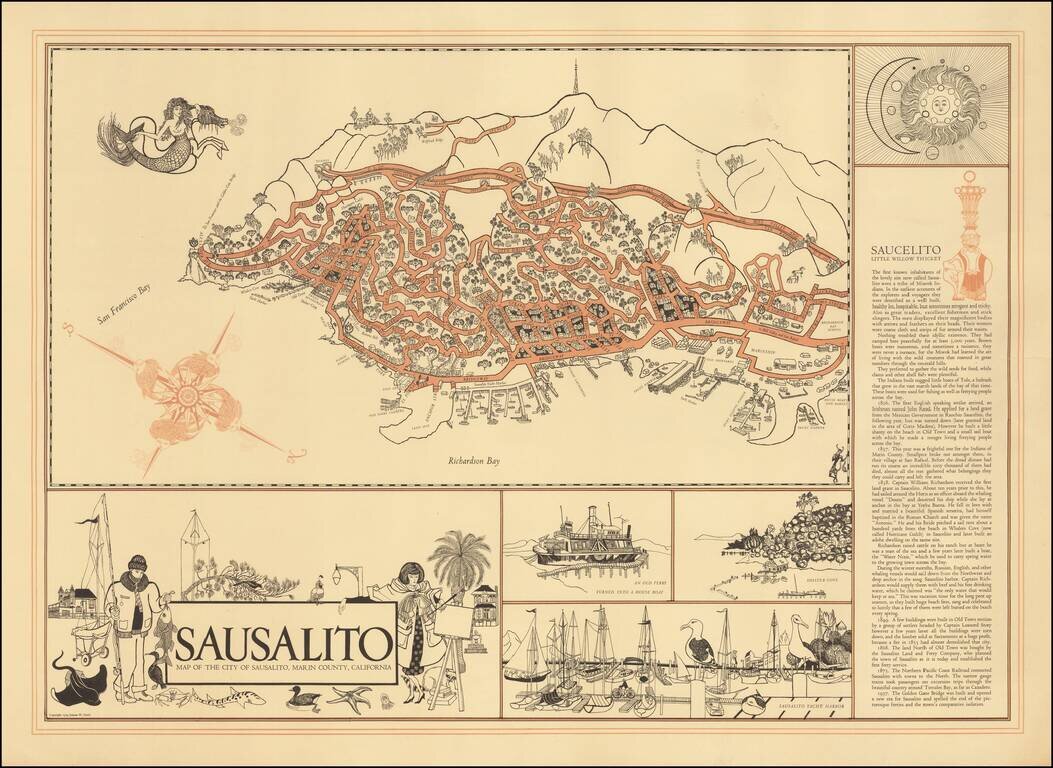
Decorative map of Sausalito, with interesting illustrations and a history of the town at the right side of the map.
![[Placerville, California]](/map/small/63008.jpg)
Lively pictorial advertising map for Placerville, California, issued in the mid-1970s. We dated the map based upon the Master Charge logo (1969-1979). The map provides a whimsical look at Placerville, in the foothills of the Sierra Mountains, with...