
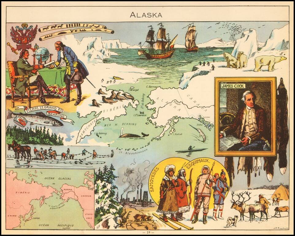
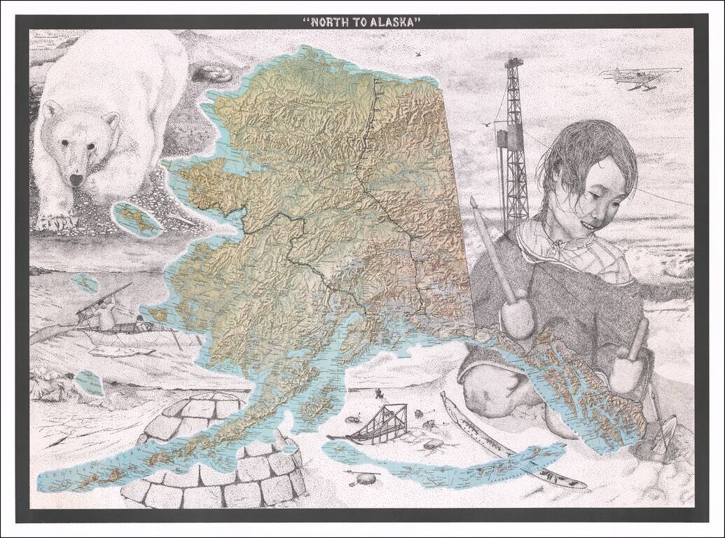
Fine Topographic Poster Map of Alaska with Images of Alaskan Life Detailed map poster depicting the topography of Alaska set amongst stippled drawings showing pictures of Alaska’s snowy landscape and life. This is the first time we have seen the...
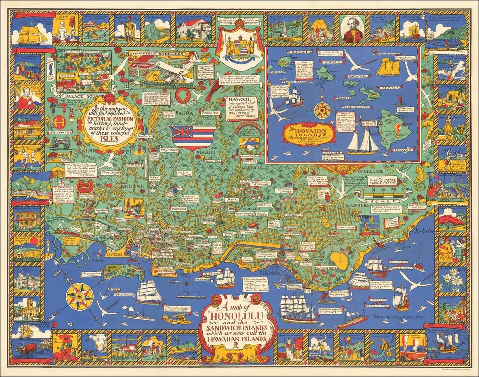
Marvelous rare pictorial map of Honolulu with inset of the Hawaiian Islands. The map includes pictorial features on the map and in vignettes surrounding the map, noting that, "In this map you will find depicted in pictorial fashion the history,...
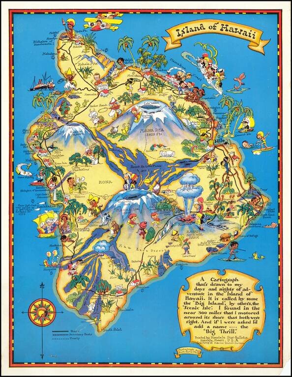
Marvelous whimsical map of the Big Island by Ruth Taylor White one of the most famous pictograph artists of the period. Ruth Taylor White was among the most prolific makers of pictographic maps. Her whimsical style combines her artistic skills with...
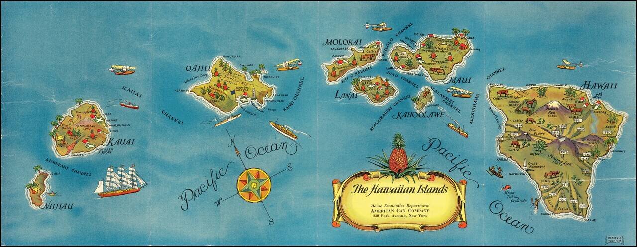
Pictorial map of Hawaii, published for the American Can Company. Each of the Hawaiian Islands includes monuments illustrating indigenous crops (lots of pineapples!), live stock, volcanoes, airports and other points of local interest. This is the...
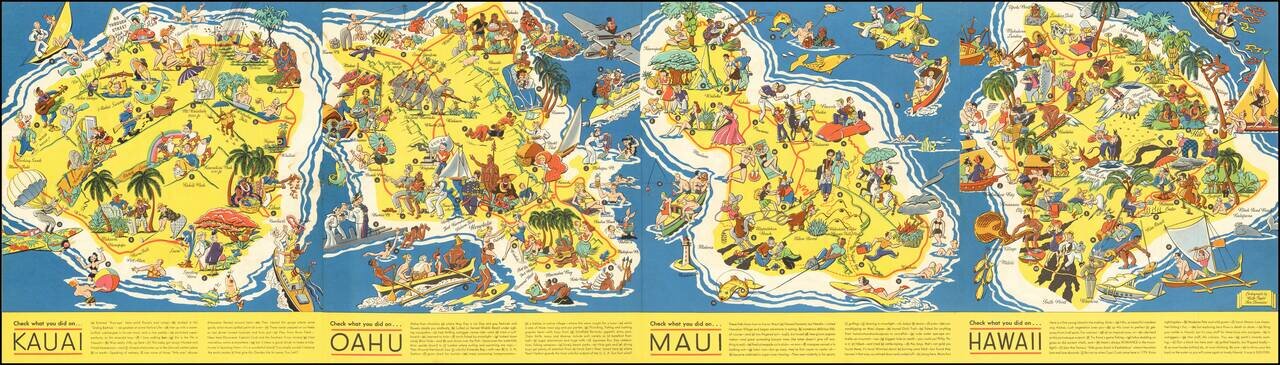
Very rare Ruth Taylor White pictorial map of Hawaii, really four separate maps of Kauai, Oahu, Maui, and Hawaii all on one sheet. This set is far rarer than her other Hawaiian maps. The maps were completed two years after she made "The Story of...
![[Aloha - Christmas Post Card]](/map/small/67516.jpg)
An Orpha Mae Klinker Christmas Card Marvelous illustration of a portion of Oahu (Diamond Head, Waikiki, Oahu, Pearl Harbor, Kaneohe Bay, etc), prepared as a 1947 Christmas card by artist Orpha Klinker. The map provides a lively look at Oahu...
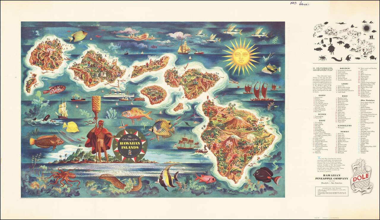
Decorative map of Hawaii, from a painting by Joseph Feher, commissioned by the Hawaiian Pineapple Company. This is the second of Dole's iconic maps, which have been sought after by collectors almost since the initial printing.
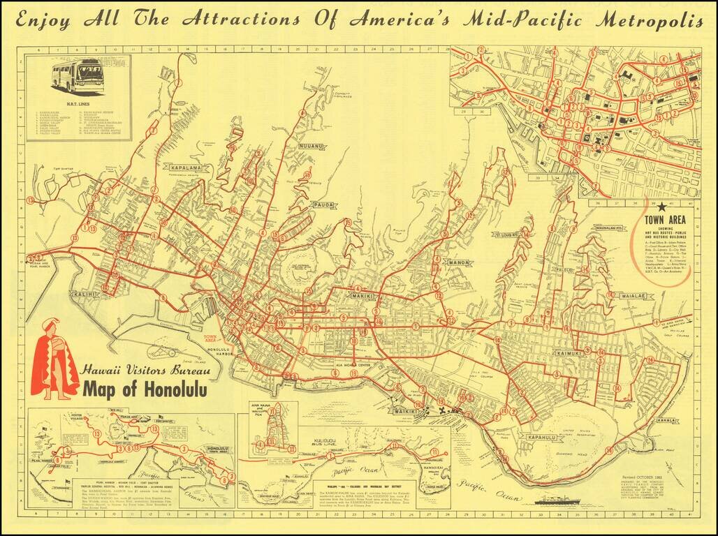
Scarce pictorial map of Honolulu, drawn by pictorial map artist Ron Rice, prepared for the Honolulu Rapid Transit Company Advertising Department, "from an original map of the city of Honolulu, Hawaii, loaned to through the courtesy of the city planning...
![Wailuku [Maui]](/map/small/61147.jpg)
Interesting pictorial advertising map of Wailuku, Hawaii, which seems to have been published by Uncle Harold's Lunch Wagon. The map is a fun mix of cultural and promotional material, with an image of pre-WWII Wailuku at the top (with Ox Cart),...
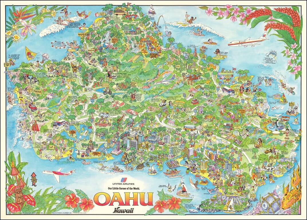
Lively pictorial map of Oahu, issued as a promotional item for United Airlines. The map is packed full of whimsical images of tourist destinations, points of interest and native scenes. A marvelous decorative image.
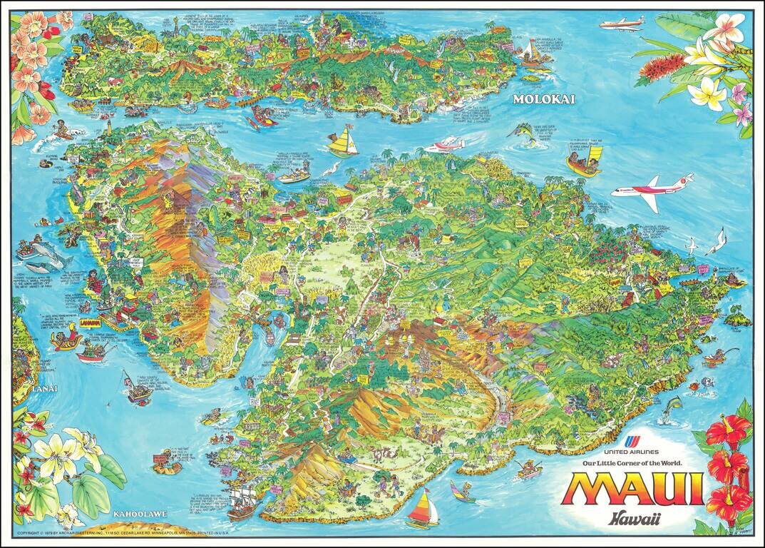
Lively pictorial map of Maui and Molokai, issued as a promotional item for United Airlines. The map is packed full of whimsical images of tourist destinations, points of interest and native scenes. A marvelous decorative image.
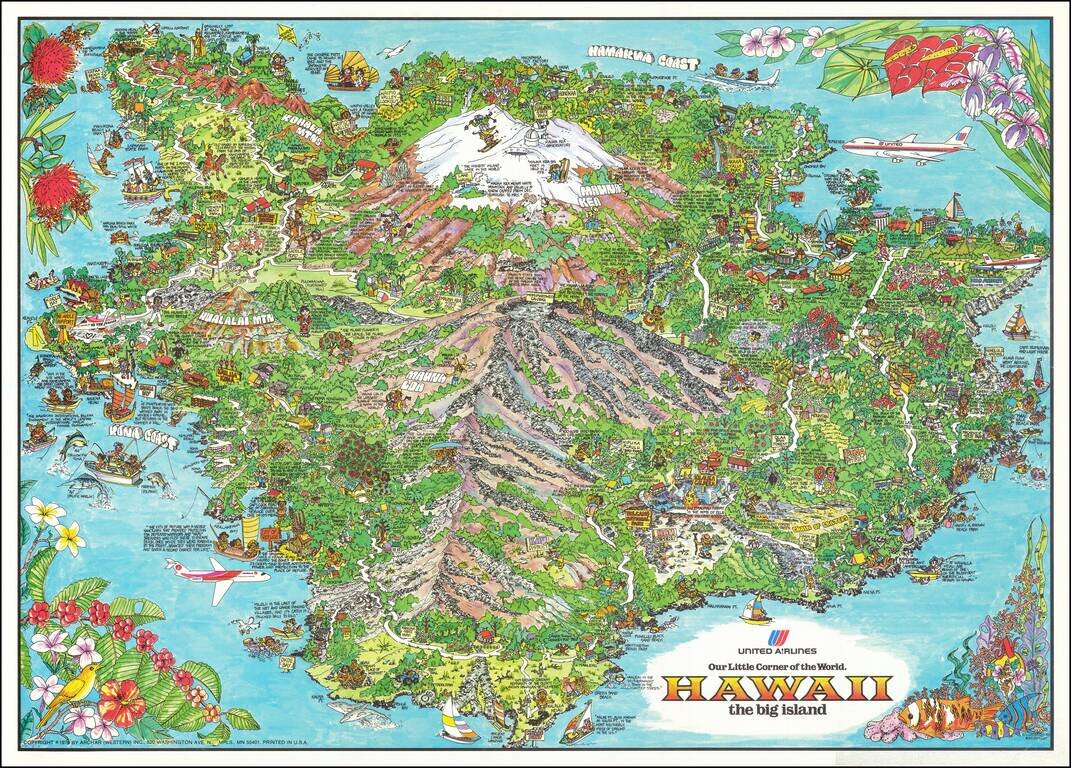
Lively pictorial map of the Big Island of Hawaii, issued as a promotional item for United Airlines. The map is packed full of whimsical images of tourist destinations, points of interest and native scenes. A marvelous decorative image.
![[Hawaiian Islands] Aloha Airlines The Spirit Moves Us . . .](/map/small/59216.jpg)
Fine early promotional map for Aloha Airlines.
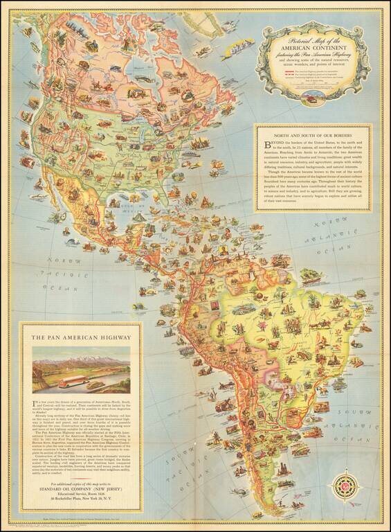
A Standard Oil Pictorial Map of the American Continent This is an attractive vintage pictorial map of the American content, stretching from Fairbanks, Alaska to Cape Horn. The map shows major roads in North America, the Pan-American Highway in South...
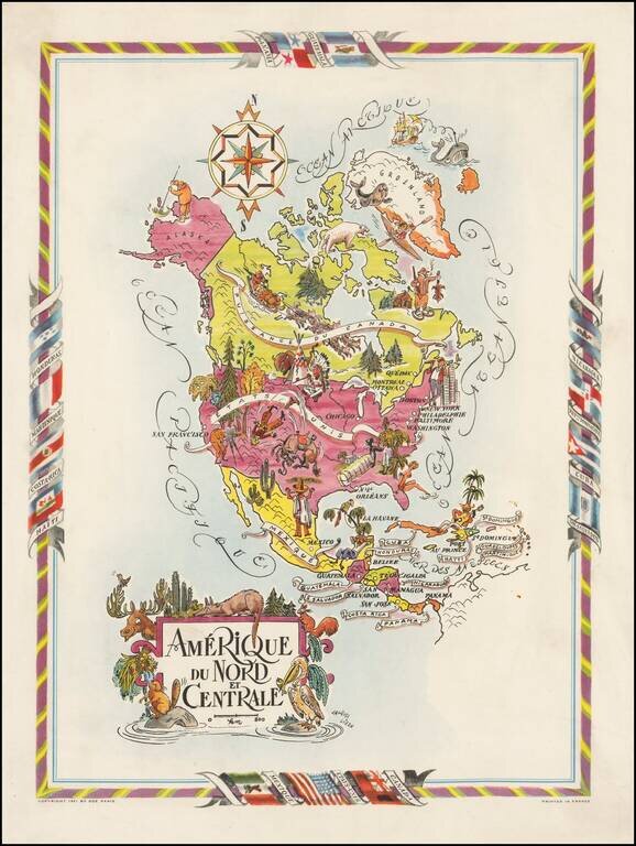
Decorative map of North and Central America, published by Jacques Lizou. Lizou published a number of maps in this style in 1951, including maps of the French provinces, etc. The map was also used in a Pan American Airways menu in the 1960s.