Map size in jpg-format: 61.1404MiB
Click to open in high resolution (open in new tab).

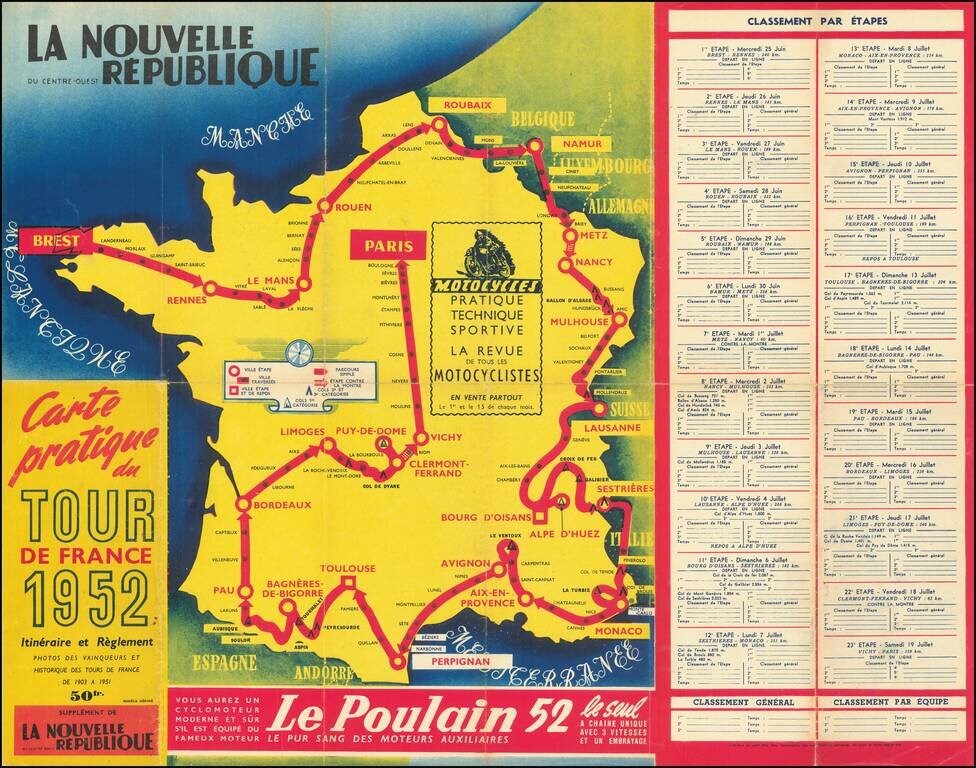
A great antique map made for the 1953 Tour de France, showing the many cities and towns the race would pass through. The route starts in Strasbourg and then passes through Liege, Lille, Caen, Nantes, Bordeaux, Marseille, and Lyon before arriving in Paris. The several cols of this route are shown, though this edition of the Tour avoids many of the most famous climbs. Printed slots are left blank so that viewers can record overall champions and the winners of each stage.
This fiftieth anniversary of the Tour de France saw the introduction of the points system and the green jersey and kept the combativity jersey introduced in 1952. The race was filled with the usual politics and rough nature of the early tour, especially on the French team. Despite this, the Frenchman Bobet won, completing the Tour in just under 130 hours.
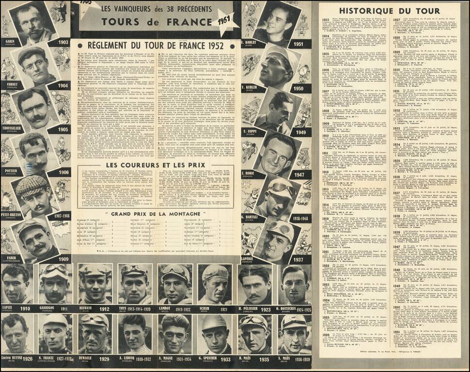
The verso explains the workings of the Tour, describing the national and regional teams, and the rules the cyclists must abide by. These are interesting and now seem archaic, for example, cyclists having to carry two bottles of water. The verso also includes images and descriptions of many of the most famous cyclists who would compete on the Tour.
This map was printed by La Nouvelle Republique du Centre-Ouest, a French newspaper headquartered in Tours.
If you are a student, write to us in telegram: @antiquemaps and indicate what material you need and for what work you need a map in high detail. We are ready to provide material on special terms. For students only!
![Carte d'Etude [Study Map]](/map/small/66795.jpg)
![Orange [Vauban Style Fortress]](/map/small/62043.jpg)
