
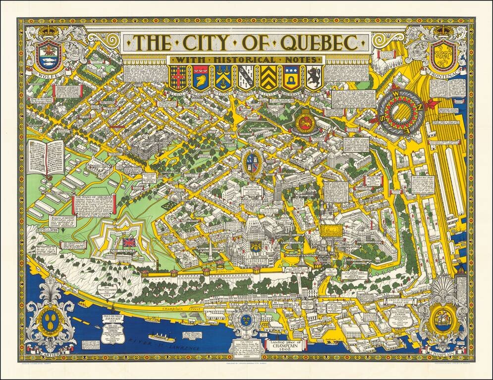
Decorative historical map of Quebec, richly adorned by coats of arms and historical facts.
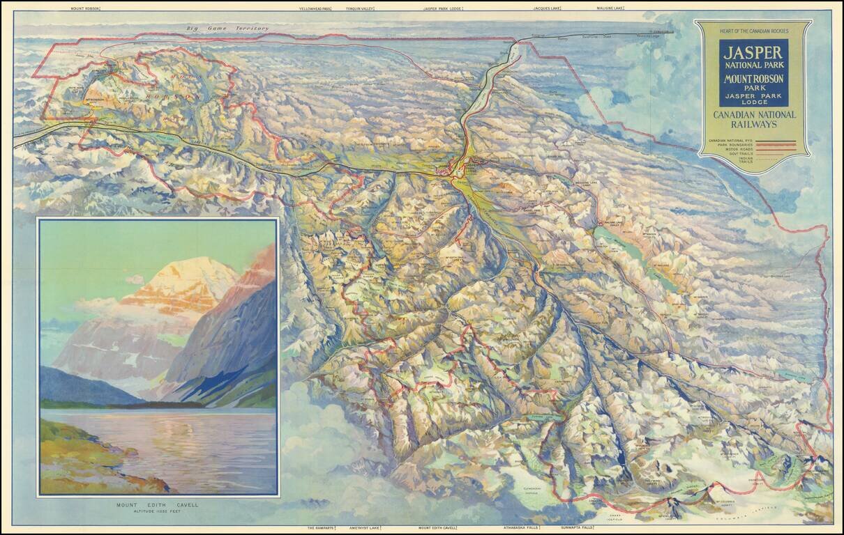
Finely illustrated vintage view-map of the Jasper National Park and environs, published by the Canadian National Railway. Color coding identifies Canadian National Railway lines, Park Boundaries, Motor Roads, Government Trails, and Indian Trails....
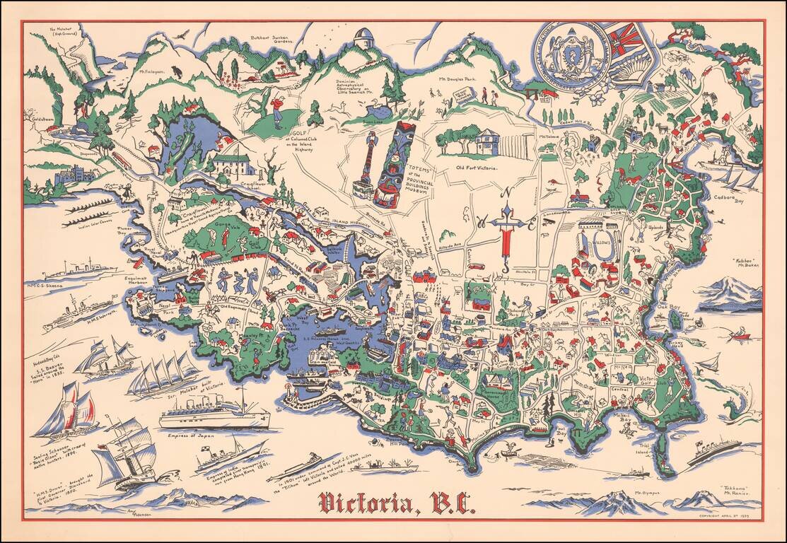
Rare pictorial map of Victoria, British Columbia, drawn by Amy Adamson. The map shows major buildings, railways, towns, major roads, landmarks, rivers, forests, recreational sites and activities. The compass is created from Cross, oriented north to...
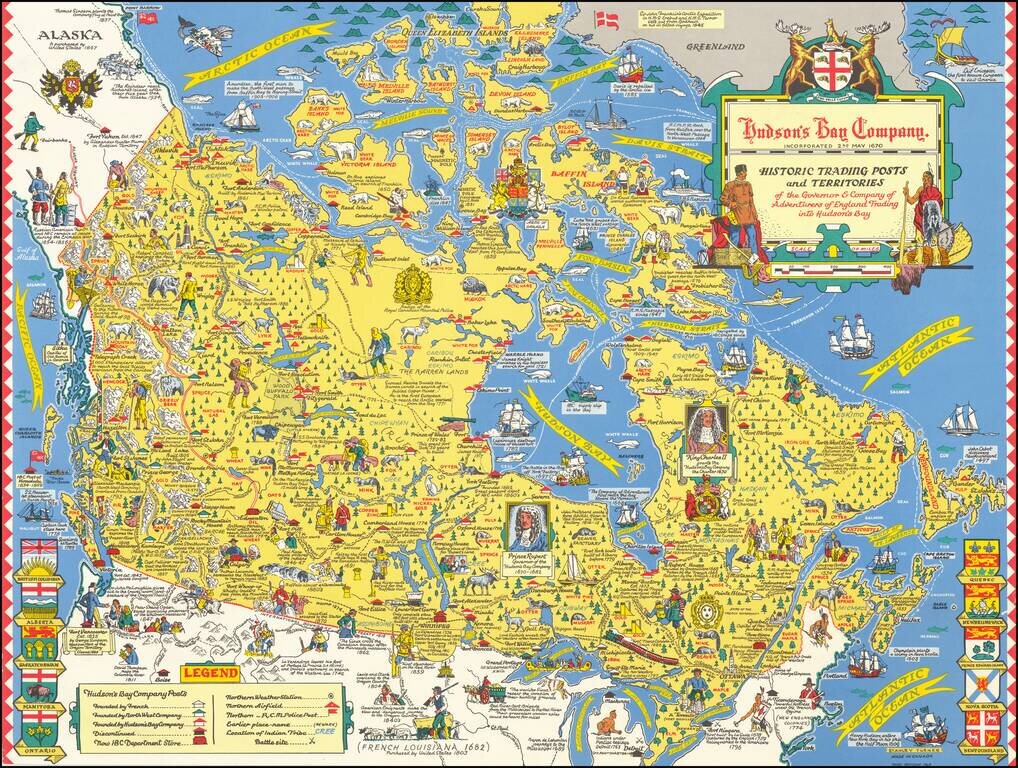
"Third Revision" of this marvelous pictorial map celebrating the history of the Hudson's Bay Company, published in Toronto. Fine large format map drawn by Toronto Artist Stanley Turner, one of the best known WWII map illustrators. The map is filled...
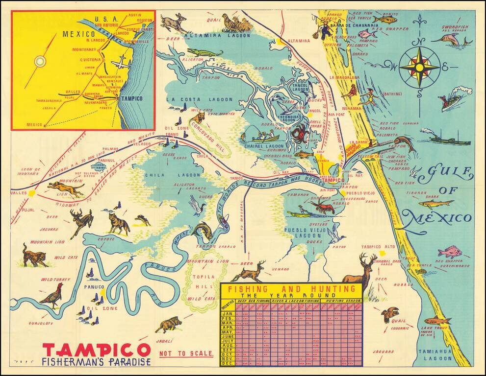
Decorative pictorial map of the Tampico area, promoting the local fishing and tourism area.
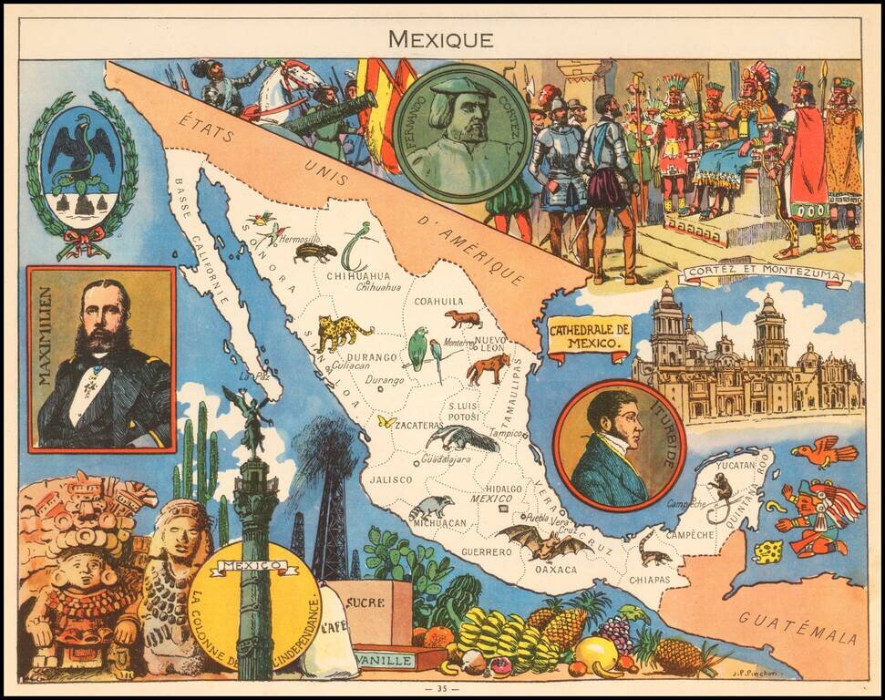
Decorative pictorial map of Mexico, published by Children's book illustrator JP Pinchon. The map was used to educate primary school children in France in the first half of the 20th Century.
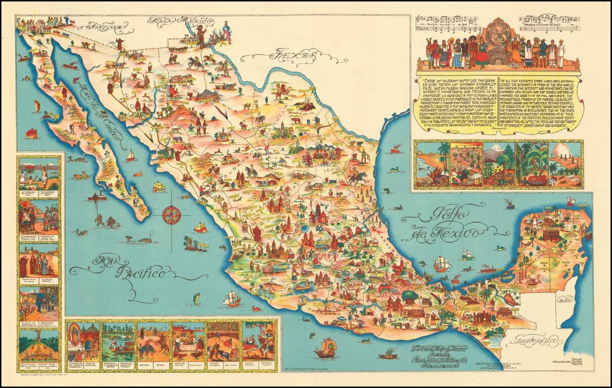
Rare large format version of this decorative map of Mexico, published in Mexico City. The map is one of the liveliest and most interesting maps of Mexico published in this pictographic style, with vivid colors and fantastic images.
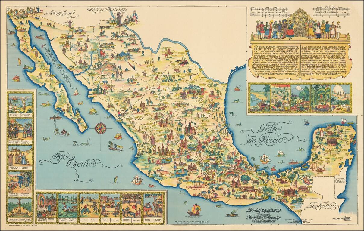
The Seldom Seen Full-Sized Poster Version. Rare large format version of this decorative map of Mexico, published in Mexico City. This is the poster-sized version of the 1950 version of Miguel Gomez Medina's 1931 pictorial map of Mexico, which was...
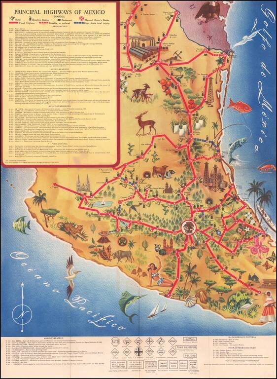
Decorative pictorial map of Mexico, showing the principal roads throughout the country. The map focuses on illustrating the principal resources and points of interest, with a symbol noting the availability of gasoline in major towns. The map was...
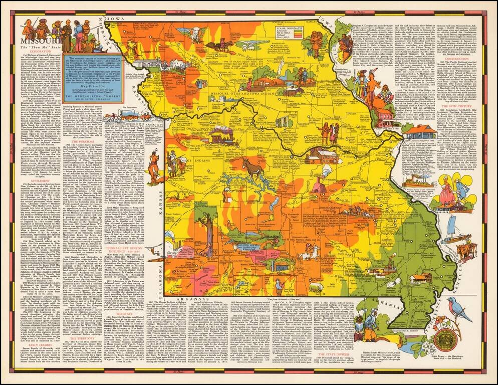
Rare pictorial map of Missouri by R.T. Aitchison, published by the Mentholatum Company. The map includes decorative vignettes illustrating the history and resources of Missouri with a detailed text history of the state. R.T. Aitchison was a Wichita,...
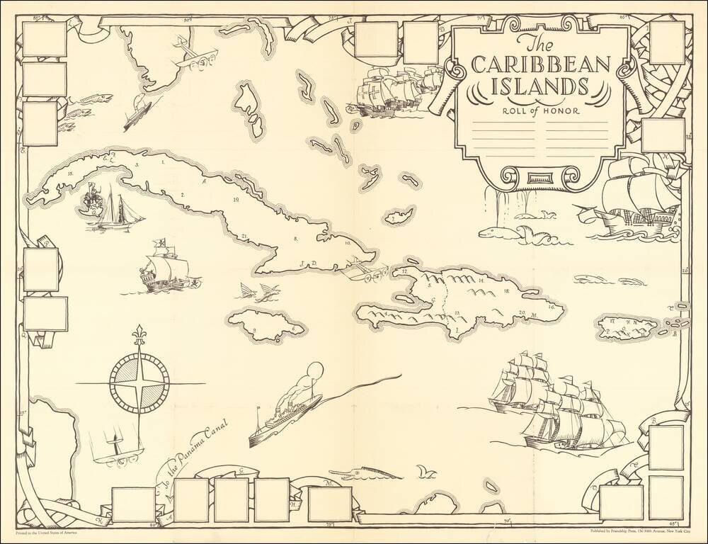
A Missionary Educational Map of the Caribbean for Children Fine large format map of the Caribbean, intended as an educational tool for church school children, published by the Friendship Press of New York City. The artist, Dr. Gilbert Q. LeSourd,...
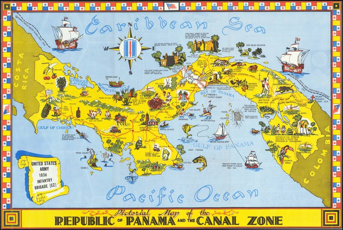
Striking pictorial map of Panama and the Canal Zone. Rich coloring, striking flag border and rich illustrations. Includes a history of Panama and facts about the Canal on the verso, along with photos. Rarity We find a single example on line...
![[Pictorial Map of the City of Hamilton] Places of Interest in The City of Hamilton and the surrounding Paris of Pembroke](/map/small/70027.jpg)
Rare vintage Bermudian pictorial map of the city of Hamilton, Bermuda. In the lower right corner of the map are the initials "KG." "HK." and "MN." This is usually the place where one would find the artist of the map, however, we cannot decipher them...
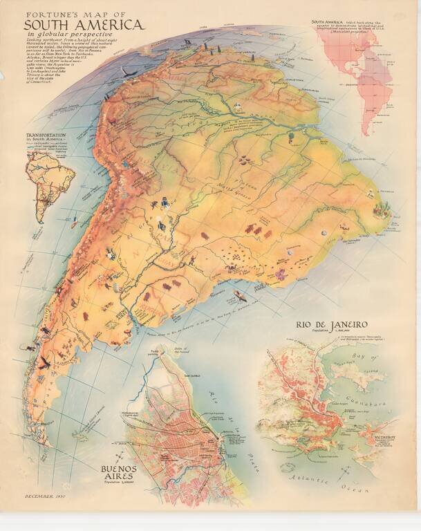
Scarce map of South America, published by Fortune Magazine. The map includes vignettes, showing natural resources, recreational activities and other vignettes highlighting the features of the various regions. Includes a second map showing a detailed...
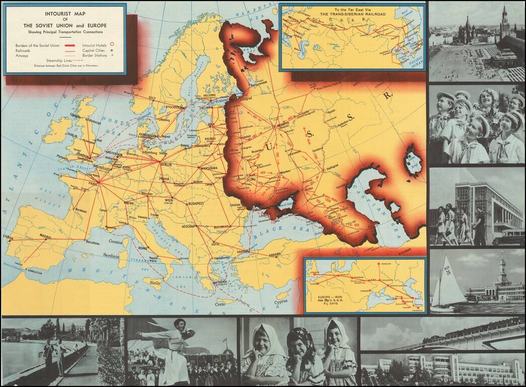
Interesting pictorial map of Europe an the Soviet Union, published by Intourist, promoting tourism in the Russia. The map shows major transit lines and charming monochromatic photos, with the verso giving different travel itineraries and general...
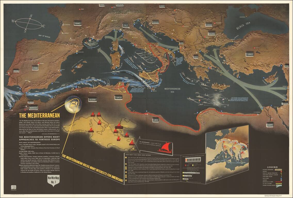
Excellent "NavWar" pictorial map of the Mediterranean Theater during the Second World War. The map highlights the progress of British and American forces in liberating North Africa and parts of southern Italy and the strategic advantages that these...