
![[Austrian Alps] Dachstein / Der Alt Welt Begriff, Besthende in 3 Haubt Theilen als Arica, Europa, Asia. Warinnen der Erste Meridian nach Frantzossicher art gezogen](/map/small/68924.jpg)
Lively pictorial map of the region centered on Dachstein in the distance. Centered on Traunsee, Attersee, Mondsee, Zellersee, Wofgangsee, Hallstattersee Fuschlsee, Wallersee, etc.
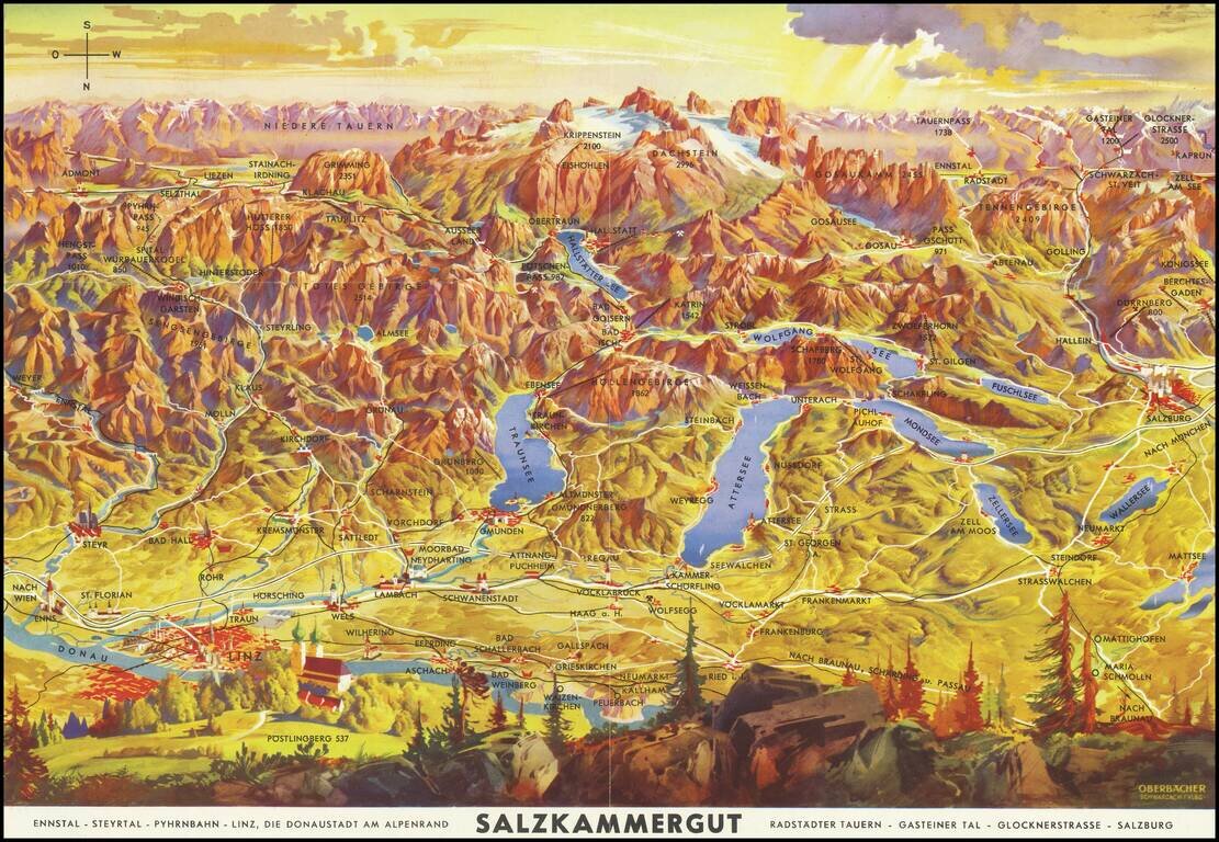
Lively pictorial map of the region including Salzburg, Linz and the Donau (Danube) River, oriented with south at the top. Centered on Traunsee, Attersee, Mondsee, Zellersee, Wofgangsee, Hallstattersee Fuschlsee, Wallersee, etc. The tallest peaks in...
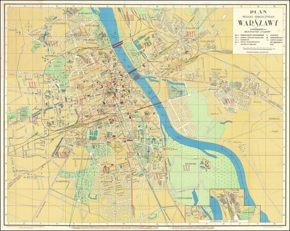
Wonderful Interwar Map of Warsaw. Detailed color-lithographed map of Warsaw issued by the famous Polish publisher and train station kiosk operator, RUCH. The map has an inset at the bottom showing a railway station. The map marks the main parts of...
![[Illustrated Plan of Moscow & its Environs] Illustrirovannyi Plan
Moskovi i yeye Okrestnostmy.](/map/small/37725.jpg)
A highly decorative and large-scale plan of Moscow, depicting the city not long before the Revolution of 1917. This magnificent map depicts all of Moscow and its environs as it appeared in 1910, during the twilight of the Czarist period. In large...
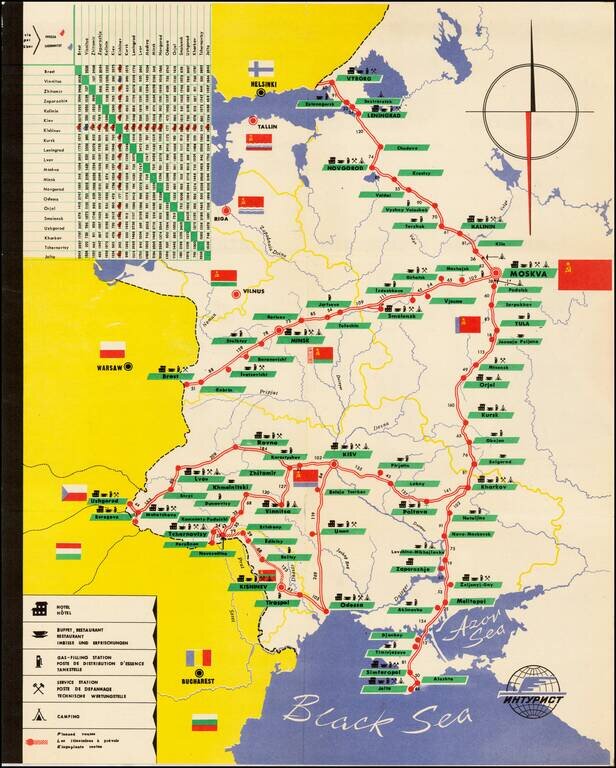
Decorative tourist map of Russia, showing the bus lines throught the country. An interesting Soviet era tourist item.
![[Pictographic Map of Moscow] Moscou.](/map/small/37917.jpg)
An attractive and engaging 1950s pictographic map of Moscow, showing the Soviet capital's main sites during the height of the Cold War. This interesting map provides a rare Western-language pictographic map of Moscow, then the capital of the Soviet...
![[Soviet Union] Our Country -- From Wooden Plough To Sputnick](/map/small/47092.jpg)
Fascinating Soviet map and promotional brochure, prepared for the USSR Section of the Brussels Universal and International Exhibition, 1858. The map shows the Russians at the North Pole and prosperously exploiting their bountiful natural resources....
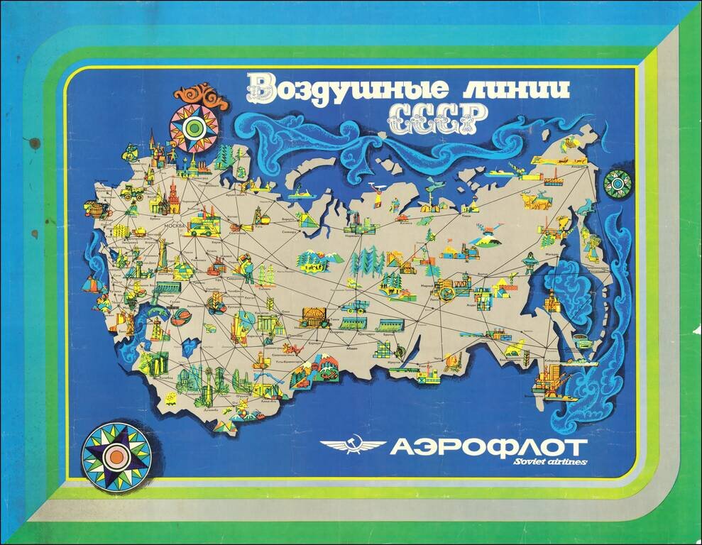
Attractive modernist travel poster issued by Aeroflot, the official national airline of the Soviet Union. The map highlights exclusively domestic routes within the Soviet Union. Interestingly, though not particularly unusual for the time, the routes...
![[Moscow. Motorist's companion. Schematic plan of the main streets and highways of the capital] Москва Схематический План Основных улиц и Магистралей Столицы](/map/small/70244.jpg)
Vintage map of Moscow focusing on automobile infrastructure at the end of the 1960s. The map shows some of the development of the city's automobile infrastructure: 105 gas stations, 32 official parking spots, a dozen of car repairs, and a small number...
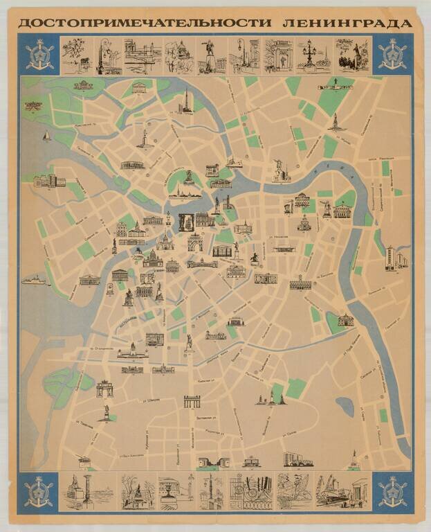
Fine Soviet-era pictorial tourist map of Leningrad (St. Petersburg), published in the former Soviet Union. The map illustrates over 90 points of interest, with 16 inset views at the top and bottom of the map. Extensive descriptive text and additional...
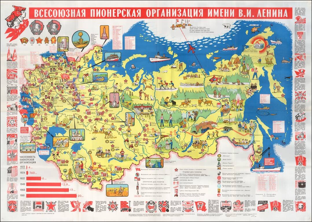
A Propaganda Map for Soviet Children -- The Soviet Boys and Girls Scouts Educational/Propaganda map of the Soviet Union (including Baltic & Southern republics) showing the State border, key cities, pioneer museums and large construction projects...

Czech-Published Map Celebrating the Victories of the 575th Motor Ambulance Company, Published in Pilsen in 1945. Fascinating separately issued map of Western Europe focusing on the movements and exploits of the American 575th Motor Ambulance Company,...
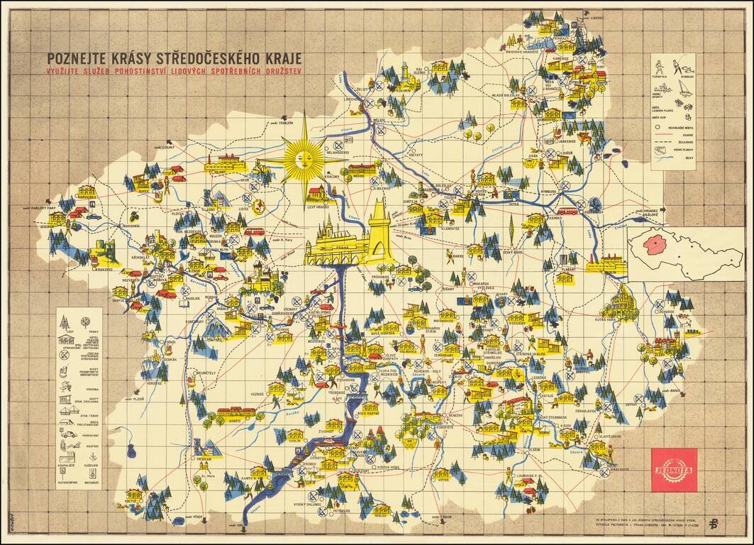
Fine example of this scarce pictorial map of the Central Bohemian regions, published by the People's Consumer Cooperatives. The title translates as: Discover the beauties of the Central Bohemian Region. Take advantage of the Hospitality Services of...
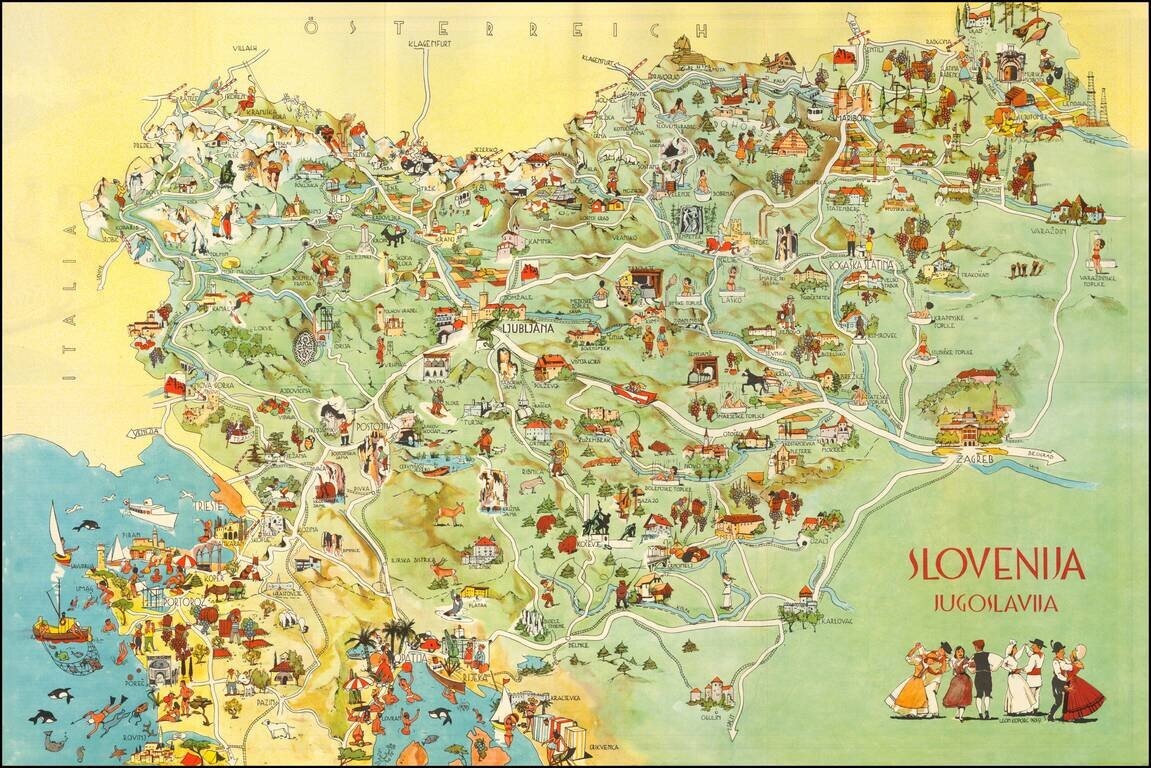
Decorative pictorial map of Slovenia, published by the Slovenian Tourist Bureau. On one side is a lively pictorial map. On the verso is a road map of the northern part of Yugoslavia. Promotional text appears in English, French, German and Italian....
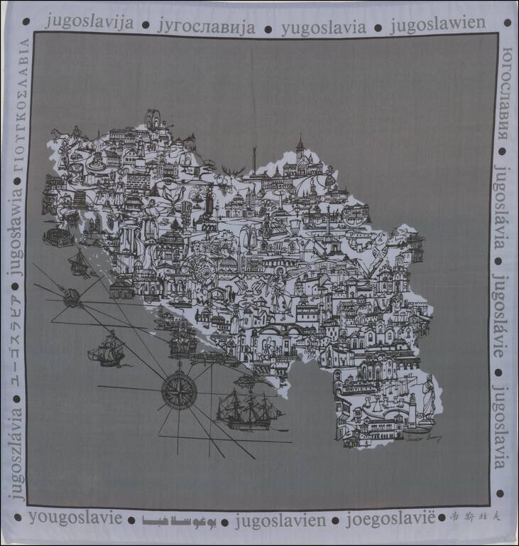
Pictorial map printed on linen in the former Yugoslavia.
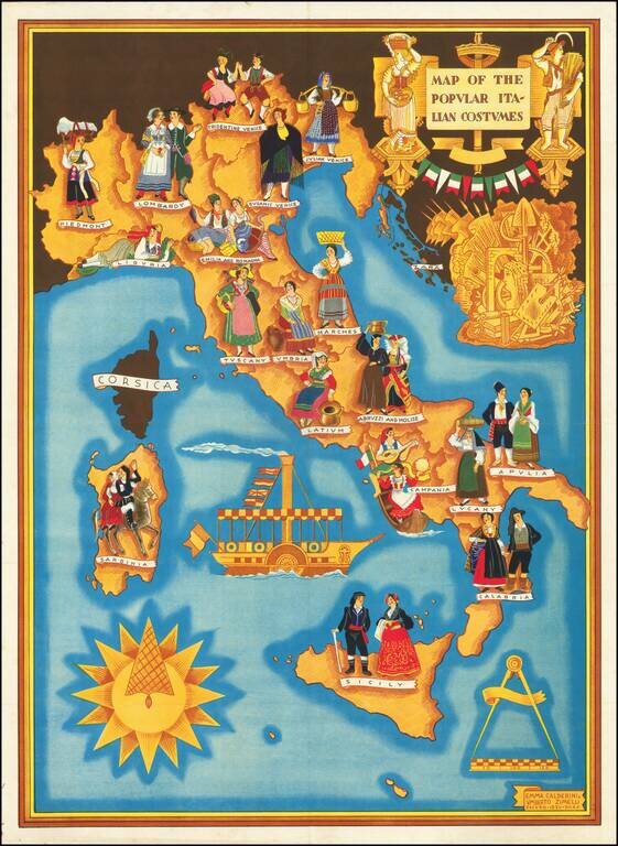
Rare Separately Published Broadside Promoting Italian Culture in Fascist Italy Striking pictorial map of Italy published in the 12th year of the Fascist Era (E.F. XII), extolling the virtues of the Fascism and Italian Culture. The present example has...