
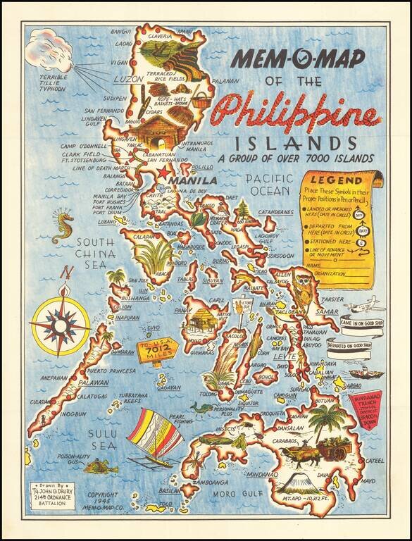
Lively pictorial map of the Philippines, drawn by John G. Drury of the 2145th Ordnance Battalion. This is one in a series of Mem-o-Maps published at the end of World War II. The maps were intended as souvenirs for the military. Military personnel...
![[Philippines] Pictorial Tour Map To The Scenic Wonders of the Mountain Province](/map/small/59513.jpg)
Rare promotional tour map of the Mountain Province, published by Capitol Publishing House. The map is centered on Mt. Data and the area around Bontoc and Baguio City. Points of interest include: Philippines Military Academy Baguio Cathedral...
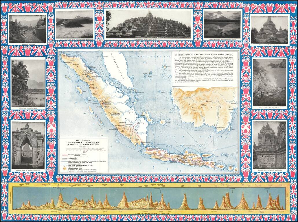
Detailed map of the Dutch East Indies, focusing on the Railroad Maps and other transportation routes in and around the islands. The map is ringed by photographs of points of interest in and around the islands, along with a profile view of the island...
![[Pictorial Map of the United Arab Republic] Kharitat Musawwarat al-Jumhuriya al-'Arabiya al-Muttahida / خريطة مصورة الجمهورية العربية المتحدة](/map/small/55146.jpg)
Fine Pictorial Map of the United Arab Republic Tourist map of the United Arab Republic, published by the Ministry of Tourism in Egypt in 1969. The map shows what is now Egypt during its short time as the United Arab Republic, as well as the boundaries...
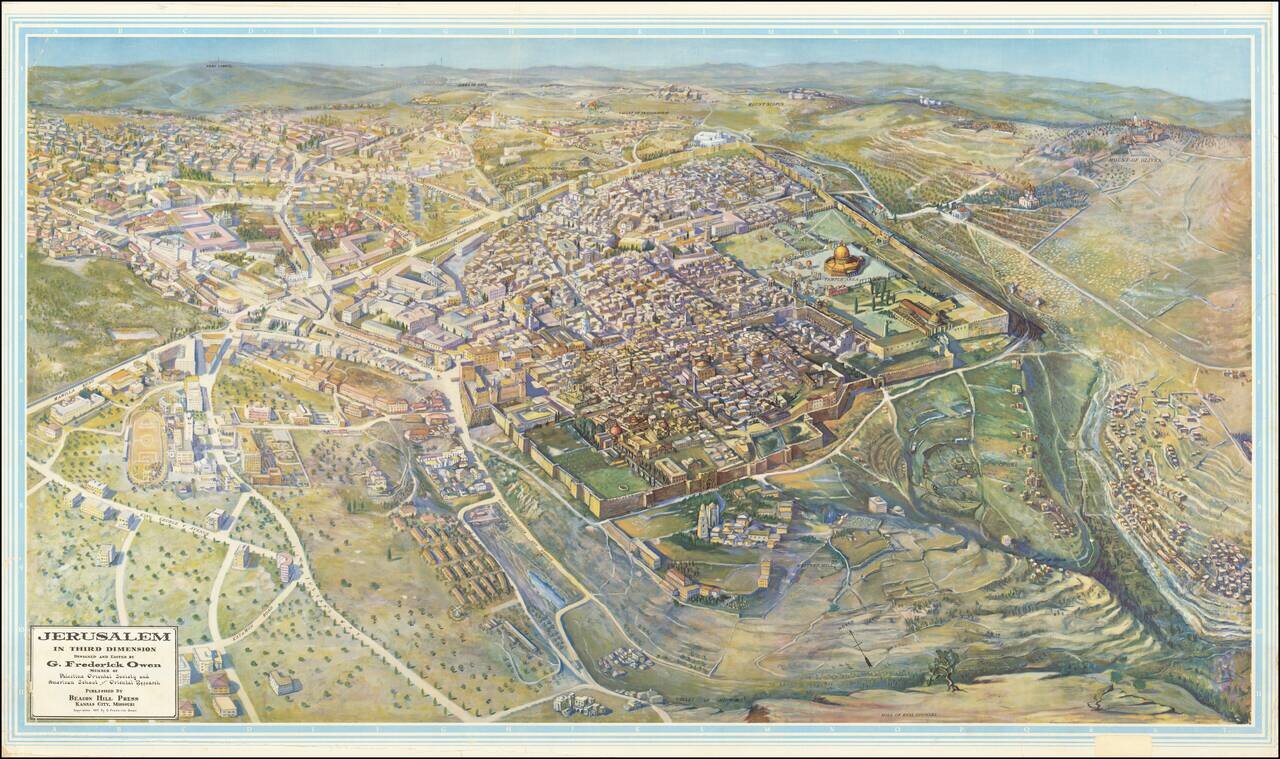
Scarce, large bird's eye view of Jerusalem published by G. Frederick Owen, in Kansas City, Missouri in 1947, the year before Israel was founded. The view looks north-northeast over Jerusalem, with the focus on the old walled city. Individual buildings...
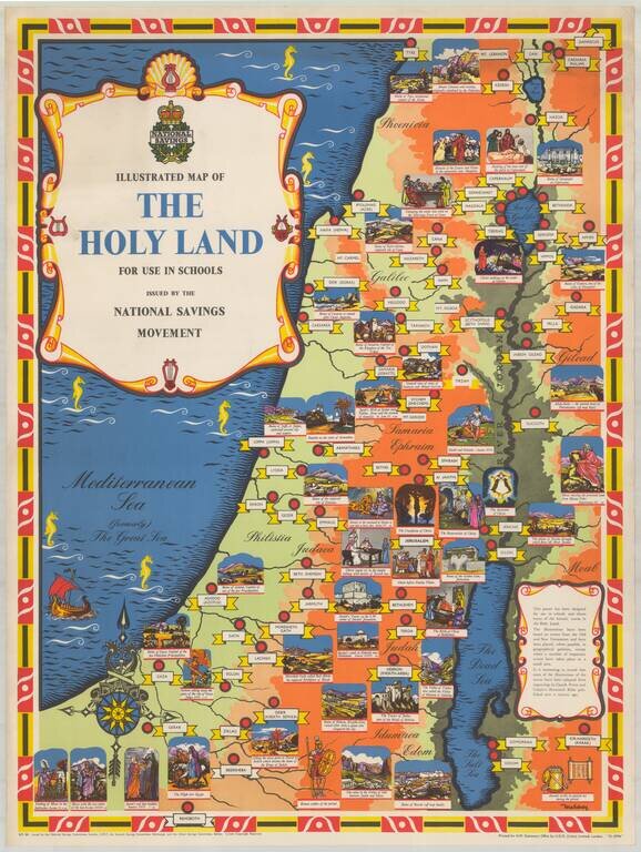
Fine pictorial / historical map of the Holy Land, issued by the National Savings Movement. We note that the map is signed by Mahoney, whose name appears on at least one other poster published by the National Savings Movement. A wide range of printed...
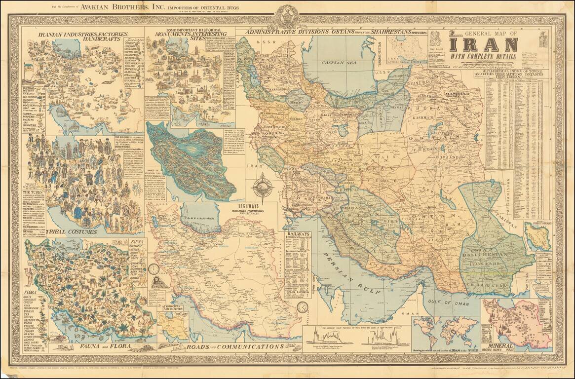
Interesting separately issued map of Iran, published in Tehran by A Sahab, one of the leading Iranian cartographic publishers. The main map is the primary depicts the cities and regions of Iran, with the surrounding maps showing This magnificent map...
![[Africa - Anti-Colonialism]](/map/small/66878.jpg)
Striking image of Africa, with a quote from Amilcar Cabral. The map was likely printed shortly after Cabral's assassination in 1973. Always bear in mind that people are not fighting for ideas, for the things in anyone's head. They are fighting to...
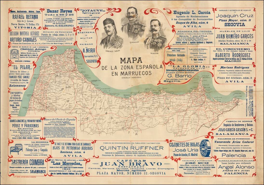
A Rare Promotional Map of Spanish Morocco Rare advertising map of Northern Morocco, during the Spanish Protectorate Period. The map includes the portraits of Spanish Foreign Legion "Africanistas": Lieutenant Colonel Santiago Gonzalez Tablas...
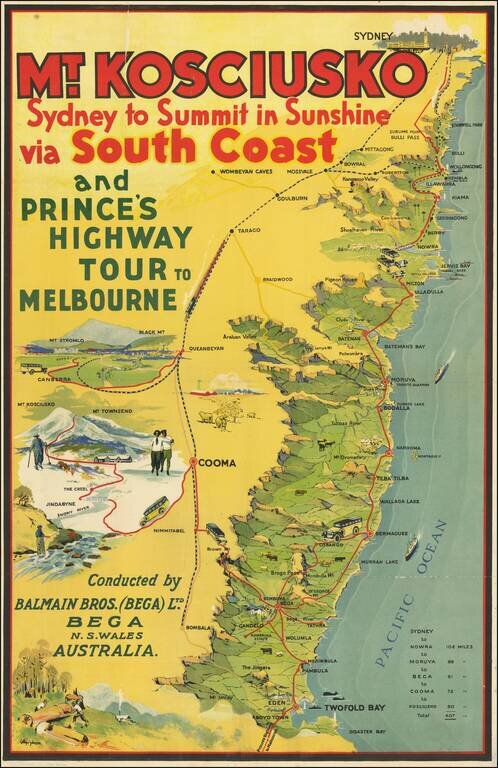
Rare travel poster of the area between Sydney and Twofold Bay, promoting the Balmain Bros. (Bega) Ltd., with the publication mark of J.H. Enemark Ltd., Litho. Sydney at the bottom left. The map illustrates a coastal motor route between Sydney and...
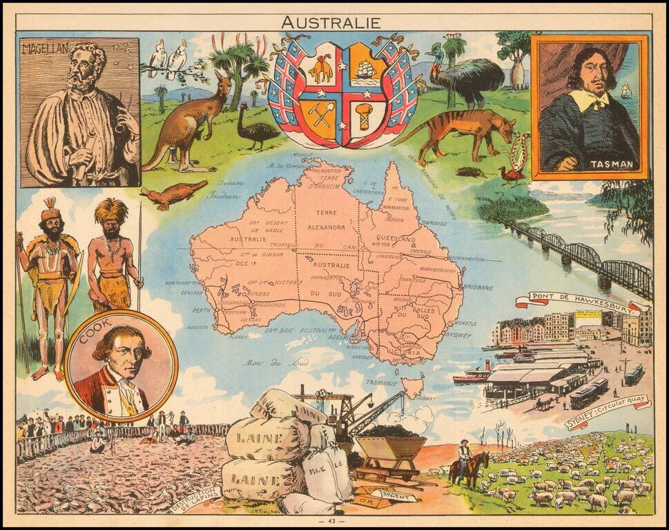
Decorative pictorial map of Australia, published by Children's book artist JP Pinchon.
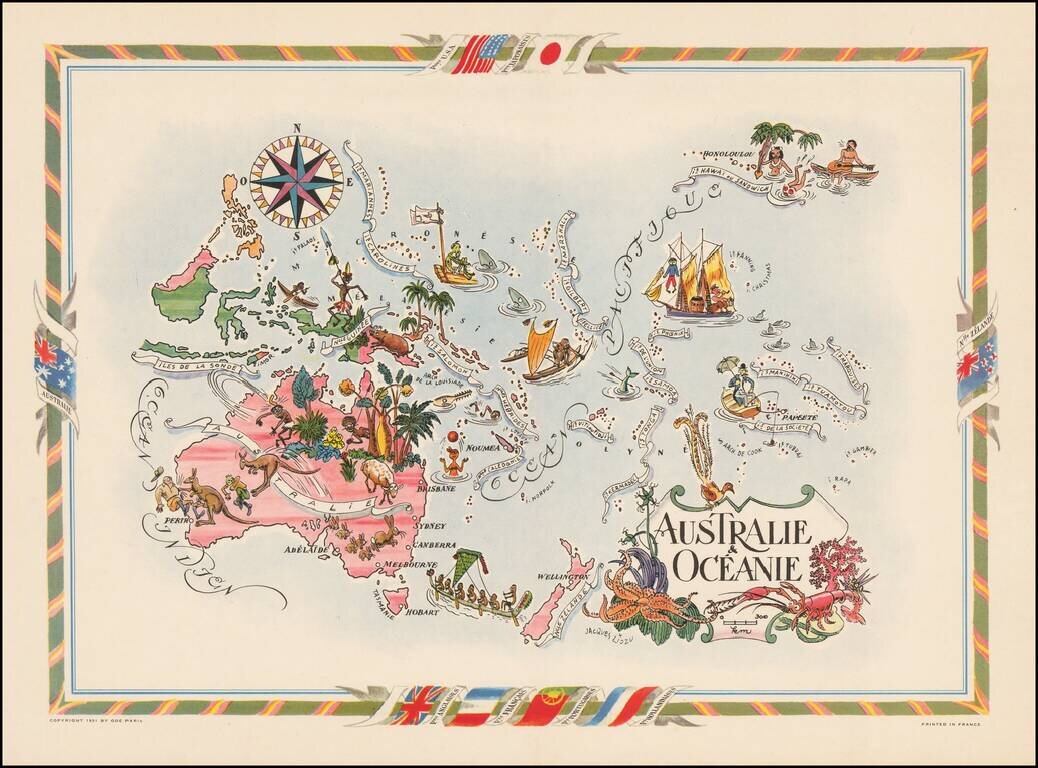
Decorative map of Australia, the Philippines, New Guinea, New Zealand and the South Pacific, published by Jacques Lizou. Lizou published a number of maps in this style in 1951, including maps of the French provinces, etc.
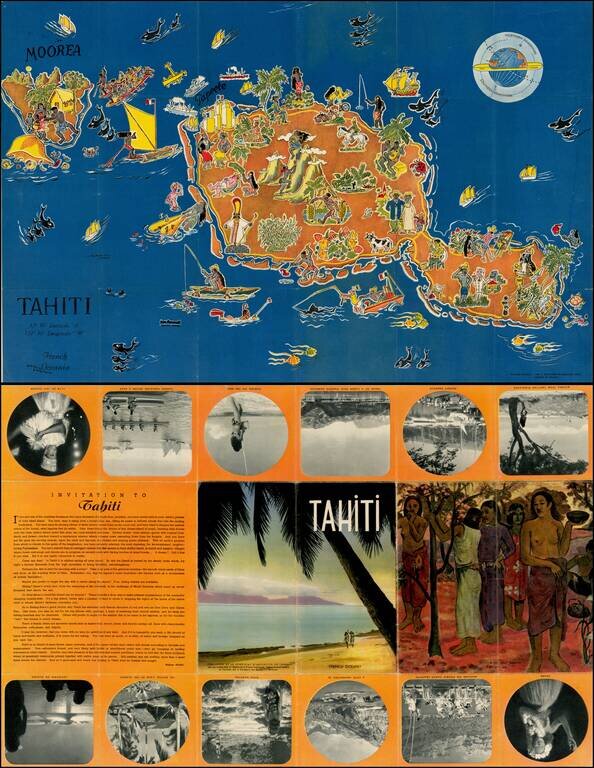
Decorative pictorial map of Tahiti, drawn by Jean Rousaute for Le Syndicat d'Initiative de Tahiti in Paris. The map shows a colorful look at the peoples, wildlife, and tourists found around Tahiti.
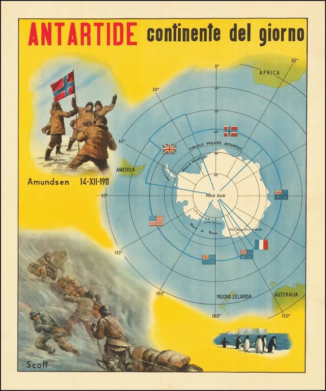
The Race for The South Pole Fine large, early twentieth-century Italian image illustrating the race for the South Pole and a map of Antarctica. The map depicts the race for the South Pole, where explorers from various nations sought to be the first...
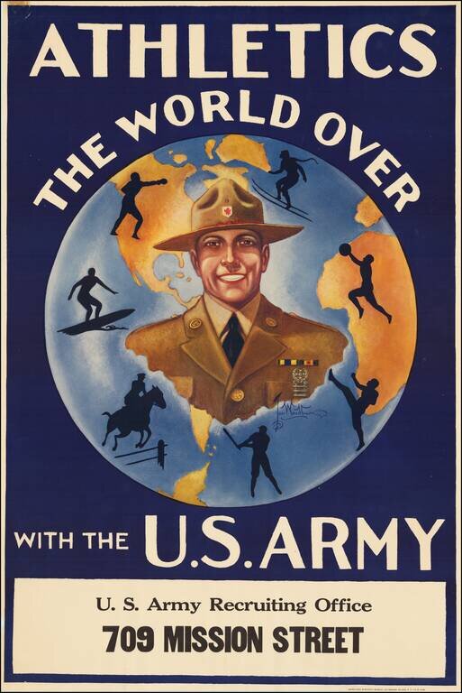
Rare U.S. Army recruiting poster featuring a globe at the center. According to the limitation note in the bottom margin, the poster was printed in an edition of 25,000, but it remains exceptionally scarce today; we find no records of it anywhere....
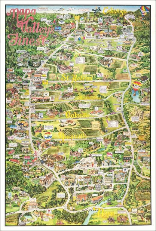
Decorative pictorial map of Napa Valley, from Napa to Calistoga, published by City Design. The map includes advertising for a number of local merchants, including wineries, restaurants, hotels and many wine related tourist attractions. Several...