
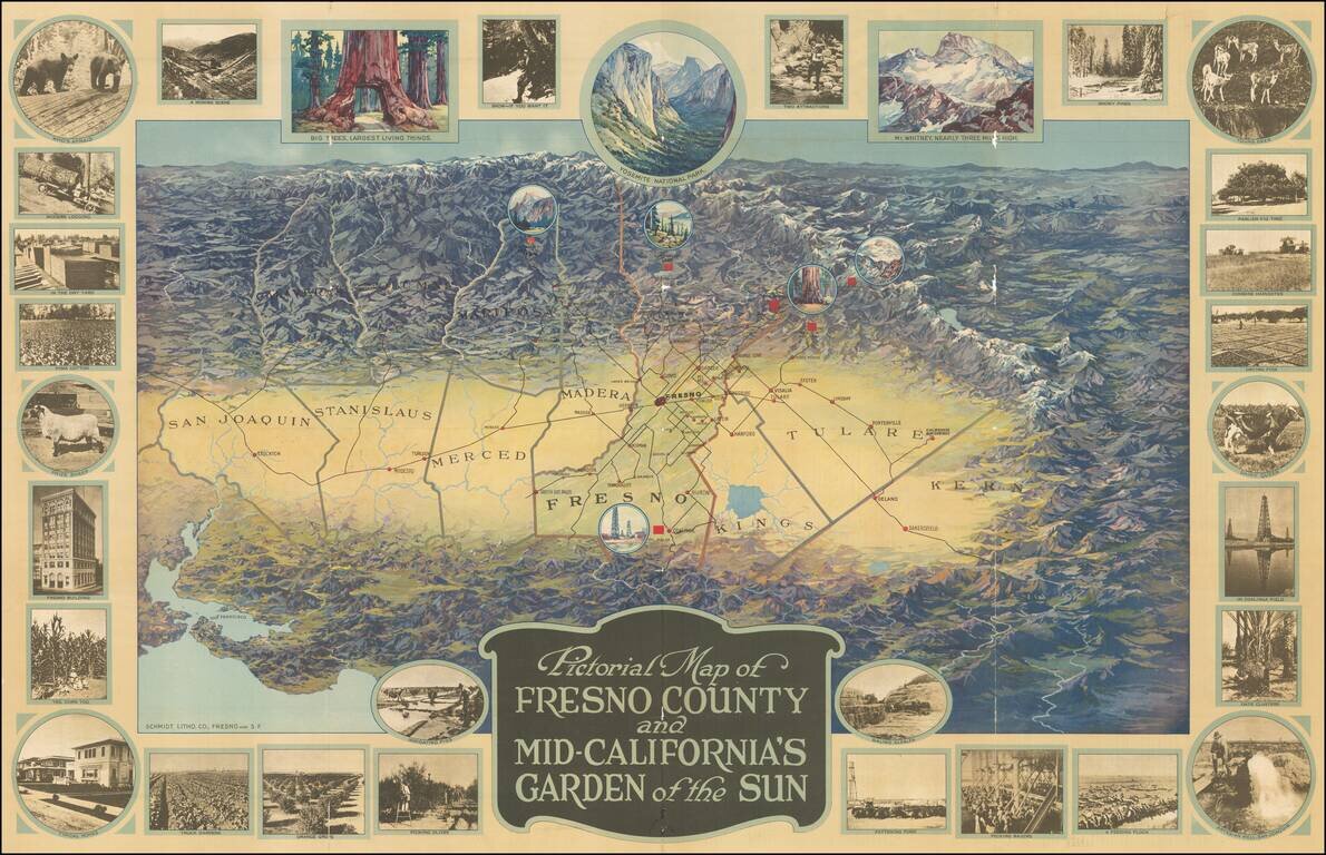
One of the great California pictorial maps from the Golden Age of American Pictorial mapmaking. The map stretches from San Francisco in the lower-left corner to San Emigdio Mountains at the right and the Sierra Nevadas in the background. The map thus...
![Map of Yosemite National Park Showing Routes of Yosemite Transportation System, High Sierra Camps and Pack Trip Country. [on sheet with:] Map of the Floor of Yosemite Valley Yosemite National Park, California](/map/small/66362.jpg)
Illustrated Stage and Railroad Routes To Yosemite Detailed topographical / pictorial map of Yosemite and Vicinity, published as a vistor's guide promotional map. The primary map illustrates the Y.T.S. Stage Service and Railroads servicing the valley...
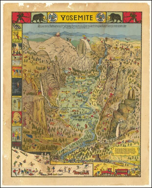
Decorative vintage pictorial map of Yosemite Valley drawn by artist Jo Mora in 1931 and later re-issued in 1941 and 1949. The map shows many humorous scenes and shows the activities common at the time in the Valley. Many landmarks are shown in an...
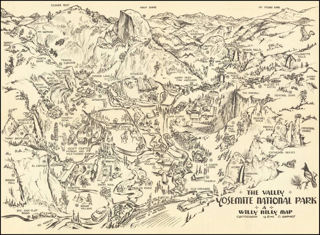
Yosemite Pictorial Rarity Rare self mailing map of Yosemite, published in 1946 by the Willy Nilly Map Company. The map is centered on Camp Curry, with an indoor venue below it having its roof blown off with music and dance. Extends to Clouds Rest,...
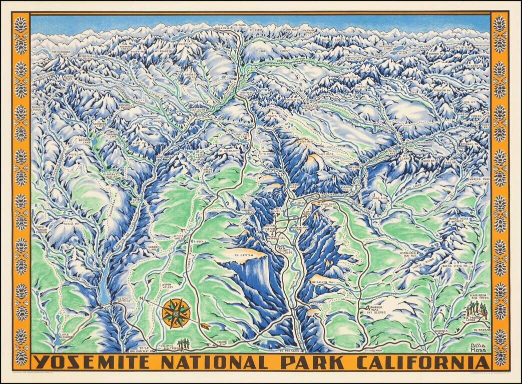
Fine example of the Della Hoss view of Yosemite National Park, published for the Yosemite Park and Curry Co. in 1955. The map provides a fine caricature view of Yosemite, locating many of its major attractions and a few not so famous, such as the...
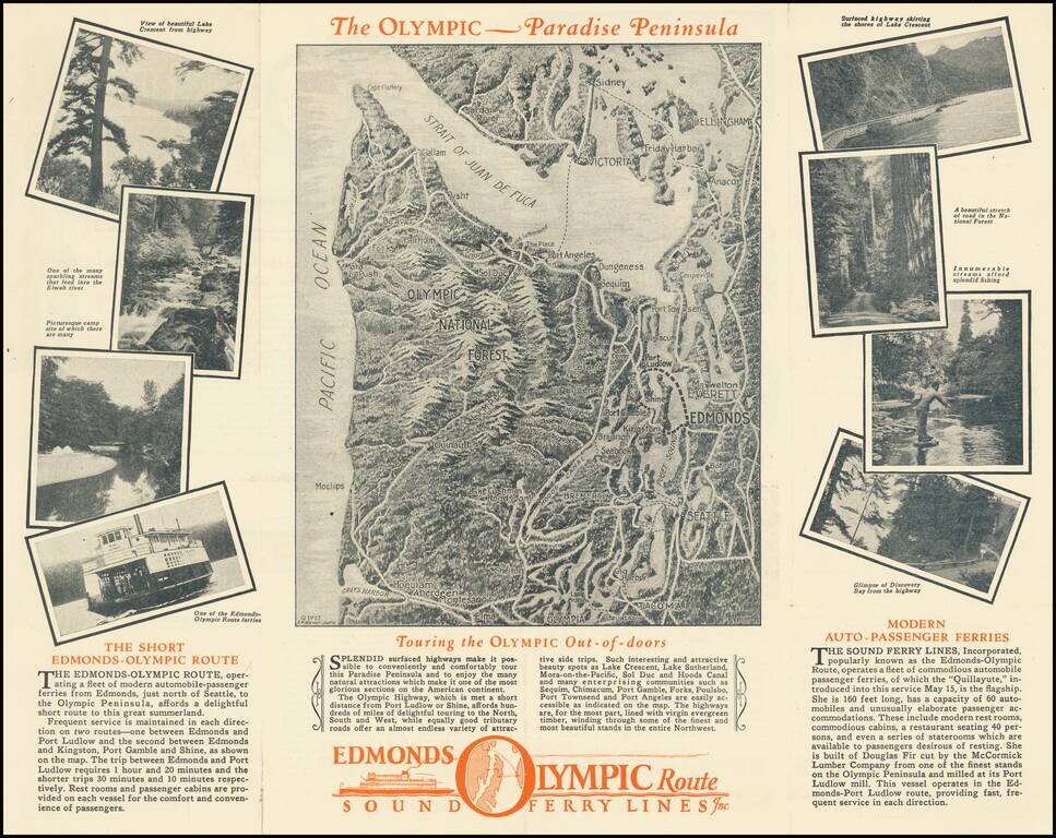
Promoting A Short Lived Puget Sound Ferry Line Interesting pictorial map and illustrated travel brochure, promoting the Edmonds Olympic Route - Sound Ferry Lines Inc. The main map image shows a monochromatic view of the Straits of Juan de Fuca and...
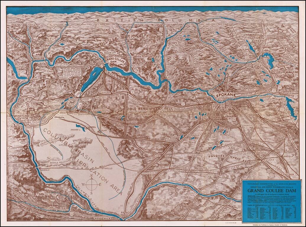
The Beginning of Construction at Coulee Dam Detailed birdseye view style map of the region bounded by Banff, Pullman Washington and the Pacific Ocean, centered on Lake Roosevelt and Grand Coulee Dam. The map is marvelous graphical depiction of the...
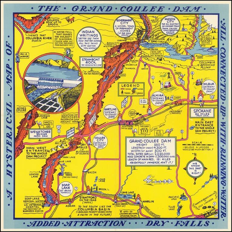
Second of two whimsical maps of Grand Coulee Dam, published by the Lindgren Brothers, "Drawn In Broken English by Jolly Lindgren," this comic pictorial map is full of puns and comic vignettes related to Grand Coulee Dam. The Lindgren Brothers issued a...
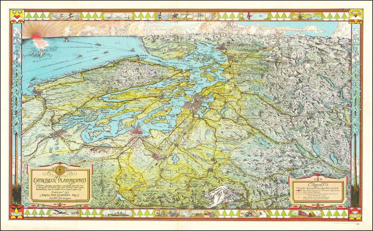
Fine large pictorial map of Puget Sound and the Northwestern Part of Washington State. The Evergreen Playground map was originally drawn during the Great Depression by Ed Poland, cartographer of many years at Kroll Map Company in Seattle, and changed...
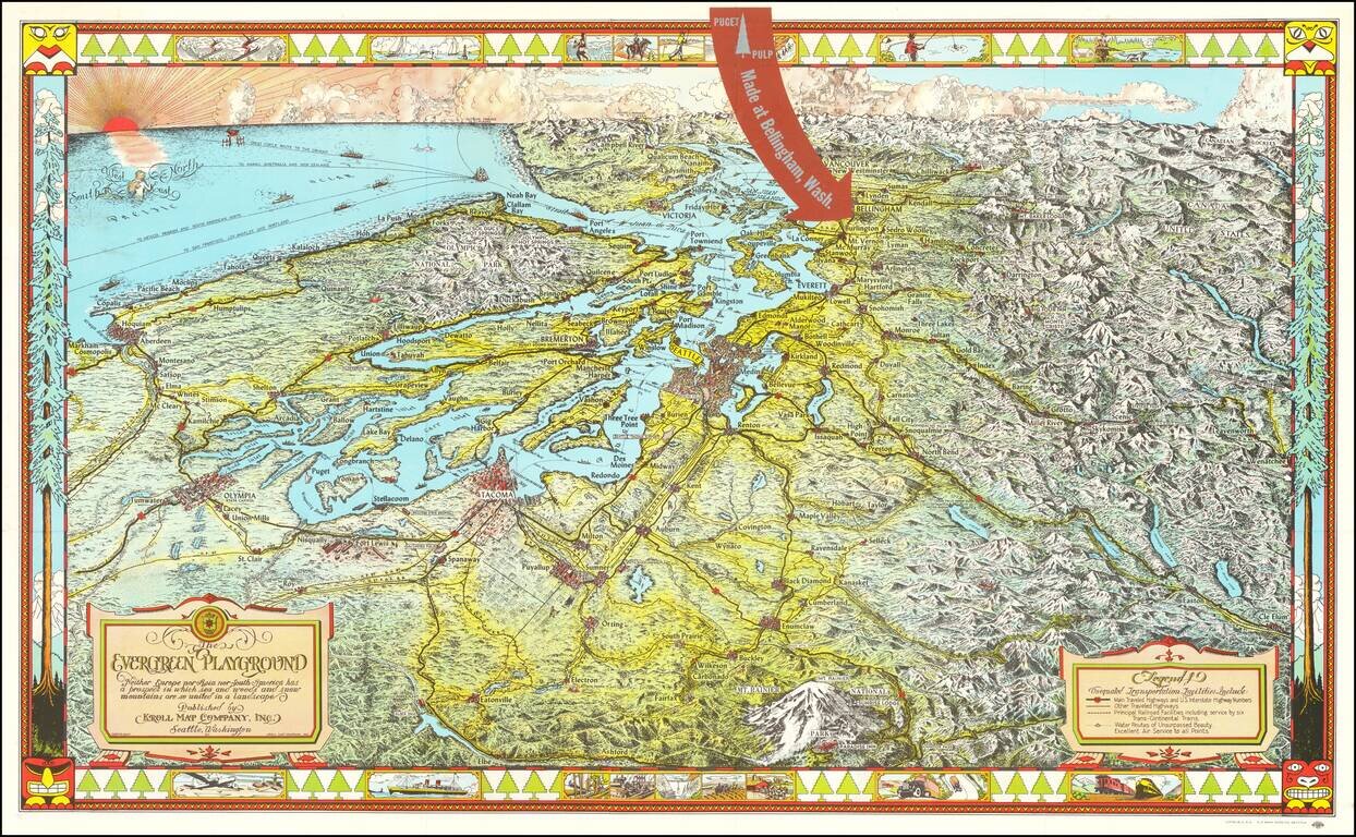
Fine large pictorial map of Puget Sound and the Northwestern Part of Washington State, which was included with a book on the history of paper pulp entitled Making Puget Pulp--A Pictorial Tour of Puget Sound Pulp & Timber's Plant At Bellingham,...
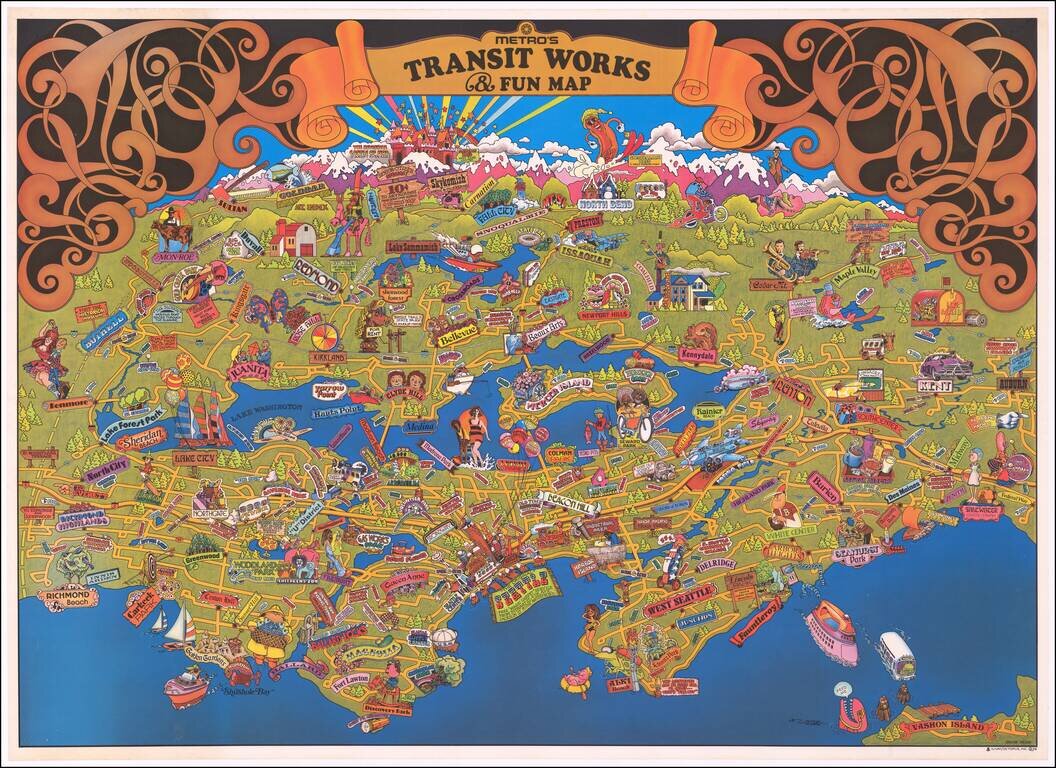
Fine large format pictorial map of the Seattle area, published by the Municipality of Metropolitan Seattle. A lively pictorial map of the Seattle area. We note the David Rumsey copy, but otherwise, the map is apparently very rare, having not been...
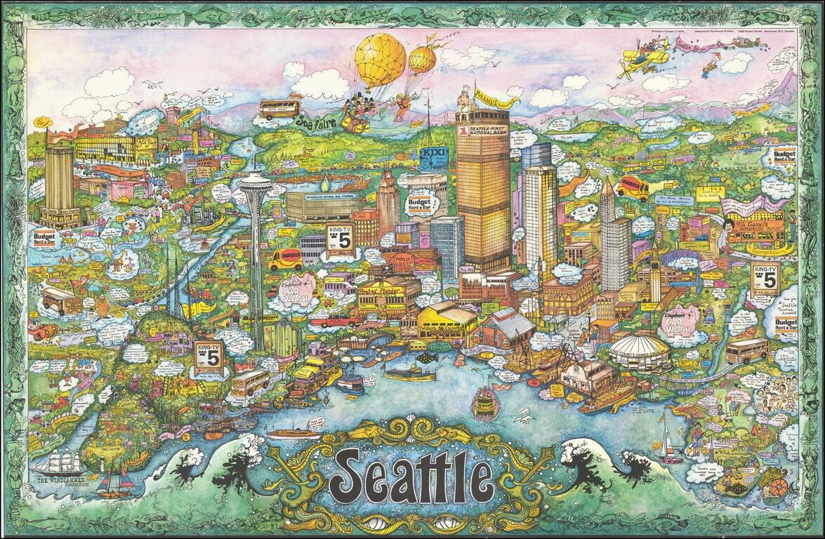
Rare whimsical pictorial view of Seattle, Washington, designed by Penthouse Studios in Vancouver and signed by artist "Robbie." A magnificent tour de force of pictographic detail. Signed only "Robbie," we are relatively certain that the artist is...
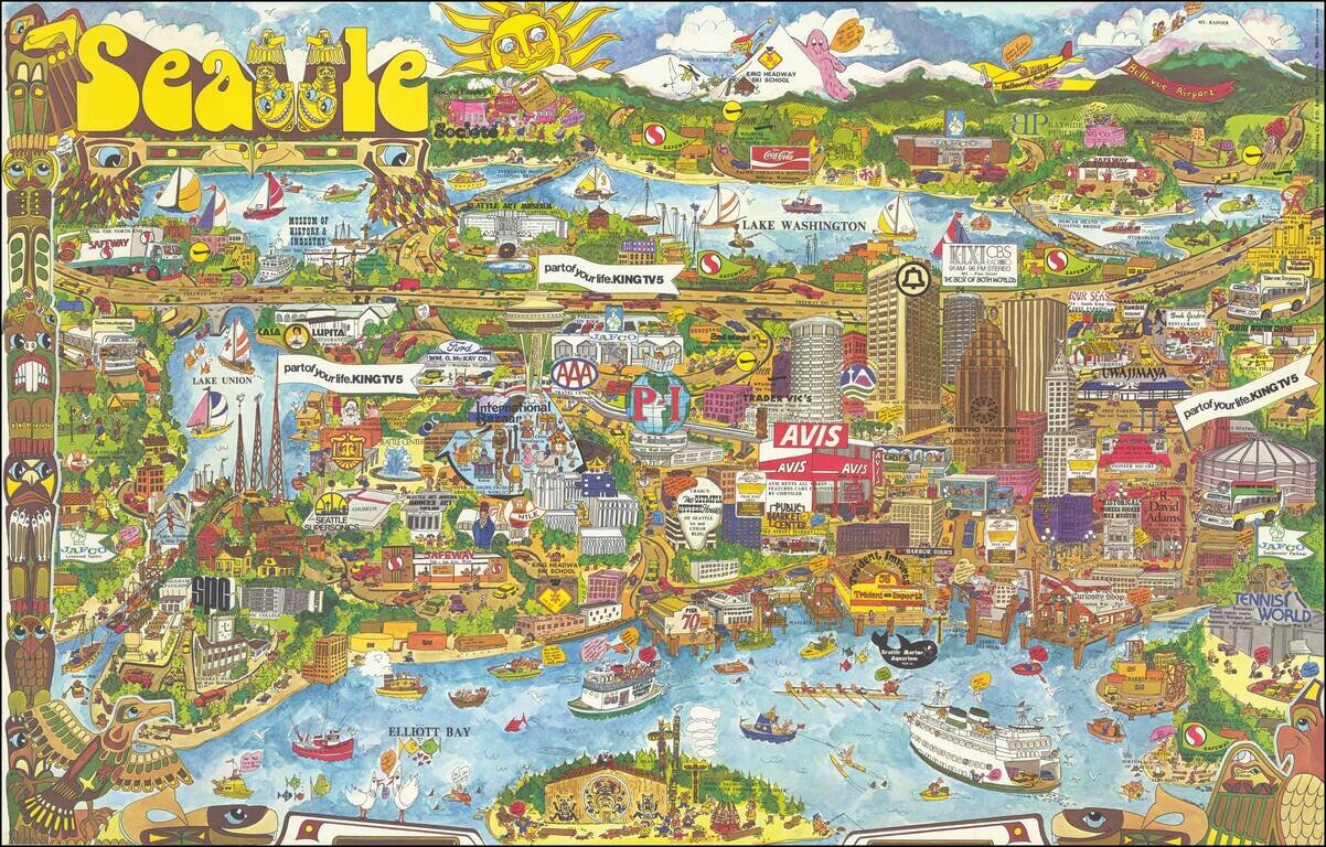
Decorative vintage pictorial map of Seattle, drawn by Roy Bishop and published by Bayside Publishing Company. The map is filled with promotional and advertising graphics, along with landmarks and whimsical images. We locate no other examples of this...
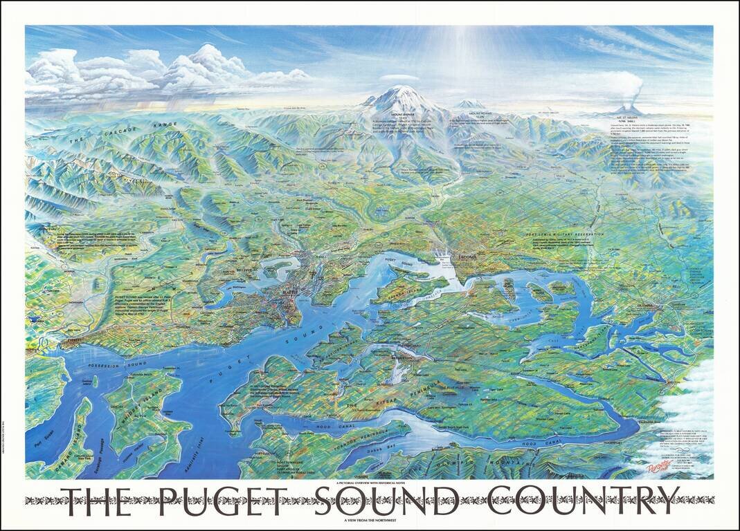
Attractive vintage bird's eye view poster of Puget Sound, showing Seattle, Mount Rainier, the eastern shores of the Olympic Peninsula, etc. The map was published in Seattle in 1981. Interestingly, the view includes a note about Mount St. Helens which...
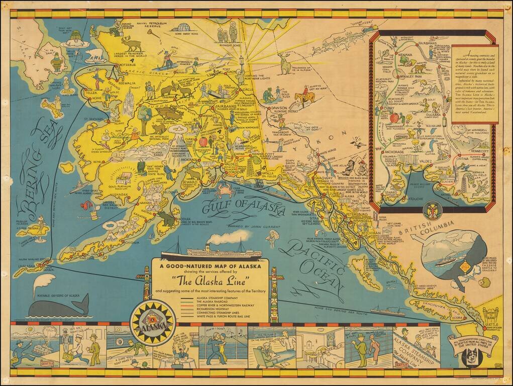
Nice example of the first edition of this decorative pictorial map of Alaska, first drawn by Edward Camy for the Alaska Steamship Company in 1934. A fine pictographic map of Alaska, with a large inset of the Alaska Railways Route from Seward to...
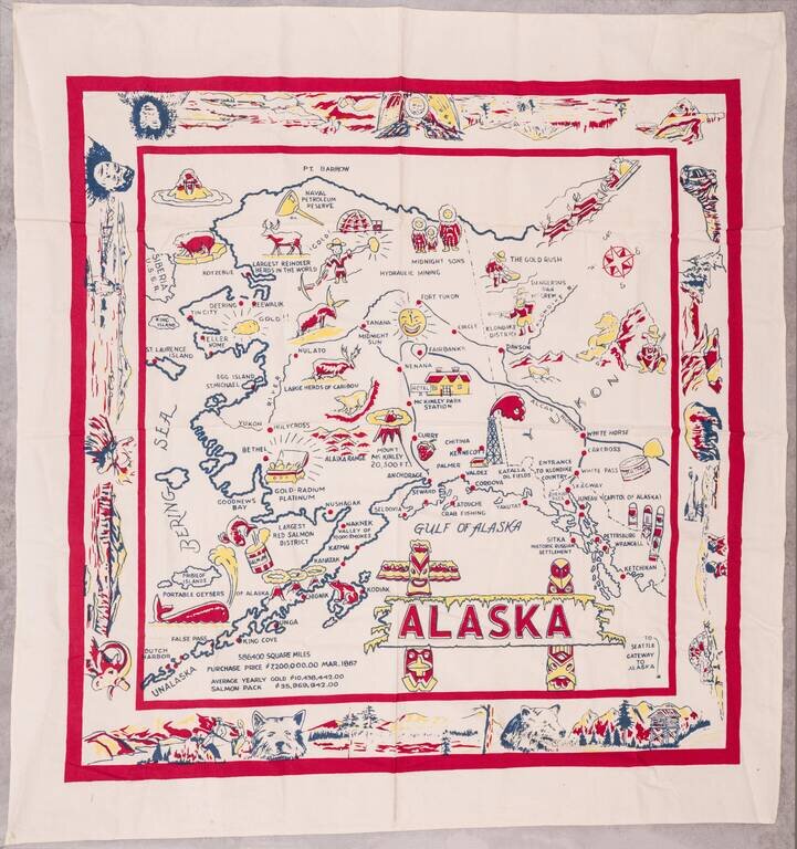
Large vintage pictorial map of Alaska printed on linen. The map is surrounded by a large decorative border featuring native Alaskans, landscapes, and wildlife. The map is not without humor; it describes whales as "portable geysers of Alaska". The...