logo

1950. Pictorial Map of Mexico

  • Pictorial Map of Mexico

Map size in jpg-format: 30.3409MiB

Download "Pictorial Map of Mexico", in high resolution.

Pictorial Map of Mexico information:

Year of creation: 
Resolution size (pixels): 
 12780x8111 px
Disk Size: 
 30.3409MiB
Number of pages: 
 1
Place: 
 Mexico, D.F.

Print information. Print size (Width x height in inches):
Printing at 72 dpi 
  177.5 х 112.65
Printing at 150 dpi 
 85.2 х 54.07
Printing at 300 dpi 
 42.6 х 27.04

An example of detailing the file of this map of in a printable high-resolution:

Click to open in high resolution (open in new tab).
Attention! this is just the central piece (central area 960x960 px) of the map file!
This is an example, so that you can see and study the level of detail of a given map. The entire Map will be fully available after payment!

Pictorial Map of Mexico

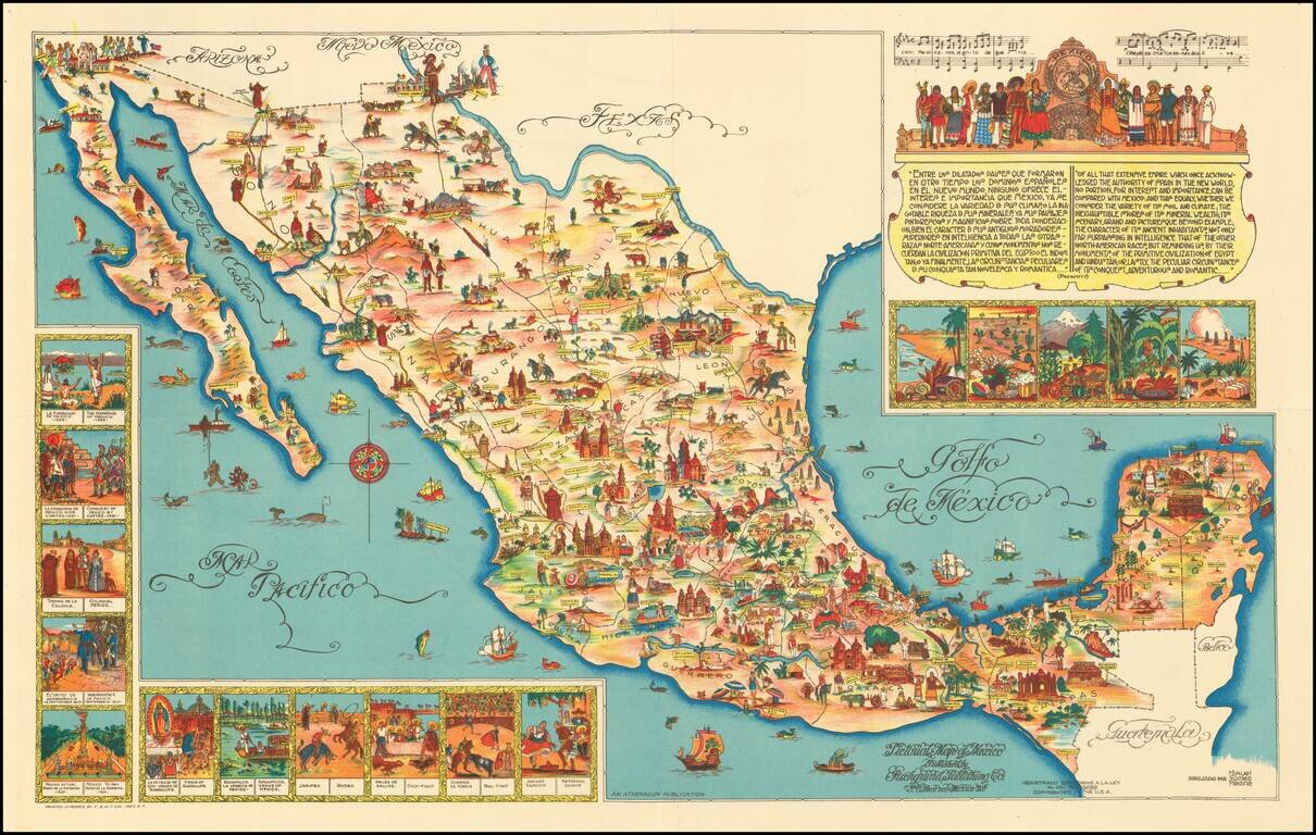
Rare large format version of this decorative map of Mexico, published in Mexico City.

The map is one of the liveliest and most interesting maps of Mexico published in this pictographic style, with vivid colors and fantastic images.


Special conditions for students!

If you are a student, write to us in telegram: @antiquemaps and indicate what material you need and for what work you need a map in high detail. We are ready to provide material on special terms. For students only!

Item information:

Year of creation:
Size:
12780x8111 px
Disk:
30.3409MiB
Number of pages:
1
Place:
Mexico, D.F.
Author:
Fischgrund Publishing Company.
$14.99

Related item