Map size in jpg-format: 90.4511MiB
Click to open in high resolution (open in new tab).
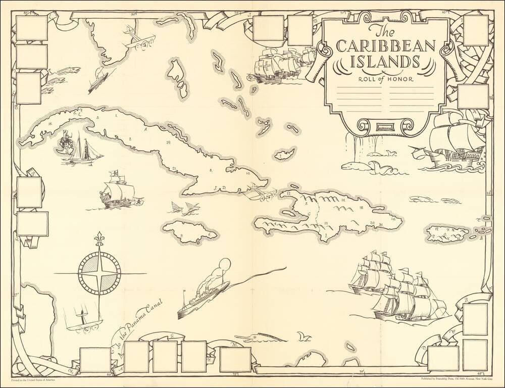
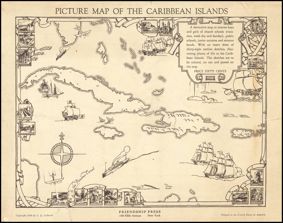
A Missionary Educational Map of the Caribbean for Children
Fine large format map of the Caribbean, intended as an educational tool for church school children, published by the Friendship Press of New York City.
The artist, Dr. Gilbert Q. LeSourd, would later serve as Associate Secretary of the Missionary Education Movement. It was likely created to illustrate Children of Sea and Sun; a course on the Caribbean islands for primary boys and girls by Mabel Garrett Wagner, which was also published by the Friendship Press in 1930 (Copyright #12675), with G.Q. LeSourd named in the copyright.
The large map is essentially a blank template for illustration by students. The smaller title map includes additional details, including inset vignettes of:
The map notes that it is:
A decorative map to interest boys and girls of church schools (vacation, week-day and Sunday), public schools, junior societies and mission bands. With an insert sheet of thirty-eight outline sketches, illustrating phases of life in the Caribbean Islands. The sketches are to be colored, cut out and pasted on the map. Price Fifty Cents.
The Friendship Press was an Missionary organization which operated in the first half of the 20th Century.
Rarity
The map would appear to be unrecorded.
If you are a student, write to us in telegram: @antiquemaps and indicate what material you need and for what work you need a map in high detail. We are ready to provide material on special terms. For students only!


![[Wall Map] West-Indische Paskaert waer in de graden der breedde over weder zyden vande middelyn wassende so vergrooten dat die geproportioneert syn tegen hunne nevenstaende graden de lengde.](/map/small/60169.jpg)