logo

1955. Pictorial Map of the Republic of Panama and the Canal Zone

  • Pictorial Map of the Republic of Panama and the Canal Zone
  • Pictorial Map of the Republic of Panama and the Canal Zone

Pictorial Map of the Republic of Panama and the Canal Zone information:

Year of creation: 
Resolution size (pixels): 
 14291x9617 px
Disk Size: 
 48.5415MiB
Number of pages: 
 2
Place: 
 n.p.

Print information. Print size (Width x height in inches):
Printing at 72 dpi 
  198.49 х 133.57
Printing at 150 dpi 
 95.27 х 64.11
Printing at 300 dpi 
 47.64 х 32.06

An example of detailing the file of this map of in a printable high-resolution:

Click to open in high resolution (open in new tab).
Attention! this is just the central piece (central area 960x960 px) of the map file!
This is an example, so that you can see and study the level of detail of a given map. The entire Map will be fully available after payment!

Pictorial Map of the Republic of Panama and the Canal Zone

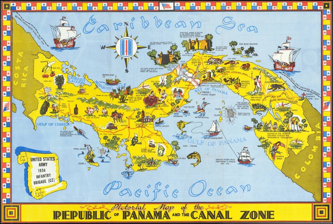
Striking pictorial map of Panama and the Canal Zone.

Rich coloring, striking flag border and rich illustrations.

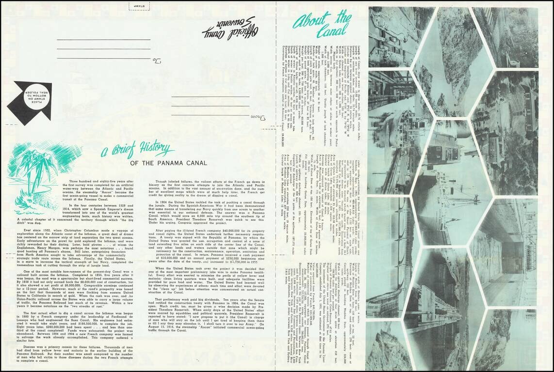
Includes a history of Panama and facts about the Canal on the verso, along with photos.

Rarity

We find a single example on line (California State Archives -- Adrien and Jean Bouché collection on Panama)


Special conditions for students!

If you are a student, write to us in telegram: @antiquemaps and indicate what material you need and for what work you need a map in high detail. We are ready to provide material on special terms. For students only!

Item information:

Year of creation:
Size:
14291x9617 px
Disk:
48.5415MiB
Number of pages:
2
Place:
n.p.
Author:
United States Army 193rd Infantry Brigade.
$14.99

Related item