logo

1950. Mexique

  • Mexique

Map size in jpg-format: 8.93049MiB

Download "Mexique", in high resolution.

Mexique information:

Year of creation: 
Resolution size (pixels): 
 6980x5520 px
Disk Size: 
 8.93049MiB
Number of pages: 
 1
Place: 
 Paris

Print information. Print size (Width x height in inches):
Printing at 72 dpi 
  96.94 х 76.67
Printing at 150 dpi 
 46.53 х 36.8
Printing at 300 dpi 
 23.27 х 18.4

An example of detailing the file of this map of in a printable high-resolution:

Click to open in high resolution (open in new tab).
Attention! this is just the central piece (central area 960x960 px) of the map file!
This is an example, so that you can see and study the level of detail of a given map. The entire Map will be fully available after payment!

Mexique

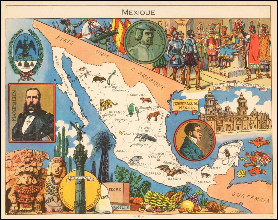
Decorative pictorial map of Mexico, published by Children's book illustrator JP Pinchon.

The map was used to educate primary school children in France in the first half of the 20th Century.


Special conditions for students!

If you are a student, write to us in telegram: @antiquemaps and indicate what material you need and for what work you need a map in high detail. We are ready to provide material on special terms. For students only!

Item information:

Year of creation:
Size:
6980x5520 px
Disk:
8.93049MiB
Number of pages:
1
Place:
Paris
Author:
Joseph Porphyre Pinchon.
$14.99

Related item