
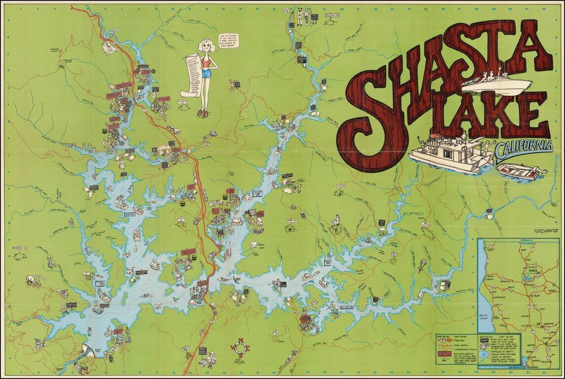
Colorful Recreational Map of Lake Shasta Detailed pictorial map of the area around Lake Shasta, California, published in 1983. The lake is filled with houseboats, motor boats, water skiers and sail boats. The map locates a number of islands, inlets...
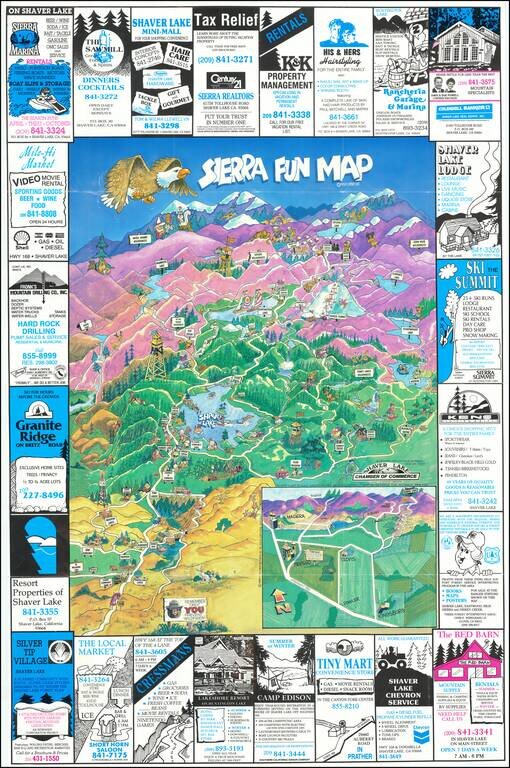
Lively pictorial map of the area centered on Shaver Lake. Attractions include Sierra Summit Ski Resort, John Muir Wilderness, Edison Lake, Ansel Adams Wilderness, Mammoth Lake, Huntington Lake, etc. The map is surrounded by local advertising. On the...
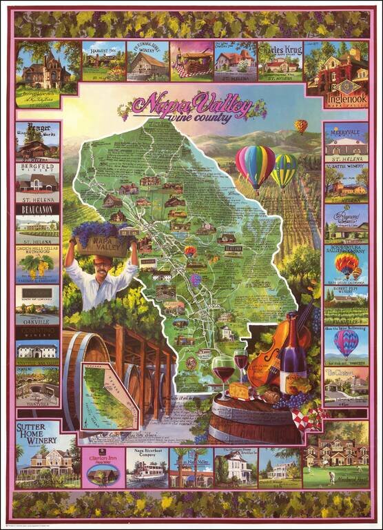
Decorative map of Napa Valley, focused on the locations of the major Wine producers and landmarks in the Valley. The map is surrounded by vignettes alternatively showing Valley landmarks and Wine producers.
![[Northern California] North Bay Horse Country](/map/small/62940.jpg)
Detailed promotional map of Northern California, advertising the horse riding facilities in the region. The map extends from Stockton and the South Bay to Clear Lake and Lake Sonoma, with illustrated advertising for riding schools, stables, hotels,...
![[Rare Variant] Disneyland 40 Years of Adventure](/map/small/65639.jpg)
The Rare First State of the 1995 Map Finely illustrated map of the Magic Kingdom, celebrating its 40th anniversary. This is one of two nearly identical maps from 1995. The difference between the two maps relate to various errors, which were...
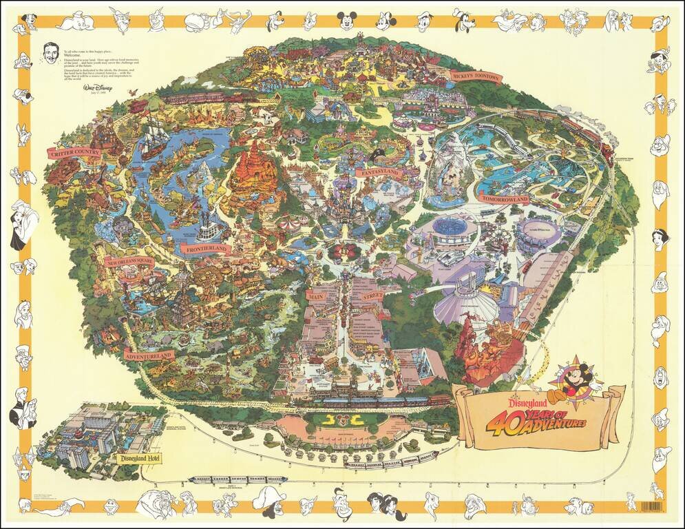
Second State of the 1995 Map Finely illustrated map of the Magic Kingdom, celebrating its 40th anniversary. This is one of two nearly identical maps from 1995. The difference between the two maps relate to various errors, which were discovered after...
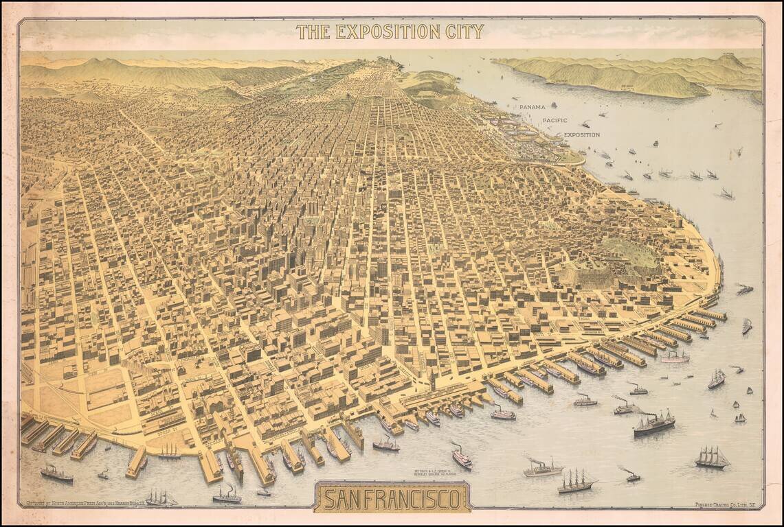
Important Early 20th Century View of San Francisco -- Antique Map Promoting the Site of the Future Panama Pacific Exposition Rare Birdseye View of San Francisco, "The Exposition City," copyrighted by North American Press Ass'n 1912 Hearst Bldg. S.F.,...
![[Hand Drawn Map By The Father of Modern Space Art] A Plan For The East Bay Prepared by Chesley Bonestell for the Purpose of Creating Interest in the Solution of that Problem. 1945.](/map/small/68505.jpg)
Waterfront Improvement Plan of the East Bay Drawn By The Father of Modern Space Art Hand drawn map illustrating a shoreline improvement plan of the East Bay, centered Berkeley, drawn by renowned American space and science fiction illustrator Chesley...
![[San Francisco] A cartograph of Treasure Island in San Francisco Bay Golden Gate International Exposition](/map/small/70375.jpg)
Fine example of Ruth Taylor White's large format map of Treasure Island and the San Francisco Golden Gate Exposition Fairgrounds, published in 1939. The map provides an aerial panorama of the exposition grounds, with a portion of San Francisco in the...
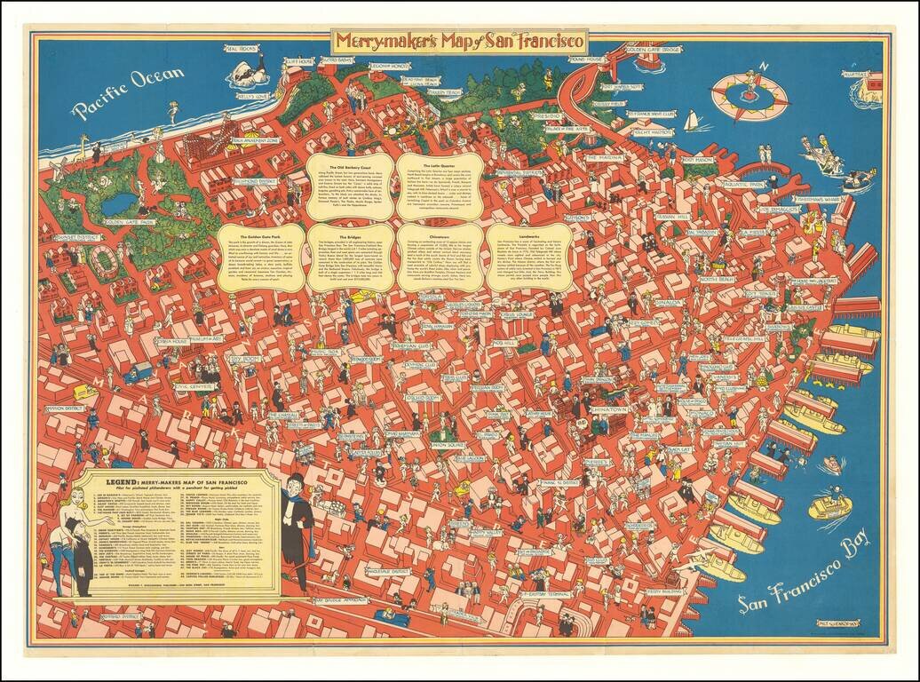
A Pilot for Pixilated Philanderers with a Penchant for Getting Pickled Scarce map of San Francisco, intended for tourists, sailors and other revelers. The map includes a guide noting Restaurants (including Joe Di Maggios), Foreign Atmosphere...
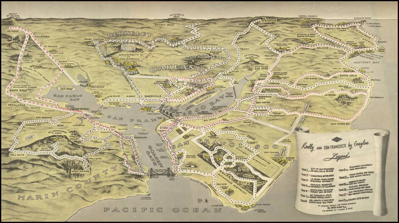
Birdseye view style map of the Bay Area, publisehd by the Gray LIne. The map illustrates 13 Gray Line sightseeking tours around the Bay area, extending out to Napa Valley, Mt. Diablo, Yosemite, Monterey, Carmel by the Sea, Half Moon Bay and the Muir...
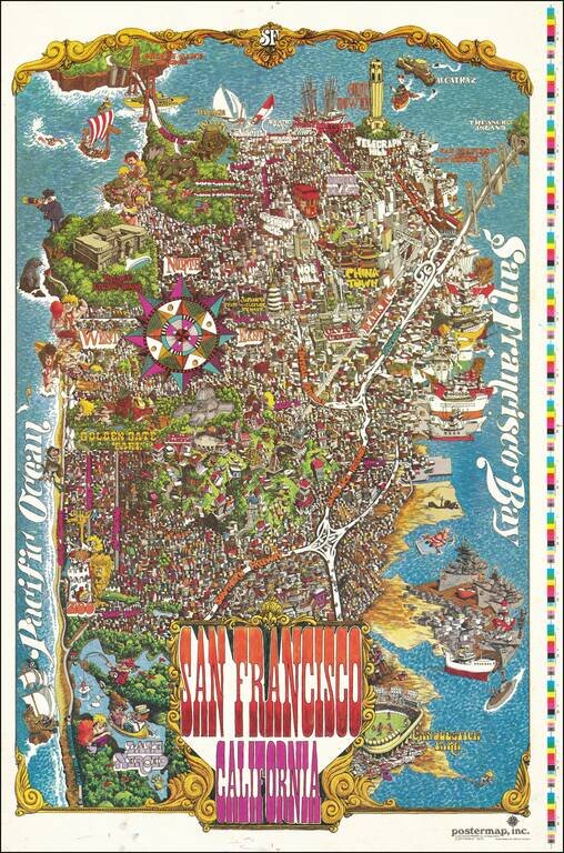
Decorative vintage pictorial map of San Francisco, published by Funny Funny World. The map shows the city in an absolute hustle and bustle; a game is being plaid at Candlestick Park, ships are lined up all along the waterfront, certain important...
![샌프란시스코 항구. 극동이 시작되는 곳 [Port of San Francisco. Where the Far East Begins]](/map/small/69449.jpg)
Rare Korean Language Edition! Striking example of this interesting Korean language promotional map of San Francisco, published in 1984. Published by the Port of San Francisco to promote Trans-Pacific Trade, the map provides a fascinating distortion...
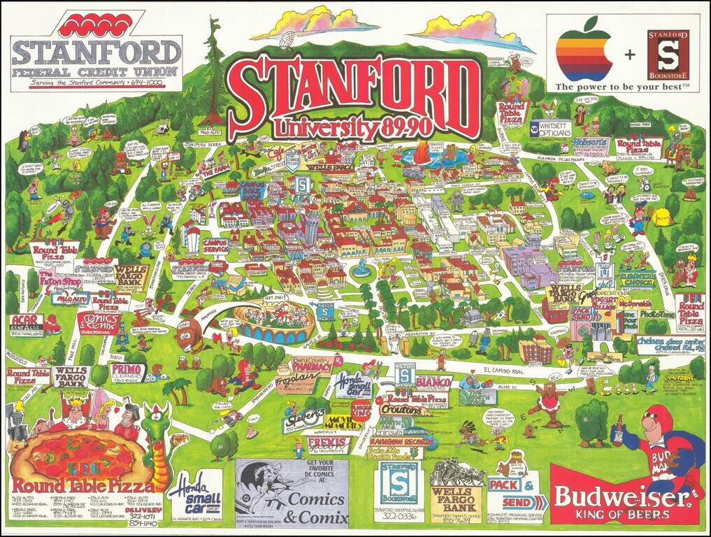
Rare separately issued vintage pictorial map of Stanford University and the surrounding areas of Palo Alto, California. Most of the major buildings of the Stanford campus are labeled. Businesses that paid the publisher have their signs and contact...
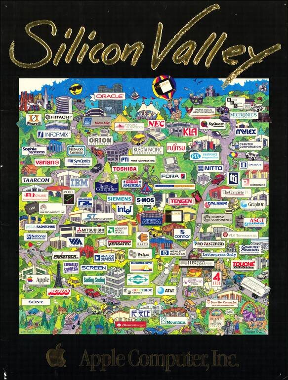
Apple's Perspective on the Silicon Valley of 1990 This wonderful pictorial map depicts the corridor running south from San Francisco to San Jose, though with no attempt at a consistent scale. The emphasis is almost entirely on the ecosystem of the...
![[Catalina / Avalon] The Island for Rest and the Sport You Love Best](/map/small/70008.jpg)
Striking pictorial view of Avalon Bay, promoting the Wilmington Transportation Company's excursions to Catalina. The view provides a fine overview of the Avalon Area, including the residence of William Wrigley Jr. on the hillside at the left and the...