Map size in jpg-format: 50.0852MiB
Click to open in high resolution (open in new tab).
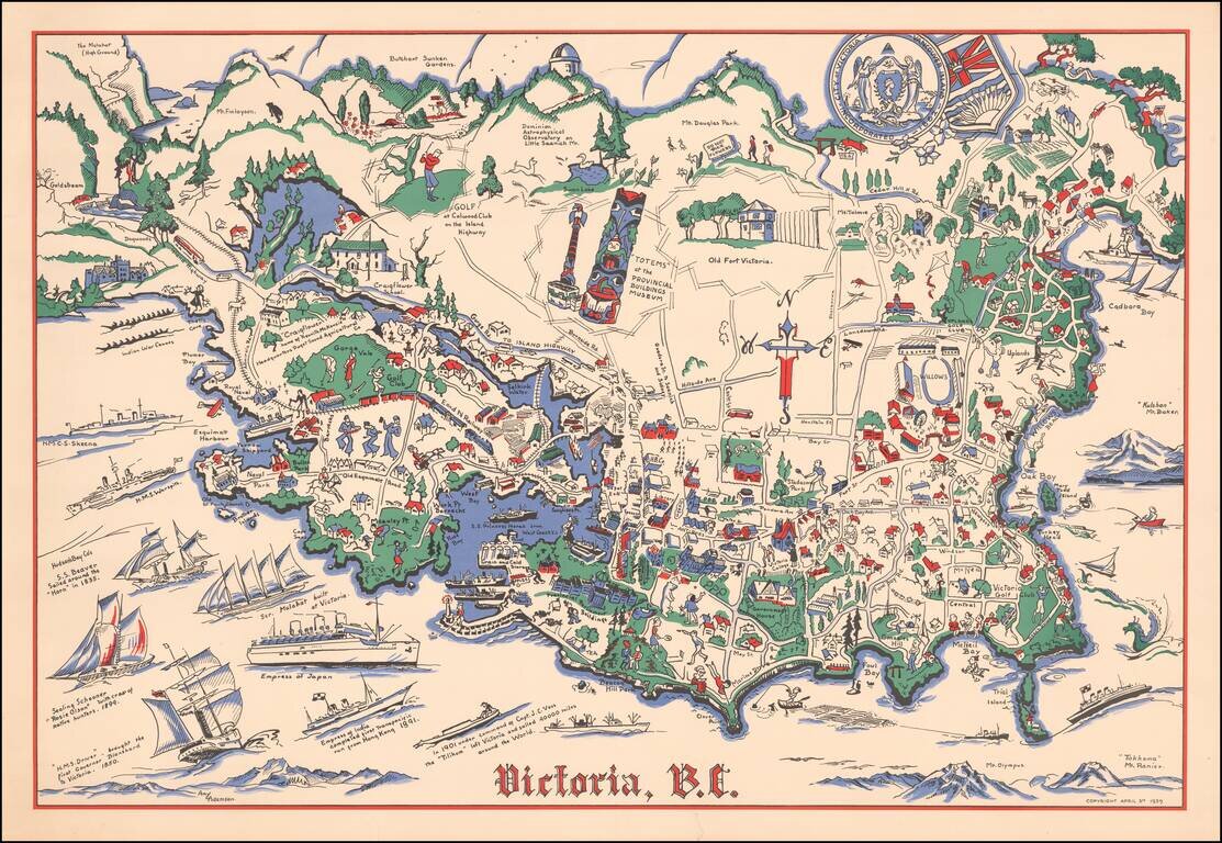
Rare pictorial map of Victoria, British Columbia, drawn by Amy Adamson.
The map shows major buildings, railways, towns, major roads, landmarks, rivers, forests, recreational sites and activities. The compass is created from Cross, oriented north to the upper margin.
Includes numerous illustrations of historical vessels in the ocean and a seal of the City of Victoria and Vancouver Island with coat of arms in upper right.
If you are a student, write to us in telegram: @antiquemaps and indicate what material you need and for what work you need a map in high detail. We are ready to provide material on special terms. For students only!
![[Signed Political Satire Artwork] Vietnam ... Vietnam ... Vietnam ...](/map/small/68726.jpg)

