Rare and antique old maps of the Caribbean & Central_America
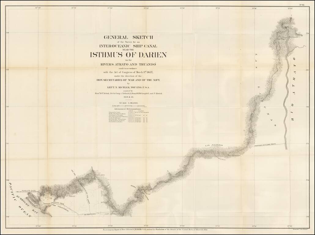
The Canal Survey of Napoleon Garella Scarce map of the Isthmus of Panama, illustrating a proposed Canal from the Atlantic to the Pacific Ocean, prepared to illustrate the Report of Rear Admiral Charles Henry Davis. Map shows towns, roads, physical...
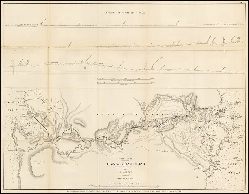
Detailed map of the proposed route of the Panama Railroad, from Manzanilla Island to Panama City, as surveyed by G.W. Hughes in 1849. The map also identifies the route examined by Garella in 1844 and a profile view above. At the outset of the...
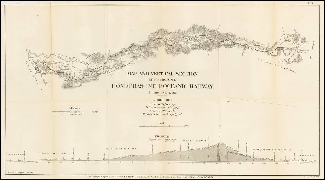
Detailed map of a portion of Honduras, showing the prospective route of a rail line from the Atlantic to the Pacific Ocean. The line extends from the Bay of Fonseca to the Bay of Honduras, showing: The located line (231 miles) with a black line...
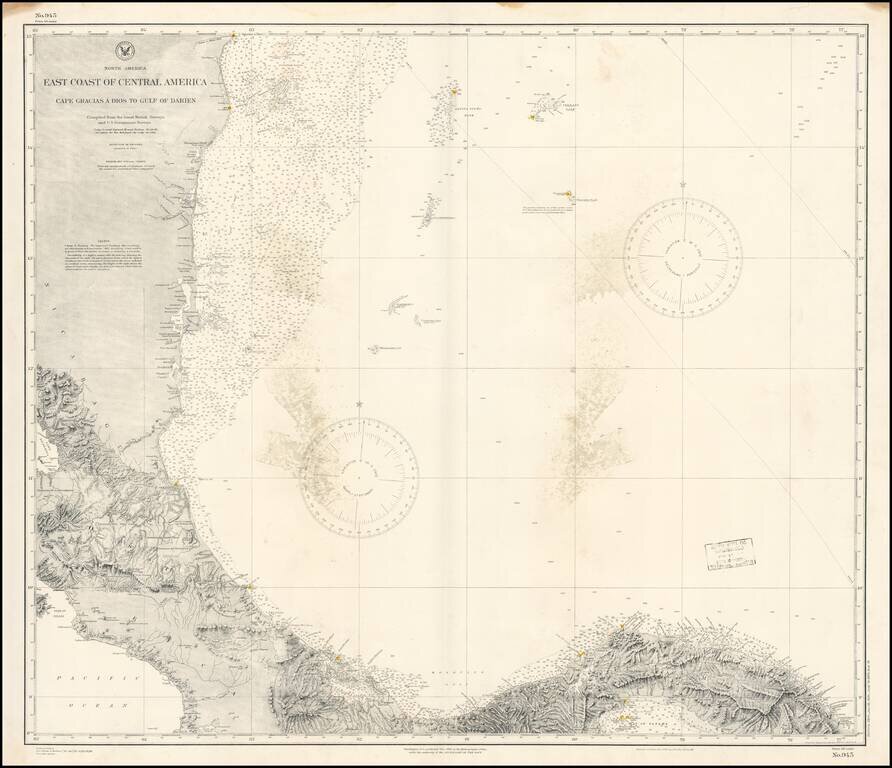
Detailed chart of the Mediterranean Coast of Panama, Costa Rica and Honduras, published by the US Coast & Geodetic Survey. The chart provides a highly detailed coastal treatment of the region, along with the offshore islands, soundings, sailing...
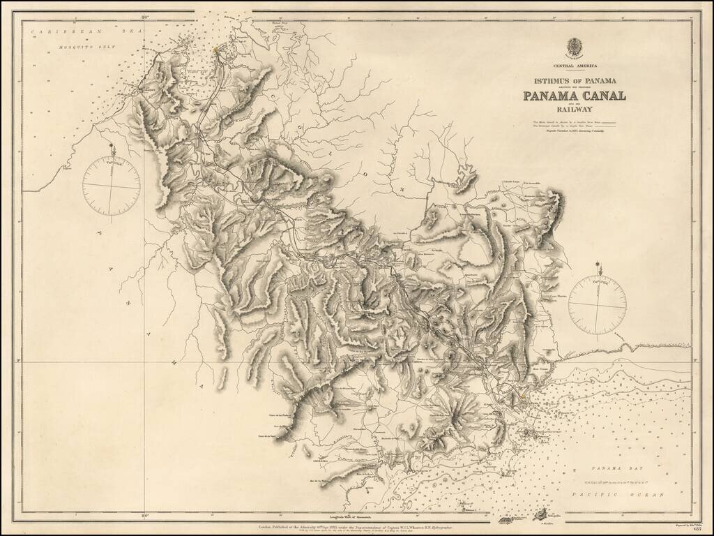
Highly detailed map of the Isthums of Panama, published by the British Admiralty. Extending from Mosquito Bay in the Caribbean Sea to Panama Bay in the Pacific, the map provides a remarkable topographical treatment of the region. This British Admiralty...
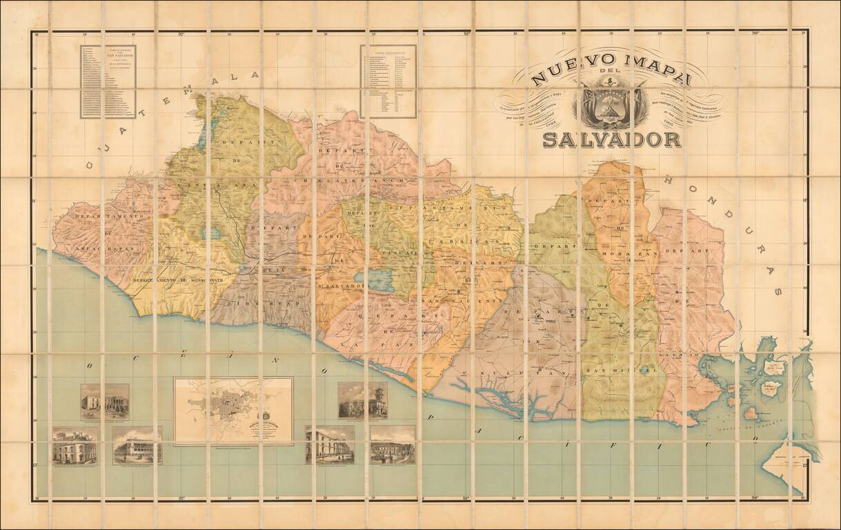
"Published under the auspices of the Supreme Government." Rare early map of El Salvador, published in 1905, based upon work undertaken by Santiago I Barberena and Jose E. Alcaine, between 1892 and 1905. This is apparently the first edition of the...
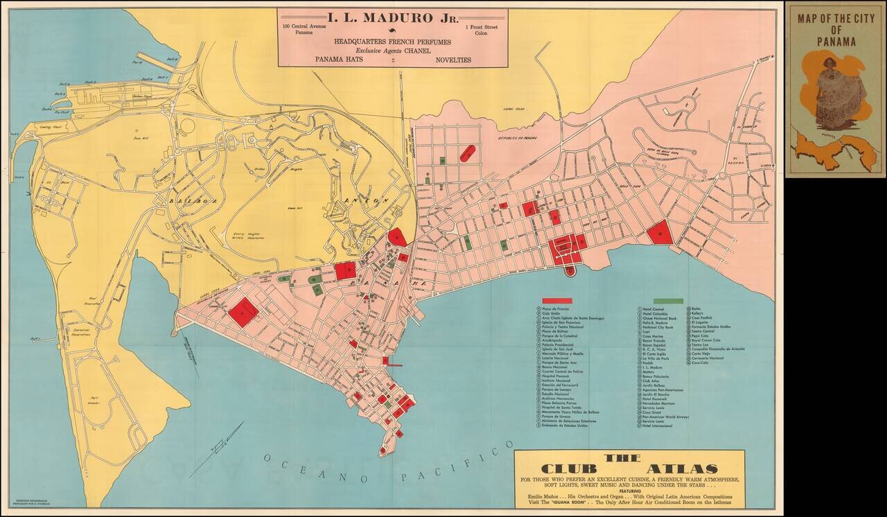
Rare early map of Panama City, published in Panama. The map was prepared as a promotional map for I.L. Maduro Jr. and Club Atlas. Includes a key locating 40 locations.
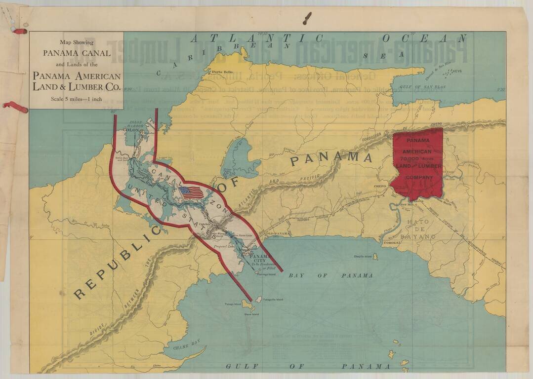
Fine promotional map of Panama, created to illustrate the lands of the Panama American Land and Lumber Company, with a map of the world on the verso. Affixed to the map is type written document. The Panama American Land and Lumber Company was formed to...
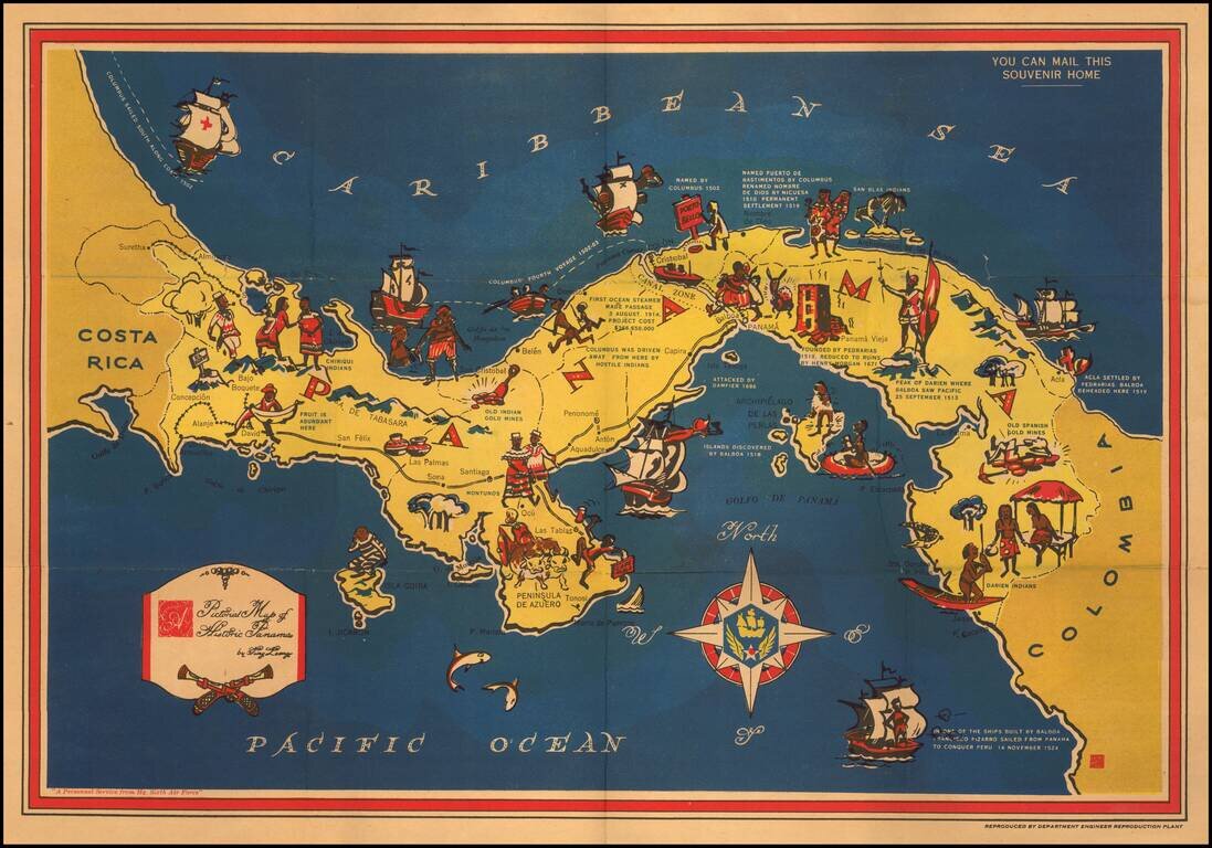
Decorative pictorial map of Panama, published by the Panama Mobile Force and Security Command. A striking map of Panama with historical notes and pictographs of people and events. At the bottom left, the note "A Personnel Service from Hq. Sixth Air...
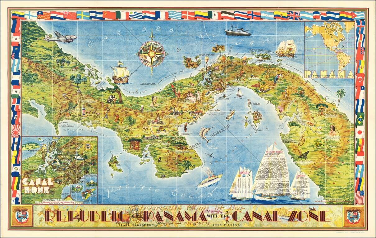
Striking large decorative map of Panama. Includes two insets: "Canal Zone and Vicinity" and "Panama The Crossroads of the World". Rich coloring, striking flag border, a particularly sophisticated example of a pictorial map. "'With a partner in the...
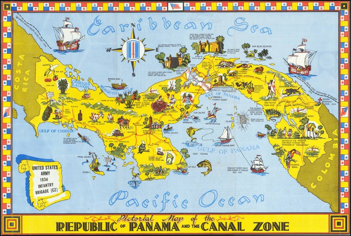
Striking pictorial map of Panama and the Canal Zone. Rich coloring, striking flag border and rich illustrations. Includes a history of Panama and facts about the Canal on the verso, along with photos. Rarity We find a single example on line...
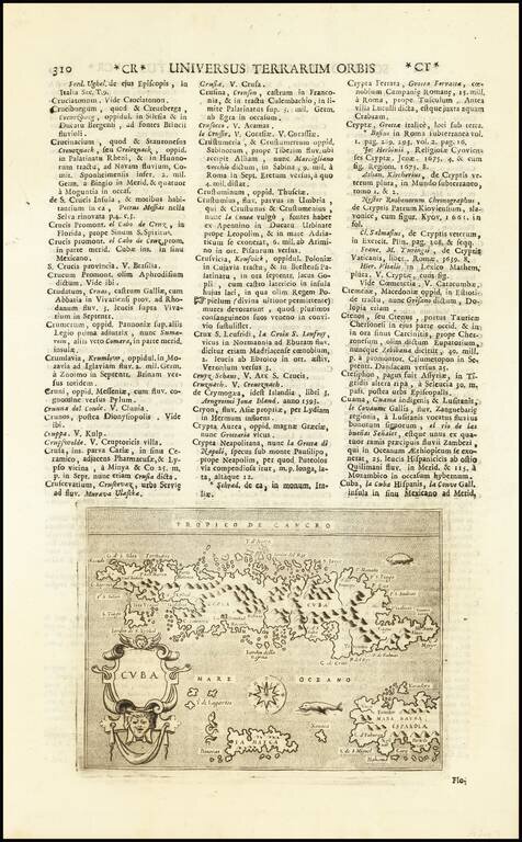
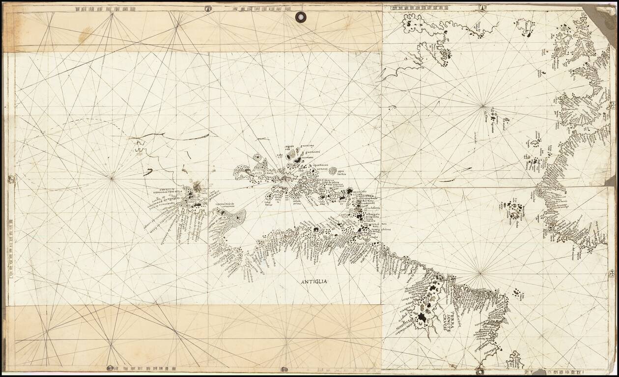
Interesting late example of Porcacchi's map of Cuba. One of the earliest obtainable maps of Cuba and one of the few published in the 16th Century. Also shows Jamaica and part of Hispaniola. Excellent topographical detail, if a bit conjectural, and...
![[Includes Havana Harbor] Paskaert vande Noord Cust van Cuba Streckende van Bahia de Matancas to Bahia Honda. Beschreven door Roggeveen . . .](/map/small/63760.jpg)
Rare English Edition - North Coast of Cuba Jacob Robyn's edition of this early chart of the north coast of Cuba, first published by Arent Roggeveen, from his Het Brandende Veen, oriented with south at the top of the map. The chart oriented with...
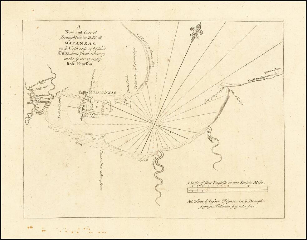
Highly detailed plan of the Bay of Matanzas on the Island of Cuba, from the English Pilot, Fourth Book, published by Mount & Page. This detailed plan includes the location of Plantations Houses, Rivers, a bridge, soundings, anchorages and other...
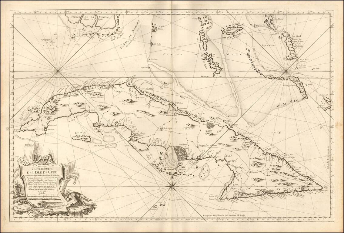
Fine Large Format Chart of Cuba By France's Royal Hydrographer Superb, large sea chart covering all of Cuba with the Florida Keys and the southern Bahamas from Bimini eastward, published in Paris for the Depot de la Marine, by Jacques Nicolas...
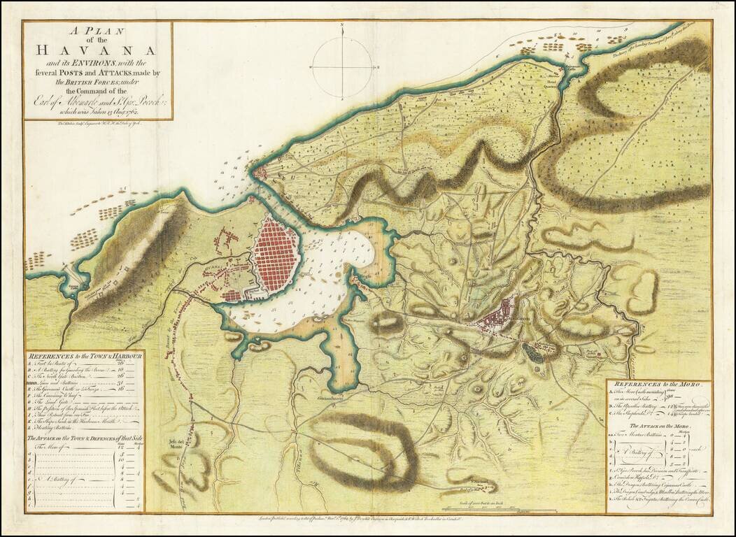
Perhaps the First Separate Map of the 1762 Siege of Havana. Extremely rare separately issued map of showing the British Siege of Havana, at the tail end of the French & Indian War. This map, published November 1, 1762, by John Boydell and R....