Rare and antique old maps of the Caribbean & Central_America
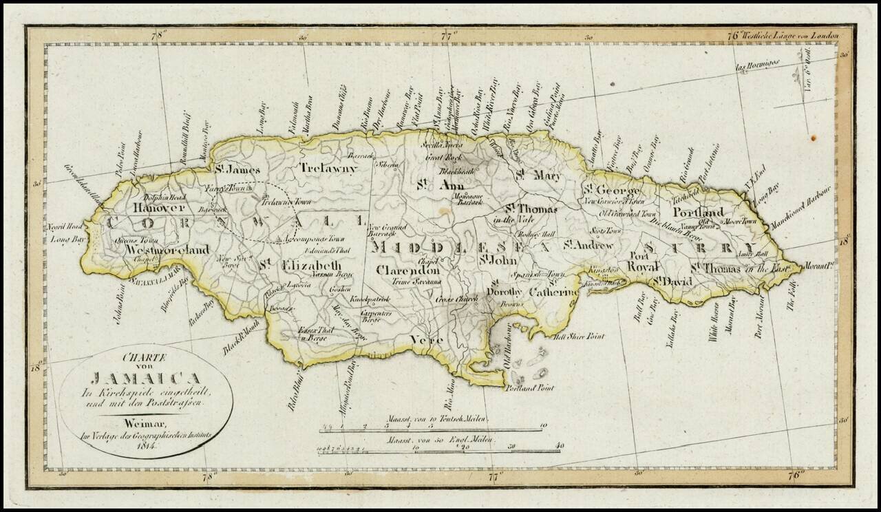
Detailed map of Jamaica, colored by Parishes. Shows Postal Roads, churches, towns, harbors, rivers, mountains and many other details. One of the earliest obtainable maps of Jamaica to locate postal roads.
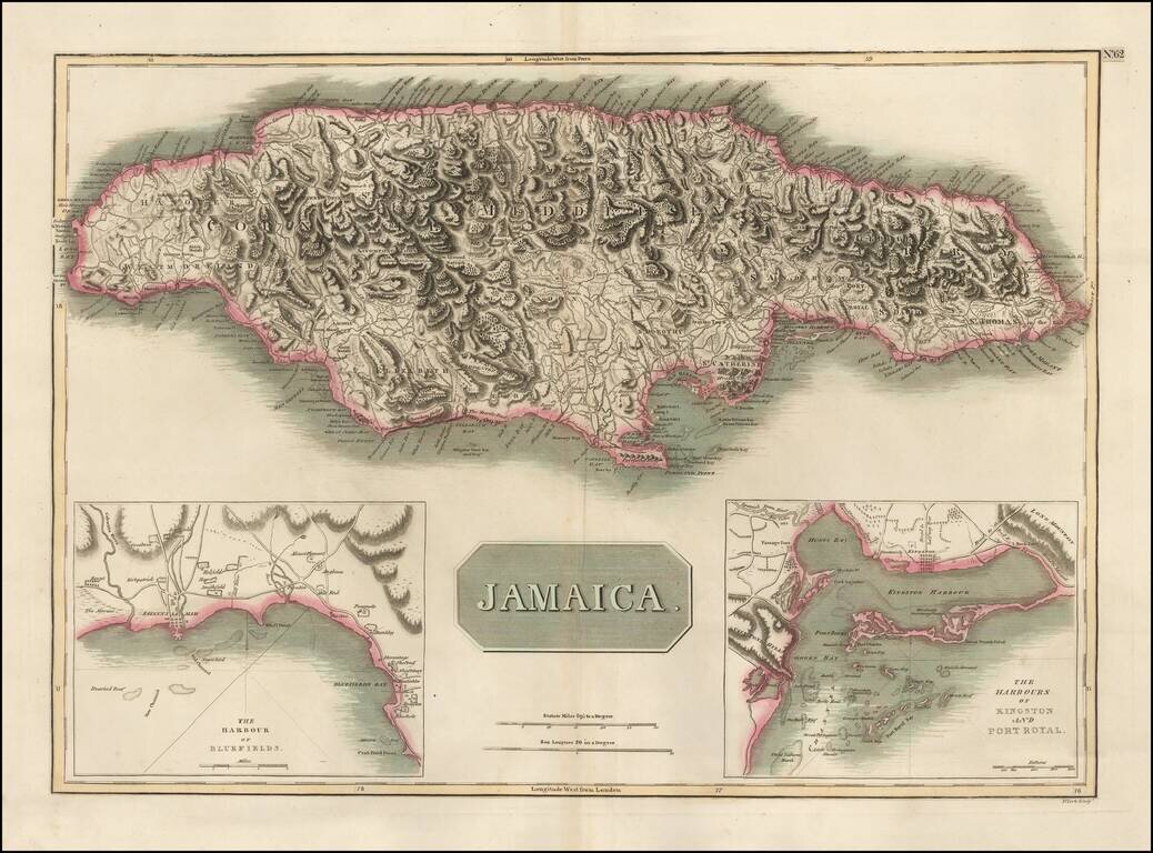
Detailed map of Jamaica, based upon Jefferys map of 1775. Includes large insets of the Harbors of Kingston and Port Royal and of Bluefields. Gorgeous topographical details. One of the best large format English maps of the period.
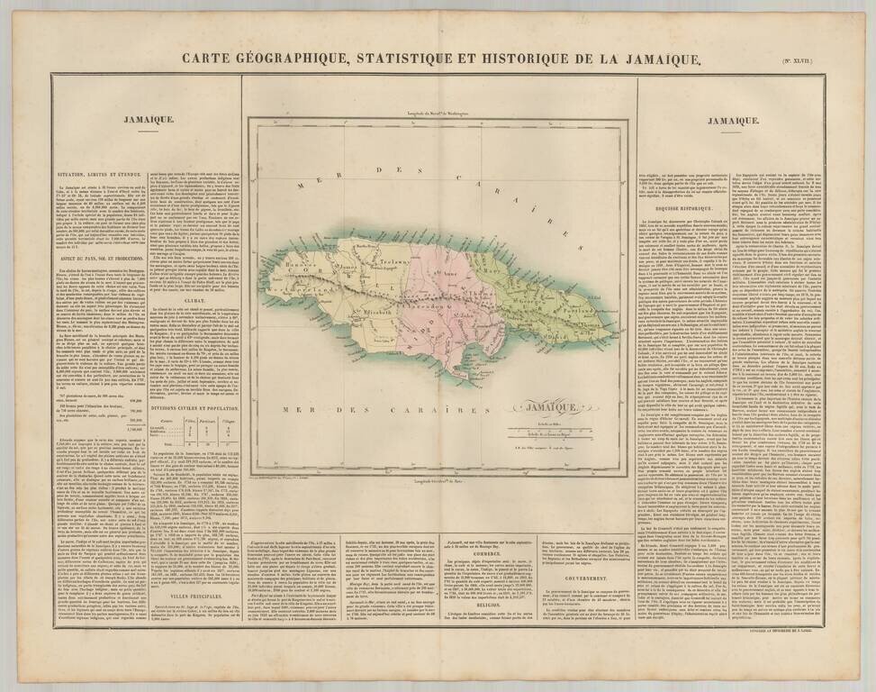
Detailed map of Jamaica, published in Paris. The map is colored by parishes, and locates roads, towns, rivers and topographical features. The map appeared in the French edition of Carey & Lea's Atlas is highly prized not only for its cartographic...
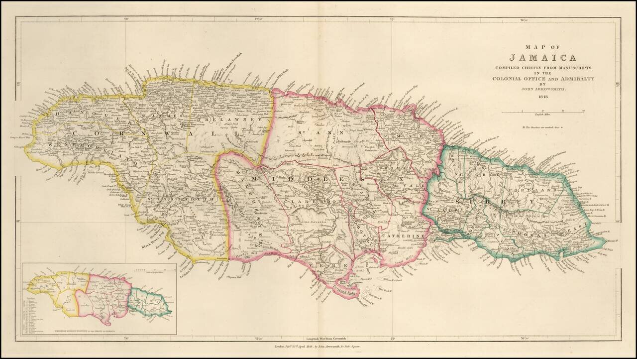
Detailed map of Jamaica, published in London by John Arrowsmith. The map is divided into three parishes, with fine details showing topography, towns, roads, rivers and other details. A smaller inset map at the bottom left corner.
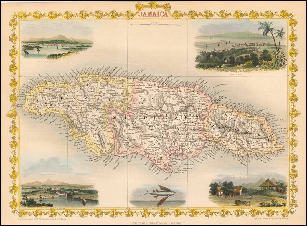
Nice full color example of Tallis' map of Jamaica, with decorative vignettes of Kingston, Port Antonio, Fort Royal Harbour and Sugar Mill. Engraved for R. Montgomery Martin's Illustrated Atlas. Tallis was one of the last great decorative map makers....
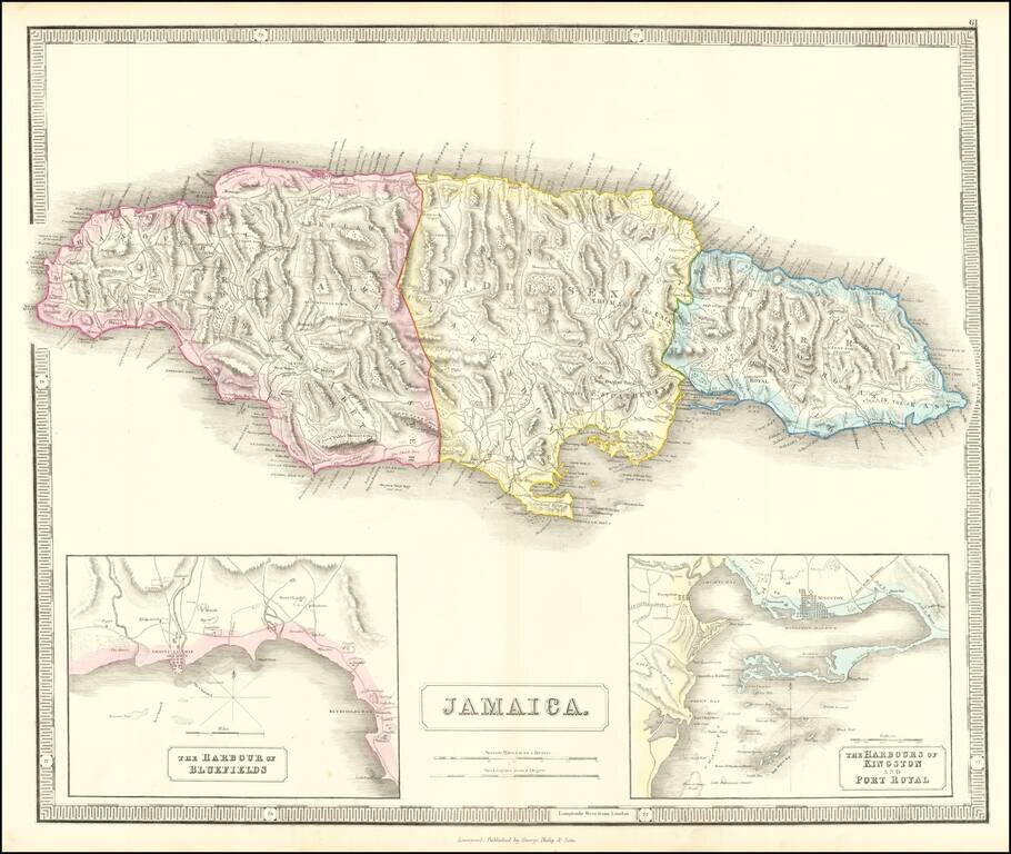
Detailed map of Jamaica, based upon Thomson's map of 1815. Includes large insets of the Harbors of Kingston and Port Royal and of Bluefields. Gorgeous topographical details. One of the best large format English maps of the period.
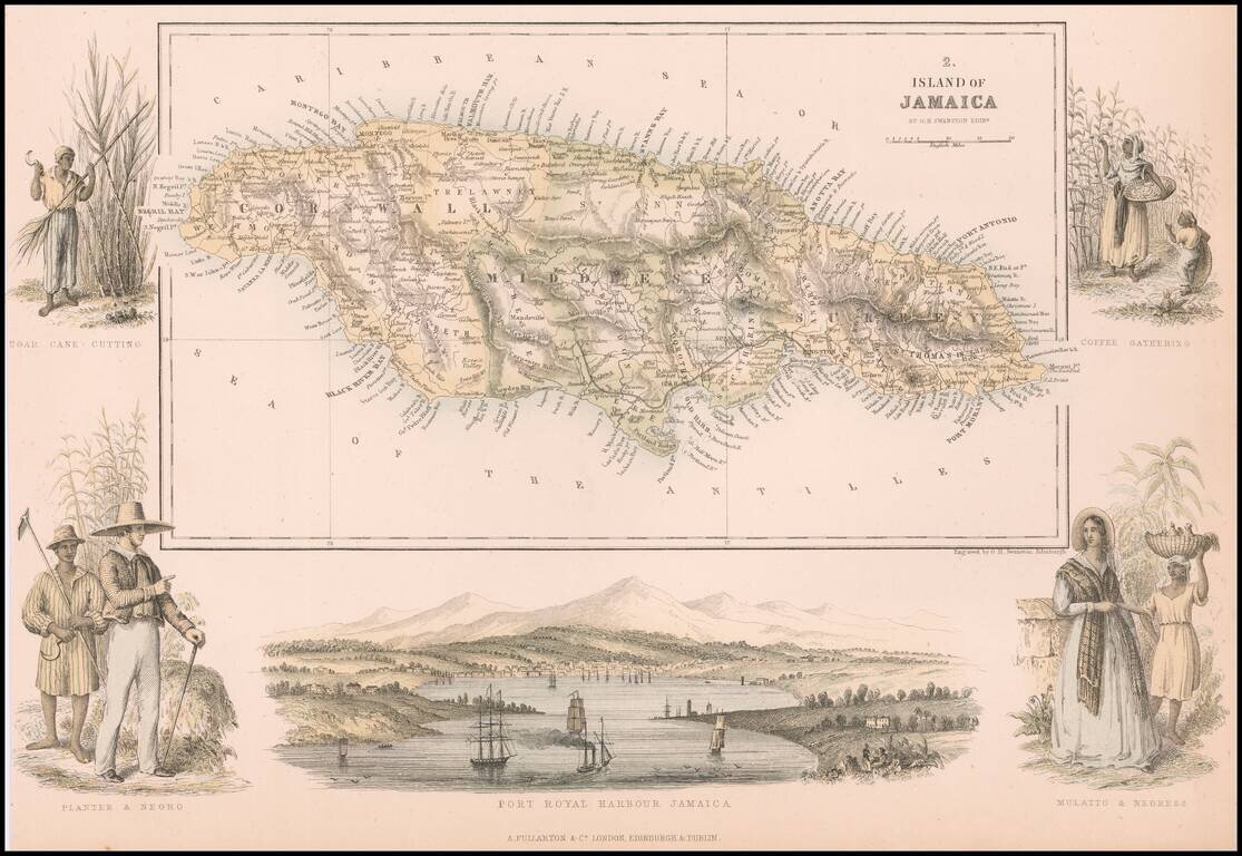
Decorative map of Jamaica, embellished with a view of Fort Royal and vignettes showing different types of Jamaican people.
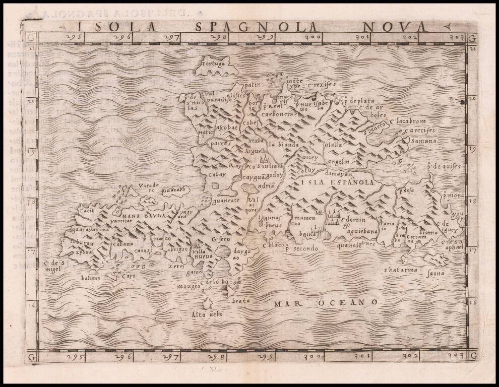
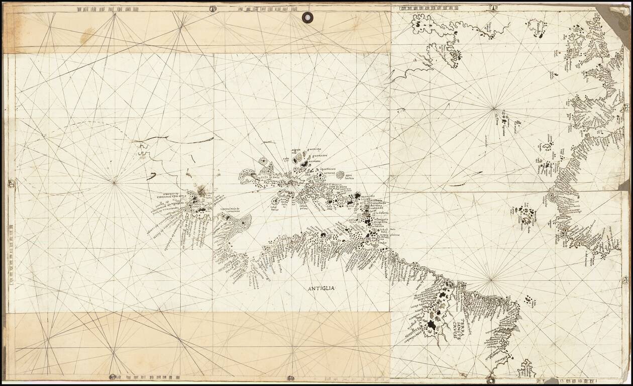
One of the earliest separately published maps of Hispaniola, which first appeared in the 1548 edition of Gastaldi's edition of Ptolemy's Geografia. The map is one of the "modern" maps to appear in Giacomo Gastaldi's La Geografia. Gastaldi was the most...
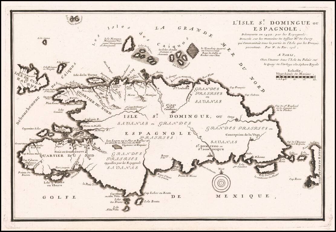
Antique Map of Haiti & Santa Domingo Detailed separate map of Hispaniola, from Nicolas De Fer's Atlas Curieux.
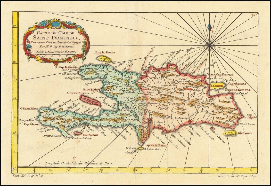
Detailed map of the Island of Saint Domingue. Remarkable detail for the period. Includes a large decorative title cartouche. One of the maps produced by Nichlas Bellin for Prevost d'Exiles influential travel book, L'Histoire Generale des Voyages.
![[Fort-Liberte Bay] Baye et Ville de Bayaha ou Port-Dauphin dans L'Isle S. Domingue](/map/small/59662.jpg)
Detailed map of the Bay of Fort-Liberte Santa Domingo, published in Nicholas Bellin's Petit Atlas Maritime. The chart is oriented with east at the top. Bellin was the first Ingenieur Hydrographe de la Marine, and also Official Hydrographer to the...
![[Port au Prince] Environs de Leogane et du Port au Prince dans L'Isle S. Domingue](/map/small/59730.jpg)
Detailed map of area around Port au Prince Bay in Haiti, published in Nicholas Bellin's Petit Atlas Maritime. The chart is oriented with southwest at the top. The plan shows the town, fortifications, anchorages, soundings, buildings, topographical...
![[Port au Prince] Le Port au Prince dans L'Isle S. Domingue](/map/small/59753.jpg)
Detailed map of Port au Prince Bay in Haiti, published in Nicholas Bellin's Petit Atlas Maritime. The chart is oriented with west at the top. The plan shows the town, fortifications, anchorages, soundings, buildings, topographical details, etc....
![[Petit Goave] Plan de la Rade et Ville du Petit Goave dans L'Isle S. Domingue](/map/small/59779.jpg)
Detailed map of area around Petit Goave Bay in Haiti, published in Nicholas Bellin's Petit Atlas Maritime. The chart is oriented with southwest at the top. The plan shows the town, fortifications, anchorages, soundings, buildings, topographical...
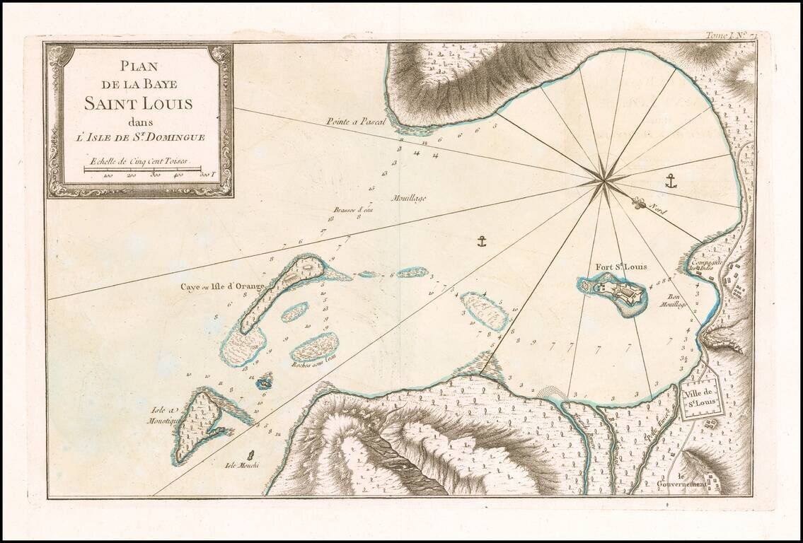
Detailed map of area around Saint Louis Bay, published in Nicholas Bellin's Petit Atlas Maritime. The chart is oriented with southwest at the top. The plan shows the town, anchorages, soundings, buildings, topographical details, etc. Bellin was the...

Detailed map of area on the southwest coast of Haiti, north of Ile a Vache, published in Nicholas Bellin's Petit Atlas Maritime. Bellin was the first Ingenieur Hydrographe de la Marine, and also Official Hydrographer to the French King.