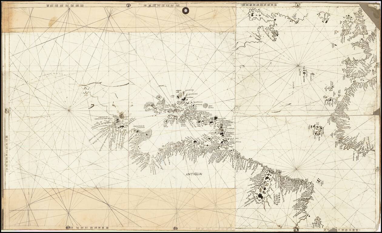
Rare and antique old maps of the Caribbean & Central_America
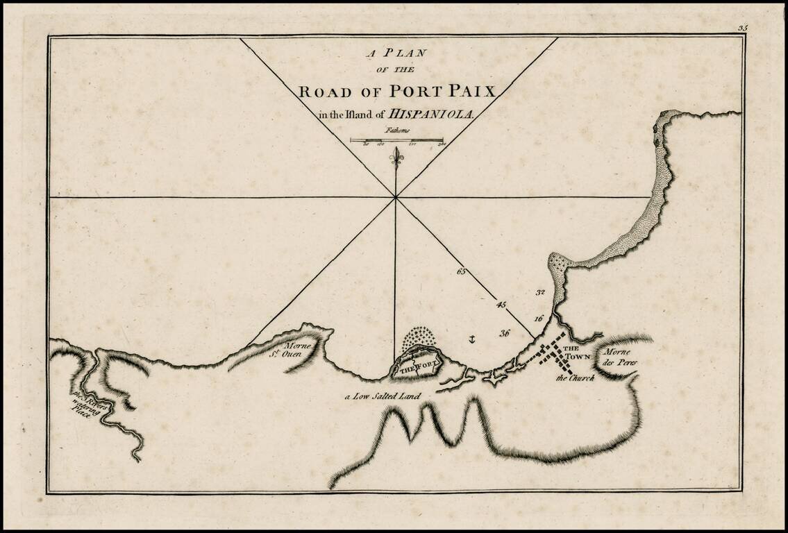
Rare early plan of Port Paix, first published by Sayer & Bennett, one of the earliest obtainable English Plans of the harbor. Includes a detailed charting of the harbor, fort and town, with soundings and anchorages, and place names.
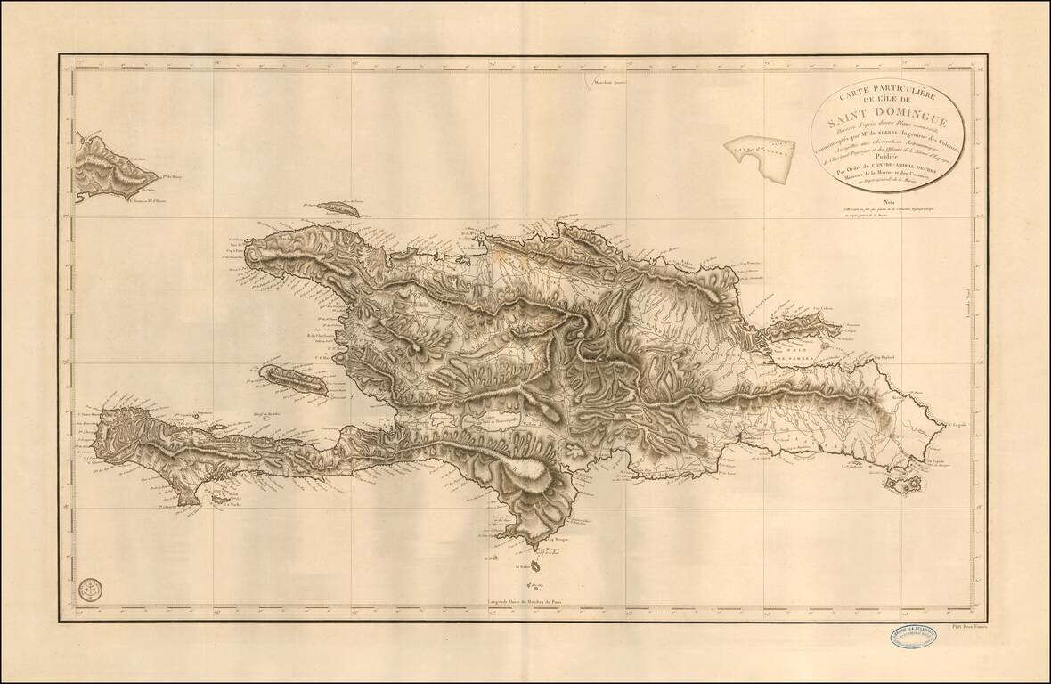
Fine sea chart of Hispaniola, published by the French Depot de la Marine. The map is based upon the work of Antoine-François Sorrel des Revières and Antoine-Hyacinthe-Anne de Chastenet de Puységur. Antoine Sorrel Des Revieres, rose to the...
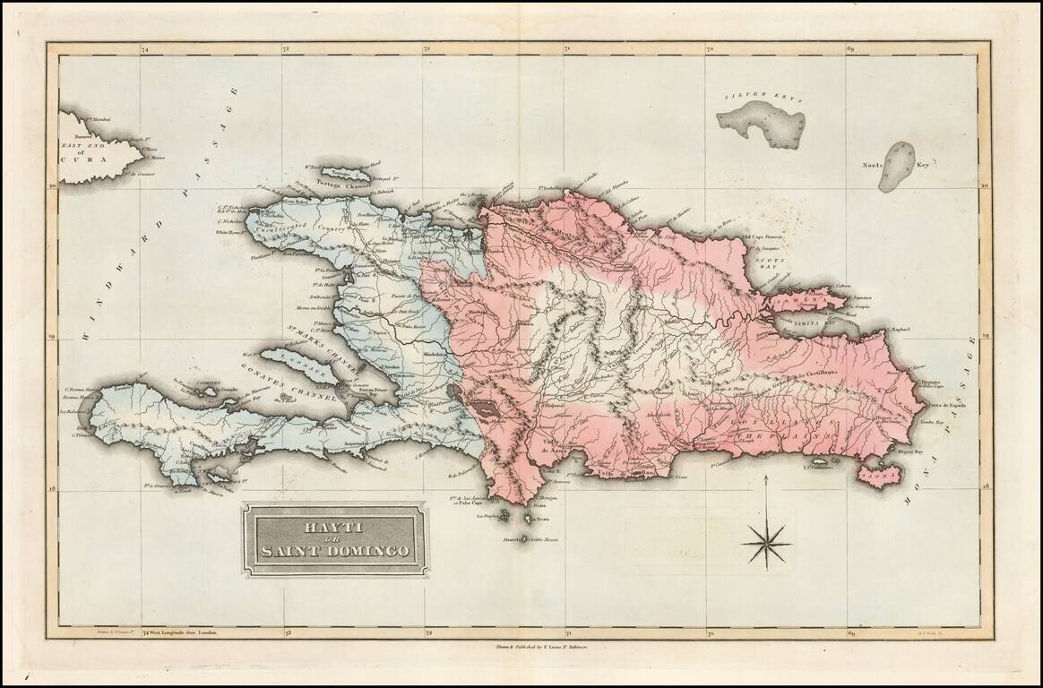
Fielding Lucas's 1823 engraved map of Hispaniola. The map shows the Republic of Spanish Haiti in the east and the Kingdom of Haiti in the west. Just as the map was published the two polities were joined as one. Fielding Lucas' fine work distinguished...
![Amer. Sep. No. 68. Haiti ou St. Domingue [includes Bahamas and Eastern Cuba]](/map/small/41790.jpg)
Highly detailed map of Haiti, the Eastern portion of Cuba, and the eastern part of the Bahamas. In the Bahamas, the map shows Watlings, Conception, Long Island, Exuma and Little Exuma, Hog Cay, Atwoods Cay, the Crooked Isles, French Cays, Mariguana,...
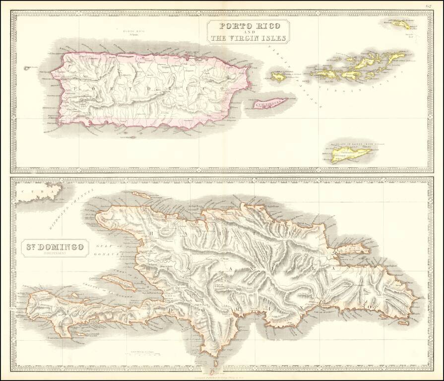
Scarce pair of maps of the Virgin Islands, Puerto Rico and Hispaniola. The top map extends to St. Croix, Anegada and Virgin Gorda.
![[Puerto Rico] S.Giovanni](/map/small/70668.jpg)
Marvelous example of Porcacchi's map of the Island of Puerto Rico. One of the earliest obtainable maps of the Island and one of the few published in the 16th Century. Excellent topographical detail, if a bit conjectural, and naming many locations....
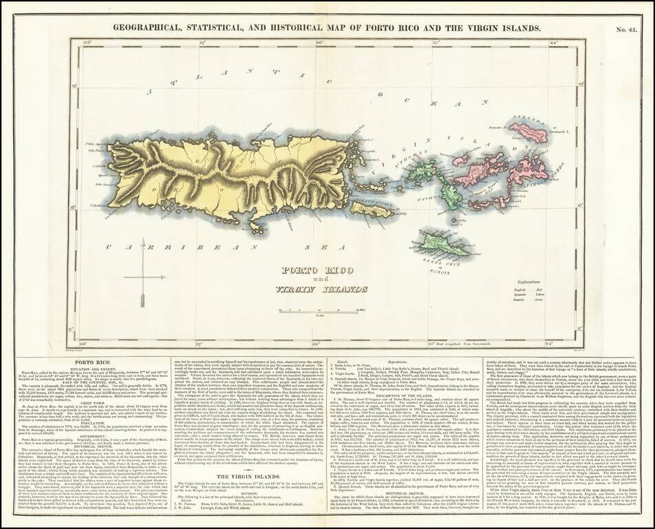
A nice detailed map of Puerto Rico and the Virgin Islands, from the first edition of Carey & Lea's American Atlas. This is one of the most detailed maps of the Virgin Islands to appear in a commercial atlas. The lengthy narrative text below...
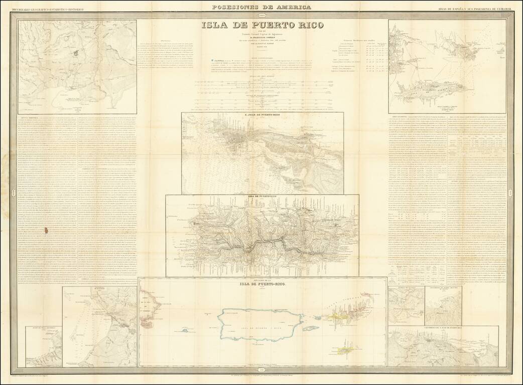
Detailed set of maps of Puerto Rico on a single sheet, published in Madrid. At the center is a large map of Puerto Rico, with a large map of San Juan above and a regional map of the islands below, including the Virgin Islands and the eastern tip of...
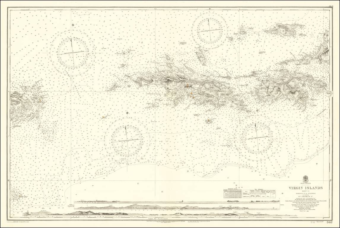
Finely detailed map, extending from Culebra and Vieques Island in the west to St. John, Tortola and Jost Van Dyke Island in the east, centered on St. Thomas. Includes profile views across the bottom. A fine detailed sea chart of this portion of the...

This circa 1964 Alfonso Alvarez architectural rendering painting (executed by A. Davoll) shows a proposed religious center on the campus of the Inter-American University in San German, Puerto Rico. Alvarez's proposed design is impressive, although it...
![[Saint Croix, Virgin Islands] Tilforladelig Kort over Eylandet St. Croix udi America Saaledes som det ved en acurat udmaaling er befunden med Quarterernes Navne og enhver Plantagies Nummer efter hvilkede udi Matriculen findes Indforte og til enhver Kiobe](/map/small/69471.jpg)
The First Reliable Chorographic Map of St. Croix Rare Danish map of the island of St. Croix, drawn by Jens Michelsen Beck and engraved by O.H. De Lode in Copenhagen. First published in 1754, Beck's map of St. Croix is the first modern map of St....
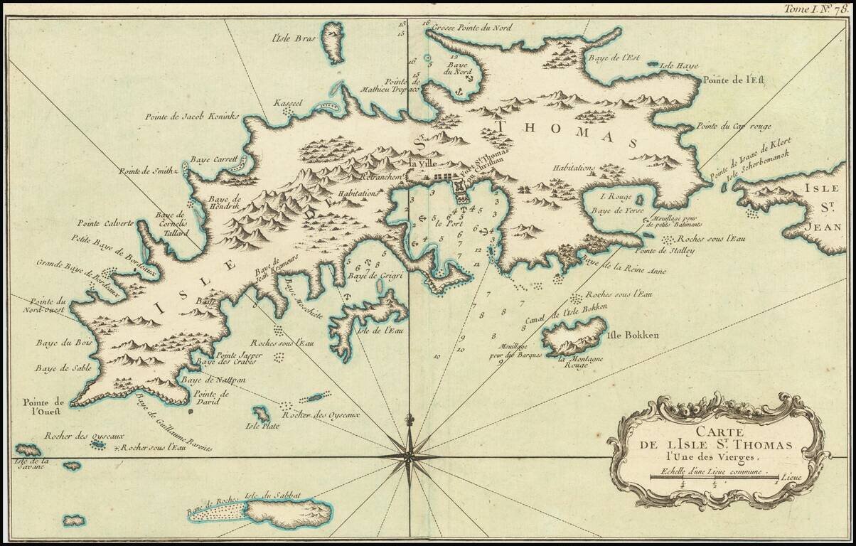
Striking map of St. Thomas, by Nicolas Bellin. Includes nice coastal and topographical detail and a decorative cartouche. There are relatively few separately issued maps of St. Thomas published in the 18th Century.
![[Virgin Islands, etc] Supplément pour les Isles Antilles, extrait des cartes Angloises](/map/small/69592.jpg)
Interesting hand-colored engraved map of the Virgin Islands, with insets of Barbuda, St. Kits, Antigua, Dominica, St. Lucia, Barbados, St. Vincent, Grenada, and Tobago. The main map covers the region from St. Thomas and St. Croix to St. Martin and...
![[Virgin Islands] Cartes De Supplement Pour Les Isles Antilles](/map/small/70820.jpg)
Excellent map of the Virgin Islands from Puerto Rico to Barbuda, centered on the American and British V.I., extending from Crab Island, St. Thomas and St. Croix to Sable Island, Sombrero Island, St. Barts, St. Martin and Anguilla. Includes 8 large...
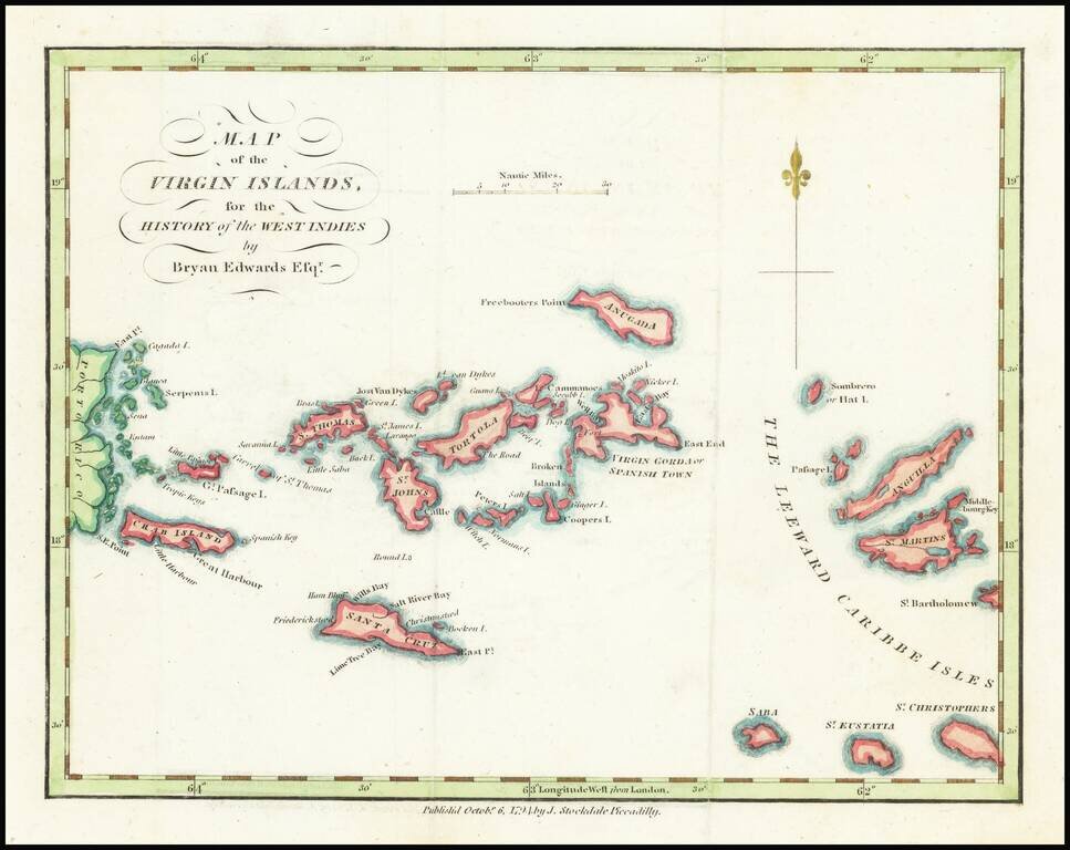
18th Century Map of the Virgin Islands Detailed map of the Virgin Islands, published in London by Brian Edwards. Extends from the east coast of Puerto Rico to St. Barts, centered on Tortola, St. Johns, Saint Croix and Virgin Gorda. There are very...
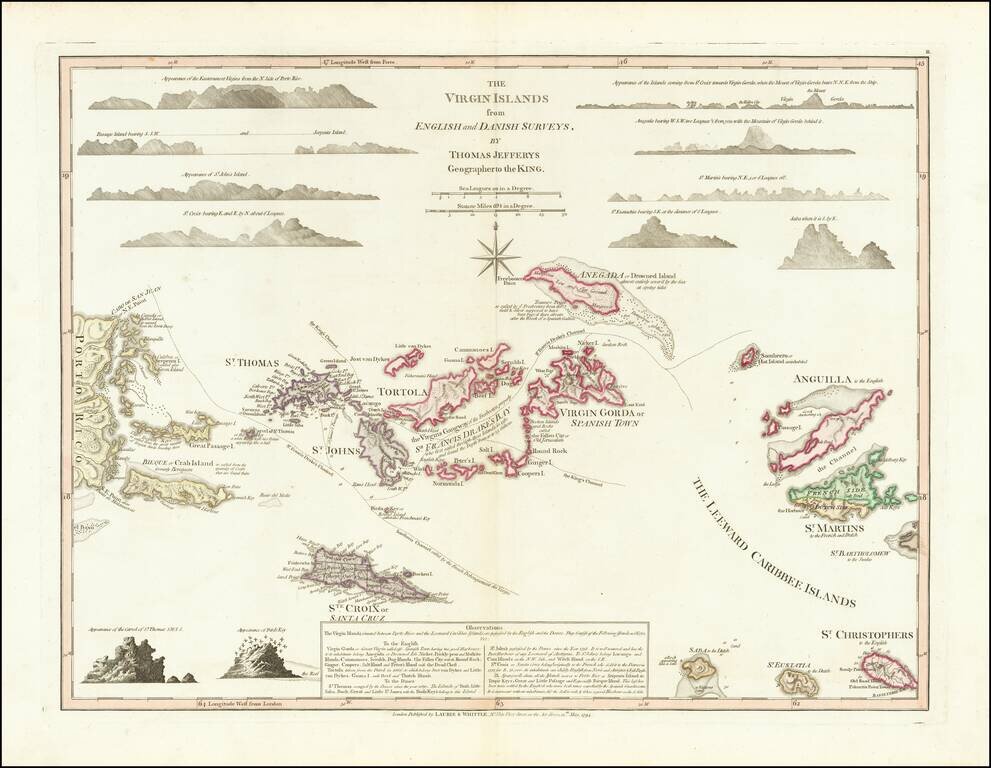
Fine full color example of Thomas Jefferys' highly sought after map of the Virgin Islands, from The West-India Atlas. Jefferys map is one of the earliest separately issued maps of the Virgin Islands and the earliest obtainable large format map to...