logo

1940. Pictorial Map of Historic Panama

  • Pictorial Map of Historic Panama
  • Pictorial Map of Historic Panama

Pictorial Map of Historic Panama information:

Year of creation: 
Resolution size (pixels): 
 10636x7449 px
Disk Size: 
 13.9558MiB
Number of pages: 
 2
Place: 
 n.p.
Author: 

Print information. Print size (Width x height in inches):
Printing at 72 dpi 
  147.72 х 103.46
Printing at 150 dpi 
 70.91 х 49.66
Printing at 300 dpi 
 35.45 х 24.83

An example of detailing the file of this map of in a printable high-resolution:

Click to open in high resolution (open in new tab).
Attention! this is just the central piece (central area 960x960 px) of the map file!
This is an example, so that you can see and study the level of detail of a given map. The entire Map will be fully available after payment!

Pictorial Map of Historic Panama

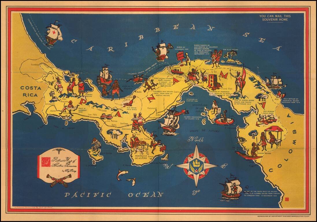
Decorative pictorial map of Panama, published by the Panama Mobile Force and Security Command.

A striking map of Panama with historical notes and pictographs of people and events.

At the bottom left, the note "A Personnel Service from Hq. Sixth Air Force" appears.


Special conditions for students!

If you are a student, write to us in telegram: @antiquemaps and indicate what material you need and for what work you need a map in high detail. We are ready to provide material on special terms. For students only!

Item information:

Year of creation:
Size:
10636x7449 px
Disk:
13.9558MiB
Number of pages:
2
Place:
n.p.
Author:
Ting Leong.
$14.99

Related item