Map size in jpg-format: 252.318MiB
Click to open in high resolution (open in new tab).
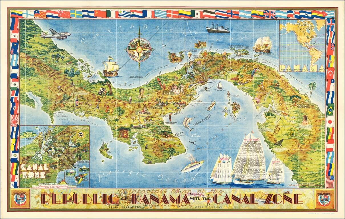
Striking large decorative map of Panama.
Includes two insets: "Canal Zone and Vicinity" and "Panama The Crossroads of the World".
Rich coloring, striking flag border, a particularly sophisticated example of a pictorial map.
"'With a partner in the 1940s he (Clark Teegarden) designed pictorial maps that in their era were quite popular, a Washington state map and a Panama Canal Map, the major reflections of his talent for painting,' said his son, John Teegarden of Seattle. 'They're neat because they have little illustrations for places in the state and in Panama. The Panama Map in particular was quite a success, and they got royalties. There were so many service and Canal Zone personnel there, and it was kind of a souvenir.'" (from Teegarden's obituary in the Seattle Times).
The pictographs highlight the animal life and characteristics of the area, including "the annual Zebra Swallowtail migration across Panama...," "old Indian gold mines," "the waters of Panama (Indian word meaning abundance of fish) are a mecca for game fishermen." The white sails of the yachts in the right foreground are used for charts of Weather Comparison,
History Briefs (with information to July 9, 1941), and the Legend which includes such as Railroads, present locks and new third locks.
If you are a student, write to us in telegram: @antiquemaps and indicate what material you need and for what work you need a map in high detail. We are ready to provide material on special terms. For students only!

![[Blaeu Atlas of America] America, Quae Est Geographiae Blavianae Pars Quinta Liber Unus Volumen Undecimum](/map/small/66852.jpg)
