Map size in jpg-format: 6.67487MiB
Click to open in high resolution (open in new tab).
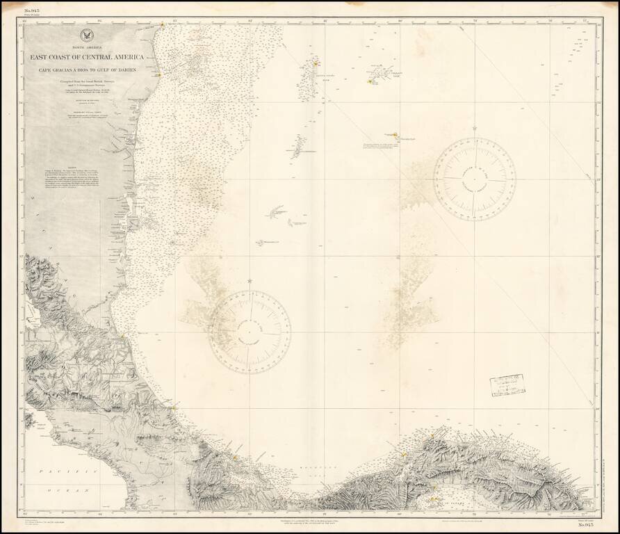
Detailed chart of the Mediterranean Coast of Panama, Costa Rica and Honduras, published by the US Coast & Geodetic Survey.
The chart provides a highly detailed coastal treatment of the region, along with the offshore islands, soundings, sailing notes, etc.
The chart tracks the coastline at a critical time in the history of the region, during the initial period of construction of the Panama Canal under the auspices of the first French Company which attempted to complete the project.
If you are a student, write to us in telegram: @antiquemaps and indicate what material you need and for what work you need a map in high detail. We are ready to provide material on special terms. For students only!

![[Blaeu Atlas of America] America, Quae Est Geographiae Blavianae Pars Quinta Liber Unus Volumen Undecimum](/map/small/66852.jpg)
