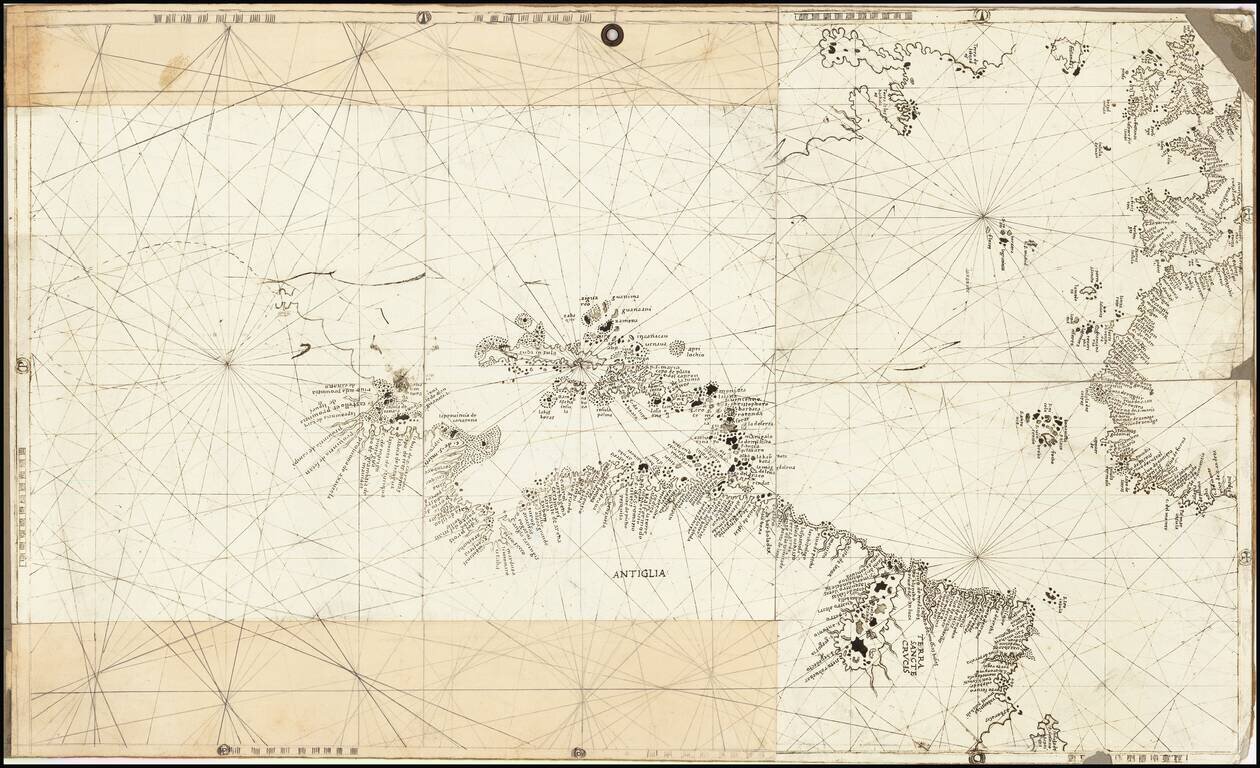
Rare and antique old maps of the Caribbean & Central_America
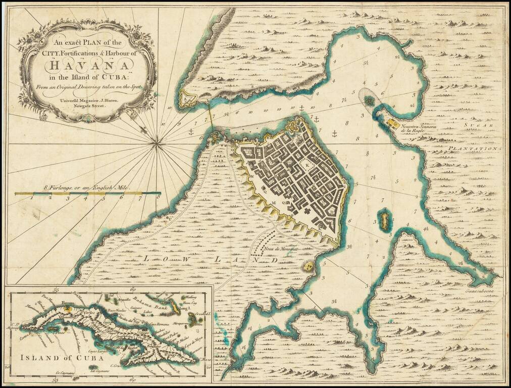
Detailed plan of Havana Harbor, showing fortifications, soundings, topographical details, etc. Includes a large inset of Cuba.
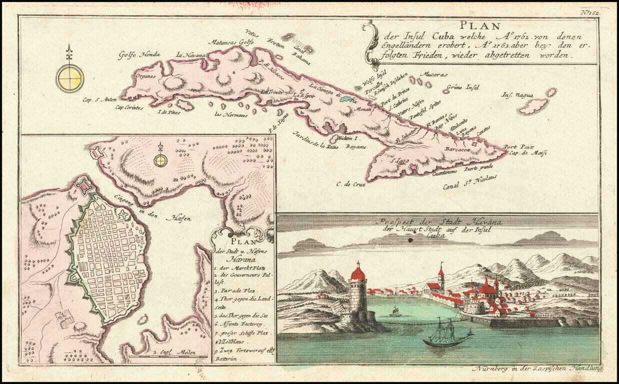
Striking map of Cuba, along with a detailed plan of Havana, and a view of the city and the entrance to its harbor, which appeared in Raspe's Shauplatz des gegenwaertigen Krieg. The plan is highly detailed with a numbered key to the city's major...
![[Cuba] [Plan of Lands at Bahia Honda]](/map/small/67161.jpg)
Intriguing Manuscript Map of Plantation Lands in Cuba Including Coffee Plantations Schematic manuscript sketch map of Bahía Honda, along the north coast of Cuba. The paleography indicates the map was made in the mid- to late-eighteenth century....
![[Hispaniola, Cuba, Martinique and Guadalupe] Carte de S.Domingue . . . / Carte de Cuba . . . / Carte de Martinique . . . / Carte de Guadalupe et des Isles de Saintes . .](/map/small/70543.jpg)
Fine, Detailed French Map of Prominent Caribbean Islands Rare, separately-published map illustrating Hispaniola, Cuba, Martinique and Guadaluope. Each inset map is nicely detailed and includes a description in the title block. This text offers a...
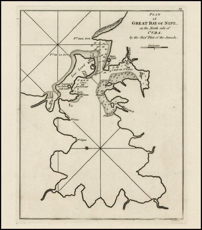
Rare early plan of Bahia de Nipe, Cuba, published by Sayer & Bennett, one of the earliest obtainable English Plans of the harbor. Includes a detailed charting of the harbor, with soundings and anchorages, and place names.
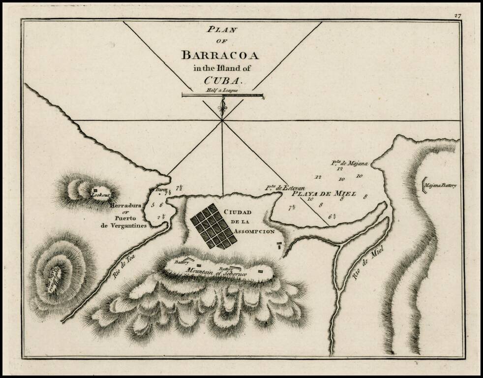
Rare early plan of Barracoa, first published by Sayer & Bennett, one of the earliest obtainable English Plans of the harbor. Includes a town plan of Ciudad de la Assompcion (sic), detailed charting of the harbor, Battery positions, look out, etc.,...
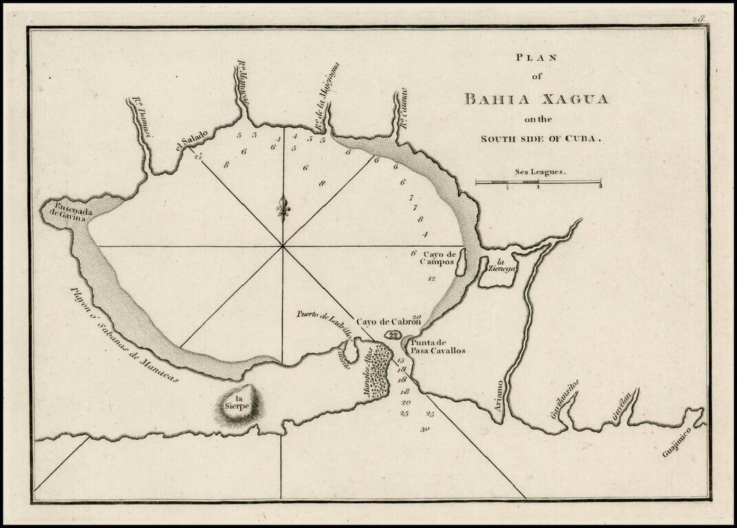
Rare early plan of the Harbor of Xagua, first published by Sayer & Bennett, one of the earliest obtainable English Plans of the harbor. Includes a plan of the harbor, small islands, lagoons,, soundings, and place names.
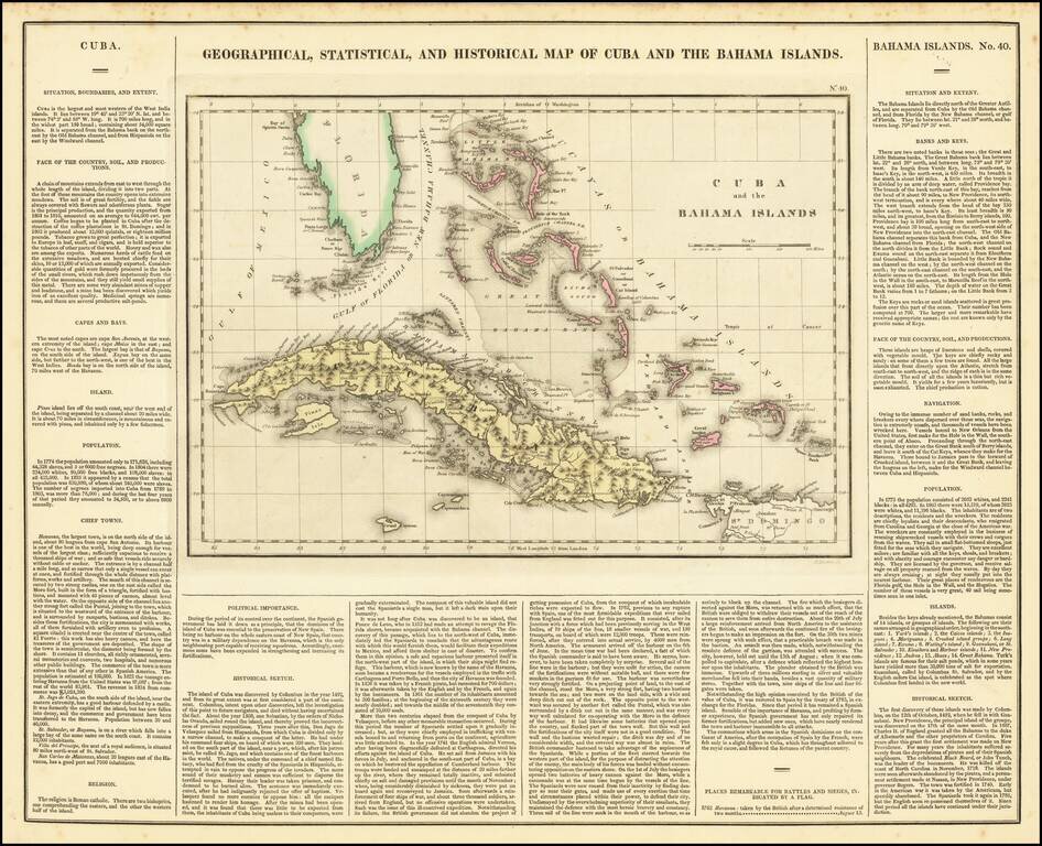
A nice detailed map of the Bahamas, South Florida, and Cuba, from the first edition of Carey & Lea's American Atlas. This is one of the most detailed maps of the Bahama Islands to appear in a commercial atlas. The lengthy narrative text below...
Remarkably detailed map of Cuba, Jamaica and the Cayman Islands, with over 100 places named and a fine depiction of the roads on Cuba and its topography. Includes roads, islands, rivers, mountains, lakes, elevations, etc. From Vandermaelen's...
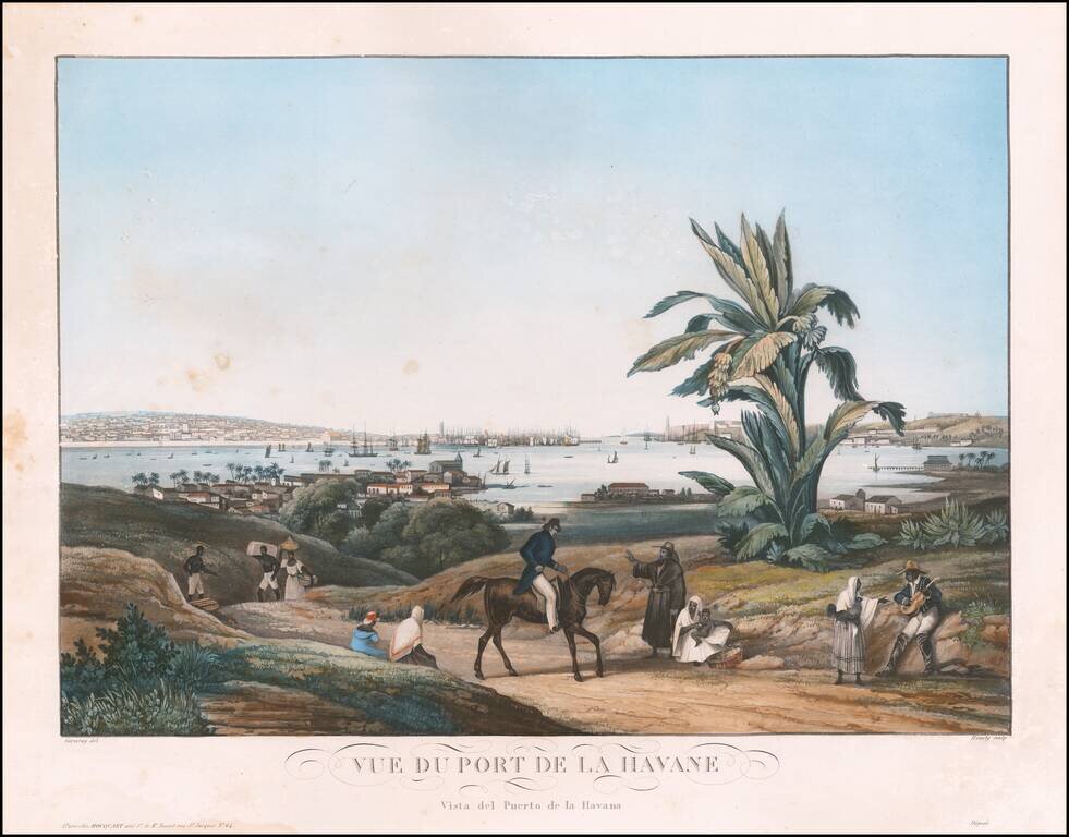
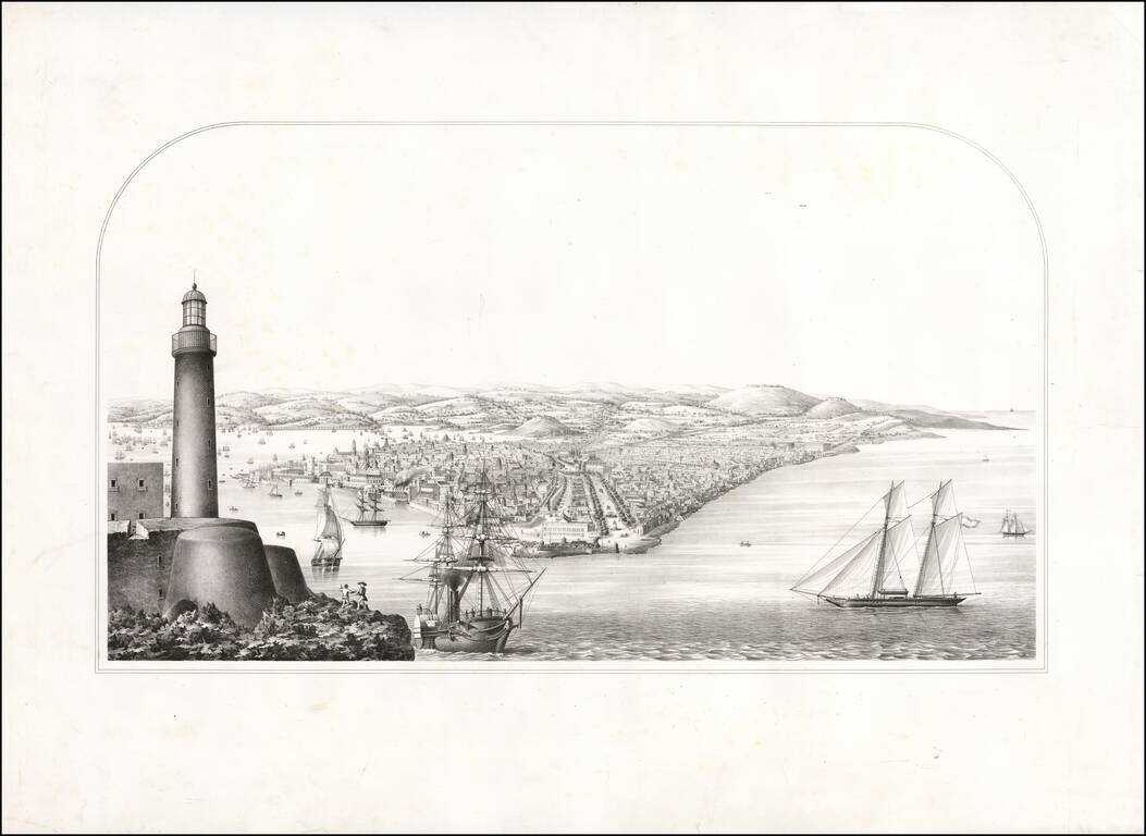
Finel view of the port of Havana, with the city in the distance and a rural scene in the foreground.
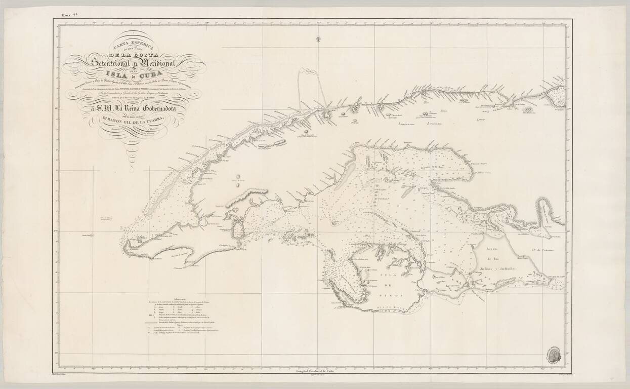
Fine Spanish Sea Chart of Western Cuba. Scarce and highly detailed chart of Cuba from official Spanish sources. Spanish maps of the Caribbean are quite scarce, even in the 19th Century. Extends from Cape San Antonio at the western tip of the island...
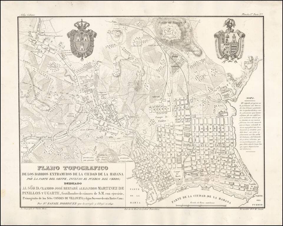
Rare map of the areas adjacent to Havana, published in Havana in 1841, which was prepared for Rafael Rodriguez's unfinished Atlas Cubano. The map is identified as "Plancha 3a. Parte 3a," published as part of a very are set of 16 or 17 maps and plans...
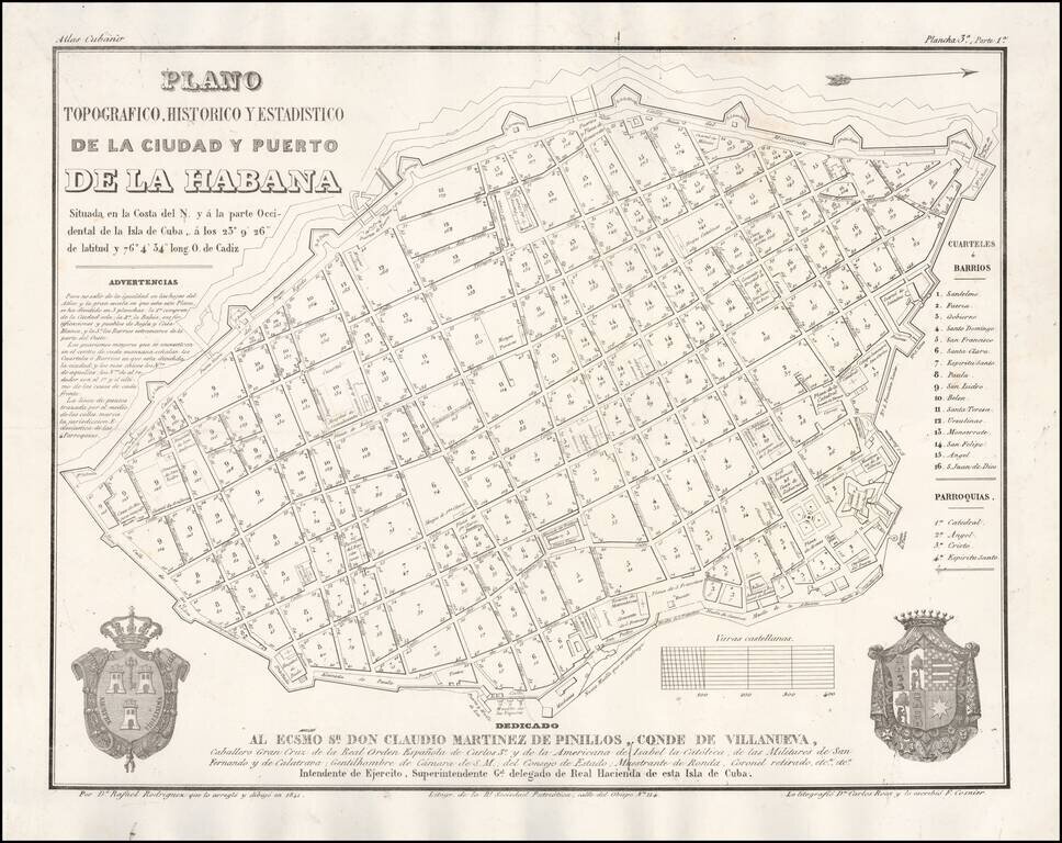
Rare map of the City of Havana, published in Havana in 1841, which was prepared for Rafael Rodriguez's unfinished Atlas Cubano. The map is identified as "Plancha 3a. Parte 1a," published as part of a very are set of 16 or 17 maps and plans of Cuba,...
Proof state of a rare view of Havana. The view was acquired in group of other items, most of which related to Rafael Rodriguez, whose most famous work is a Cuban Atlas described by Emilio Cueto as follows: 528. Rodriguez Rodriguez, Rafael Ρίο...
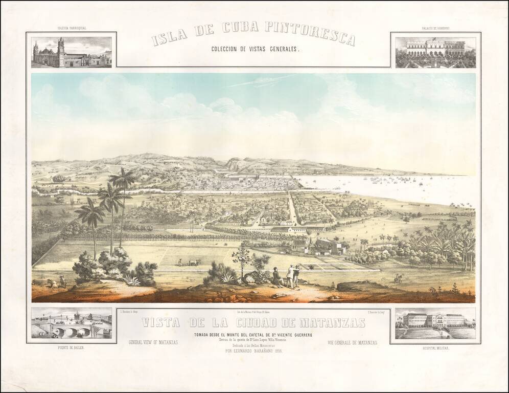
Rare view of the City of Matanzas taken from the Monte de Cafetal de Dn. Vincente Guerrero. Spectacular panorama of the city of Matanzas, northwest of Cuba, designed by Leonardo Barañano, lithographed in color by Eugenio Bourrelier. The view is...
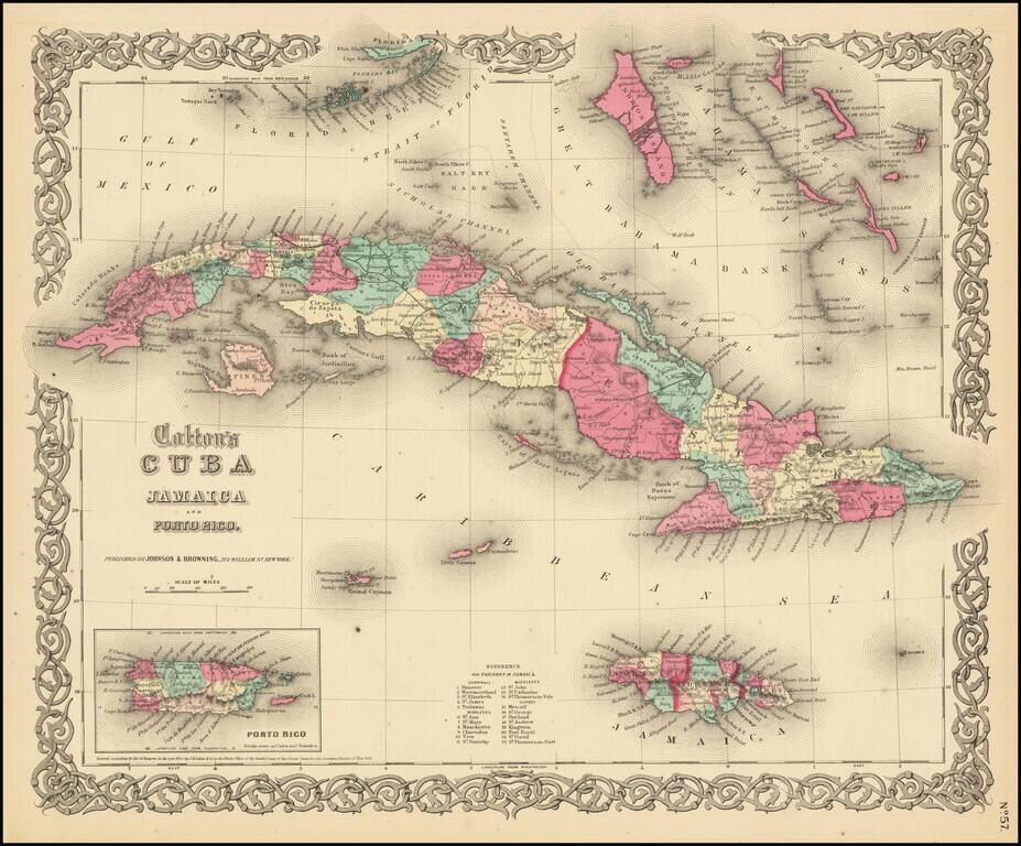
One of the best mid-19th Century American published maps of Cuba and the region. Shows outstanding detail throughout. Cuba and Jamaica are colored by counties and parishes, with towns, rivers, lakes, mountains and other details shown. Roads system is...