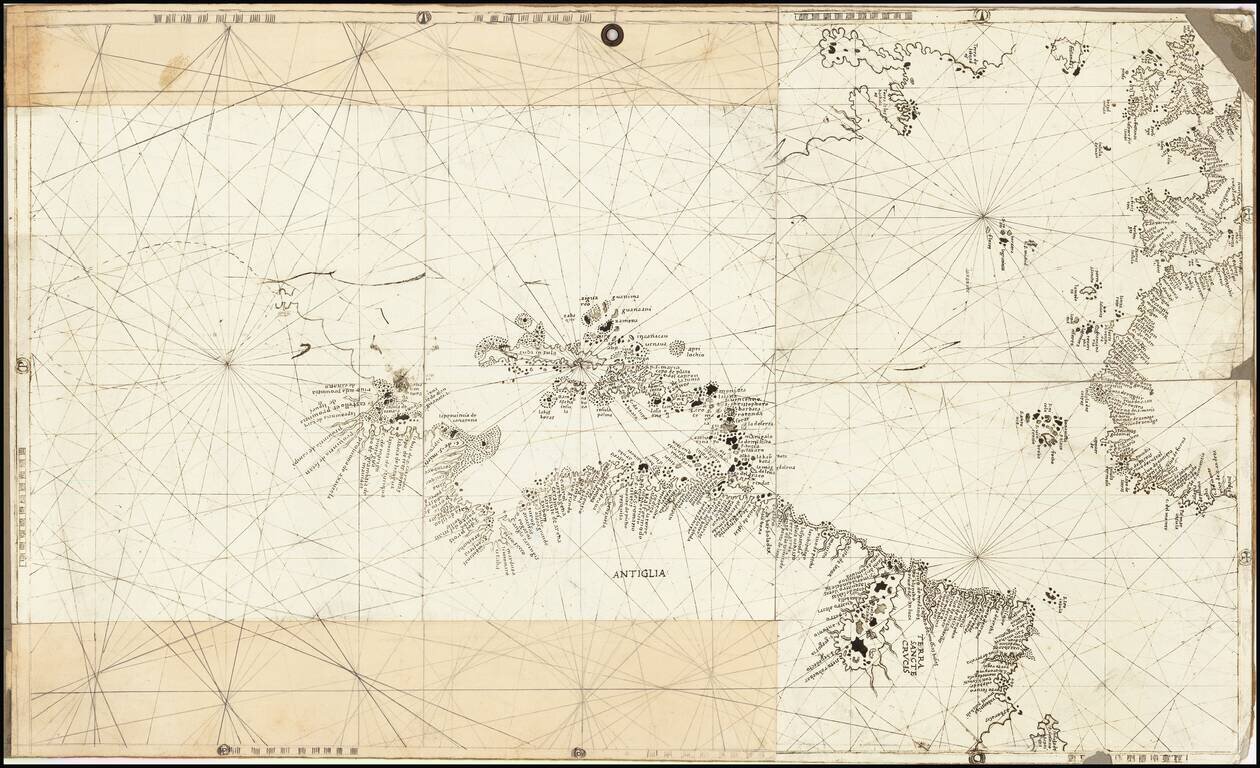
Rare and antique old maps of the Caribbean & Central_America
Detailed map of the Caribbean, Southern Florida, and a portion of Central America. Excellent details for a map of this size. Bradford's Comprehensive Atlas launched him as one of the prominent cartographic publishers of the period. This and his...
The map is quite detailed for its size and includes a fine wash color. Burr's Atlas was perhaps the most elegant American commercially published atlas of its time, utilizing wonderful wash colors and elegant engraving style. Burr studied under Simeon...
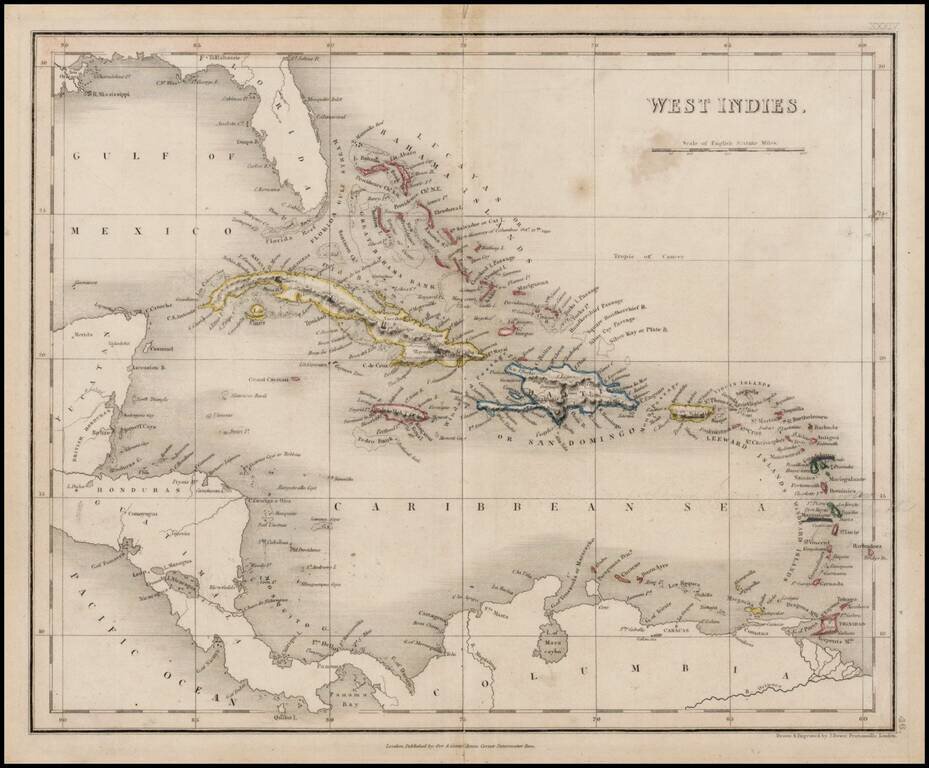
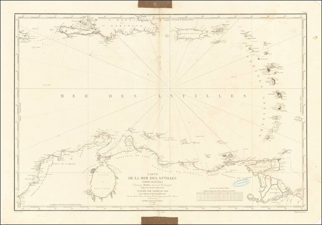
Chart of the Caribbean Used By French Navigator Nice example of the general Depot de la Marine sea chart of the Caribbean and coast of Venezuela, published in 1843. The chart extends from Jamaica and Santa Domingo to the Lesser Antilles, with Puerto...
Nice example of Mitchell's map of the West Indies from an early edition of Mitchell's New Universal Atlas.
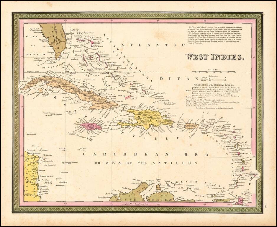
Detailed and attactive map of the southern portion of Florida and the Caribbean, from the Universal Atlas. The map shows the various European Powers possessions, including Spanish, British, French, Dutch, Danish and Swedish, along with substantial...
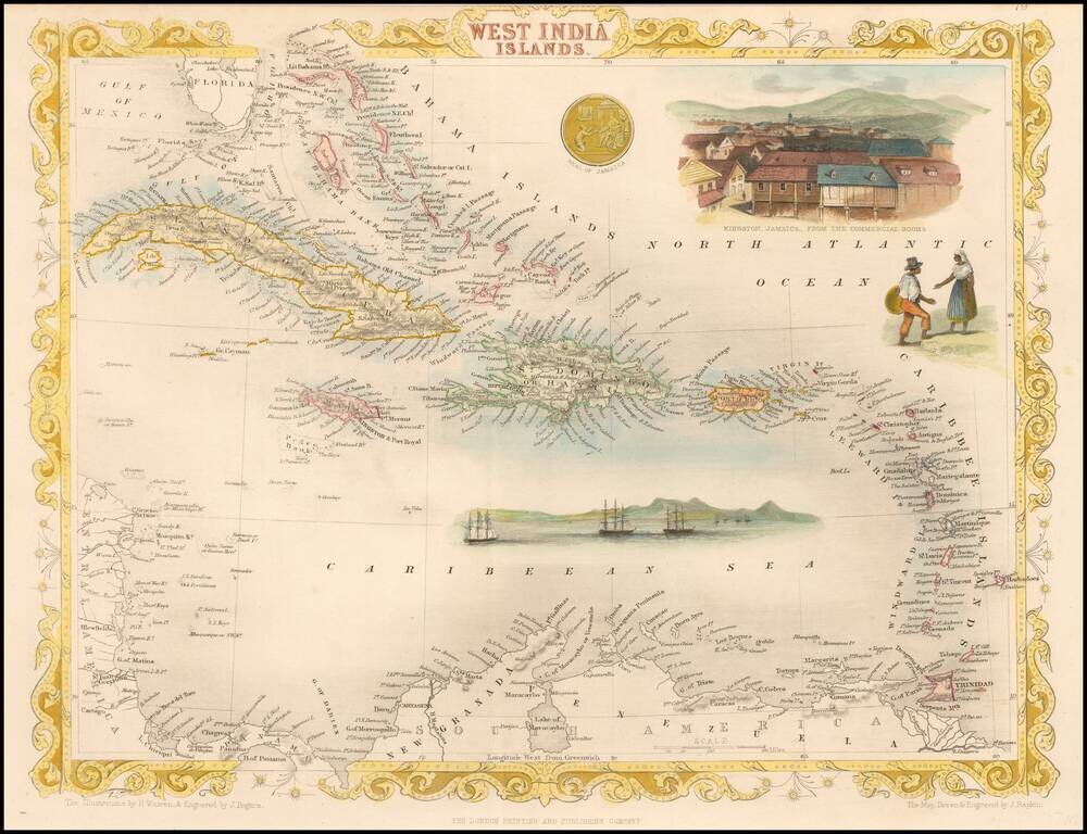
Striking full color example of this marvelous map. Showing vignettes of Kingston, Jamaica, from the commercial rooms. Also showing the harbors and people trading. The Seal of Jamaica is shown in its splendor. Engraved for R. Montgomery Martin's...
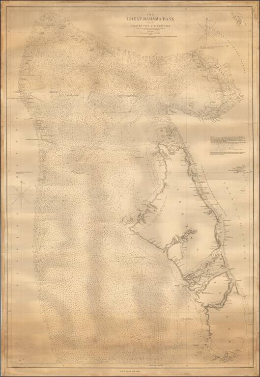
One of the Earliest Modern Sea Charts of the Central Section of the Great Bahama Banks. Fine chart of the Bahama Banks, focusing on Andros Island and the neighboring islands, etc., published by Blunt. The map reaches east to New Providence Island...
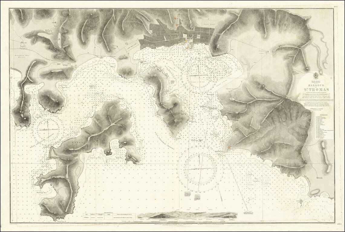
Detailed chart of the harbor at St. Thomas and environs, including a profile view of the approach to the harbor and remarkable details for both land and sea. The chart includes a plan of Charlotte Amalia, and a detailed depiction of the topography,...
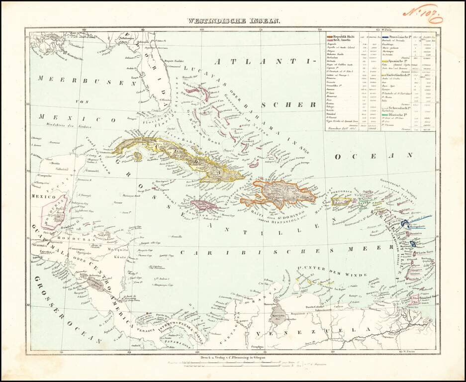
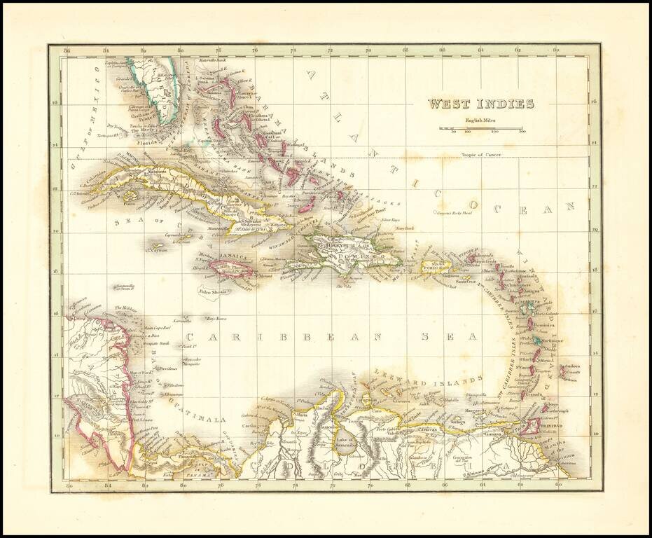
Detailed map of the Caribbean, from Florida to the cCoast of Venezuela and the Yucatan. Includes a key identifying populations, sizes and colonial possessions.
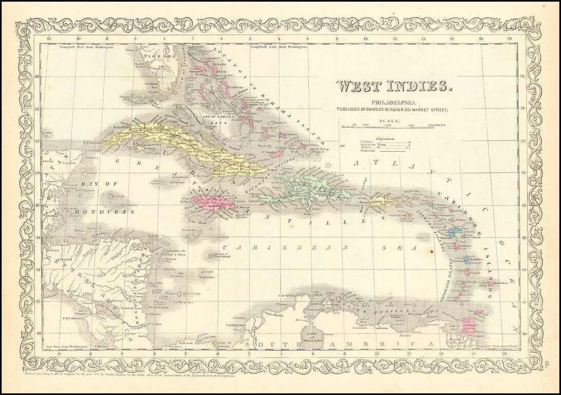
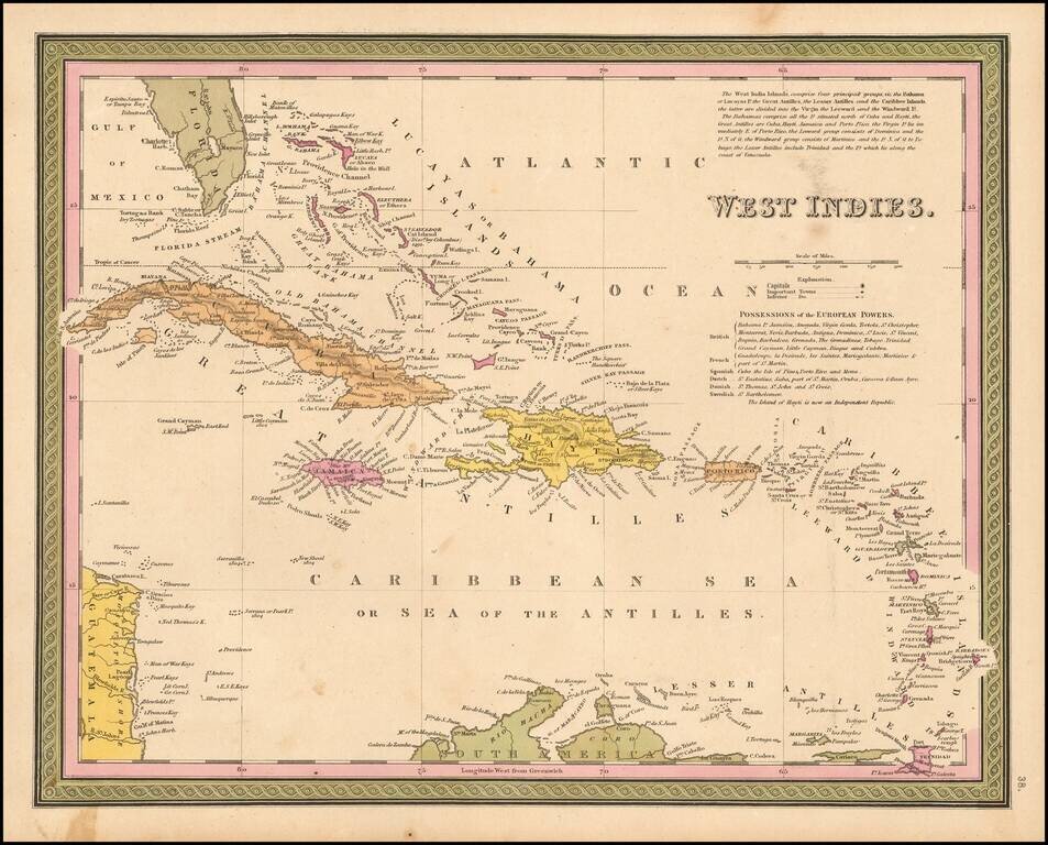
Detailed and attractive map of the southern portion of Florida and the Caribbean, in Charles Desilver's Universal Atlas. The map shows the various European Powers possessions, including Spanish, British, French, Dutch, Danish and Swedish, along with...
![Colton's West Indies [Bermuda and Havana insets]](/map/small/67374.jpg)
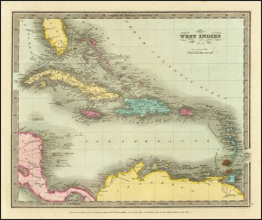
An 1857 edition of Colton's map of the West Indies which was published nearly yearly from 1855 to 1865 and more occasionally until at least 1874. It is a detailed map of the islands of the Caribbean showing Florida and Central America. The map includes...
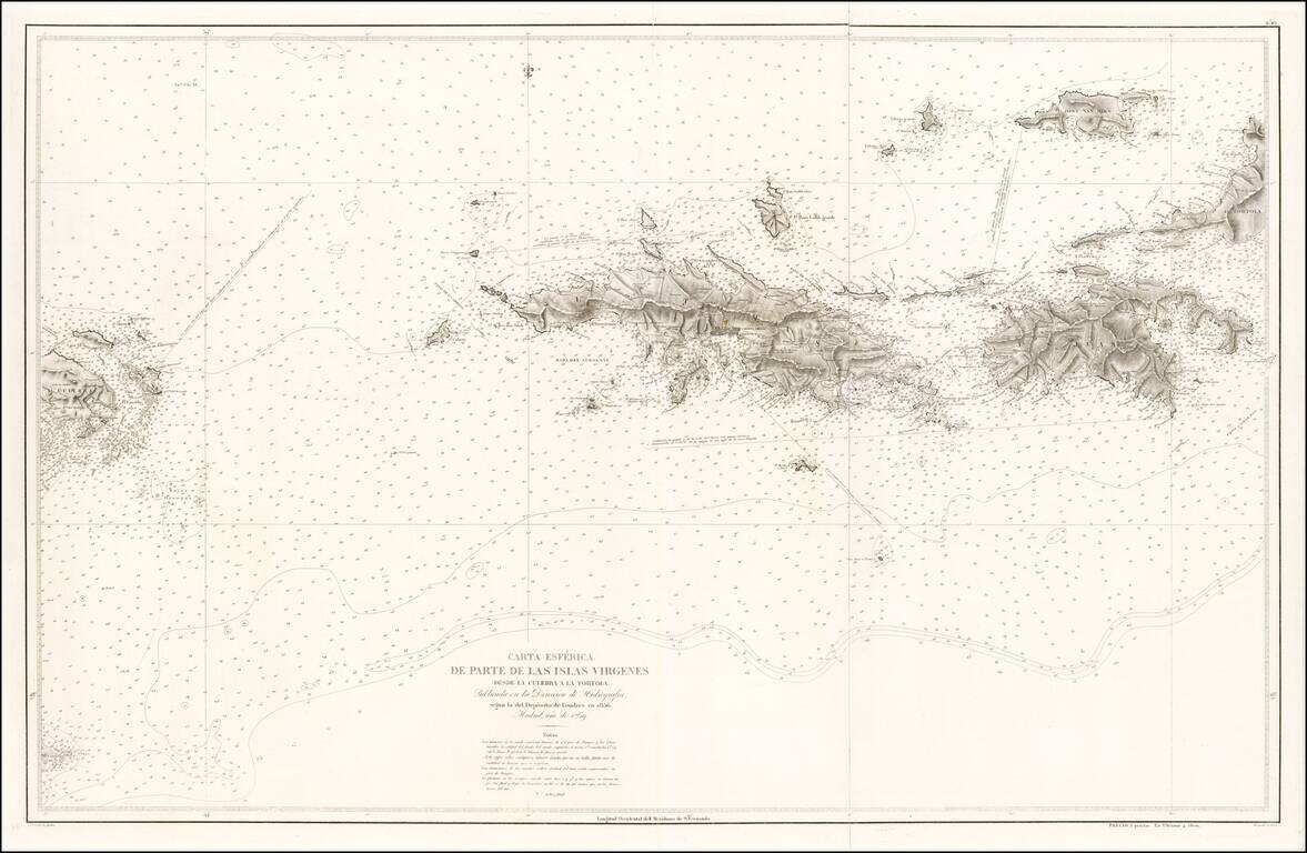
Rare separately issued Spanish Sea Chart of the Virgin Islands, published by the Spanish Hydrographical Department in Madrid. The map extends from Culebra and Culebrita in the west to St. John, St. Thomas, Hans Lolik, Joost Van Dyke, Western Tortola,...
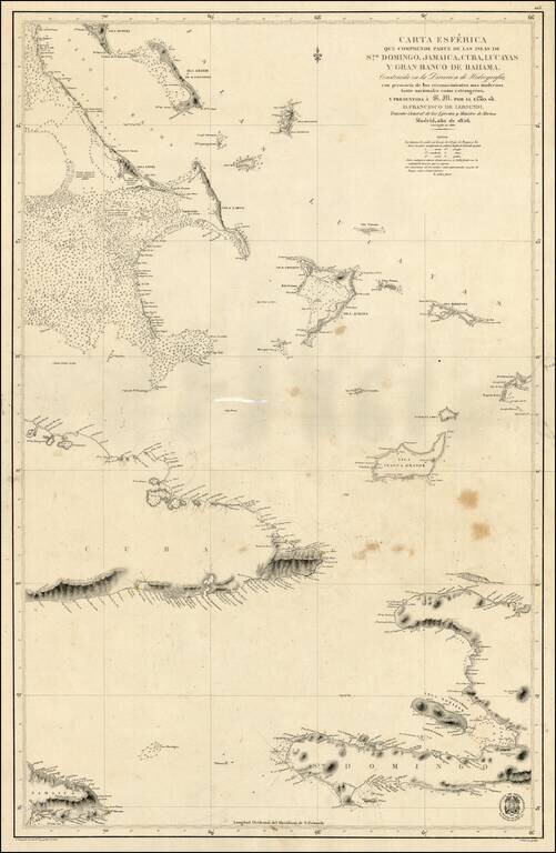
Scarce Spanish Sea Chart of the southern part of Haiti, the Caicos and neighboring Islands.
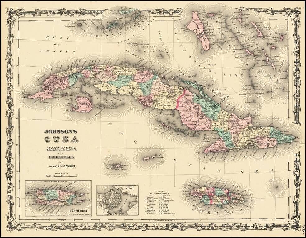
Attractive map of Cuba, the Florida Keys, the Bahamas, Jamaica, and the Caymans. Shows towns, rivers, mountains, etc. Inset maps of Havana and Puerto Rico.

Decorative map Curacao, the Leeward Islands and Surinam (or Dutch Guayana). Includes a large view of the Residence Offices and Tent-Barte of the Cacao Plantations of Alkmaar on the River Commewina and a view of Curacao from the east.