Map size in jpg-format: 52.012MiB
Click to open in high resolution (open in new tab).
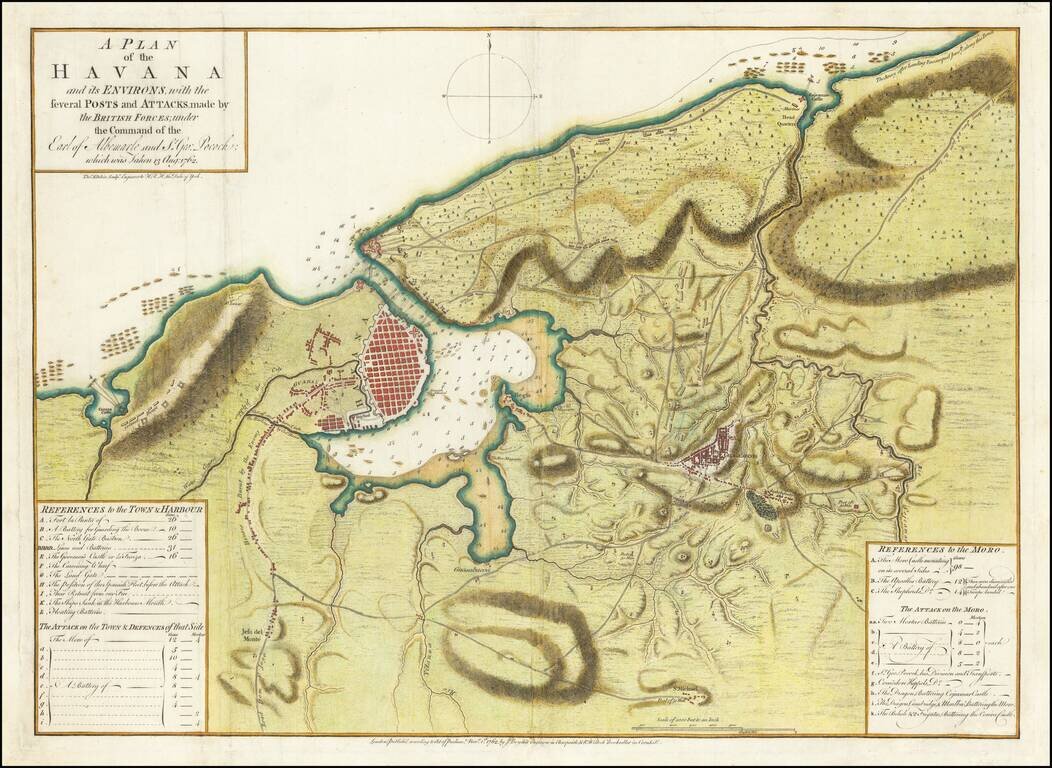
Perhaps the First Separate Map of the 1762 Siege of Havana.
Extremely rare separately issued map of showing the British Siege of Havana, at the tail end of the French & Indian War.
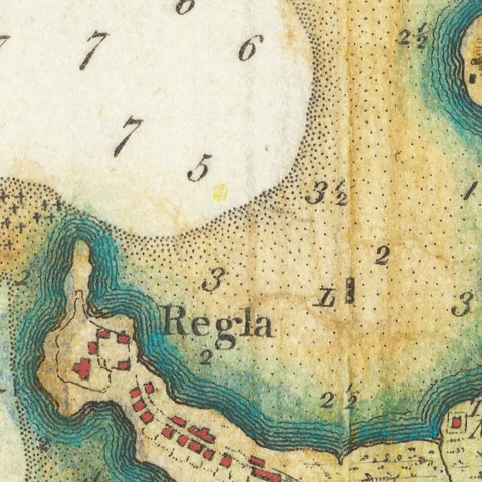
This map, published November 1, 1762, by John Boydell and R. Willock, is perhaps the earliest separately issued printed map of the siege. It includes 2 keys, which include references to the town and harbor, details on the attack of the town and its defenses, and a separate key with references to the Morro and details of its attack and defenses. Marvelous topographical detail. Includes ship positions, soundings, and other information.
Colonel Howe's position above the city is labeled.
Spain and Cuba in the French and Indian War
Although deeply suspicious of England's expanding commercial interests, Spain at first remained neutral in the Seven Years War. Lured by the promise of Minorca and Gibraltar, however, Charles III of Spain declared war against England in January 1762. Spain's timing was poor. England's naval supremacy had already given her the upper hand in the West Indies, and in June a large British fleet landed an army near Havana. Yellow fever and malaria took a heavy toll on these forces, but reinforcements under the Command of the Earl of Albemarle made it possible to continue the siege of Morro Castle, the key to Havana harbor. The castle fell on July 30, forcing the city to surrender two weeks later.
Rarity
The plan is extremely rare, with only one example appearing in a dealer catalog or at auction in the past 30 years (Bonhams June 8, 1999; Lot 339).
We have located examples at the Biblioteca Nacional José Martí (Cuba), Massachusetts Historical Society, and the National Maritime Museum.
This is the second example of the map that we have handled; the first was in 2006.
Thomas Kitchin (1719–1784) was a British cartographer and engraver. Born in Southwark, England, Kitchin was the eldest of several children. He was apprenticed to the map engraver Emanuel Bowen from 1732 to 1739, and he married Bowen’s daughter, Sarah, in December 1739. By 1741 Kitchin was working independently and in 1746 he began taking on apprentices at his firm. His son Thomas Bowen Kitchin was apprenticed to him starting in 1754. By 1755 Kitchin was established in Holborn Hill, where his firm produced all kinds of engraving material, including portraits and caricatures. He married his second wife, Jane, in 1762. Beginning in 1773 Kitchin was referred to as Hydrographer to the King, a position his son also later held. He retired to St. Albans and continued making maps up to the end of his life.
A prolific engraver known for his technical facility, clean lettering, and impressive etched decoration, Kitchin produced several important works throughout his career. He produced John Elphinstone’s map of Scotland in 1746, and the first pocket atlas of Scotland, Geographia Scotiae, in 1748/1749. He co-published The Small English Atlas in 1749 with another of Bowen’s apprentices, Thomas Jefferys. He produced The Large English Atlas serially with Emanuel Bowen from 1749 to 1760. This latter was the most important county atlas since the Elizabethan era, and the first real attempt to cover the whole country at a large scale. In 1755 Kitchin engraved the important John Mitchell map of North America, which was used at the peace treaties of Paris and Versailles. In 1770 he produced the twelve-sheet road map England and Wales, and in 1769–70 he produced Bernhard Ratzer’s plans of New York. In 1783 he published The Traveller’s Guide through England and Wales.
If you are a student, write to us in telegram: @antiquemaps and indicate what material you need and for what work you need a map in high detail. We are ready to provide material on special terms. For students only!