Map size in jpg-format: 35.2503MiB
Click to open in high resolution (open in new tab).
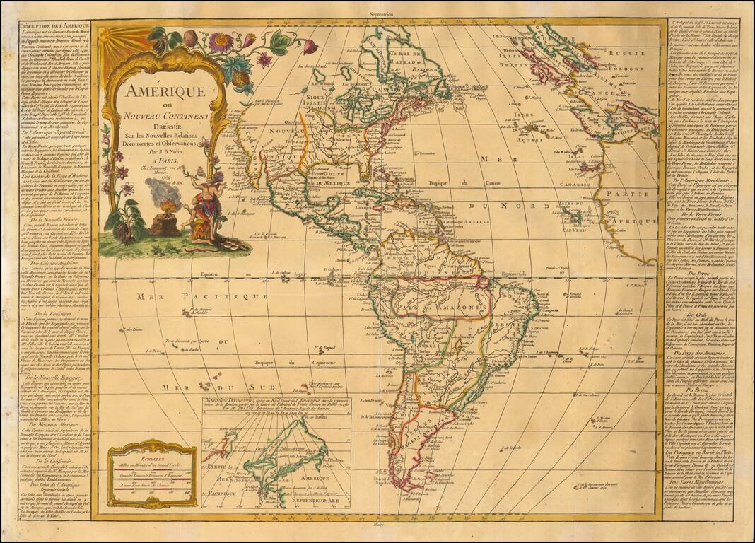
Decorative map of America, published in Paris by Daumont, based upon work of Johann Baptist Nolin.
A fine early example of the map, which includes a large inset map showing the "New Discoveries" in the Northwest part of America, most notably the depiction of prospective routes from Hudson's Bay and Baffin's Bay to the Pacific Ocean, based upon information provided by Joseph Nicolas De L'Isle, reporting on recent discoveries by the Russians.
At the left and right margins, the map includes a detailed description of America.
The present example is an early state of the map, which was issued periodically for the next 60 years. We note editions of 1781, 1795, 1811, 1817, all of which are scarce on the market.
If you are a student, write to us in telegram: @antiquemaps and indicate what material you need and for what work you need a map in high detail. We are ready to provide material on special terms. For students only!


